- Open road tolling
-
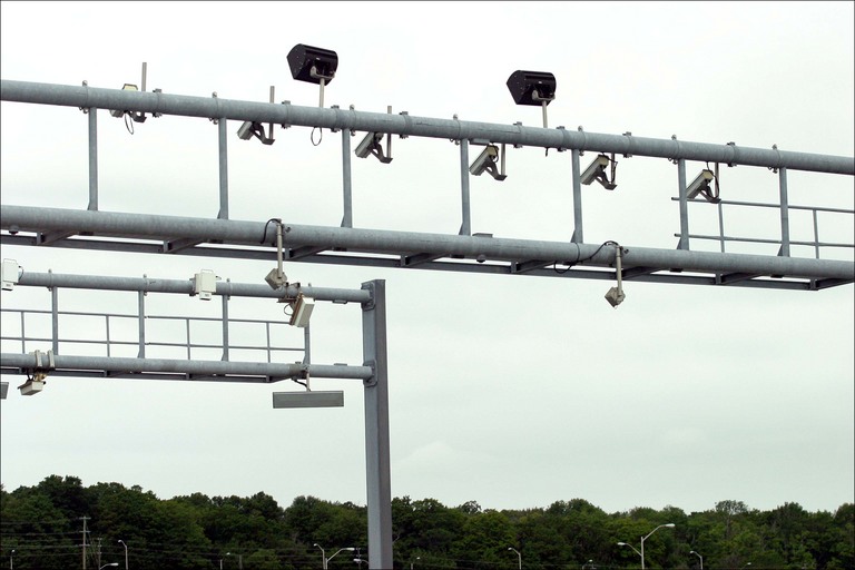
 The ORT lanes at the West 163rd Street toll plaza, going northbound on the Tri-State Tollway near the Chicago suburb of Hazel Crest.
Open road tolling (ORT) or free-flow tolling is the collection of tolls on toll roads without the use of toll booths. An electronic toll collection system is usually used instead. The major advantage to ORT is that users are able to drive through the toll plaza at highway speeds without having to slow down to pay the toll. In some installations, ORT may also reduce congestion at the plazas by allowing more vehicles per hour/per lane. The disadvantage to ORT is the possibility of "leakage"; that is, "violators" who do not pay. Leakage may either be written off as an expense by the toll operator, or offset in part or whole by fees and fines collected against the violators.
Contents
History
 Many ETC systems use transponders like this one to electronically debit the accounts of registered cars without their stopping
In 1959, Nobel Economics Prize winner William Vickrey was the first to propose a system of electronic tolling for the Washington metropolitan area. He proposed that each car would be equipped with a transponder. “The transponder’s personalised signal would be picked up when the car passed through an intersection, and then relayed to a central computer which would calculate the charge according to the intersection and the time of day and add it to the car’s bill” [1]
Norway has been the world's pioneer in the widespread implementation of this technology. ETC was first introduced in Bergen, in 1986, operating together with traditional tollbooths.[2] The first major deployment of an RFID electronic toll collection system in the United States was the TollTag system used on the Dallas North Tollway, implemented in 1989 by Amtech.[3] The first fully automated toll highway in the world, Ontario Highway 407, opened in Canada on 7 June, 1997.[4] The highway manages to achieves this automation through the uses both RFID technology along with automatic number plate recognition.[5]
On September 1998, Singapore was the first city in the world to implement an electronic road toll collection system for purposes of congestion pricing.[6] Today there are many roads around the world working with electronic toll collection technologies, and ORT has opened the feasibility to implement congestion pricing policies in urban areas.
Collection methods
 Main article: Electronic toll collection
Collection of tolls on open toll roads is usually conducted through either the use of transponders or automatic plate recognition. While rarely used as the primary vehicle identification method, automatic number plate recognition is used on a number of different highway systems. Both methods aims to eliminate the delay on toll roads by collecting tolls electronically by electronically debiting the accounts of registered car owners without requiring them to stop.
Transponders
Transponders are a receiver-transmitter that will generate a reply signal upon proper electronic interrogation. Transponders are an adaptation of military identification friend or foe technology. Most current AVI systems rely on radio-frequency identification, where an antenna at the toll gate communicates with a transponder on the vehicle via dedicated short-range communications (DSRC). RFID tags have proved to have excellent accuracy, and can be read at highway speeds. Some early AVI systems used barcodes affixed to each vehicle, to be read optically at the toll booth. Optical systems proved to have poor reading reliability, especially when faced with inclement weather and dirty vehicles.
Automatic number plate recognition
Automatic number plate recognition (ANPR) is a system that uses optical character recognition on images to read the license plates on vehicles. While the technology is most commonly used by law enforcement for traffic enforcement cameras or for cataloging the movements of traffic or individuals, ANPR has also been used as a method of electronic toll collection. Typically, a system of cameras are located at each junction and detect the transponders, logging the unique identity of each vehicle in much the same way as the ANPR system does. The use of ANPR reduces fraud related to non-payment, makes charging effective, and reduces the amount of required manpower to enforce the toll road.
See Also
References
- ^ Kelly, Frank (2006): Road Pricing: Addressing congestion, pollution and the financing of Britain’s road. Published in “Ingenia” by The Royal Academy of Engineering, volume 39, p. 36-42.
- ^ "Road tolling in Norway". Norwegian Public Road Administration. http://www.vegvesen.no/_attachment/109072/binary/187602. Retrieved 2 April 2011.
- ^ "About NTTA". North Texas Tollway Authority. North Texas Tollway Authority. 24 February 2009. http://www.ntta.org/AboutUs/Who/History.htm. Retrieved 2 April 2011.
- ^ Mitchell, Bob (June 6, 1997). "At Last — Opening Bell Tolls for the 407". The Toronto Star: pp. A1, A6.
- ^ "Frequently Asked Questions". 407 ETR. 407 Express Toll Route. http://www.407etr.com/About/qas.htm#q50. Retrieved 2 April 2011.
- ^ Cervero, Robert (1998), The Transit Metropolis, Island Press, Washington, D.C., p. 169, ISBN 1-55963-591-6 Chapter 6/The Master Planned Transit Metropolis: Singapore
External links

Wikimedia Foundation. 2010.