- Masaka
-
Masaka Location in Uganda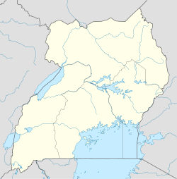
 Masaka
Coordinates: 0°18′46″S 31°42′47″E / 0.31278°S 31.71306°E Country  Uganda
Region Central Uganda District Masaka District Government - Mayor Elevation 3,937 ft (1,200 m) Population (2011 Estimate) - Total 74,100 Masaka is a town in Central Uganda, lying west of Lake Victoria. It is the chief town of Masaka District. Besides being the headquarters of Masaka District, the town is the regional headquarters and largest metropolitan area in Lyantonde District, Sembabule District, Lwengo District, Bukomansimbi District, Kalungu District, Masaka District, Rakai District, and Kalangala District.[1]
Contents
Location
Masaka lies approximately 140 kilometres (87 mi) to the southwest of Kampala, on the highway to Mbarara.[2] The town lies very close to the Equator, as can be seen from the latitude values. It was Uganda's second-biggest town for a long time. Today this status has changed, as the city was largely destroyed in the Uganda-Tanzania War of 1979 and again in the 1981-1986 civil war that removed Obote from power for the last time.[3]
Population
According to the 2002 national census, the population of Masaka was about 67,800. In 2010, the Uganda Bureau of Statistics (UBOS), estimated the population of the town at 73,300.[4] In 2011, UBOS estimated the mid-year population of Masaka at 74,100.[5]
Economic activities
Most of the people are farmers with both cattle and other crops. Masaka used to be the highest producer of the indigenous banana food (locally referred to as Matooke). Other economic activities include:
- Meat & Fish Processing
- Production of Beverages
- Furniture Manufacturing
- Manufacture of Footwear
- Manufacture of Baked Products
- Glass Manufacturing
Landmarks
The landmarks in Masaka or close to its borders include:
- The headquarters of Masaka District Administration
- The offices of Masaka Town Council
- Masaka Central Market
- The headquarters of the Mechanized Division of the Uganda People's Defense Force
- Muteesa I Royal University - Established in 2007, in memory of the late Kabaka Muteesa I Mukaabya who reigned over the Kingdom of Buganda between 1856 until 1884.
- The Western Campus of Kampala University (KU)
- St. Henry's College Kitovu - An all-boys, boarding, secondary school with a student body in exceess of 1,000
- The headquarters of the Roman Catholic Diocese of Masaka
- Lake Nabugabo lies 20 kilometres (12 mi) to the east to downtown Masaka.[6]
- Bukakkata, a port on the western shores of Lake Victoria is located 24 miles (39 km) east of Masaka.
- Ssese Islands in Lake Victoria - Masaka is the nearest large city from Kalangala, the largest town in these islands.
Other points of interest
Other points of interest within the town limits include the following:
- A branch of Barclays Bank
- A branch of Centenary Bank
- A branch of DFCU Bank
- A branch of PostBank Uganda
- A branch of Bank of Africa
- A branch of Stanbic Bank
- A branch of Tropical Bank
- A branch of Equity Bank
- A branch of Crane Bank
- A branch of Opportunity Uganda Limited - A Tier II Financial Institution
- A branch of Pride Microfinance Limited - A Tier III Financial Institution
- A branch of Uganda Finance Trust Limited - A Tier III Financial Institution
- Masaka Currency Center - A currency storage and processing facility owned and operated by the Bank of Uganda, Uganda's Central Bank.[7]
- A branch of the National Social Security Fund
- The Ambiance, a big club in Masaka.
External links
See also
- Masaka District
- Muteesa I Royal University
- Central Region, Uganda
Photos
References
- ^ Masaka is Regional Headquarters For Eight Districts
- ^ Map Showing Kampala And Masaka With Distance Marker
- ^ Masaka Has Been Decimated By War
- ^ 2002 and 2010 Population Estimates for Ugandan Cities and Towns
- ^ 2011 Estimated Populations of Ugandan Cities And Towns
- ^ Location of Lake Nabugabo
- ^ Bank of Uganda Maintains Masaka Currency Center
 Masaka District
Capital: Masaka Towns and villages Masaka · Bukakkata · Nzizi · Nkoni · Kasaka · Nabugabo · Kyanja · Kaganda · BisanjeGeography Economy Barclays Bank · Centenary Bank · DFCU Bank · PostBank Uganda · Stanbic Bank · Tropical Bank · Kenya Commercial Bank · Pride Microfinance Limited · Uganda Finance Trust Limited · Opportunity Uganda LimitedNotable landmarks Lake Nabugabo · River Nabajuzi · Masaka Regional Referral Hospital · Roman Catholic Diocese of Masaka · Kitovu HospitalEducation Notable people Alintuma Nsambu · Edward SsekandiCategories:- Populated places in Uganda
- Cities in the Great Rift Valley
- Central Region, Uganda
- Lake Victoria
- Masaka District

Wikimedia Foundation. 2010.