- Masindi
-
Masindi Market Street Masindi on a Sunday morning Location in Uganda
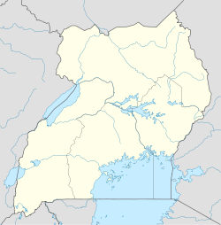
 Masindi
Coordinates: 01°41′01″N 31°43′20″E / 1.68361°N 31.72222°E Country  Uganda
Region Western Uganda Sub-region Bunyoro sub-region District Masindi District Government - Mayor Elevation 3,740 ft (1,140 m) Population (2011 Estimate) - Total 45,400 Masindi is a town in Western Uganda, which lies on the road from Kampala to the Murchison Falls National Park. It is the 'chief town' of the Masindi District and the district headquarters are located there. The district is named after the town, as is the case in many Ugandan districts.
Contents
Location
Masindi is located approximately 215 kilometres (134 mi) northwest of Kampala, Uganda's capital and largest city, on an all-weather tarmac highway.[1] The coordinates of the town are: 01 41 01N, 31 43 20E (Latitude: 1.6835; Longitude:31.7222).
Population
The 2002 national census estimated the population of Masindi to be 28,300. The Uganda Bureau of Statistics (UBOS), estimated the population of the town at 38,600 in 2008.[2] In 2011, UBOS estimated the population of Masindi at 45,400.[3] As of May 2011[update], Masindi is the largest town by population, in Bunyoro sub-region.[4]
History
As capital of Bunyoro, Masindi was visited by Samuel Baker, a British explorer and anti-slavery campaigner, from 25 April 1872 to 14 June 1873. The Baker expedition was forced to withdraw because of the hostility of the Omukama Kabaléga, the King of Bunyoro at the time.[5]
Points of Interest
The points of interest within the town limits or close to the edges of town include:
- The headquarters of Masindi District Administration
- The offices of Masindi Town Council
- Masindi Hotel - Built in 1923, it is the oldest hotel in Uganda
- Masindi Hospital - A 200 bed public hospital administered by the Uganda Ministry of Health
- A branch of Barclays Bank
- A branch of Centenary Bank
- A branch of Stanbic Bank
- A branch of the National Social Security Fund
- The main campus of the Kigumba Institute of Petroleum Studies, located 44 kilometres (27 mi), northeast of Masindi.
- Kinyara Sugar Works - One of three major manufacturers of refined sugar in Uganda, located 15 kilometres (9.3 mi), west of Masindi.
- Masindi Airport - ICAO Code:HUMI; IATA Code: KCU. A public airport, administered by the Uganda Civil Aviation Authority[6]
External links
See also
- Masindi District
- Bunyoro Kingdom
- Bunyoro sub-region
- Western Region, Uganda
- Murchison Falls National Park
References
- ^ Distance Between Kampala And Masindi With Map
- ^ 2002 and 2008 Population Estimates of Ugandan Cities and Towns
- ^ Estimated Population of Masindi In 2011
- ^ Populations of Major Urban Centers In Uganda
- ^ To The Heart Of The Nile: Lady Florence Baker and the Exploration of Central Africa, by Pat Shipman
- ^ Airports in Uganda
 Masindi District
Capital: Masindi Towns and villages Economy Barclays Bank · Centenary Bank · Stanbic Bank · Kinyara Sugar Works · Kinyara Power StationNotable landmarks Masindi Airport · Murchison Falls National Park · Budongo Forest Reserve · Bugungu Wildlife Reserve · Butiaba Port · Omukama's Masindi Palace · Masindi Hotel · Masindi HospitalEducation Kigumba Institute of Petroleum StudiesNotable people Kabakumba MasikoCategories:- Masindi District
- Populated places in Uganda
- Western Region, Uganda


Wikimedia Foundation. 2010.