- Dyke, Lincolnshire
-
Coordinates: 52°47′20″N 0°21′46″W / 52.78877°N 0.36287°W
Dyke 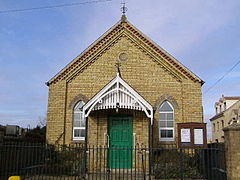
Baptist Chapel, Dyke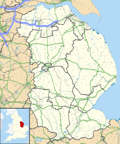
 Dyke
Dyke
Dyke shown within LincolnshireOS grid reference TF105225 Parish Bourne District South Kesteven Shire county Lincolnshire Region East Midlands Country England Sovereign state United Kingdom Post town BOURNE Postcode district PE10 0 Dialling code 01778 Police Lincolnshire Fire Lincolnshire Ambulance East Midlands EU Parliament East Midlands UK Parliament Grantham and Stamford List of places: UK • England • Lincolnshire Dyke is a hamlet in the South Kesteven district of Lincolnshire, England. It lies within the civil parish of Bourne.
The name Dyke arises from its lying on Car Dyke, a once much larger Roman ditch, which runs along the western edge of The Fens. The section of Car Dyke between Dyke and Bourne is a scheduled ancient monument.[1]
For population statistics Dyke, Twenty, South Fen, and Spalding road outside Bourne are taken together; Dyke is the largest of these settlements.[citation needed] The 2001 census recorded a population of 1,598.[2]
Dyke and Dyke Fen fall within the drainage area of the Black Sluice Internal Drainage Board.[3]
A new fountain was built on the green in the centre of the village to mark the millennium.[citation needed]
Dyke's public house is The Wishing Well Inn.
References
- ^ "National Monuments record for listed portion of Car Dyke". http://www.pastscape.org.uk/hob.aspx?hob_id=1034975.
- ^ "Office for National Statistics web site, 2001 census.". http://neighbourhood.statistics.gov.uk/dissemination/NeighbourhoodProfile.do?a=7&c=PE10+0AF&g=468584&i=1001x1012&j=310664&m=1&p=1&q=1&r=0&s=1250374818778&enc=1&tab=2&inWales=false.
- ^ "Black Sluice IDB". http://www.blacksluiceidb.gov.uk/.
External links
 Media related to Dyke, Lincolnshire at Wikimedia Commons
- "Dyke", homepages.which.net. Retrieved 22 July 2011
Categories:- Villages in Lincolnshire
- Lincolnshire geography stubs


Wikimedia Foundation. 2010.