- Merrylands, New South Wales
-
Merrylands
Sydney, New South Wales
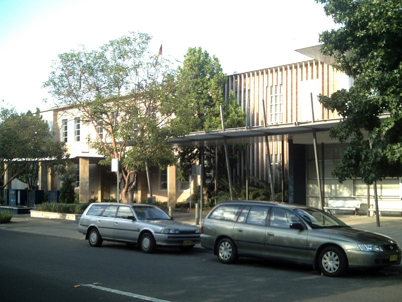
Chambers of the City of Holroyd CouncilPostcode: 2160 Location: 25 km (16 mi) west of Sydney CBD LGA: City of Holroyd, City of Parramatta State District: Granville Federal Division: Parramatta, Blaxland Suburbs around Merrylands: Mays Hill Parramatta Granville Merrylands West Merrylands Holroyd Guildford West Guildford South Granville Merrylands is a suburb in western Sydney, New South Wales, Australia. Merrylands is located 25 kilometres west of the Sydney central business district and is the administrative centre of the local government area of the City of Holroyd. Part of the suburb (east of the railway line) is located in the local government area of the City of Parramatta.
Contents
History
Merrylands was named after the former English home of Arthur Todd Holroyd (1806–1887), who acquired land in this area in 1855. The local government area that Merrylands is part of is named after him.
Commercial area
Merrylands has a commercial area around Merrylands railway station. Stockland Merrylands Mall is a shopping centre with supermarkets, discount department stores and specialty shops.[1]
Transport
The Merrylands railway station is serviced by the South Line and, the Cumberland Line of the CityRail network.
Churches
There are a number of churches in Merrylands, including Merrylands East Presbyterian Church, St Margaret Marys Catholic Church, Merrylands Anglican Church, Merrylands Baptist Church, Merrylands Uniting Church, Merrylands Presbyterian Church and an Evangelical church.
Climate
Merrylands has a humid subtropical climate, with hot and muggy summers and mild winters. Summers average at 28.7°C and winters Average at 17.6°C. 2/3 of the year the sun is shining. Merrylands can get hotter than surrounding areas like Parramatta. The hottest maximum temp ever recorded in Merrylands was 44°C on 1 January 2006, the coldest Temp recorded in Merrylands was 1.7°C on 17 July 2005.
Population
Demographics
Slightly over half of Merrylands' population are foreign-born, with Lebanon being the highest of any single country (8.45%) and 49.3% of residents being born in Australia.[2] Merrylands is made up of a large community with people from Italian, Lebanese, African and Assyrian background, with the majority being of Christian faith. According to the 2006 Census, the most common languages spoken at home in Merrylands were English (36.2%), Arabic (19.6%), Turkish (3.0%), Mandarin (2.9%) and Cantonese (2.9%)[3].
Notable residents
Some of the current and former residents of Merrylands include:
- Betty Cuthbert - Athlete. Born in Merrylands.
- Liam Fulton - Professional rugby league player. Resides in Merrylands.
- Rick Springfield - Singer, musician and actor. Born in Merrylands.
- Matthew Gardiner - Trade Unionist. Raised in Merrylands
- Paul Nakad - Musician and actor. Resides in Merrylands.
References
- ^ Stockland Merrylands Mall
- ^ Merrylands (2160) Suburb Demographics, http://myboot.com.au/2160/Merrylands/demographics.aspx
- ^ 2006 Census Table:Merrylands, http://www.censusdata.abs.gov.au/ABSNavigation/prenav/ViewData?action=404&documentproductno=SSC11651&documenttype=Details&order=1&tabname=Details&areacode=SSC11651&issue=2006&producttype=Census%20Tables&javascript=true&textversion=false&navmapdisplayed=true&breadcrumb=LPTD&&collection=Census&period=2006&productlabel=Language%20Spoken%20at%20Home%20(full%20classification%20list)%20by%20Sex&producttype=Census%20Tables&method=Place%20of%20Usual%20Residence&topic=Language&
- The Book of Sydney Suburbs, Compiled by Frances Pollen, Angus & Robertson Publishers, 1990, Published in Australia ISBN 0-207-14495-8
Coordinates: 33°50′15″S 150°59′30″E / 33.83742°S 150.99168°E
Suburbs and localities within the City of Holroyd · Western Sydney · Sydney Fairfield · Girraween · Granville · Greystanes · Guildford · Guildford West · Holroyd · Mays Hill · Merrylands · Merrylands West · Parramatta · Pemulwuy · Pendle Hill · Prospect · South Wentworthville · Smithfield · Wentworthville · Westmead · Woodpark · Yennora
Categories:- Suburbs of Sydney
Wikimedia Foundation. 2010.