- Dhapa, Nepal
-
Dhapa, Nepal — Municipality — Location in Nepal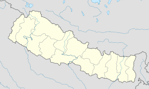
 Dhapa, Nepal
Coordinates: 29°22′N 81°58′E / 29.37°N 81.97°ECoordinates: 29°22′N 81°58′E / 29.37°N 81.97°E Country  Nepal
NepalZone Karnali Zone District Jumla District Population (1991) - Total 3,080 Time zone Nepal Time (UTC+5:45) Dhapa is a village development committee in Jumla District in the Karnali Zone of north-western Nepal. At the time of the 1991 Nepal census it had a population of 3080 persons living in 588 individual households.[1]
References
- ^ "Nepal Census 2001". Nepal's Village Development Committees. Digital Himalaya. http://www.digitalhimalaya.com/collections/nepalcensus/form.php?selection=1. Retrieved 11 September 2008.
External links
Badki, Birat, Buvramadichaur, Chandan Nath, Chhumchaur, Depalgaun, Dhapa, Dillichaur, Garjyangkot, Ghode Mahadev, Gothichaur, Haku , Kalikakhetu, Kanakasundari , Kartik Swami, Labhra , Lihi , Mahabe Pattharkhola , Mahadev, Mahat Gaun, Malika Bota , Malikathota, Narakot , Pandawagufa, Patarasi , Patmara , Sanigaun , Talium , Tamti, Tatopani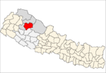 Categories:
- Populated places in Jumla District
- Karnali Zone geography stubs


Wikimedia Foundation. 2010.