- Saranap, California
-
Saranap — Census-designated place — Location in California
 Saranap
Coordinates: 37°53′06″N 122°04′34″W / 37.885°N 122.07611°WCoordinates: 37°53′06″N 122°04′34″W / 37.885°N 122.07611°W Country  United States
State  California
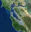
County Contra Costa County Area[1] – Total 1.135 sq mi (2.939 km2) – Land 1.135 sq mi (2.939 km2) – Water 0 sq mi (0 km2) 0% Elevation[2] 180 ft (55 m) Population (2010) – Total 5,202 – Density 4,584.3/sq mi (1,770/km2) Saranap (until 1913, Dewing Park)[3] is a residential census-designated place (CDP) within central Contra Costa County, California. Lying at an elevation of 180 feet (55 m), it is bounded on the south and east by portions of Walnut Creek (including the gated senior residential development Rossmoor) and on the north and west by Lafayette. Saranap's ZIP code is 94595, but is addressed "Walnut Creek, CA" for delivery purposes as this is the postal designated city name used by residents. The community is in telephone area code 925. Saranap's population is 5,202.
Saranap has had numerous opportunities to be annexed either part of Lafayette, or of Walnut Creek. These have been largely resisted by the occupants, whose land use is governed by county rules. These include the ability to keep small aviaries and bees, which can be highly restricted by law in surrounding cities, and in newer neighborhoods by restrictive covenants. As the local school district is independent of these city boundaries, and some of the cities impose additional parcel taxes, residents have little incentive to change the status quo. Only a minor addition was made to Lafayette from Saranap in recent decades, adding only one more street and being largely motivated by marginally superior housing values associated with the city of Lafayette.
Contents
Etymology
The community's name comes from an early 20th century inter-urban commuter rail system. The local station, located near the intersection of Tice Valley Boulevard and Olympic Way, was named after the railroad developer's mother, Sara Napthaly. This developer promoted the railroad to enhance the value of land developments, a process that led to a development pattern similar to a trolley car suburb, although in fact the railroad was a conventional regional rail line.
Geography
According to the United States Census Bureau, the CDP has a total area of 1.135 square miles (3 km2), all of it land.
Demographics
The 2010 United States Census[4] reported that Saranap had a population of 5,202. The population density was 4,583.6 people per square mile (1,769.7/km²). The racial makeup of Saranap was 4,275 (82.2%) White, 70 (1.3%) African American, 15 (0.3%) Native American, 451 (8.7%) Asian, 10 (0.2%) Pacific Islander, 113 (2.2%) from other races, and 268 (5.2%) from two or more races. Hispanic or Latino of any race were 437 persons (8.4%).
The Census reported that 5,176 people (99.5% of the population) lived in households, 11 (0.2%) lived in non-institutionalized group quarters, and 15 (0.3%) were institutionalized.
There were 2,173 households, out of which 706 (32.5%) had children under the age of 18 living in them, 1,097 (50.5%) were opposite-sex married couples living together, 194 (8.9%) had a female householder with no husband present, 74 (3.4%) had a male householder with no wife present. There were 95 (4.4%) unmarried opposite-sex partnerships, and 27 (1.2%) same-sex married couples or partnerships. 634 households (29.2%) were made up of individuals and 189 (8.7%) had someone living alone who was 65 years of age or older. The average household size was 2.38. There were 1,365 families (62.8% of all households); the average family size was 2.98.
The population was spread out with 1,192 people (22.9%) under the age of 18, 281 people (5.4%) aged 18 to 24, 1,367 people (26.3%) aged 25 to 44, 1,687 people (32.4%) aged 45 to 64, and 675 people (13.0%) who were 65 years of age or older. The median age was 41.9 years. For every 100 females there were 96.7 males. For every 100 females age 18 and over, there were 91.6 males.
There were 2,257 housing units at an average density of 1,988.7 per square mile (767.8/km²), of which 1,474 (67.8%) were owner-occupied, and 699 (32.2%) were occupied by renters. The homeowner vacancy rate was 0.9%; the rental vacancy rate was 4.1%. 3,764 people (72.4% of the population) lived in owner-occupied housing units and 1,412 people (27.1%) lived in rental housing units.
External links
- Google Map Centered at Tice Valley/Boulevard Way and Olympic Blvd., location of the original Saranap Station.
References
- ^ U.S. Census
- ^ U.S. Geological Survey Geographic Names Information System: Saranap, California
- ^ Durham, David L. (1998). California's Geographic Names: A Gazetteer of Historic and Modern Names of the State. Quill Driver Books. p. 699. ISBN 9781884995149.
- ^ All data are derived from the United States Census Bureau reports from the 2010 United States Census, and are accessible on-line here. The data on unmarried partnerships and same-sex married couples are from the Census report DEC_10_SF1_PCT15. All other housing and population data are from Census report DEC_10_DP_DPDP1. Both reports are viewable online or downloadable in a zip file containing a comma-delimited data file. The area data, from which densities are calculated, are available on-line here. Percentage totals may not add to 100% due to rounding. The Census Bureau defines families as a household containing one or more people related to the householder by birth, opposite-sex marriage, or adoption. People living in group quarters are tabulated by the Census Bureau as neither owners nor renters. For further details, see the text files accompanying the data files containing the Census reports mentioned above.
San Francisco Bay Area Bodies of water Bodega Bay · Carquinez Strait · Clifton Forebay · Golden Gate · Grizzly Bay · Guadalupe River · Half Moon Bay · Lake Berryessa · Napa River · Oakland Estuary · Petaluma River · Richardson Bay · Richmond Inner Harbor · Russian River · San Francisco Bay · San Leandro Bay · San Pablo Bay · Sonoma Creek · Suisun Bay · Tomales Bay
Counties Alameda · Contra Costa · Marin · Napa · San Francisco · San Mateo · Santa Clara · Solano · Sonoma
Major cities Cities and towns
100k–250kCities and towns
25k–99kAlameda · Belmont · Benicia · Brentwood · Burlingame · Campbell · Castro Valley · Cupertino · Danville · Dublin · East Palo Alto · Foster City · Gilroy · Livermore · Los Altos · Los Gatos · Martinez · Menlo Park · Milpitas · Morgan Hill · Mountain View · Napa · Newark · Novato · Oakley · Pacifica · Palo Alto · Petaluma · Pittsburg · Pleasant Hill · Pleasanton · Redwood City · Rohnert Park · San Bruno · San Carlos · San Leandro · San Mateo · San Pablo · San Rafael · San Ramon · Saratoga · South San Francisco · Suisun City · Union City · Vacaville · Walnut Creek · Windsor
Cities and towns
5k–25kAlamo · Albany · Alum Rock · American Canyon · Ashland · Atherton · Bay Point · Blackhawk-Camino Tassajara · Cherryland · Clayton · Discovery Bay · Dixon · El Cerrito · El Sobrante · Emeryville · Fairview · Half Moon Bay · Healdsburg · Hercules · Hillsborough · Lafayette · Larkspur · Los Altos Hills · Millbrae · Mill Valley · Moraga · North Fair Oaks · Orinda · Piedmont · Pinole · San Anselmo · San Lorenzo · Sonoma · Stanford · Tamalpais-Homestead Valley
Sub-regions Categories:- Census-designated places in Contra Costa County, California
- Unincorporated communities in California


Wikimedia Foundation. 2010.