- Lake Champlain
-
For ships named after the lake, see USS Lake Champlain.
Lake Champlain 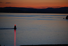
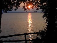
Lake Champlain near Burlington in early twilight Location New York / Vermont in USA; and Quebec in Canada Coordinates 44°32′N 73°20′W / 44.533°N 73.333°WCoordinates: 44°32′N 73°20′W / 44.533°N 73.333°W Primary inflows Otter Creek, Winooski River, Missisquoi River, Lamoille River, Ausable River, Chazy River, Boquet River, Saranac River Primary outflows Richelieu River Catchment area 21,326 km2 (8,234 sq mi) Basin countries Canada, United States Max. length 201 km (125 mi) Max. width 23 km (14 mi) Surface area 1,269 km2 (490 sq mi) Average depth 19.5 m (64 ft) Max. depth 122 m (400 ft) Water volume 25.8 km3 (6.2 cu mi) Residence time 3.3 years Shore length1 945 km (587 mi) Surface elevation 29 to 30 m (95 to 100 ft) Islands 80 (Grand Isle, North Hero, Isle La Motte, see list) Settlements Burlington, Vermont; Plattsburgh, New York 1 Shore length is not a well-defined measure. Lake Champlain (French: lac Champlain) is a natural, freshwater lake in North America, located mainly within the borders of the United States (states of Vermont and New York) but partially situated across the Canada—United States border in the Canadian province of Quebec.
The New York portion of the Champlain Valley includes the eastern portions of Clinton County and Essex County. Most of this area is part of the Adirondack Park. There are recreational opportunities in the park and along the relatively undeveloped coastline of Lake Champlain. The cities of Plattsburgh and Burlington are to the north and the village of Ticonderoga in the southern part of the region. The Quebec portion is located in the regional county municipalities of Le Haut-Richelieu and Brome–Missisquoi.
Contents
Geology
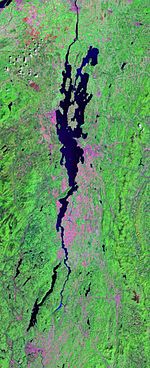 Landsat photo
The Champlain Valley is among the northernmost valleys considered part of the Great Appalachian Valley, reaching from Quebec to Alabama. The Champlain Valley is a physiographic section of the larger Saint Lawrence Valley, which in turn is part of the larger Appalachian physiographic division.[1]
It is one of numerous large lakes in an arc from Labrador through the northern United States and into the Northwest Territories of Canada. Although it is smaller than the Great Lakes of Ontario, Erie, Huron, Superior, or Michigan, Lake Champlain is a large body of fresh water. Approximately 1,269 km2 (490 sq mi) in area, the lake is roughly 201 km (125 mi) long, and 23 km (14 mi) across at its widest point.[2][3] The maximum depth is approximately 400 feet (120 m). The lake varies seasonally from about 95 to 100 ft (29 to 30 m) above mean sea level.
Hydrology
Lake Champlain is situated in the Lake Champlain Valley between the Green Mountains of Vermont and the Adirondack Mountains of New York, drained northward by the 106 miles (171 km) long Richelieu River into the St. Lawrence River at Sorel-Tracy, Quebec northeast and downstream of Montreal. It also receives the waters from the 32 miles (51 km)-long Lake George, so its basin collects waters from the northwestern slopes of the Green Mountains of Vermont, the north and west slopes of the Berkshire Hills of Massachusetts, and the northern most eastern peaks of the Adirondack Mountains of New York State.
The lake drains nearly half of Vermont. About 250,000 people get their drinking water from the lake.[4]
The lake is fed by Otter Creek, the Winooski, Missisquoi, and Lamoille Rivers in Vermont, and the Ausable, Chazy, Boquet, and Saranac rivers in New York. Lake Champlain also receives water from Lake George via the La Chute River.
It is connected to the Hudson River by the Champlain Canal.
Chazy Reef
The Chazy Reef is an extensive Ordovician carbonate rock formation which extends from Tennessee to Quebec and Newfoundland. It occurs in prominent outcropping at Goodsell Ridge, Isle La Motte, the northernmost island in Lake Champlain.
The oldest reefs are around "The Head" of the south end of the island; slightly younger reefs are found at the Fisk Quarry; and the youngest (the famous coral reefs) are located in fields to the north.[5] Together, these three sites provide a unique narrative of events which took place over 450 million years ago in the ocean in the Southern Hemisphere, long before the emergence of Lake Champlain 20 thousand years ago.
History
The lake was named for the French explorer Samuel de Champlain, who encountered it in 1609. While the ports of Burlington, Vermont; Port Henry, New York; and Plattsburgh, New York are little used nowadays except by small craft, ferries and lake cruise ships, they had substantial commercial and military importance in the 18th and 19th centuries.
There is conflicting information on Native American names for the lake. Many historical works give Caniaderi Guarunte as the Iroquois name for the lake (meaning: mouth or door of the country), because the waterway was an important northern gateway to their lands.[6] A number of other sources give Petonbowk (meaning the lake in between) as the Algonquian Abenaki name for the lake.[7] The St. Francis/Sokoki Abenaki Band, who make their home along the Masipskiwibi (Missisquoi, "Crooked River") River in northwestern Vermont call the lake Bitawbagok, the same meaning as Petonbowk.[8] Some recent articles [9][10] appeared during the Champlain Quadricentennial (2009) claiming Ondakina as the “local” native name for the lake, but none cites a verifiable source.
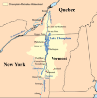 Map showing the Lake Champlain-River Richelieu watershed.
Colonial America and the Revolutionary War
In colonial times, Lake Champlain provided an easily traversed water (or, in winter, ice) passage between the Saint Lawrence and the Hudson Valleys. Travelers preferred to use boats and sledges on the lake rather than go by the unpaved and frequently mud-bound roads of the time. The northern tip of the lake at Saint-Jean-sur-Richelieu, Quebec (St. John in colonial times) is a short distance from Montreal. The southern tip at Whitehall (Skenesborough in revolutionary times) is a short distance from Saratoga, Glens Falls, and Albany, New York.
Forts at Ticonderoga and Crown Point (Fort St. Frederic) controlled passage of the lake in colonial times. Important battles were fought at Ticonderoga in 1758 and 1775. Following a frenetic shipbuilding race through the Spring and Summer of 1776 by the British at the north end of the lake and the Americans at the south end, they fought a significant naval engagement on October 11 at the Battle of Valcour Island. While it was a tactical defeat for the Americans and the small fleet led by Benedict Arnold was almost entirely destroyed, the Americans gained a strategic victory. The British invasion was delayed long enough so that the approach of winter prevented the fall of these forts until the following year. In this period, the Continental Army gained strength and was victorious at Saratoga.
War of 1812
The Battle of Lake Champlain, also known as the Battle of Plattsburgh, fought on September 11, 1814, ended the final British invasion of the northern states during the War of 1812. Fought just prior to the signing of the Treaty of Ghent, the American victory denied the British any leverage to demand exclusive control over the Great Lakes or territorial gains against the New England states.
Three US Naval ships have been named after this battle, including the USS Lake Champlain (CV-39), the USS Lake Champlain (CG-57), and a cargo ship used during World War I.
Following the War of 1812, the US Army began construction on "Fort Blunder", an unnamed fortification built by the Americans at the northernmost end of Lake Champlain to protect against any further attacks from British Canada. Its nickname came from a surveying error: the initial phase of construction on the fort turned out to be taking place on a point .75 miles (1.21 km) north of the Canadian border. Once this error was spotted, construction was abandoned. Locals scavenged materials used in the abandoned fort for use in their own homes and public buildings. The signing of the Webster-Ashburton Treaty in 1842 later adjusted the U.S. boundary northward to include the strategically important site of "Fort Blunder." Following this in 1844, work was commenced once again, replacing the remains of the 1812 era fort with a massive new Third System masonry fortification known as Fort Montgomery. Portions of this fort are still standing.
Modern history
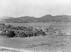 A 1902 photograph of Fort Henry at Lake Champlain.
In the early 19th century, the construction of the Champlain Canal connected Lake Champlain to the Hudson River system, allowing north-south commerce by water from New York City to Montreal and Atlantic Canada.
In 1909, 65,000 people celebrated the 300th anniversary of the discovery of the lake. Attending dignitaries included President William Howard Taft, along with representatives from France, Canada and the United Kingdom.[11][12]
In 1929, then-New York Governor Franklin Roosevelt and Vermont Governor John Weeks, dedicated the first bridge to span the lake, from Chimney Point to Chimney Point.[13] This bridge lasted until December of 2009.
On February 19, 1932, boats were able to sail on Lake Champlain. No living person could remember the lake being free of ice during the winter up until then.[14]
Lake Champlain briefly became the nation's sixth Great Lake on March 6, 1998, when President Clinton signed Senate Bill 927. This bill, which reauthorized the National Sea Grant Program, contained a line declaring Lake Champlain to be a Great Lake. Not coincidentally, this status allows neighboring states to apply for additional federal research and education funds allocated to these national resources. Following a small uproar, the Great Lake status was rescinded on March 24 (although Vermont universities continue to receive funds to monitor and study the lake).
"Champ", Lake Champlain monster
In 1609 Samuel de Champlain wrote that he saw saw a lake monster five feet (1.5 m) long, as thick as a man's thigh, with silver-gray scales a dagger could not penetrate. The alleged monster had two-and-a-half foot jaws with sharp and dangerous teeth. Indians claimed to have seen similar monsters eight to ten feet long (around 2.7 m). This mysterious creature is likely the original Lake Champlain monster.[15] The monster still receives considerable attention, as indicated by the name (Vermont Lake Monsters) and mascot (Champ) of the state's minor league baseball team[16] and a Vermont Historical Society publication, which also offers several mundane explanations for the so-called monster: "floating logs, schools of large sturgeons diving in a row, or flocks of black birds flying close to the water."[17]
Ecology
A pollution prevention, control, and restoration plan for Lake Champlain[18] was first endorsed in October 1996 by the governors of New York and Vermont and the regional administrators of the EPA (United States Environmental Protection Agency). In April 2003, the plan was updated and Quebec signed onto it. The plan is being implemented by the Lake Champlain Basin Program and its partners at the state, provincial, federal and local level. It is renowned as a model for interstate and international cooperation. It primary goals are to reduce phosphorus inputs to Lake Champlain; reduce toxic contamination; minimize the risks to humans from water-related health hazards; and control the introduction, spread, and impact of non-native nuisance species to preserve the integrity of the Lake Champlain ecosystem.
Agricultural and urban runoff from the watershed or drainage basin is the primary source of excess phosphorus, which exacerbates algae blooms in Lake Champlain. The most problematic blooms have been cyanobacteria, commonly called blue-green algae, in the northeastern part of the Lake, primarily Missisquoi Bay.[19]
To reduce phosphorus inputs to this part of the Lake, Vermont and Quebec agreed to reduce their inputs by 60% and 40%, respectively, by an agreement signed in 2002.[20] While agricultural sources (manure and fertilizers) are the primary sources of phosphorus (about 70%) in the Missisquoi basin, runoff from developed land and suburbs is estimated to contribute about 46% of the phosphorus runoff basin-wide to Lake Champlain, and agricultural lands contributed about 38%.[21]
In 2002, the cleanup plan noted that the lake had the capacity to absorb 110 metric tons (110 long tons; 120 short tons) of phosphorus each year. In 2009, a judge noted that 218 metric tons (215 long tons; 240 short tons) were still flowing in annually. Sixty municipal and industrial sewage plants discharge processed waste from the Vermont side[22]
In 2008, the EPA expressed concerns to the State of Vermont that the Lake's cleanup was not progressing fast enough to meet the original cleanup goal of 2016.[23] The State, however, cites its Clean and Clear Action Plan[24] as a model that will see positive results for Lake Champlain.
In 2007, phosphates were banned for dishwasher use in Vermont starting in 2010. This will save an estimated −-5 short tons (−0.91 t) from flowing into the lake. While this represents 0.6% of the phosphate pollution, it took $1.9 million to remove this from treated wastewater, an EPA requirement.[25]
Although there are pollution issues, Lake Champlain is safe for swimming, fishing, and boating. It is considered a world-class fishery for salmonid species (Lake trout and Atlantic salmon) and bass. About 81 fish species live in the Lake, and more than 300 bird species rely on it for habitat and as a resource during migrations.[26]
By 2008 there were at least six institutions monitoring lake water health: 1) In 2002 the Conservation Law Foundation appointed a "lakekeeper" who criticizes the state's pollution controls, 2) Friends of Missisquoi Bay was formed in 2003, 3) the Lake Champlain Committee, 4) Vermont Water Resources Board hired a water quality expert in 2008 to write water quality standards and create wetland protection rules, 5) In 2007 the Vermont Agency of Natural Resources appoints a "Lake czar" to oversee pollution control. Clean and Clear, an agency of the Vermont state government established in 2004 and 6) the Nature Conservancy which focuses on biodiversity and ecosystem health.[27]
In 2001, it was believed that farming contributed 38% of the phosphorus runoff. By 2010, it had become clear that there was no way to clearly determine that environmentally-conscious farming practices, enforced by law, had made any positive contribution to lake cleanliness. A federally funded study was started to analyze this problem and to arrive at a solution.[28]
Biologists have been trying to control lampreys in the lake since 1985 or earlier. Lampreys are native to the area but expanded until they were wounding nearly all Lake trout in 2006 and 70-80% of salmon. The use of pesticides against the lamprey reduced their casualties of in other fish to 35% of salmon were affected and 31% of lake trout. The goal was 15% of salmon and 25% of lake trout.[29]
The federal and state governments originally budgeted $18 million for lake programs for 2010. This was later supplemented by an additional $6.5 million from the federal government.[30]
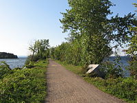 The causeway connecting Colchester and South Hero.
Railroad
There were four significant railroad crossings of the lake. As of 2011, only one remains.
- The "floating" rail trestle from Larabees Point, Vermont to Ticonderoga, New York was operated by the Addison Branch of the Rutland Railroad. It was abandoned in 1918 due to a number of accidents which resulted in locomotives and rail cars falling into the lake.
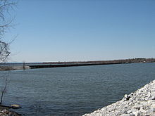 The Swanton-Alburgh trestle spans Lake Champlain between the two Vermont towns, a distance of about .8 miles (1.3 km)
- The Island Line Causeway. This marble rock-landfill causeway stretched from Colchester, Vermont (on the mainland) three miles (5 km) north and west to South Hero, Vermont. Two breaks in the causeway were spanned by a fixed iron trestle and a swing bridge that could be opened to allow boats to pass. Rutland Railroad (later Rutland Railway) operated trains over this causeway from 1901-1961. The Railway was officially abandoned in 1963, with tracks and trestles removed over the course of the ten years that followed. The marble causeway still remains, as does the fixed iron trestle that bridges the lesser of the two gaps. The swing bridge over the navigation channel was removed sometime in the early 1970s. Now called Colchester Park, the main three-mile (5 km) causeway is a recreation area for cyclists, runners, and anglers. Two smaller marble rock-landfill causeways were also erected as part of this line that connected Grand Isle to North Hero, Vermont and from North Hero to Alburgh.
- The Alburgh, Vermont - Rouses Point, New York rail trestle. From sometime in the late 19th century until 1964, this wooden trestle carried two railroads (the Rutland Railroad and the Central Vermont Railroad) over the lake just south of the US 2 vehicular bridge. The iron swing bridge at the center (over the navigation channel) has been removed, but most of the wooden pilings remain and can easily be seen looking south from the US 2 bridge. Part of the trestle on the Rouses Point side has been converted for use as an access pier associated with the local marina.
- The Swanton - Alburgh, Vermont rail trestle. Built in the same manner as at Rouses Point, crossing the lake just south of Missisquoi Bay and the Canadian border, within yards south of the Vermont Route 78 bridge. It is still in use by the New England Central Railroad.
Natural history
In 2010, the estimate of cormorant population, considered a nuisance, ranged from 14,000 to 16,000. A Fish and Wildlife commissioner said that the ideal population would be 3,300 or about 3 per 1 square kilometre (0.39 sq mi). Cormorants had disappeared from the lake (and all northern lakes) due to the use of DDT in the 1940s and 1950s.[31]
Ring-billed gulls are also considered a nuisance. Measures have been taken to reduce their population. Authorities are attempting to encourage the return of black crowned night herons, cattle egrets, great blue herons, which disappeared during the time DDT was being used.[31]
Infrastructure
Lake crossings
The Alburgh Peninsula (also known as the Alburgh Tongue), extending south from the Quebec shore of the lake into Vermont, shares with Point Roberts, Washington, and the Northwest Angle in Minnesota as well as Province Point (see below) the distinction of being reachable by land from the rest of its state only via Canada. However, unlike the other three cases, this is no longer of practical significance since highway bridges across the lake do provide access to the peninsula within the United States (from three directions, in fact).
Province Point, Vermont
A few kilometres to the north-east of the town of East Alburgh, Vermont, Province Point is the southernmost tip of a small promontory approximately 2 acres (1 ha) in size 45°00′48″N 73°11′36″W / 45.013351°N 73.193257°W.[32] The promontory is cut through by the US-Canadian border as such the area is a practical exclave of the United States contiguous with Canada.
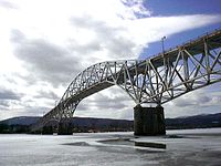 The Champlain Bridge between New York and Vermont, demolished in December of 2009.
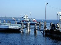
Mainland
There are two roadways across the lake, but only one is open as of October 2009. The Champlain Bridge across the southern part of the lake, connecting Chimney Point in Vermont with Crown Point, New York, was closed indefinitely due to structural problems that could have led to a collapse.[33] In 2009, the bridge was used by 3,400 drivers per day,[34] and driving around the southern end of the lake adds two hours to the trip. The bridge was determined to be beyond repair, and both states agreed to work on a replacement as quickly as possible.[35] On December 28, 2009, the bridge was destroyed in a controlled demolition, making way for a new bridge which opened on November 7, 2011.[36]
To the north, US 2 runs from Rouses Point, New York to Grand Isle County, Vermont in the town of Alburgh, before continuing south along a chain of islands towards Burlington. To the east, Vermont Route 78 runs from an intersection with US 2 in Alburgh through East Alburgh to Swanton. The US 2-VT 78 route technically runs from the New York mainland to an extension of the mainland between two arms of the lake and then to the Vermont mainland, but it provides a direct route across the two main arms of the northern part of the lake.
Ferry
North of Ticonderoga, New York, the lake widens appreciably; ferry service is operated by the Lake Champlain Transportation Company at:
- Charlotte, Vermont to Essex, New York (may not travel when the lake is frozen)
- Burlington, Vermont to Port Kent, New York (seasonal)
- Grand Isle, Vermont to Cumberland Head, part of Plattsburgh, New York (year-round icebreaking service)
While the old bridge was being demolished and the new one constructed, Lake Champlain Transportation Company operated a free, 24 hour ferry from just south of the bridge to Chimney Point in Vermont at the expense of the states of New York and Vermont at a cost to the states of about $10 per car.[37][38]
The most southerly crossing is the Fort Ticonderoga Ferry, connecting Ticonderoga, New York with Shoreham, Vermont just north of the historic fort.
Railroad
The Swanton, VT, to East Alburg, Vermont, rail trestle.
Waterways
Lake Champlain has been connected to the Erie Canal via the Champlain Canal since the canal's official opening September 9, 1823, the same day as the opening of the Erie Canal from Rochester on Lake Ontario to Albany. It connects to the St. Lawrence River via the Richelieu River, with the Chambly Canal bypassing rapids on the river since 1843. Together with these waterways the lake is part of the Lakes to Locks Passage. The Lake Champlain Seaway, a project to use the lake to bring ocean-going ships from New York City to Montreal, was proposed in the late 19th century and considered as late as the 1960s, but rejected for various reasons.
Surroundings
Major cities
Burlington, Vermont (pop. 42,217, 2010 Census) is by far the largest city on the lake, having a larger population than the 2nd and 3rd most populated cities/towns (Plattsburgh, New York, and Colchester, Vermont, respectively) combined. The fourth-largest community is the Burlington suburban city of South Burlington.
Islands
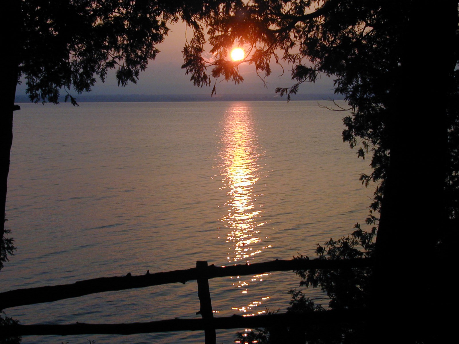
 At sunset, looking west from Grand Isle to Plattsburgh and Crab Island
Lake Champlain contains roughly 80 islands, three of which comprise four entire Vermont towns (most of Grand Isle County). The largest islands:
- South Hero Island, the largest, containing the towns of Grand Isle, Vermont and South Hero, Vermont
- North Hero Island, containing the town of North Hero, Vermont
- Isle La Motte, containing the town of Isle La Motte, Vermont
- Valcour Island, New York
- Juniper Island (Lake Champlain)
- Three Sisters
- Four Brothers[39]
- Savage Island
- Burton Island (State Park)
- Cloak Island
- Garden Island
- Crab Island, New York
- Dameas Island
- Hen Island
- Carleton's Prize
- Young Island,[40] also known as "Bird Island" due to the birds that have overrun the island[citation needed]
- Providence Island[41]
- Stave Island[42]
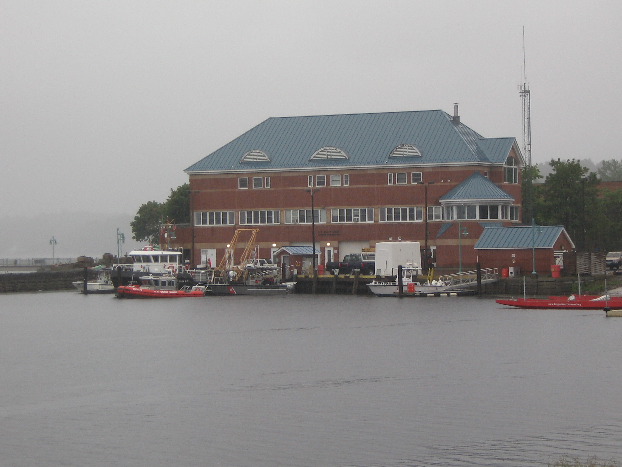
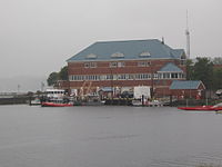 USCG, Burlington, Vermont - main installation.
Lighthouses
- There is a historic stone lighthouse located on Cumberland Head, which is privately owned.
- The privately owned Isle La Motte lighthouse on the northern end of the island was originally red, but it faded to pink over time.[43]
- The privately owned cast iron Juniper Island Light dates from 1846. In 1954 it was deactivated and replaced by a steel tower.
- On Point Au Roche, part of Beekmantown, New York, there is a privately owned, historic lighthouse.
- Valcour Island, near the New York shore is home to Bluff Point Lighthouse, built in 1871. It was manned by a full time lightkeeper until 1930, making it one of the last lighthouses to be manned on the Lake. The Cumberland Head Light operated until 1934.
- Split Rock Lighthouse, NY south of Essex, NY, near a natural boundary of the territory between the Mohawk and Algonquin tribes.[44]
All active navigational aids on the American portion of the lake are maintained by USCG Burlington station, along with those on international Lake Memphremagog to the east.[45] Aids to navigation on the Canadian portion of the lake are maintained by the Canadian Coast Guard.[46]
Parks
There are a number of parks in the Lake Champlain region of both Vermont and New York.
Two on the New York side of the lake include Point Au Roche State Park, which have hiking and cross country skiing trails. A public beach is located on park grounds, and the Ausable Point State Park. The Cumberland Bay State Park is located on Cumberland Head, with a campground, city beach, and sports fields.
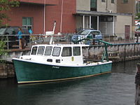 Vermont Department of Fish and Wildlife boat docked near ECHO Aquarium.
There are various parks along the lake on the Vermont side, including Sand Bar State Park in Milton, featuring a 2,000 feet (610 m) natural sand beach, swimming,canoe and kayak rentals, food concession, picnic grounds and a play area. At 226 acres (91 ha), Grand Isle State Park contains camping facilities, a sand volleyball court, a nature walk trail, a horseshoe pit and a play area. Burlington's Waterfront Park is a revitalized industrial area.
Public safety
Coast Guard Station Burlington provides "Search and Rescue, Law Enforcement and Ice Rescue services 24 hours a day, 365 days a year."[45] Services are also provided by local and state governments bordering on the lake, including Vermont State Police,[47] New York State Police Marine Detail,[48] and Vermont Fish and Wildlife wardens.[49]
See also
- Champlain Sea, post-glacial predecessor to Lake Champlain
- Île aux Noix
- List of New York rivers
- Burlington, Vermont
- Plattsburgh, New York
- Cumberland Head, New York
Notes
- ^ "Physiographic divisions of the conterminous U. S.". U.S. Geological Survey. http://water.usgs.gov/GIS/metadata/usgswrd/XML/physio.xml. Retrieved December 6, 2007.
- ^ "Champlain, Lake". The canadian encyclopedia. February 12, 2011. http://www.thecanadianencyclopedia.com/index.cfm?PgNm=TCE&Params=A1ARTA0001504.
- ^ Veyron, Michel (1989) (in fr). Dictionnaire canadien des noms propres. Éditions Larousse. p. 764. ISBN 2-920318-06-3.
- ^ Curran, John (August 11, 2010). "State seeks dismissal of phosphorus lawsuit". Burlington, Vermont: Burlington Free Press. pp. 1B. http://www.burlingtonfreepress.com/article/20100811/NEWS02/8110319/Vermont-urges-dismissal-of-suit-over-lake-phosphorus.
- ^ University of Vermont Professor of Geology, Charlotte Mehrtens
- ^ Thomas Pownall (1976). A topographical description of the dominions of the United States of America. Ayer Publishing. A topographical description of the dominions of the United States of America by Thomas Pownall
- ^ John Charles Huden (1962). Indian place names of New England. Museum of the American Indian, Heye Foundation. Indian place names of New England by John Charles Huden
- ^ "Abenaki". Abenakination.org. http://www.abenakination.org/whoweare.html. Retrieved March 2, 2011.
- ^ "Indian Summer | Seven Days". 7dvt.com. http://www.7dvt.com/2009indian-summer. Retrieved March 2, 2011.
- ^ "Champlain's journal: Entering 'The Lake Between'". Pqasb.pqarchiver.com. July 14, 2009. http://pqasb.pqarchiver.com/burlingtonfreepress/access/1787867421.html?dids=1787867421:1787867421&FMT=ABS&FMTS=ABS:FT&date=Jul+14%2C+2009&author=Joel+Banner+Baird&pub=The+Burlington+Free+Press&edition=&startpage=n%2Fa&desc=Champlain%27s+journal%3A+Entering+%27The+Lake+Between%27. Retrieved March 2, 2011.
- ^ Hyde, Bruce (January 3, 2008). My Turn:Get ready to celebrate the 400th. The Burlington Free Press.
- ^ "1909 Champlain Tercentenary Celebration of the Discovery of Lake Champlain". Hrmm.org. http://www.hrmm.org/quad/1909champlain/contents.html. Retrieved March 2, 2011.
- ^ "Vermont History Timeline". historicvermont.org. August 26, 2010. http://www.historicvermont.org/sites/html/history.html.
- ^ [.http://www.bartonchronicle.com/index.php/reviews/books/110-asurpriseoneverypage Barton Chronicle] retrieved August 21, 2009
- ^ Hill, Ralph Nading (1976). Lake Champlain: Key to Liberty. Woodstock, Vermont: Countryman Press.
- ^ "Vermont Lake Monsters Home Page". The Official Site of Minor League Baseball. 2011. http://vermont.lakemonsters.milb.com/index.jsp?sid=t462. Retrieved October 11, 2011.
- ^ "Vermont's Very Own Monster". Vermont Historical Society. http://vermonthistory.org/documents/GreenMountaineer/VermontsVeryOwn.pdf. Retrieved October 11, 2011.
- ^ "Lake Champlain Management Plan, April 2003". http://www.lcbp.org/impofa.htm.
- ^ Watzin, M.C. (2007). Monitoring and Evaluation of Cyanobacteria in Lake Champlain: Summer 2006.. Lake Champlain Basin Program. [1] Abstract online
- ^ "Missisquoi Bay Phosphorus Reduction Agreement, August 2002" (PDF). http://www.lcbp.org/PDFs/missbay_agreeEN.pdf.
- ^ Troy A., Wang D. and Capen D. (2007 http://www.lcbp.org/publication_detail.aspx?id=211). Updating the Lake Champlain Basin Land Use Data to Improve Prediction of Phosphorus Loading.. Lake Champlain Basin Program.
- ^ Page, Candace (July 9, 2009). "Sewage:Judge sides with CLF, throws out Montpelier permit". Burlington, Vermont: Burlington Free Press. pp. 4A.
- ^ Page, Candace (June 3, 2008). EPA scolds state on efforts to clean up Lake Champlain. The Burlington Free Press.
- ^ "Vermont Clean and Clear Action Plan". http://www.anr.state.vt.us/cleanandclear/.
- ^ Baird, Joel Banner (June 26, 2010). "Detergents must soon be phosphate free". Burlington, Vermont: Burlington Free Press. pp. 1A.
- ^ ""Lake Champlain Basin Atlas: Plants and Animals", 2004". Lcbp.org. http://www.lcbp.org/Atlas/HTML/nat_plants.htm. Retrieved March 2, 2011.
- ^ Page, Candace (December 14, 2008). Lake Champlain gets another watchdog. Burlington Free Press.
- ^ Page, Candace (July 6, 2010). "Lake Champlain cleanup effort focuses on Rock Rive6". Burlington, Vermont: Burlington Free Press. pp. 1B.
- ^ Page, Candace (January 22, 2009). Lamprey wounds decrease. Burlington Free Press.
- ^ Page, Candace (July 24, 2010). "Lake scores $6.5 million". Burlington, Vermont: Burlington Free Press. pp. 1A. http://www.burlingtonfreepress.com/apps/pbcs.dll/article?AID=2010100724001.
- ^ a b Page, Candace (July 11, 2010). "Cutting the cormorant population". Burlington, Vermont: Burlington Free Press. pp. 1C, 8C.
- ^ http://wikimapia.org/#lat=45.0129735&lon=-73.1926346&z=17&l=0&m=b&show=/2203373/Province-Point
- ^ McKinstry, Lohr (October 17, 2009). "Vital bridge at Crown Point closed". The Press Republican. http://www.pressrepublican.com/archivesearch/local_story_290052622.html. Retrieved October 31, 2009.
- ^ NYT article of December 12, 2009 (page A12)
- ^ "New York, Vermont to replace Lake Champlain bridge". New York State. November 9, 2009. http://www.state.ny.us/governor/press/press_1109092.html. Retrieved November 28, 2009.
- ^ "Controlled explosions bring down Lake Champlain Bridge, unsafe NY-VT span was closed in Oct.". Associated Press. LA Times. December 28, 2009. http://www.latimes.com/news/nationworld/nation/wire/sns-ap-us-bridge-closed-demolition,0,1331812.story. Retrieved January 4, 2010.[dead link]
- ^ Bridge is costly, but ferry is more by Nick Reisman, Poststar.com, May 18, 2010.
- ^ "Ferry At Champlain Bridge Set To Start Running". WPTZ. January 31, 2010. http://www.wptz.com/news/22352789/detail.html.
- ^ Meyers, Jeff (August 10, 2008). "Four Brothers Islands a haven for a variety of birds » Local News". Press-Republican. http://www.pressrepublican.com/homepage/local_story_222221553.html. Retrieved March 2, 2011.
- ^ "Cormorants on Lake Champlain". Nasw.org. July 3, 1996. http://www.nasw.org/users/nbazilchuk/Articles/cormorants.htm. Retrieved March 2, 2011.
- ^ http://www.nrb.state.vt.us/wrp/decisions/upw/1998/upw9802dec.pdf
- ^ "A Tour of the Historic Lake Champlain Islands by Jim Millard". Historiclakes.org. December 5, 2010. http://www.historiclakes.org/explore/islands.html. Retrieved March 2, 2011.
- ^ "Isle La Motte, VT". Lighthousefriends.com. http://www.lighthousefriends.com/light.asp?ID=669. Retrieved May 25, 2011.
- ^ "Watchtowers on the Water - NYS Dept. of Environmental Conservation". Dec.ny.gov. March 19, 2003. http://www.dec.ny.gov/pubs/57578.html. Retrieved March 2, 2011.
- ^ a b United States Coast Guard (March 5, 2009). "USCG: Station Burlington, Vermont". http://www.uscg.mil/d1/staBurlington/.
- ^ Canadian Coast Guard (December 9, 2009). "Canadian Coast Guard - Marinfo". http://www.marinfo.gc.ca/en/Balisage/BalisageAutomne.asp?lstVoyage=931.
- ^ Vermont State Police (November 12, 2009). "Recreation Unit and Education Unit". http://www.dps.state.vt.us/vtsp/rec_enforce.html.
- ^ New York State, Division of State Police. "Marine Detail". http://www.troopers.state.ny.us/specialized_services/Marine_Detail/. Retrieved December 11, 2009.
- ^ "Vermont Fish and Wildlife". http://www.anr.state.vt.us/fw/fwhome/laws_info.cfm. Retrieved January 4, 2010.
External links
Categories:- Biosphere reserves of the United States
- Borders of New York
- Borders of Vermont
- Canada–United States border
- International lakes of North America
- Lake Champlain
- Lakes of New York
- Lakes of Quebec
- Lakes of Vermont
- Geography of Montérégie
- Geography of Washington County, New York
- Geography of Essex County, New York
- Geography of Clinton County, New York
- Geography of Addison County, Vermont
- Geography of Chittenden County, Vermont
- Geography of Rutland County, Vermont
- Geography of Franklin County, Vermont
- Geography of Grand Isle County, Vermont
- Visitor attractions in Essex County, New York


Wikimedia Foundation. 2010.