- Mount Majura
-
Mount Majura 
Top of Mount MajuraElevation 888 m (2,913 ft) Location Location in ACT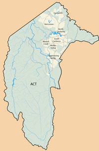
 Mount Majura
Location Australian Capital Territory, Australia Coordinates 35°14′15″S 149°10′50″E / 35.2375°S 149.18056°ECoordinates: 35°14′15″S 149°10′50″E / 35.2375°S 149.18056°E Climbing Easiest route Hike Mount Majura, is a small mountain located in Canberra, Australia. Mount Majura lies close to the more prominent Mount Ainslie and at 888 metres (2,913 ft) is the highest point in Canberra. Other large hills include Mount Taylor, Mount Ainslie, Mount Mugga Mugga, Mount Stromlo and Black Mountain.
Contents
Canberra Nature Park
Mount Majura is part of the Canberra Nature Park, lying at the back (eastern) end of the suburb of Hackett, which is on the northeast edge of Canberra. At the top is a radar station and aircraft warning light for the nearby Canberra Airport. The station contains a primary and secondary radar system, as well as transmitters and receivers for Telstra, Optus, Vodafone and a repeater for the Canberra Amateur Radio Club. The road primarily serves the radar station and, unlike the road on Mount Ainslie, is unavailable to the public. However, there are popular walking trails which lead to the top of the mountain from Ainslie and Hackett. There is also an extensive series of single track bicycle trails on the eastern side, in an area known as the Majura Pines.[1] The hill is covered with native Australian trees, mostly eucalyptus.
Naming
Mount Majura was named by Robert Campbell, one of the first major land owners when the area around the mountain was first settled.[2] It is believed to be named after a location in India. However, the exact site is unclear. Campbell spent much of his life as a merchant trading between England, India and Australia. Some believe [3] that Mount Majura is named after Majura Gate in the city of Surat. However this is unlikely since the Indian office of Campbell & Co. was located in the city of Kolkata.
Majura Range Military Training Area
Located to the east of Mount Majura, Majura MTA is a facility belonging to the Australian Department of Defence. The MTA is used primarily by the Australian Army for the conduct of field exercises and weapon qualification shoots. The MTA is located near to the Royal Military College, Duntroon and the Australian Defence Force Academy and is frequently used by these training establishments. Accommodation and support on the range is through 'Camp Blake', which consists of headquarters buildings, Q-Store, Mess, Staff accommodation and amenities and trainee accommodation and amenities.
The MTA contains a number of shooting ranges including the 600m Marksmanship Training Range (MTR), 25m Pistol range, Grenade range and multiple other ranges. Artillery ranges are also situated on the site and are designated as danger areas due to the risk of unexploded ordnance.
References
 Categories:
- Mountains of the Australian Capital Territory


Wikimedia Foundation. 2010.