- National Register of Historic Places listings in Kenosha County, Wisconsin
-
Buildings, sites, structures, districts, and objects in Kenosha County listed on the National Register of Historic Places
-
- This National Park Service list is complete through NPS recent listings posted November 10, 2011.[1]
[2] Landmark name [3] Image Date listed Location City or town Summary 1 Alford Park Warehouse December 31, 2002 1885 Sheridan Rd.
42°37′19″N 87°49′34″W / 42.621944°N 87.826111°WKenosha 2 Barnes Creek Site July 20, 1977 Address Restricted Kenosha 3 Boys and Girls Library October 24, 1980 5810 8th Ave.
42°34′57″N 87°49′14″W / 42.5825°N 87.820556°WKenosha 4 Chesrow Site November 30, 1978 S of Kenosha on WI 32 Kenosha 5 Civic Center Historic District July 26, 1989 Roughly bounded by 55th St., 8th Ave., 58th St., and 10th Ave.
42°35′04″N 87°49′19″W / 42.584444°N 87.821944°WKenosha 6 Anthony and Caroline Isermann House 
February 25, 2004 6416 Seventh Ave.
42°34′33″N 87°49′08″W / 42.575833°N 87.818889°WKenosha 7 Frank and Jane Isermann House 
February 25, 2004 6500 Seventh Ave.
42°34′33″N 87°49′08″W / 42.575833°N 87.818889°WKenosha 8 Kemper Hall June 7, 1976 6501 3rd Ave.
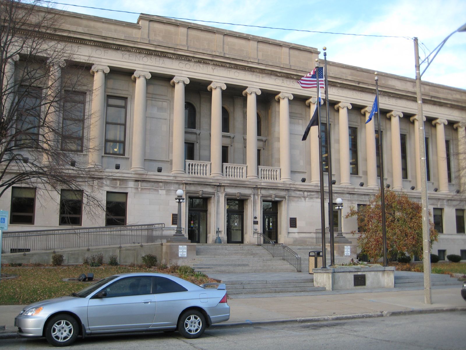
42°34′35″N 87°48′50″W / 42.576389°N 87.813889°WKenosha 9 Kenosha County Courthouse and Jail 
March 9, 1982 912 56th St.
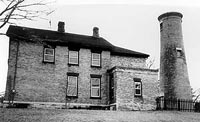
42°35′06″N 87°49′23″W / 42.585°N 87.823056°WKenosha 10 Kenosha Light Station 
June 28, 1990 5117 Fourth Ave.
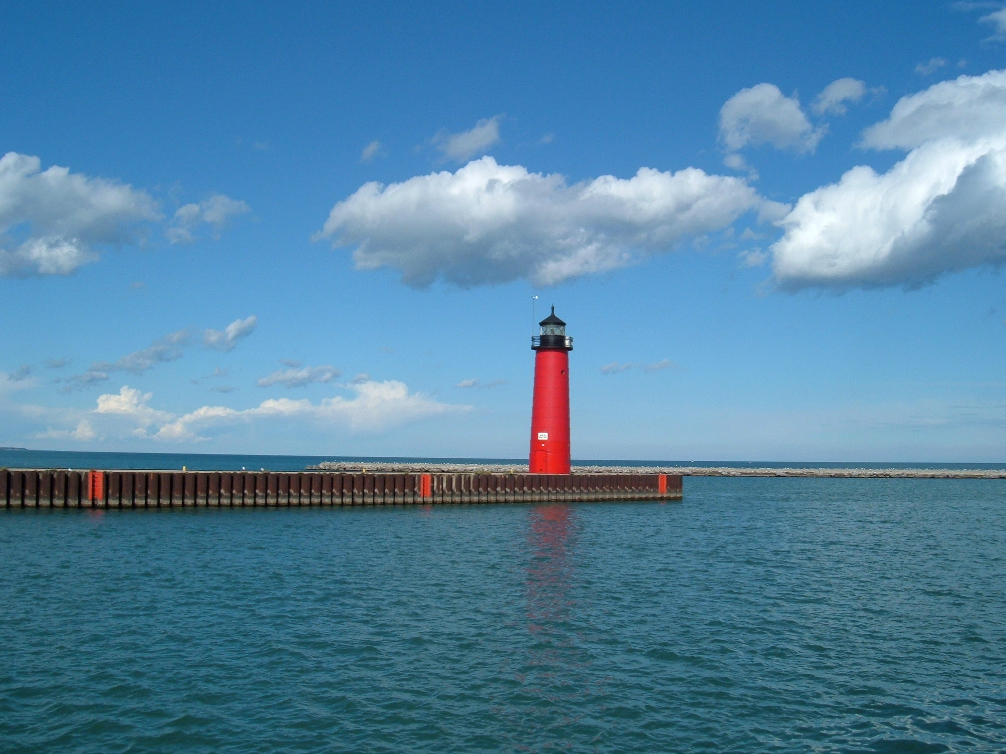
42°35′23″N 87°48′57″W / 42.589722°N 87.815833°WKenosha 11 Kenosha North Pierhead Light 
June 24, 2008 North pier at Kenosha harbor entry, 0.1 mile east of Simmons Island Park
42°35′20″N 87°48′31″W / 42.588842°N 87.8086°WKenosha 12 Library Park 
June 22, 2000 711 59th Place
42°34′50″N 87°49′11″W / 42.580556°N 87.819722°WKenosha 13 Library Park Historic District November 29, 1988 Roughly bounded by 59th St., 7th Ave., 61st St., and 8th Ave.
42°34′50″N 87°49′09″W / 42.580556°N 87.819167°WKenosha 14 Lucas Site February 24, 1995 Address Restricted Pleasant Prairie 15 Manor House October 29, 1980 6536 3rd Ave.
42°34′28″N 87°48′55″W / 42.574444°N 87.815278°WKenosha 16 John McCaffary House January 31, 1978 5732 13th Court
42°34′56″N 87°49′35″W / 42.582222°N 87.826389°WKenosha 17 Rosinco July 18, 2001 12 mi. E of Kenosha
42°37′30″N 87°38′14″W / 42.625°N 87.637222°WLake Michigan 18 Simmons Island Beach House 
February 20, 2003 5001 Simmons Island
42°35′27″N 87°48′51″W / 42.590833°N 87.814167°WKenosha 19 Gilbert M. Simmons Memorial Library 
December 17, 1974 711 59th Pl.
42°34′50″N 87°49′10″W / 42.580556°N 87.819444°WKenosha 20 Southport Beach House January 8, 2003 7825 First Ave.
42°33′41″N 87°48′45″W / 42.561389°N 87.8125°WKenosha 21 St. Matthew's Episcopal Church 
June 6, 1979 5900 7th Ave.
42°34′55″N 87°49′08″W / 42.581944°N 87.818889°WKenosha 22 Third Avenue Historic District November 1, 1988 Along Third Ave. between 61st and 66th Sts.
42°34′35″N 87°48′52″W / 42.576389°N 87.814444°WKenosha 23 Washington Park Clubhouse January 23, 2003 2205 Washington Rd.
42°36′04″N 87°50′11″W / 42.601111°N 87.836389°WKenosha 24 Justin Weed House December 3, 1974 3509 Washington Rd.
42°36′09″N 87°51′07″W / 42.6025°N 87.851944°WKenosha 25 Wehmhoff Mound (47KN15) November 21, 1985 Address Restricted Wheatland 26 WISCONSIN shipwreck (iron steamer) October 7, 2009 Address Restricted Kenosha See also
References
- ^ "National Register of Historic Places: Weekly List Actions". National Park Service, United States Department of the Interior. Retrieved on November 10, 2011.
- ^ Numbers represent an ordering by significant words. Various colorings, defined here, differentiate National Historic Landmark sites and National Register of Historic Places Districts from other NRHP buildings, structures, sites or objects.
- ^ "National Register Information System". National Register of Historic Places. National Park Service. . http://nrhp.focus.nps.gov/natreg/docs/All_Data.html.
U.S. National Register of Historic Places Topics Lists by states Alabama • Alaska • Arizona • Arkansas • California • Colorado • Connecticut • Delaware • Florida • Georgia • Hawaii • Idaho • Illinois • Indiana • Iowa • Kansas • Kentucky • Louisiana • Maine • Maryland • Massachusetts • Michigan • Minnesota • Mississippi • Missouri • Montana • Nebraska • Nevada • New Hampshire • New Jersey • New Mexico • New York • North Carolina • North Dakota • Ohio • Oklahoma • Oregon • Pennsylvania • Rhode Island • South Carolina • South Dakota • Tennessee • Texas • Utah • Vermont • Virginia • Washington • West Virginia • Wisconsin • WyomingLists by territories Lists by associated states Other Municipalities and communities of Kenosha County, Wisconsin City 
Villages Towns CDPs Camp Lake | Lake Shangrila | Lily Lake | Powers Lake‡ | Wilmot
Unincorporated
communitiesBassett | Benet Lake | Brighton | Central Park | Chapin | Kellogg's Corners | Klondike | Liberty Corners | New Munster | Paris | Salem | Salem Oaks | Slades Corners | Somers | Trevor | Voltz Lake
Ghost town Footnotes ‡This populated place also has portions in an adjacent county or counties
Categories:- Kenosha County, Wisconsin
- Lists of historic places in Wisconsin
-


Wikimedia Foundation. 2010.