- Czarny Las, Podlaskie Voivodeship
-
For other places with the same name, see Czarny Las (disambiguation).
Czarny Las — Village — 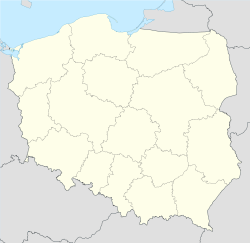
 Czarny Las
Coordinates: 53°39′54″N 23°4′2″E / 53.665°N 23.06722°E Country  Poland
Voivodeship Podlaskie County Augustów Gmina Sztabin Czarny Las [ˈt͡ʂarnɨ ˈlas] is a village in the administrative district of Gmina Sztabin, within Augustów County, Podlaskie Voivodeship, in north-eastern Poland.[1] It lies approximately 4 kilometres (2 mi) south-west of Sztabin, 22 km (14 mi) south of Augustów, and 62 km (39 mi) north of the regional capital Białystok.
References
Seat 
Other villages Andrzejewo • Balinka • Brzozowe Grądy • Budziski • Chomaszewo • Cisów • Czarniewo • Czarny Las • Dębowo • Długie • Ewy • Fiedorowizna • Grzędy • Hruskie • Huta • Jagłowo • Jaminy • Janówek • Jasionowo Dębowskie • Jastrzębna Druga • Jastrzębna Pierwsza • Jaziewo • Kamień • Karoliny • Klonowo • Kolonie Jasionowo • Komaszówka • Kopiec • Kopytkowo • Krasnoborki • Krasnybór • Kryłatka • Kunicha • Lebiedzin • Lipowo • Łubianka • Mogilnice • Motułka • Ostrowie • Podcisówek • Polkowo • Rogowo • Ściokła • Sosnowo • Wilcze Bagno • Wilkownia • Wolne • Wrotki • ŻmojdakCategories:- Villages in Augustów County
- Augustów County geography stubs


Wikimedia Foundation. 2010.