- Creelsboro, Kentucky
-
Creelsboro — Ghost town — Creelsboro, Kentucky Location within the state of Kentucky
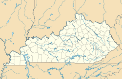
 Creelsboro
Coordinates: 36°53′06″N 85°11′51″W / 36.885°N 85.1975°WCoordinates: 36°53′06″N 85°11′51″W / 36.885°N 85.1975°W Country United States State Kentucky County Russell Time zone Central (CST) (UTC-6) – Summer (DST) CDT (UTC-5) ZIP codes FIPS code GNIS feature ID Creelsboro is a ghost town in Russell County, Kentucky, United States. The historic town was thriving some sixteen years before Russell County was formed. It was named for Elijah Creel, an early settler, and was at one time the busiest river port on the Cumberland River between Nashville, Tennessee, and Burnside, Kentucky. The town hosted a bank, school, three stores and a building that provided lodging for steam boat passengers. Creelsboro was a major trade center along the Cumberland River in the 19th century, although its actual population was only about 50. With the construction of the Wolf Creek Dam, traffic from steamboats and other vessels greatly decreased. Creelsboro's current population primarily are involved in agriculture. Many tourists visit the area to access the Cumberland River for trout fishing and other recreational boating activities.
External links
Municipalities and communities of Russell County, Kentucky Cities 
Unincorporated
communitiesCreelsboro | Crocus‡
Footnotes ‡ This populated place also has portions in an adjacent county or counties.
Categories:- Ghost towns in Kentucky
- Geography of Russell County, Kentucky
- Kentucky geography stubs
- United States ghost town stubs


Wikimedia Foundation. 2010.