- National Park Sjeverni Velebit
-
Sjeverni Velebit — National Park —  Location of N.P. Sjeverni Velebit within Croatia
 Sjeverni Velebit
Coordinates: 44°41′35″N 15°00′25″E / 44.69306°N 15.00694°E Country Croatia County Lika-Senj County Time zone CET (UTC+1) – Summer (DST) CEST (UTC+2) Website National Park Sjeverni Velebit National Park Sjeverni Velebit (lit. Northern Velebit; Croatian: Nacionalni park Sjeverni Velebit) is a national park in Croatia that covers 109 km² of the northern section of the Velebit mountain, the largest mountain in Croatia. Because of the abundant variety of this part of the Velebit range and its authenticity, the area was upgraded from its classification as a nature reserve to a national park[1] in 1999, and started work in September the same year.
The whole of the Velebit mountain is a nature park, a lesser category of nature conservation. Another national park on Velebit is the Paklenica on its southern side.
Contents
The park
The park reserve is protected and visitors cannot pass through except on designated trails. Inside the reserve there are the Visibaba (Galanthus) botanical reserve, with an abundance of the endemic Croatian subspecies of Sibiraea altaiensis, and the Zavižan-Balinovac-Velika kosa botanical reserve, famous for its outstanding collection of species of mountain flora. Inside the reserve there is the well known Velebit Botany Garden, founded by pharmacology professor Fran Kušan in 1967.
The Park is criss-crossed with numerous mountaineering trails. The best known is the Premužić's Trail, named after its constructor, the forester Ante Premužić who built it in late 1933. The path runs through the most beautiful and most interesting parts of the park. From the numerous peaks in the surroundings there are magnificent views of the Adriatic Sea and its islands (Pag, Rab, Goli otok, Prvić and Krk) as well as of the continental side.
 Park map.
The Park's cultural value is apparent in the form of numerous ruins of so-called "summer lodges". These bear witness to ages past and long forgotten when Velebit was populated by numerous shepherds and cattle farmers. On its coastal banks there are many ruined houses, lodges and stonewalls which are all the evidence that remain of a local population that long since scattered all around the globe, leaving nothing but traces of their presence on this remarkably beautiful and exquisite land.
The peak Zavižan (1676 m) is located within the park. It is the site of the meteorological station with the highest altitude in Croatia.
Special reservations
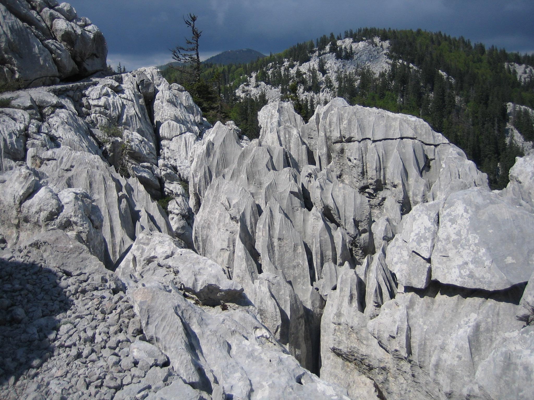
The special reservations in the park are two locales called Hajdučki kukovi and Rožanski kukovi. Their names come from a folk name given to large stone masses which rise up over the surroundings of the Velebit mountains. They are situated in the center of the park, but are not a regular part of it, access to them is restricted. Only scientific researchers and educational visits are allowed in the protected area.
Hajdučki kukovi
Hajdučki kukovi, is part of the Kukovi group of peaks in the north part of the Velebit, in Croatia. Together with Rožanski kukovi it forms an area of around 22 km² declared as a nature reserve in 1969. It is separated from Rožanski kukovi by the Skrbina Draga and Veliki Lubenovac field.
The kukovi group has around 40 "hips" that easily exceed 1600 m. The area around Hajdučki kukovi has a complex underground drainage system. The terrain is much wilder than around Rožanski kukovi, and there are parts where even today no human foot has ever trod.[2] Lukina jama, the deepest mountain cave in Croatia and one of the deepest in southeast Europe with a depth of 1392 m, discovered in 1992 in the Hajdučki kukovi landscape by a local caving enthusiast named Ozren Lukić who joined a mountain division during the war (1991–1995) as a volunteer and got killed by a sniper in 1992.[1] Lukina jama was named after him.
Rožanski kukovi
 Rossi's Cabin
The first "kuk", Gromovača (1675 m), lies two and a half hour walk from the hostel in Zavižan. The centre of the rocks begin immediately behind Rossijeva koliba (a mountain hut), which is also 2.5 hours walk from the hostel.[2] The most interesting part of this rocky region is on the path from Rossilijeva koliba to Crikvena (1641 m), half an hour's walk from the hut.
In an area of about 18 km² there are more than fifty stony peaks, all over 1600 m, some with bizarre shapes of towers, spires or obelisks. Here all the phenomena of karst rock meet - chasms, dizzying heights, crevices, caves, natural gateways and passes.
The most well-known and the most popular sights are Novotnijev kuk, Rossilijev kuk and Premužičev kuk.
See also
References
- ^ a b Rudolf Abraham, Walking in Croatia, pg. 130, Cicerone Press (2004), ISBN 185284406X
- ^ a b Radovan Radovinović, The Croatian Adriatic Tourist Guide, pg. 143, Naklada Naprijed - Zagreb (1999), ISBN 953-178-097-8
External links
- NP Sjeverni Velebit
- National Park web site
- Awarded "EDEN - European Destinations of Excellence" non traditional tourist destination 2009
Protected areas of Croatia National parks Nature parks Kopački rit • Papuk • Lonjsko polje • Medvednica • Žumberak-Samoborsko gorje • Učka • Velebit • Vransko lake • Telašćica • Biokovo • LastovoCoordinates: 44°41′35″N 15°00′25″E / 44.69306°N 15.00694°E
Categories:- National parks of Croatia
- Biosphere reserves of Croatia
- Dinaric Alps


Wikimedia Foundation. 2010.