- 2008–09 Australian region cyclone season
-
2008–09 Australian region cyclone season 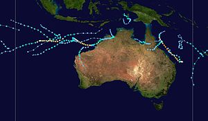
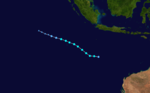
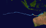
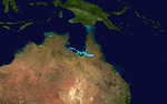
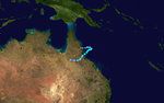
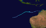
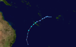
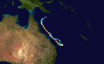
Season summary mapFirst storm formed: 18 November 2008 Last storm dissipated: 28 April 2009 Strongest storm: Hamish – 925 hPa (mbar), 215 km/h (130 mph) (10-minute sustained) Tropical lows: 23 Tropical cyclones: 11 Severe tropical cyclones: 3 Total fatalities: 4 direct, 1 indirect Total damage: $103.3 million (2008 USD) Australian region cyclone seasons
2006–07, 2007–08, 2008–09, 2009–10, 2010–11Related articles: - Timeline of the 2008-09 Australian region cyclone season
- 2008–09 South-West Indian Ocean cyclone season
- 2008–09 South Pacific cyclone season
The 2008–09 Australian region cyclone season was an event in the cycle of tropical cyclone formation. It officially started on 1 November 2008, and officially ended on 30 April 2009. The regional tropical cyclone operational plan defines a "tropical cyclone year" separately from a "tropical cyclone season"; the "tropical cyclone year" began on 1 July 2008 and ended on 30 June 2009.[1]
The scope of the Australian region is limited to all areas south of the equator, east of 90°E and west of 160°E. This area includes Australia, Papua New Guinea, western parts of the Solomon Islands, East Timor and southern parts of Indonesia.[1]
Tropical cyclones in this area are monitored by five Tropical Cyclone Warning Centres (TCWCs): the Australian Bureau of Meteorology in Perth, Darwin, and Brisbane; TCWC Jakarta in Indonesia; and TCWC Port Moresby in Papua New Guinea.[1] The Joint Typhoon Warning Center issues unofficial warnings for the region, designating tropical depressions with the "S" suffix when they form west of 135°E, and the "P" suffix when they form east of 135°E.
Seasonal forecasts
Australian Region
Tropical Cyclone Intensity ScaleCategory Sustained
windsGusts Five >107 kt
>200 km/h>151 kt
>279 km/hFour 86-107 kt
160-200 km/h122-151 kt
225-279 km/hThree 64-85 kt
118-159 km/h90-121 kt
165-224 km/hTwo 48-63 kt
89-117 km/h68-89 kt
125-164 km/hOne 34-47 kt
63-88 km/h49-67 kt
91-125 km/hTropical
Low<34 kt
<63 km/h<49 kt
<91 km/hOn 26 September 2008 the New Zealand National Institute of Water & Atmospheric Research issued a seasonal forecast for the whole of the southern Pacific Ocean to the east of 150°E. They predicted that the 2008-09 South Pacific cyclone season would see an average risk of cyclones forming, which meant that 8-10 tropical cyclones with wind speeds greater than 35 knots would form east of 150°E.[2]
The Tropical Cyclone Warning Centre in Perth on 20 October 2008 forecasted that this season would be an average to an above average season with at least five to seven tropical cyclones, forming within their area of responsibility.[3] The forecast also predicted that there would be at least 2 coastal impacts, with a "higher than normal risk" of a pre Christmas tropical cyclone.[3] There was also a "significant risk" of a severe tropical cyclone impacting the north-western Australian coast.[3]
The Tropical Cyclone Warning Centre in Darwin on 20 October 2008 also predicted that the 2008-09 season may be an "above average" season in the Northern Territory.[4] An average season sees two-three cyclones form in TCWC Darwins area of responsibility, which includes the includes the Gulf of Carpentaria.[4] TCWC Darwin also predicted that there was an "even chance" of a severe tropical cyclone (Category 3 or greater) forming and that a cyclone would form before Christmas in the Timor Sea.[4]
The Tropical Cyclone Warning Centre in Perth issued an updated prediction for seasonal activity on 30 January 2009 in which they said that their earlier prediction of an average to above average season was still on track.[5] There was expected to be at least three more tropical cyclones, which would form in their area of responsibility before the end of the cyclone season on 1 May with a high chance of a tropical cyclone forming within February.[5] They also reported that there was a significant risk of a severe Tropical Cyclone coastal impact during the remainder of the season.[5]
Seasonal summary

Storms
Tropical Low 01U (Bernard)
Tropical low (Australian scale) Tropical depression (SSHS) 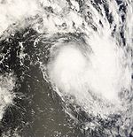
Duration 21 November – 22 November Intensity 35 km/h (25 mph) (10-min), 998 mbar (hPa) Main article: Tropical Storm BernardOn 15 November, an area of low pressure developed within the area of responsibility of Météo-France.[6] The low strengthened into a tropical disturbance on 19 November[7] and further into a moderate tropical storm the next day, receiving the name Bernard.[8] Shortly afterward, it weakened to a tropical depression due to unfavourable conditions.[9] On 21 November, the remnants of Bernard moved into the Australian region and were classified as tropical low 01U by TCWC Perth.[10] The JTWC also reported Bernard as having wind speeds, equivalent to a tropical depression while within the Australian Region.[11] However later that day the Tropical Low dissipated.[11]
Tropical Cyclone Anika
Category 2 tropical cyclone (Australian scale) Tropical storm (SSHS) 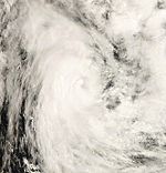
Duration 18 November – 22 November Intensity 95 km/h (60 mph) (10-min), 990 mbar (hPa) Late on 17 November, the Joint Typhoon Warning Center noted that an area of low pressure had formed within the Central Indian Ocean just inside TCWC Jakarta's area of responsibility.[12] Early the next day TCWC Jakarta declared it as a tropical depression and started to issue Cyclone Warnings for the Cocos (Keeling) Islands.[13] The JTWC began issuing advisories on Tropical Cyclone 02S later that day.[14] It was upgraded to a Category 1 cyclone early on 19 November.[15] On 20 November, Anika reached its peak intensity as a Category 2 cyclone with winds of 95 km/h (60 mph) and a pressure of 984 hPa.[16] The intensification was the result of deep convection wrapping around the center of circulation and Dvorak Technique intensity estimates reaching T3.5.[17] Cyclone Anika passed to the north of the Cocos Islands, and cyclone warnings were cancelled later that day.[16] Later that day, it weakened to a Category 1 cyclone.[18] As the storm tracked over cooler waters, it continued to weaken. By 21 November, the storm weakened to a tropical low due to increasing wind shear. The next day, the Anika dissipated over open waters.[16]
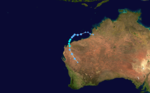
Severe Tropical Cyclone Billy
Category 4 severe tropical cyclone (Australian scale) Category 3 tropical cyclone (SSHS) 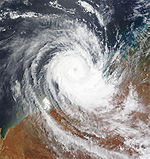
Duration 17 December – 28 December Intensity 175 km/h (110 mph) (10-min), 950 mbar (hPa) On 17 December, a tropical low formed in the Arafura Sea north-west of Darwin in the Northern Territory. It moved into the Joseph Bonaparte Gulf and was very slow moving. On the night of 18 December it intensified into a Category 1 cyclone and was named Billy. On 20 December, Billy made landfall as a Category 2 cyclone approximately 65 kilometres north of Wyndham. After then, it weakened to a tropical low and moved slowly south westwards. It then moved off the coast just north of Kuri Bay and redeveloped into a tropical cyclone on 22 December as the storm turned to the north-north east. Late on 24 December, Billy began to rapidly intensify and reached Category 4 strength early on 25 December and became a typical annular cyclone. Later that same day, Billy weakened into a category 3 cyclone as it replaced its eyewall and TCWC Perth issued their final tropical advice as the system was moving away from land. Billy weakened into a category 1 cyclone on 27 December and weakened into a tropical low on 28 December. Later that day, TCWC Perth issued their final advisory as it continued to weaken.[19]
Two remote indigenous communities, Kalumburu and Oombulgurri were cut off by flood waters with roads and the airstrips closed.[20]
Tropical Low 04U
Tropical low (Australian scale) 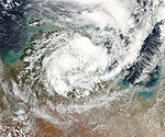
Duration 21 December – 24 December Intensity 55 km/h (35 mph) (10-min), 1000 mbar (hPa) On 20 December, an area of low pressure, associated with developing convection, formed about 1000 km (560 mi) east of Darwin in the Gulf of Carpentaria.[21] The next day, the Bureau of Meteorology in Darwin designated the system as a tropical low.[22] Banding features developed along the southern portion of the system and further development was anticipated as the low was located underneath an anticyclone.[23] Around 5:26 a.m. local time on 23 December, the low made landfall near Port Roper, preventing further development of the storm.[24] About 36 hours after landfall, the Australian Bureau of Meteorology issued their final advisory on the system as it dissipated over land.[25]
Tropical Low 05U
Tropical low (Australian scale) 
Duration 23 December – 28 December Intensity 35 km/h (25 mph) (10-min), 1003 mbar (hPa) On 23 December, TCWC Brisbane noted that a weak tropical low had formed within the Solomon Sea, about 1330 kilometres to the north east of Cairns.[26] Over the next few days the low moved towards the south west into the Coral Sea.[27]
Tropical Cyclone Charlotte
Category 1 tropical cyclone (Australian scale) Tropical storm (SSHS) 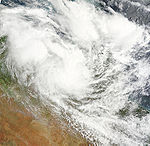
Duration 8 January – 12 January Intensity 85 km/h (50 mph) (10-min), 987 mbar (hPa) On 8 January, TCWC Darwin identified a Tropical Low in the southern Gulf of Carpentaria. The next day TCWC Brisbane begin to issue advices on the low issuing Cyclone Watches for coastal communities between Aurukun on the Cape York Peninsula and the Northern Territory/Queensland border. On 11 January, the Tropical Low developed into Tropical Cyclone Charlotte, and on 12 January at 4:00am (AEST), crossed the coast near the Gilbert River Mouth with wind gusts of 120 km/h (70 mph).
Heavy rains, estimated at over 150 mm (5.9 in), from Tropical Cyclone Charlotte flooded at least 100 homes in low-lying areas on Cape York including Babinda, Mount Sophia and at Normanton.[28] The rains also caused mudslides which, as described by an affected home-owner "...it's just mud, mud everywhere". The main road to Karumba was also cut off by flood waters.[29] Damages from the storm are estimated at $15 million (USD).[30]
Tropical Low 07U
Tropical low (Australian scale) Duration 11 January – Intensity 35 km/h (25 mph) (10-min), Unknown On January 11 a tropical low formed in the Coral Sea. The winds peaked at 35 miles per hour (56 km/h).
Tropical Cyclone Dominic
Category 2 tropical cyclone (Australian scale) Tropical storm (SSHS) 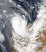
Duration 22 January – 27 January Intensity 100 km/h (65 mph) (10-min), 976 mbar (hPa) On 22 January, TCWC Perth noted that Tropical Low 08U had formed overland, to the north of Broome in North-West Australia. JTWC had upgrade this system become a significant tropical cyclone as "good".[31] On 25 January at 11:15am (AWDT), TCWC Perth issued a Tropical Cyclone Warning for coastal areas from Wickham to Exmouth. Later that day, the JTWC issued a Tropical Cyclone Formation Alert as a tropical cyclone was likely to form within the following 48 hours.[31] TCWC Perth begun issuing advices for the developing tropical low and posted tropical cyclone warning along the far western coastline of the Western Australia region. On 26 January, the system became Tropical Cyclone Dominic. Further intensification followed and Dominic was upgraded to a Category 2 cyclone several hours later. Morning of 27 January, Dominic made landfall just after 7am (AWDT) near Onslow.[32][33] Later that day Dominic weakened to a Category 1 cyclone before weakening into a tropical low during the day. JTWC issued its last advisory on this system on 27 January as it continued to weaken inland.
The formation of Dominic in an area that produces significant amounts of oil resulted in numerous evacuations of offshore oil platforms. The platforms remained closed for several days until the storm dissipated, resulting in a loss of roughly 200,000 barrels (32,000 m3) per day, increasing global gasoline prices.[34] A red alert was declared for Onslow In preparations for the landfall of Dominic a crane worker was killed in Port Hedland while dismantling a crane.[35]
In Onslow, the roof of the local library was blown off, resulting in flooding within the building. A nearby hospital also sustained flood damage.[34] Several trees and power lines were downed by high winds and some roads were flooded.[36]
Following the storm, the shires of Ashburton, Carnarvon, Upper Gascoyne, Murchison, Yalgoo, Moora, Northam, York, Quairading and Beverley were eligible for disaster assistance from the Australian Government.[37]
Tropical Cyclone Ellie
Category 1 tropical cyclone (Australian scale) Tropical storm (SSHS) 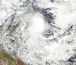
Duration 30 January – 4 February Intensity 75 km/h (45 mph) (10-min), 989 mbar (hPa) Early on 30 January, the TCWC in Brisbane noted that a Tropical Low, had formed within a monsoon trough.[38] Later that day the JTWC, reported that multi spectral imagery had shown a developing low level circulation center with deep convection located over the western quadrant of the Low level circulation centre.[39] Late the next day the Bureau of Meteorology reported that the low had intensified into a tropical cyclone and assigned the name of Ellie to the cyclone.[40] They also reported that Ellie had reached its peak winds of 80 km/h, (50 mph), which made Ellie a Category one cyclone on the Australian Tropical Cyclone Intensity Scale.[40] Later that day the Joint Typhoon Warning Center initiated issuing warnings on Ellie designating it as Tropical Cyclone 12P and also reported peak wind speeds of 75 km/h, (45 mph) which made Ellie equivalent to a Tropical Storm on the Saffir–Simpson Hurricane Scale.[41] Ellie made landfall near Mission Beach at about Midnight AEST, 2 February (1400 UTC), as a Category 1 system and weakened into a Tropical Low.[42] TCWC Brisbane was expecting Tropical Low ex-Ellie to move back over the Coral Sea within 24 to 36 hours after Ellie made landfall and possibly reintensify into a tropical cyclone.[42] However, this did not happen. The low that had been Ellie redeveloped within the south eastern Gulf of Carpentaria. Torrential rain from the remnants of Ellie flooded areas in Northern Queensland, causing about A$110 million (US$70.7 million) in damages. In Ingham, between Cairns and Townsville, some 50 homes were flooded, with 32 people evacuated to emergency accommodation at a local high school.[43]
Tropical Cyclone Freddy
Category 1 tropical cyclone (Australian scale) Tropical storm (SSHS) 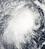
Duration 2 February – 10 February Intensity 85 km/h (50 mph) (10-min), 992 mbar (hPa) On 2 February, TCWC Perth noted that a Tropical Low had developed in the monsoon trough, which was located over the Kimberly region. On 3 February, at 03:45 WDT TCWC Perth issued a cyclone watch for the area between Kalumburu and Broome as the storm continued to move west winds intensified to 75 km/h and warning that the storm may develop into a cyclone later in the day.[44] The system was located 500 km north west of Port Hedland on 5 February and is forecasted to continue moving westward into the Indian Ocean and strengthen into a cyclone although its not expected to affect the West Australian coast line.[45] On 6 February at 1200Z, the Joint Typhoon Warning Center identified the system as Tropical Cyclone 14S. Freddy tracked slowly south westward and steadily weakened as it was affected by more shear and cooler waters. The JTWC issued its final advisory on 9 February, as the system had dissipated. The outer bands of Freddy produced heavy rains in Indonesia. A landslide triggered by these rains killed two people.[46]
Tropical Low 11U
Tropical low (Australian scale) Duration 4 February – 5 February Intensity 45 km/h (30 mph) (10-min), Unknown TCWC Brisbane — Coral sea
Tropical Low 12U
Tropical low (Australian scale) Duration 10 February – February Intensity 45 km/h (30 mph) (10-min), Unknown TCWC Perth — Timor Sea
Tropical Low 13U (Innis)
Main article: Cyclone Innis (2009)Tropical low (Australian scale) Tropical storm (SSHS) 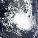
Duration 18 February – 18 February Out of area Intensity 45 km/h (30 mph) (10-min), 1004 mbar (hPa) On 18 February, the extra tropical remnants of Cyclone Innis, briefly curved into the Australian Region, as a result the remnants were designated as Tropical Low 13U by TCWC Brisbane. However as Innis was expected to recurve into the South Pacific within 24 hours primary warning responsibility remained with TCWC Wellington. Later that day Innis recurved into the south Pacific.
Tropical Low 14U
Tropical low (Australian scale) Duration 25 February – 28 February Intensity 55 km/h (35 mph) (10-min), 996 mbar (hPa) On 25 February, TCWC Darwin reported a Tropical Low developed within the monsoon trough west of Darwin, Northern Territory. JTWC forecasted of this system becoming a tropical cyclone as "fair". The next early morning TCWC Perth begun issuing tropical cyclone advices on the developing low, posting a cyclone watch for the Pilbara coastal areas. On 26 February, JTWC upgraded the system's chances to "good" and issued the Tropical Cyclone Formation Alert. The low made landfall over Port Hedland without becoming a tropical cyclone.
The tropical low dropped upwards of 112 mm (4.4 in) of rain along the Pilbara coast, causing minor flooding. Flood warnings and watches were issued for areas around several rivers due to the rains.[47]
Tropical Low 15U (Hina)
Tropical low (Australian scale) Duration 22 February – Intensity 55 km/h (35 mph) (10-min), 996 mbar (hPa) TCWC Darwin
Tropical Low Gabrielle
Tropical low (Australian scale) Tropical storm (SSHS) 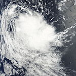
Duration 1 March – 5 March Intensity 65 km/h (40 mph) (10-min), 996 mbar (hPa) Gabrielle formed out of a low pressure system that quickly developed. It begin to move south east and soon weakened into a tropical low. It slowly tracked south and south westwardly, it slowly reintensified and gained tropical cyclone status. As an anticyclone possibly forming to the south of the system. This might have allowed the storm to strengthen a bit before dissipating over cooler waters later in the week, but it then unexpectedly turned the west and dissipated on 5 March.
Bureau of Meteorology in Perth noted that in post-analysis determined that Gabrielle did not meet the minimum requirements of a tropical cyclone by the Australian definition. Gales were observed in one quadrant or another throughout most of Gabrielle's life but at no one time did they extend more than halfway around the low level circulation center.[48]
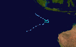
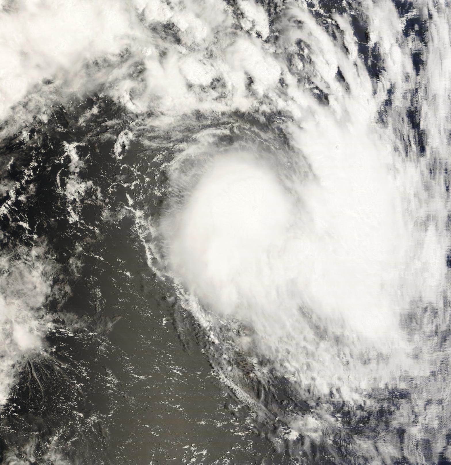
Severe Tropical Cyclone Hamish
Category 5 severe tropical cyclone (Australian scale) Category 4 tropical cyclone (SSHS) 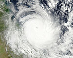
Duration 4 March – 11 March Intensity 215 km/h (130 mph) (10-min), 925 mbar (hPa) Main article: Cyclone HamishOn 4 March, a weak Tropical Low developed in an active trough located over the north western Coral Sea slowly moving south east. The low began to intensify despite its proximity to land. At 11pm EST (1100 UTC), the Tropical Low developed into Tropical Cyclone Hamish and convective band begin to develop. The next day, the cyclone strengthened into a Category 2 cyclone, and by the 11pm advisory, had strengthen further to a Category 3 Severe Tropical Cyclone and a defined eye showed on the satellite. Later that day it begin to affect the north eastern Queensland. On 7 March, Hamish was located approximately 230 kilometres from Cairns with the Bureau of Meteorology expecting Hamish to intensify into a Category 4 with the cyclone expecting to brush through near Mackay on Sunday night or Monday morning.[49] during that day Hamish had intensified to a Category 4 cyclone.[50] Later that day the storm intensified into a Category 5 cyclone, the first since Cyclone George, during its closest approach to Hayman Island. During 8 March, Severe Tropical Cyclone Hamish weakened to a Category 4 cyclone. The cyclone was forecasted to make landfall near Bundaberg however the Bureau of Meteorology then expected Hamish not to make landfall and to continue to move in a south easterly direction and slowly weaken. A trawler caught in rough seas produced by the storm sent out a distress signal as it was overcome by the storm. Rescue attempts to retrieve the three crew members were hampered by Hamish and were called off but expected to resume of 10 March.[51] On 10 March 11am EST (0100 UTC) Hamish had weakened to a Category 3 cyclone with the Bureau of Meteorology is expected that Hamish slow and continue to weaken. On 11 March 7am EST (2100 UTC) the Hamish weakened further to a Category 2 cyclone with the Bureau of Meteorology expected Hamish to continually be slow moving and weaken, with the cyclone beginning to move in a north west direction later in the day. The storm continued to weaken and BoM downgraded it to a tropical low later that day.
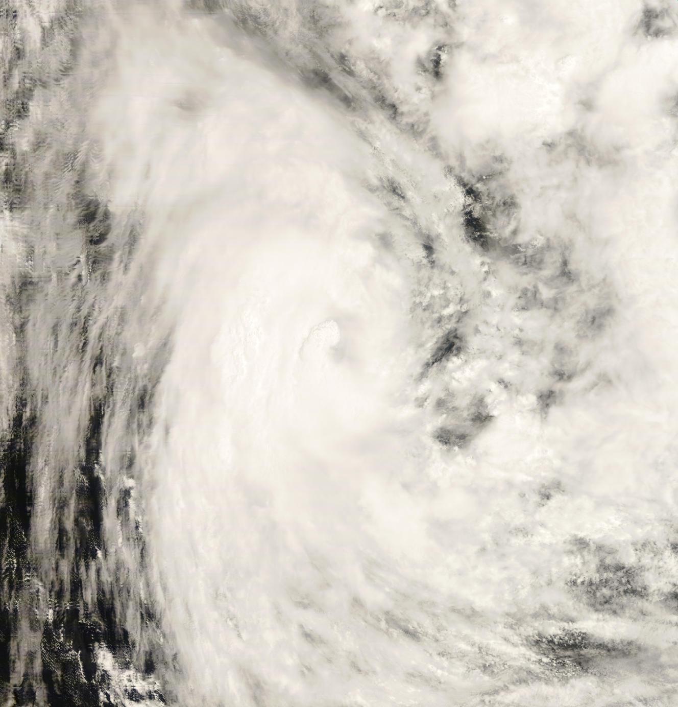
Severe Tropical Cyclone Ilsa
Category 4 severe tropical cyclone (Australian scale) Category 3 tropical cyclone (SSHS) 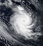
Duration 12 March – 27 March Intensity 165 km/h (105 mph) (10-min), 958 mbar (hPa) On 12 March, TCWC Darwin identified that a weak tropical low had formed in the Arafura Sea.[52] On 17 March, TCWC Perth began issuing shipping warnings for the developing tropical low. The low developed into Tropical Cyclone Ilsa late on 17 March. Ilsa became a Category 3 Severe Tropical Cyclone on the evening of 19 March and continued to intensify, despite predictions that Ilsa would weaken. Ilsa quickly strengthened the next morning to a Category 4 cyclone, despite predictions that the cyclone would weaken before reaching that intensity. Steady weakening began soon after; Ilsa was downgraded to a Category 3 cyclone on 20 March and to Category 1 on 23 March. On 24 March, the cyclone was downgraded to a tropical low and advisories were discontinued.
Tropical Low 19U
Tropical low (Australian scale) Duration 19 March – 20 March Intensity 45 km/h (30 mph) (10-min), 999 mbar (hPa) On 19 March, TCWC Brisbane identified that a weak tropical low had formed in the Coral Sea near 13S, 153E. Conditions remained unfavourable for development and the storm rapidly dissipated.
Forming in the same area as Cyclone Hamish did earlier in March, officials along the Sunshine Coast feared that it could track towards the disaster zones along the Queensland coast. The storm could hinder clean-up efforts of the large oil spill caused by Hamish. Another fear was that residents would panic upon hearing of another approaching cyclone, leading to unnecessary evacuations.[53] Up to 68 mm (2.6 in) of rain fell in South Johnstone.[54]
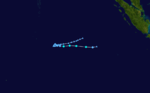
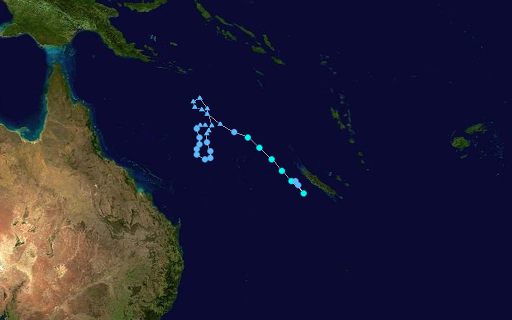
Tropical Cyclone Jasper
Category 2 tropical cyclone (Australian scale) Tropical storm (SSHS) 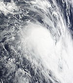

Duration 22 March – 24 March Out of area Intensity 95 km/h (60 mph) (10-min), 980 mbar (hPa) On 23 March, the remnants of Tropical Low 20U combined with areas of the monsoon trough to form a new low pressure system. This area rapidly consolidated into a new Tropical Low and on 24 March, developed into Tropical Cyclone Jasper in the eastern Coral Sea. Jasper exited the Australian region and entered into the South Pacific, RSMC Nadi region of responsibility. It then weakened unexpectedly and dissipated as it began to move off the coast of New Caledonia.
Tropical Low 21U
Tropical low (Australian scale) Duration 23 March – Intensity 55 km/h (35 mph) (10-min), Unknown TCWC Darwin - 23 March
Tropical Low 22U
Tropical low (Australian scale) 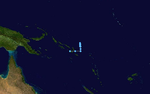
Duration 11 April – 13 April Intensity 35 km/h (25 mph) (10-min), 1004 mbar (hPa) Early on 11 April, Tropical Disturbance 15F moved into TCWC Brisbane's area of responsibility and was re-designated as Tropical Low 22U.[55][56] Over the next couple of days, the disturbance remained weak as it moved towards the southern tip of Papua New Guinea. The tropical low then dissipated on 13 April.[57][58]
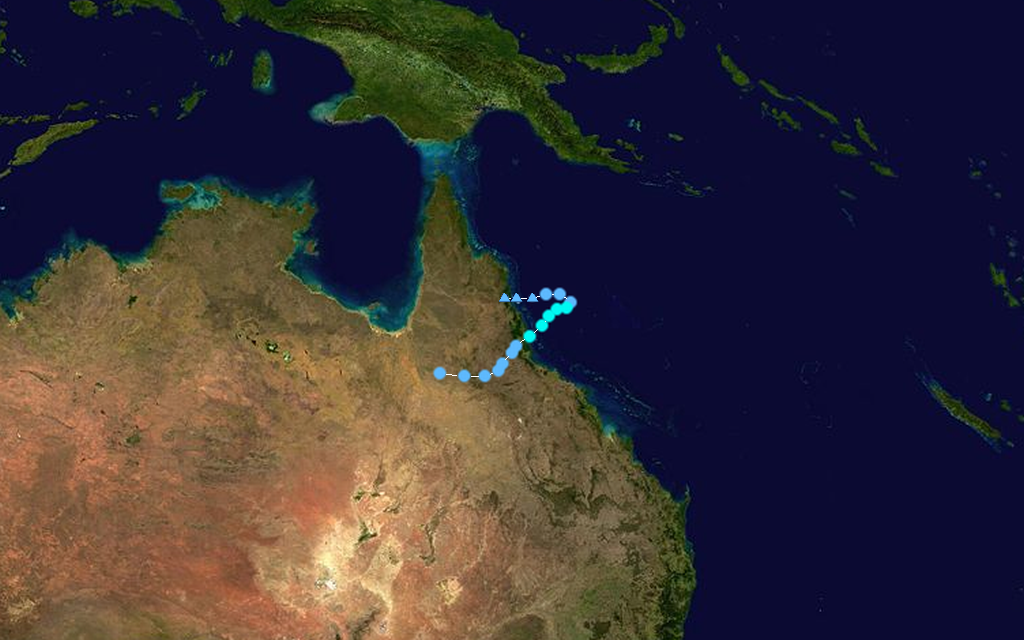
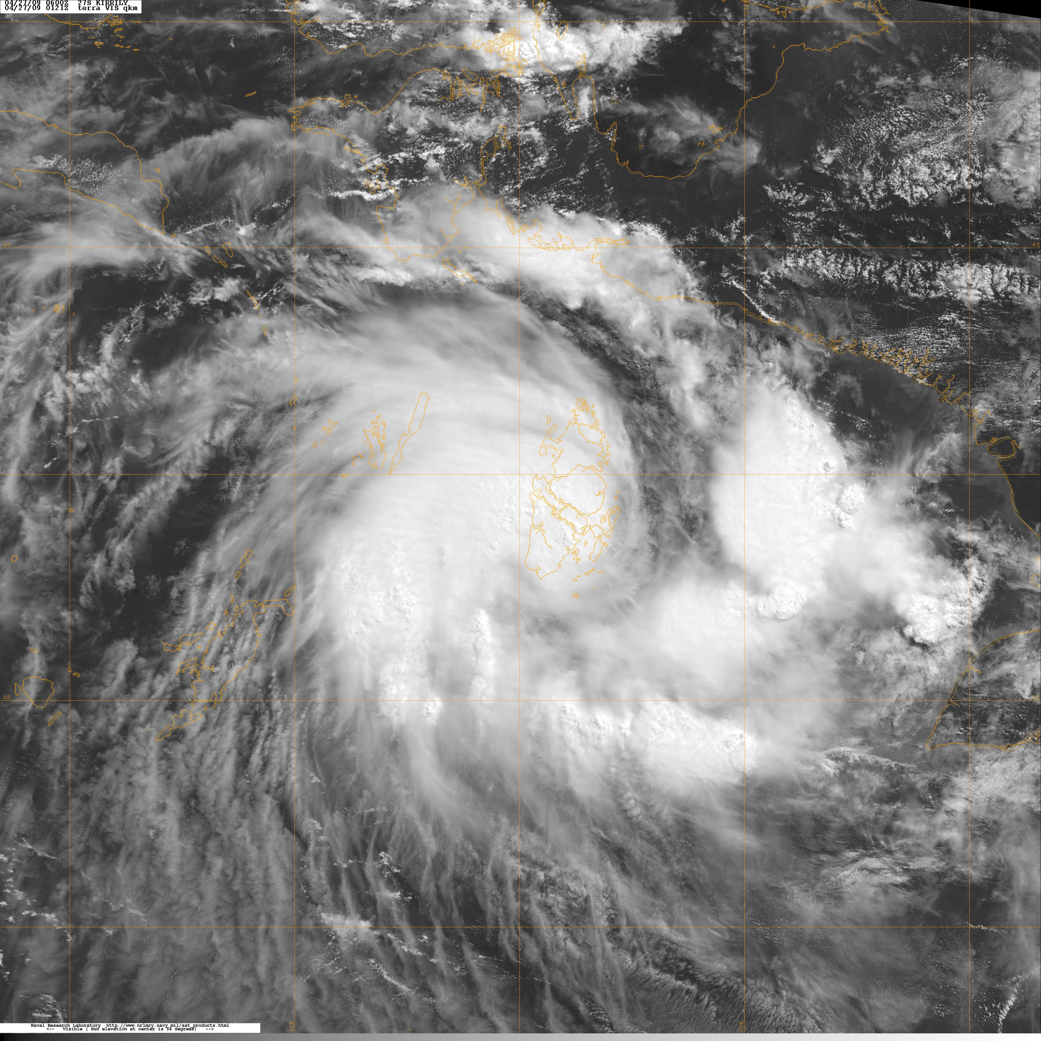
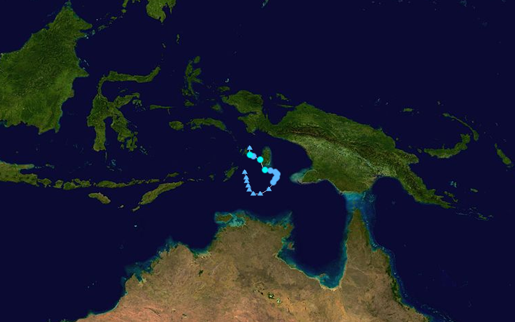
Tropical Cyclone Kirrily
Category 1 tropical cyclone (Australian scale) Tropical storm (SSHS) 

Duration 25 April – 28 April Intensity 75 km/h (45 mph) (10-min), 998 mbar (hPa) On 25 April, TCWC Darwin reported a weak Tropical Low had formed in the Arafura Sea. JTWC reported the system's chances forming into a significant Tropical Cyclone within 24 hours as "poor". Later on 26 April, JTWC upgraded the low's chances of forming from "poor" to "fair" and later in afternoon the low strengthened with JTWC upgrading the low from "fair" to "good" and issued a Tropical Cyclone Formation Alert. Joint Typhoon Warning Center designated the system as Tropical Cyclone 27S later on 27 April. In the afternoon, TCWC Darwin upgraded 23U to a Category 1 tropical cyclone and designated it as Tropical Cyclone Kirrily. Later that day, as it made landfall over Aru Islands, the low weakened slightly and JTWC downgraded Kirrily to tropical depression, and TCWC Darwin downgraded Kirrily to a tropical low. In the afternoon of the 27th, the JTWC again upgraded Kirrily into tropical storm. In the afternoon of the next day, JTWC issued their final warning on Kirrily (27S) and BoM downgraded the storm to a tropical low.
Storm names
TCWC Jakarta
TCWC Jakarta monitored Tropical Cyclones from the Equator to 10S and from 90E to 125E. No tropical depressions reached Tropical Cyclone strength within Jakarta's Area of Responsibility .[59]
- No names were used in TCWC Jakarta's Area of Responsibility during this season.
TCWC Port Moresby
Tropical cyclones that might have developed north of 10°S between 141°E and 160°E would have been assigned names by the Tropical Cyclone Warning Centre in Port Moresby, Papua New Guinea. Tropical cyclone formation in this area is rare, with no cyclones developing in it since 2007.[60]
- No names were used in TCWC Port Moresby's Area of Responsibility during this season.
Australian Bureau of Meteorology
Each Australian Tropical Cyclone Warning Centre (Perth, Darwin, and Brisbane) maintains a list of names arranged alphabetically and alternating male and female. Except from the start of the 2008-09 Tropical Cyclone Year, there will only be one list that the Bureau of Meteorology (BoM) will use to name Tropical Cyclones.[61] BOM monitored all tropical cyclones that formed between 90°E and 160°E, issuing special advisories when a cyclone formed in either TCWC Jakarta's or Port Moresby's area of responsibility.
- The names used this season were:
- Anika
- Billy
- Charlotte
- Dominic
- Ellie
- Freddy
- Gabrielle
- Hamish
- Ilsa
- Jasper
- Kirrily
- Note: After Tropical Cyclone Gabrielle had dissipated, it was determined that Gabrielle had never reached tropical cyclone intensity.
- Note: In June 2009, Severe Tropical Cyclone Hamish was retired by the Bureau of Meteorology.[62] No other names used during the 2008-09 cyclone season was retired.
Season impact
2008-2009 Australian cyclone statistics Storm name Active dates Storm category at peak intensity
Max wind
(mph)
Min. press.
(mbar)
Landfall(s) Damage (millions
USD)
Deaths Where When Wind (mph)
Anika 17 November – 22 November Category 2 cyclone 60 984 none none 0 02U 21 November – 22 November Tropical low 25 998 none none 0 Billy 17 December – 28 December Category 4 cyclone 110 948 Wyndham, Western Australia 20 December 60 .5 0 04U 22 December – 24 December Tropical low 35 1000 Port Roper, Northern Territory 23 December 35 none 0 05U 23 December – 28 December Tropical low 25 1003 none none 0 Charlotte 9 January – 12 January Category 1 cyclone 50 987 Gilbert River Mouth, Queensland 11 January 50 32.6 0 Dominic 22 January – 27 January Category 2 cyclone 60 980 Onslow, Western Australia 27 January 60 minimal 0 (1) 08U 25 January – 26 January Tropical low 35 1000 none none 0 09U 28 January – 30 January Tropical low 30 1001 none none 0 Ellie 30 January – 4 February Category 1 cyclone 45 989 Mission Beach, Queensland 1 February 45 70.7 0 Freddy 2 February – 10 February Category 2 cyclone 60 983 none unknown 2 12U 5 February – 7 February Tropical low 30 1003 none none 0 13U 13 February – 16 February Tropical low 30 998 none none 0 14U 18 February – 18 February Tropical low 30 998 none none 0 15U 25 February – 28 February Tropical low 35 996 Port Hedland, Western Australia 28 February 35 minimal 0 Gabrielle 1 March – 5 March Tropical low 35 998 none none 0 Hamish 4 March – 11 March Category 5 cyclone 130 925 none >0.02 2 Ilsa 12 March – 27 March Category 4 cyclone 105 958 none none 0 19U 16 March – 20 March Tropical low 30 999 none none 0 Jasper 23 March – 25 March Category 2 cyclone 65 980 none none 0 21U 27 March – 31 March Tropical low 35 1002 none none 0 22U 11 April– 13 April Tropical low 25 1004 none none 0 Kirrily 25 April – 28 April Category 1 cyclone 45 998 Aru Islands (direct hit, no landfall) 27 April 45 none 0 Aru Islands 27 April 45 none 0 Kai Islands 28 April 25 none 0 Season Aggregates 23 cyclones 18 November – 28 April 130 925 8 landfalls ~103.3 4 (1) See also
- List of Southern Hemisphere tropical cyclone seasons
- Atlantic hurricane seasons: 2008, 2009
- Pacific hurricane seasons: 2008, 2009
- Pacific typhoon seasons: 2008, 2009
- North Indian Ocean cyclone seasons: 2008, 2009
References
- ^ a b c "Tropical Cyclone Operational plan for the South Pacific & Southeast Indian Ocean 2008" (PDF). WMO. http://www.wmo.ch/pages/prog/www/tcp/documents/TCP24-English2008.pdf. Retrieved 11 December 2008.
- ^ "Average risk of tropical cyclones across the South Pacific". National Institute of Water & Atmospheric Research. 26 September 2008. http://www.webcitation.org/5bj2QO214. Retrieved 21 October 2008.
- ^ a b c "Outlook for tropical cyclone season for North West Australia Weather Bureau Warns of Early Cyclone Risk". TCWC Perth. 20 October 2008. http://www.webcitation.org/5biwidF4t. Retrieved 21 October 2008.
- ^ a b c "Tropical Cyclone Seasonal Outlook for the Northern Region". TCWC Darwin. 20 October 2008. http://www.webcitation.org/5bj0NR5t4. Retrieved 21 October 2008.
- ^ a b c "Outlook for tropical cyclone season for North West Australia Updated Season Outlook tips more cyclone activity in the Northwest". Bureau of Meteorology. 20 October 2008. http://www.webcitation.org/5biwidF4t. Retrieved 21 October 2008.
- ^ "Significant Tropical Weather Advisory for the Indian Ocean 15-11-2008 00Z". Joint Typhoon Warning Center. http://www.webcitation.org/5cMH0lRLX. Retrieved 8 February 2009.
- ^ "Tropical cyclone Warning 19-11-2008 06z". Météo-France. http://www.webcitation.org/5cRTr0lTP. Retrieved 8 February 2009.
- ^ "Tropical cyclone Warning 20-11-2008 12z". Météo-France. http://www.webcitation.org/5cTVnaai0. Retrieved 8 February 2009.
- ^ "Tropical cyclone Warning 20-11-2008 18z". Météo-France. http://www.webcitation.org/5cTqkearx. Retrieved 8 February 2009.
- ^ "Updated High Seas Forecast for Metarea 10/11". Bureau of Meteorology. 20 November 2008. http://www.webcitation.org/5cU6ykuC9. Retrieved 31 January 2009.
- ^ a b Joint Typhoon Warning Center (21 November 2008). "JTWC Best Track Bernard". United States Naval Research Laboratory. http://199.9.2.143/tcdat/tc09/SHEM/03S.BERNARD/trackfile.txt. Retrieved 1 February 2009.
- ^ "Significant Tropical Weather Outlook for the Indian Ocean". Joint Typhoon Warning Center. 17 November 2008. http://www.webcitation.org/5cPaQx4O4. Retrieved 18 March 2009.
- ^ Narelle Towie (19 November 2008). "Cyclone warning for Cocos Islands". Sunday Times (Perth Now). http://www.news.com.au/perthnow/story/0,21598,24675672-5017007,00.html. Retrieved 18 March 2009.[dead link]
- ^ "Tropical Cyclone 02S JTWC Advisory NR 001". Joint Typhoon Warning Center. 18 November 2008. http://www.webcitation.org/5cQpHPvN1. Retrieved 18 March 2009.
- ^ "Cyclone Anika Advice Number 5". Australian Bureau of Meteorology. 19 November 2008. http://www.webcitation.org/5cQt9gzVb. Retrieved 18 March 2009.
- ^ a b c Western Australian Regional Office (2009). "Preliminary Tropical Cyclone Report for Tropical Cyclone Anika". Australian Bureau of Meteorology. http://www.bom.gov.au/announcements/sevwx/wa/watc20081117.shtml. Retrieved 18 March 2009.
- ^ "Cyclone Anika Technical Bulletin 20-11-08 00Z". Australian Bureau of Meteorology. 20 November 2008. http://www.webcitation.org/5cSc5T6Lm. Retrieved 18 March 2009.
- ^ "Cyclone Anika Advice Number 10". Australian Bureau of Meteorology. 20 November 2008. http://www.webcitation.org/5cTqTzH5d. Retrieved 18 March 2009.
- ^ "TCWC Perth's final advisory on Billy". TCWC Perth. 28 December 2008. http://www.webcitation.org/5dPWZgMQW. Retrieved 28 December 2008.
- ^ "Cyclone Billy expected to intensify". The Age. 21 December 2008. http://news.theage.com.au/national/cyclone-billy-expected-to-intensify-20081221-731c.html. Retrieved 21 December 2008.
- ^ "Significant Tropical Weather Outlook for the Western and South Pacific Oceans". Joint Typhoon Warning Center. 20 December 2008. http://www.webcitation.org/5dDxbKAhb. Retrieved 18 March 2009.
- ^ "Tropical Cyclone Outlook for 21 December 2008". Australian Bureau of Meteorology. 21 December 2008. http://www.webcitation.org/5dE8WW5Ss. Retrieved 18 March 2009.
- ^ "Significant Tropical Weather Outlook for the Western and South Pacific Oceans". Joint Typhoon Warning Center. 21 December 2008. http://www.webcitation.org/5dFGogMk2. Retrieved 18 March 2009.
- ^ "Severe Weather Warning". Australian Bureau of Meteorology. 23 December 2008. http://www.webcitation.org/5dGe4sxOn. Retrieved 18 March 2009.
- ^ "Cancellation of Severe Weather Warning". Australian Bureau of Meteorology. 24 December 2008. http://www.webcitation.org/5dIn0k5WF. Retrieved 18 March 2009.
- ^ "Tropical Cyclone Outlook for the Coral Sea 23-12-08 05z". Australian Bureau of Meteorology. http://img212.imageshack.us/my.php?image=bomvo9.jpg. Retrieved 26 December 2008.
- ^ "Tropical Cyclone Outlook for the Coral Sea 26-12-08 05z". Australian Bureau of Meteorology. http://img210.imageshack.us/my.php?image=bomye9.jpg. Retrieved 26 December 2008.
- ^ "Cyclone floods 100 homes". Brisbane Times. 12 January 2009. http://www.brisbanetimes.com.au/news/queensland/cyclone-floods-100-homes/2009/01/12/1231608573863.html. Retrieved 12 January 2009.
- ^ "Homes flooded as Charlotte edges across Cape York". ABC News Australia. 12 January 2009. http://www.webcitation.org/5dm8TIG7s. Retrieved 12 January 2009.
- ^ "Tropical Storm Brings Gales, Rain to North Queensland (Update2)". Bloomberg L.P. News. 12 January 2009. http://www.webcitation.org/5dmAAT7Bi. Retrieved 12 January 2009.
- ^ a b http://www.webcitation.org/5e5DLv8tW
- ^ "Rainfall, flooding as Cyclone Dominic moves further inland". ABC News (Australian Broadcasting Corporation). 27 January 2009. http://www.abc.net.au/news/stories/2009/01/27/2475170.htm. Retrieved 27 January 2009.
- ^ "Cyclone Dominic savages Onslow as it crosses coast". News Limited (Perth Now). 27 January 2009. http://www.news.com.au/perthnow/story/0,21598,24961125-948,00.html. Retrieved 27 January 2009.[dead link]
- ^ a b Staff Writer (30 January 2009). "Cyclone Dominic Drenches NW Australia". Earthweek. http://www.earthweek.com/2009/ew090130/ew090130e.html. Retrieved 27 June 2009.
- ^ Staff Writer (26 January 2009). "Crane worker dies in cyclone preparation". Sydney Morning Herald. http://news.smh.com.au/breaking-news-national/crane-worker-dies-in-cyclone-preparation-20090126-7pxs.html. Retrieved 27 June 2009.
- ^ Staff Writer (27 January 2009). "Cyclone Dominic savages Onslow as it crosses coast". Perth Now. http://www.news.com.au/perthnow/story/0,21598,24961125-948,00.html. Retrieved 27 June 2009.[dead link]
- ^ Staff Writer (27 January 2009). "Tropical Cyclone Dominic and associated flooding" (PDF). Fire and Emergency Services Authority of Western Australia. http://www.fesa.wa.gov.au/internet/upload/994500240/docs/WANDRRA__Web__Notification_for_TC_Dominic_and_assoc_flooding_2008-09_-_Amendment_1.pdf. Retrieved 27 June 2009.
- ^ "High Seas Weather Warning for Metarea 10 issued by the Australian Bureau of Meteorology". Bureau of Meteorology. 29 January 2009. http://www.webcitation.org/5eDGfoqIm. Retrieved 31 January 2009.
- ^ "Significant Tropical Weather Advisory for the Western and South Pacific Oceans Reissued". Joint Typhoon Warning Center. 30 January 2009. http://www.webcitation.org/5eGhvScVY. Retrieved 1 February 2009.
- ^ a b "Tropical Cyclone Technical Bulletin:Australia- Eastern Region". Bureau of Meteorology. 31 January 2009. http://www.webcitation.org/5eFJ9XI9l. Retrieved 31 January 2009.
- ^ "Tropical Cyclone 12P.Ellie". Joint Typhoon Warning Center. 1 February 2009. http://199.9.2.143/tcdat/tc09/SHEM/12P.ELLIE/trackfile.txt. Retrieved 1 February 2009.
- ^ a b "Cyclone Ellie crosses Qld coast". Australian Broadcasting Corporation (ABC News). 1 February 2009. http://www.abc.net.au/news/stories/2009/02/02/2479491.htm. Retrieved 1 February 2009.
- ^ "Another potential cyclone brewing off Cairns". Brisbane Times. 4 February 2009. Archived from the original on 4 February 2009. http://www.webcitation.org/query?url=http%3A%2F%2Fwww.brisbanetimes.com.au%2Fnews%2Fqueensland%2Fanother-potential-cyclone-brewing-off-cairns%2F2009%2F02%2F04%2F1233423274227.html&date=2009-02-04. Retrieved 4 February 2009.
- ^ "TROPICAL CYCLONE ADVICE NUMBER 4". TCWC Perth. 03:45 WDT 3 February 2008. http://www.bom.gov.au/cgi-bin/wrap_fwo.pl?IDW24100.txt. Retrieved 3 February 2009.
- ^ "TROPICAL CYCLONE INFORMATION BULLETIN". TCWC Perth. 15:51 WDT 5 February 2009. http://www.bom.gov.au/cgi-bin/wrap_fwo.pl?IDW24000.txt. Retrieved 5 February 2009.
- ^ http://www.straitstimes.com/Breaking%2BNews/SE%2BAsia/Story/STIStory_336058.html
- ^ Staff Writer (1 March 2009). "Pilbara region cops a downpour as tropical low unloads on Western Australia". Herald Sun. http://www.news.com.au/heraldsun/story/0,21985,25122410-5005961,00.html. Retrieved 7 March 2009.[dead link]
- ^ http://www.australiasevereweather.com/cyclones/2009/trak0903.htm
- ^ "Cyclone Hamish set to intensify". Fairfax Media (Sydney Morning Herald). 7 March 2009. http://news.smh.com.au/breaking-news-national/cyclone-hamish-set-to-intensify-20090307-8rov.html. Retrieved 7 March 2009.
- ^ "Cyclone Hamish now Category Four". Sky News. 7 March 2009. http://www.skynews.com.au/news/article.aspx?id=309485. Retrieved 7 March 2009.[dead link]
- ^ AAP (9 March 2009). "Fears for trawler crew in cyclone area". The Australian. http://www.theaustralian.news.com.au/story/0,25197,25160442-12377,00.html. Retrieved 9 March 2009.
- ^ http://www.webcitation.org/5fDPkPqIF
- ^ Anne-Louise Brown (18 March 2099). "Keep cyclones away, SES urges". Sunshine Coast Daily. http://www.thedaily.com.au/news/2009/mar/18/keep-cyclones-away-ses-urges/. Retrieved 18 March 2009.
- ^ Jessica Travena (18 March 2009). "Possible cyclone brewing off Queensland coast, again". North Queensland Register. http://nqr.farmonline.com.au/news/state/agribusiness-and-general/general/possible-cyclone-brewing-off-queensland-coast-again/1463074.aspx. Retrieved 18 March 2009.
- ^ "Tropical Disturbance Summuary 10 April 2009 02z". Fiji Meteorological Service. 10 April 2009. http://www.webcitation.org/5fwWlELIB. Retrieved 14 October 2009.
- ^ "TCWC Brisbane Tropical Cyclone Outlook: 11 April 2009". Bureau of Meteorology. 11 April 2009. http://www.webcitation.org/5fx3gDymo. Retrieved 2 January 2010.
- ^ "TCWC Brisbane Tropical Cyclone Outlook: 12 April 2009". Bureau of Meteorology. 12 April 2009. http://www.webcitation.org/5fyNqsyq7. Retrieved 2 January 2010.
- ^ "TCWC Brisbane Tropical Cyclone Outlook: 13 April 2009". Bureau of Meteorology. 13 April 2009. http://www.webcitation.org/5fzrzGgjD. Retrieved 2 January 2010.
- ^ "Tropical Cyclone names". WMO. http://www.wmo.int/pages/prog/www/tcp/Storm-naming.html. Retrieved 4 September 2008.
- ^ "Monthly Global Tropical Cyclone Summary October". Gary Padgett. http://www.australiasevereweather.com/cyclones/2008/summ0711a.htm.
- ^ "Tropical Cyclone Names". BOM. http://www.bom.gov.au/weather/cyclone/about/cyclone-names.shtml#names. Retrieved 8 August 2008.
- ^ "Tropical Cyclone Warning Services: Tropical Cyclone Outlook". Archived from the original on 15 August 2009. http://www.bom.gov.au/weather/cyclone/about/cyclone-names.shtml. Retrieved 13 August 2009.
External links
- Australian Bureau of Meteorology (TCWC's Perth, Darwin & Brisbane).
- Tropical Cyclone Warning Center Jakarta.
- Joint Typhoon Warning Center (JTWC).
- World Meteorological Organization
Tropical cyclones of the 2008–09 Australian region cyclone season
BAustralian Tropical Cyclone Scale TL 1 2 3 4 5  Book ·
  Category ·
  Portal ·
  WikiProject ·
  Commons
2000–09 Australian region cyclone seasons Categories:


Wikimedia Foundation. 2010.