- Jaghatsadzor
-
Coordinates: 40°08′48″N 45°48′56″E / 40.14667°N 45.81556°E
Jaghatsadzor
Ջաղացաձոր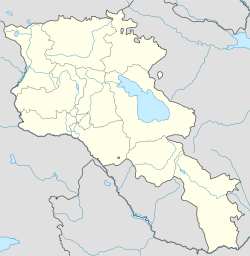
 Jaghatsadzor
Coordinates: 40°08′48″N 45°48′56″E / 40.14667°N 45.81556°E Country Armenia Marz (Province) Gegharkunik Population (2001) – Total 141 Time zone (UTC+4) – Summer (DST) (UTC+5) Jaghatsadzor (Armenian: Ջաղացաձոր, also Romanized as Jaghats’adzor and Djaghatsadzor; formerly, Sariyagub and Sariyaghub) is a town in the Gegharkunik Province of Armenia.
References
- Jaghatsadzor at GEOnet Names Server
- Report of the results of the 2001 Armenian Census, National Statistical Service of the Republic of Armenia
- Brady Kiesling, Rediscovering Armenia, p. 48; original archived at Archive.org, and current version online on Armeniapedia.org.
Capital: GavarGavar Berdkunk · Gandzak · Gavar · Gegharkunik · Hayravank · Karmirgyugh · Lanjaghbyur · Lchap · Noratus · Sarukhan · Tsaghkashen · Tsovazard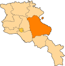
Sevan Chkalovka · Ddmashen · Geghamavan · Lchashen · Norashen · Semyonovka · Sevan · Tsaghkunk · Tsovagyugh · Varser · ZovaberChambarak Martuni Artsvanist · Astghadzor · Dzoragyugh · Geghhovit · Lichk · Madina · Martuni · Nerkin Getashen · Tsakkar · Tsovasar · Tsovinar · Vaghashen · Vardadzor · Vardenik · Verin Getashen · Yeranos · ZolakarVardenis Akhpradzor · Akunk · Areguni · Arpunk · Avazan · Ayrk · Azat · Daranak · Geghakar · Geghamabak · Geghamasar · Jaghatsadzor · Kakhakn · Karchaghbyur · Khachaghbyur · Kut · Kutakan · Lchavan · Lusakunk · Makenis · Mets Masrik · Nerkin Shorzha · Norabak · Norakert · Pambak · Pokr Masrik · Shatjrek · Shatvan · Sotk · Torfavan · Tretuk · Tsapatagh · Tsovak · Vanevan · Vardenis · Verin ShorzhaCategories:- Populated places in Gegharkunik
- Gegharkunik geography stubs


Wikimedia Foundation. 2010.