- Wilts & Berks Canal
-
Wilts & Berks Canal A section of the Canal near Rushey Platt, Swindon.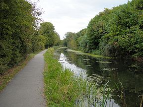
Date of act 1795 Construction began 1796 Date completed 1810 Date closed 1914 Maximum boat length 72 ft 0 in (21.95 m) Maximum boat beam 7 ft 0 in (2.13 m) Start point River Thames End point Kennet and Avon Canal Status Under restoration Wilts & Berks Canal Legend


River Thames 

Abingdon (proposed) 
New basin - Jubilee Junction (140m) 
Lock 
Pumping Station Oday Hill Lock 
Oday Hill Bridge Stonehill Lock 
B4107 road bridge 
New Cut Mill South Locks (4) 
New Cut Mill North Locks (4) bridge 
Abingdon (historic) 
Abingdon Lock Tythe Barn Lock 


A34 road bridge Drayton Lock Steventon Lock 
Ardington Locks (2) Grove Locks (1) A338 Road bridge Grove Locks (5) A417 road bridge 

Wantage branch 
Wantage wharf 
West Challow Bridge 
Childrey Brook 
Childrey Bridge Shippery Bridge 
Childrey Wharf B4001 New Road Bridge 
Railway bridge Longcot Locks (2) Longcot wharf Road bridge 

Longcot branch B4000 road bridge Steppingstones Lane Bridge Marston Locks (4) 
route south of Swindon (proposed) 
Thames and Severn Canal North Wilts Branch 
Latton Basin 
aqueducts (2) 
tunnel B4553 road bridge Hayes Knoll Lock Crosslands Lock Pry Lock 
Mouldon Lock Moredon Breathing Places Mannington Lock 
Locks (5) 
Swindon urban route proposed 
Kingshill wharf Rushey Platt section 
M4 tunnel (proposed) Hay Lane Bridge Chaddington Lane Bridge Chaddington Lane Spill Weir 
Chaddington Lock Woodshaw Lock Templar Firs section (1150m) 
spill weir 
Buxton Bridge Noremarsh Bridge B4011 road bridge Dunnington Locks (2) Dunnington aqueduct(Brinkworth Brook) Breach Lane Bridge A3102 road bridge 
Tokenham Reservoir Tockenham Bridge Trow Lane Bridge Seven Locks, Lyneham (7) Bowd's Lane Bridge Sodom Lane Bridge Dauntsey Lock B4069 road bridge Dauntsey section (700m) City Bridge (Dauntsey) Wood Common Lock Foxham section (700m) Foxham Locks (2) Foxham Road Bridge Charlcutt Hill Bridge Wick Bridge Bencroft Hill Bridge Stanley Junction Calne Branch Carpenters Bridge Hazeland Bridge Fisher's Brook Aqueduct Conigre Locks (2) Conigre Tunnel (under A4) Chaveywell Bridge Calne Lock Calne wharf Stanley Locks (2) Stanley aqueduct (River Marden) Studley Hill Road Bridge Forest Gate Lock A4 Forest Gate bridge 
Chippenham Branch (historic) Branch (now under Pewsham Way) 
Tunnel (intact but buried under 
Burlands Rd and Little Englands) Chippenham wharf (now Bus Station) Pewsham Top Lock Pewsham Top Lock Bridge 

Pewsham Middle Lock and Dry Dock Pewsham Bottom Lock 
Cocklemore Brook Spill Weir Triangle Wood Spill Weir 
Double Bridge Naish Hill section (500m) Bell Inn Bridge Lacock Lock Queenfield Lock 

Melksham (proposed) 
Melksham Locks (3) Melksham Town Lock River Avon 
Challymead Locks (3) Berryfield Lock Outmarsh Lock Melksham (historic) Melksham Forest Lock A3102 road bridge A365 road bridge Semington Lock 

Kennet and Avon Canal The Wilts & Berks Canal is a canal in the historic counties of Wiltshire and Berkshire, England, linking the Kennet and Avon Canal at Semington, near Melksham, to the River Thames at Abingdon. The North Wilts Canal merged with it to become a branch to the Thames and Severn Canal at Latton near Cricklade. Among professional trades boatmen, the canal was nicknamed the Ippey Cut, possibly short for Chippenham.
The 52-mile (84 km) canal was opened in 1810, but abandoned in 1914 – a fate hastened by the collapse of Stanley aqueduct in 1901. Much of the canal subsequently became unnavigable: many of the structures were deliberately damaged by army demolition exercises; parts of the route were filled in and in some cases built over. In 1977 the Wilts & Berks Canal Amenity Group was formed with a view to full restoration of the canal. Several locks and bridges have since been restored, and over 8 miles (13 km) of the canal have been rewatered.
Contents
Construction
A plan for the canal was published by Robert Whitworth Snr. along with William Whitworth in 1793.[1] The Bill empowering construction of the canal received Royal Assent in 1795. It allowed the company to raise £111,900 through 1,119 shares at a cost of £100 each for the construction of the canal. Another Act of Parliament was passed in 1801 which allowed the company to raise a further £200,000 to complete the canal.[2]
The canal was cut during the years 1796 to 1810. Robert Whitworth Snr. remained as an engineer on the canal from 1796 to 1799.[1] William Whitworth was resident engineer during this period and, upon Robert's departure, he became engineer until the canal's completion, for which he was paid £255,262.[1]
Following completion, a further two Acts were passed in 1810 and 1813 to alter toll rates on the canal, and another Act was passed in 1815 to allow the company to raise £100,000 to pay off debts collected during the construction of the canal, and to construct a reservoir.[2]
Route
The main canal was 52 miles (84 km) long, with branches totalling 6 miles (9.7 km) to Chippenham, Calne, Wantage and Longcot. It was cut to take narrowboats 72 feet (22 m) long and 7 feet (2.1 m) wide. There were 42 locks on the main line and three on the Calne branch. There were three short tunnels.
While the main canal was opened in 1810, some branches were operating before this and others added afterwards. The North Wilts Canal from Swindon to the Thames and Severn Canal at Cricklade was opened in 1819; it had 11 locks. It was originally a separate company, but merged with the Wilts & Berks following an Act of Parliament in 1821.[2]
Key Locations on Route Location OS Grid Ref Coordinates
(Links to map resources)Notes Jubilee Junction SU496949 51°39′04″N 1°16′55″W / 51.651°N 1.282°W junction with River Thames Wantage SU384887 51°35′46″N 1°26′17″W / 51.596°N 1.438°W Shrivenham SU234880 51°35′24″N 1°39′43″W / 51.590°N 1.662°W Cricklade SU104945 51°38′56″N 1°50′56″W / 51.649°N 1.849°W junction with Thames and Severn Canal approximate mid-point SU135834 51°32′56″N 1°48′18″W / 51.549°N 1.805°WCoordinates: 51°32′56″N 1°48′18″W / 51.549°N 1.805°W junction with North Wilts Canal Seven Locks SU201808 51°31′34″N 1°58′16″W / 51.526°N 1.971°W Stanley Junction ST959726 51°27′07″N 2°03′29″W / 51.452°N 2.058°W junction with Calne branch Semington Junction ST898610 51°20′53″N 2°08′46″W / 51.348°N 2.146°W junction with Kennet & Avon Canal Operation
Coal came from the Radstock and Paulton mines in the Somerset coalfield by way of the Somersetshire Coal Canal, which joined the Kennet and Avon Canal at Dundas. In 1837 43,642 tons of coal were transported via the Wilts & Berks Canal from the Somerset coalfield, with 10,669 tons being handled at Abingdon wharf.[3] The Wilts and Berks thus became a link in the "chain" of canals providing a transportation route between the West Country and the Midlands. Water supply was always a problem and a reservoir was constructed near Swindon to supply the canal, now known as Coate Water.[4]
The Wilts & Berks Canal was never a great commercial success due to competition from the railways, especially the Great Western Railway from 1841. In addition, long stretches of the canal were through a type of clay which is unsuitable for lining a canal, and so there was a constant need for puddling, making maintenance costs prohibitive. Despite this, the Wilts & Berks Canal operated for more than a century, but through traffic had pretty much ceased by 1901. In that year the Stanley Aqueduct over the River Marden collapsed; an event that proved to be the death knell of the canal.
Abandonment
 Overgrown section of the canal, west of Wantage, in 2006.
The canal was formally abandoned by an Act of Parliament in 1914.[5] The Act was sponsored by Swindon Corporation, which gained control of all the land within its boundary. In other areas ownership returned to the owners of adjacent land.
From the early 1930s much of the canal was filled in and generally used for dumping rubbish. Chippenham Wharf, once home to Brinkworth's Coal Depot, was used by residents as a refuse tip, and council minutes from 1926 show a decision to dump pig offal in the disused waterway. A bus station was built on the site, the buried wharf being uncovered briefly during redevelopment in 2006.[6]
During the Second World War many of the locks and other canal structures were used for army exercises and damaged by explosives.
Very little of the old canal survived in usable form, but long rural stretches are clearly delineated.
Restoration
 The new link to the Thames under construction
 The canal near Grove frozen in December 2010
In 1977 the Wilts & Berks Canal Amenity Group was formed to protect what remained of the canal, and restore short sections for their amenity value. Their first projects included the clearing of sections at Kingshill, Shrivenham, Dauntsey and Wootton Bassett.[7] Ten years later this became a major restoration project.
The Wilts & Berks Canal Trust was formed in 1997 as a partnership between the W & B Canal Amenity Group and the district and county councils covering the route of the canal. This included the District Councils of North Wilts, West Wilts and Vale of the White Horse, the County Councils of Oxfordshire and Wiltshire, and Swindon Borough Council. The aims of the trust were to protect, conserve and improve the canal and its branches, with the ultimate aim of restoring the whole canal to navigable status. However, the legal structure of the group was unsuitable for accessing some of the grants available for canal restoration, and so it was reformed into the Wilts & Berks Canal Partnership in 2001.[8]
Although development has taken place on some of the land of the canal, much of its route is intact, especially in rural areas. The "line" of the canal has been preserved in Local Development Plans, which means that no new building or development should now take place on the former canal.
The connection of the canal with the River Thames at Abingdon had been closed by development. On 30 August 2006 the Jubilee Junction was opened providing a new connection with the River Thames further downstream near Culham Lock.[9] The cut initially runs for about 150 yards (140 m) to a winding hole, but will eventually link to the historic route of the canal to the west of Abingdon.[10]
The Trust is progressing with re-watering many of the rural sections, and is working with local councils to construct new sections (possibly including new tunnels) where urban development has made the original route unavailable. Not all development has been urban, however. In Uffington, for instance, a farm has been built on the old wharf site, over the filled canal.
As of 2006[update], a number of bridges and locks have been rebuilt and at least 8 miles (13 km) of the canal are in water.
On 26 May 2009, Double Bridge and a short section of rewatered canal was officially opened by the Trust's patron, HRH The Duchess of Cornwall.[11]
There are some significant engineering challenges lying ahead for the Trust, but they offer opportunities to improve the areas surrounding the canal. The M4 motorway at Swindon was built over the line of the canal. Swindon Council are supporting the restoration of the canal, and are actively planning to route it through the town centre, albeit not quite on the original route. In 2007 a feasibility study suggested that a proposal to construct a canal through Swindon would cost £50m.[12][13] Despite some objections,[14][15] Swindon Borough Council gave approval in 2008 for further investigation of the scheme proposed by the Wilts & Berks Canal Trust.[16] The Thames Valley Chamber of Commerce Group also welcomed the project "as a key element in transforming Swindon's town centre into a leisure and visitor attraction, disposing of its dreary reputation." [17]
In Melksham, where much of the route has been lost to housing,[18] the Town Council has agreed in principle to support plans to route the canal through the River Avon in the centre of town. A new weir would raise water levels to permit navigation and an existing weir would be demolished.[19]
The Wilts & Berks Canal Trust has the following active restoration projects:[20]
Active Restoration Projects Project Details Coordinates
(Links to map resources)Childrey Wharf Drainage works and new spill weir 51°35′46″N 1°29′06″W / 51.596°N 1.485°W Steppingstones Lane Bridge Bridge being rebuilt - nearing completion 51°35′28″N 1°39′40″W / 51.591°N 1.661°W Latton Basin 51°39′29″N 1°52′30″W / 51.658°N 1.875°W Hayes Knoll Lock Lock being rebuilt 51°36′54″N 1°51′00″W / 51.615°N 1.850°W River Ray Valley, Moredon Joint project between the Trust and BBC Breathing Spaces[21] 51°34′55″N 1°49′12″W / 51.582°N 1.820°W Chaddington Lane spill weir and canal Lock and Spill weir rebuilt, dredging and reprofiling of canal in progress. 51°31′55″N 1°51′47″W / 51.532°N 1.863°W Seven Locks, Lynham Lock chambers 3 & 4 now rebuilt. Lock 2 and bridge to be redesigned & rebuilt. 51°31′34″N 1°58′19″W / 51.526°N 1.972°W Pewsham Locks and canal 3 locks, a bridge, a dry dock, a spill weir and a culvert undergoing restoration. 51°26′17″N 2°05′31″W / 51.438°N 2.092°W Restored & new sections in water Location Details Coordinates
(Links to map resources)Jubilee Junction 150 yards (140 m) of new canal and winding hole constructed. Navigable from River Thames.[10] 51°39′04″N 1°16′55″W / 51.651°N 1.282°W Temple Firs section 1,250 yards (1,140 m) of canal restored 51°32′02″N 1°53′24″W / 51.534°N 1.890°W Dauntsey section 770 yards (700 m) in water - has a land-locked narrow boat! 51°31′12″N 2°00′36″W / 51.520°N 2.010°W Foxham section 770 yards (700 m) in water 51°30′07″N 2°01′59″W / 51.502°N 2.033°W Double Bridge & Naish Hill section Bridge & 550 yards (500 m) of canal restored[11] 51°25′44″N 2°06′07″W / 51.429°N 2.102°W Note: Much of the route is over land in private ownership with no rights of public access, which may include restoration sites.
Restoration issues
There is some controversy about the restoration of the canal, in particular the felling of trees and the corresponding short-term disruption of wildlife habitats that have evolved in the 100 or so years since the canal was abandoned, and this has been addressed in the North Wiltshire Local Plan.[22]
The trees that most frequently have to be removed are Salix fragilis (Crack willow), a fast-growing, short-lived member of the Willow family. These have seeded themselves on the towpath side of the canal and may shed large branches in windy weather and are therefore hazardous. Trust Work parties consisting of unpaid volunteers may be called out at short notice to deal with trees that have fallen across the towpath, blocking the way for walkers and cyclists.
The Trust aims to keep local groups and residents informed and involved with the work. Senior members of the Trust regularly give talks and guided walks along the canal. These are intended to show how a linear wildlife corridor can be created from what has formerly been stagnant water with rubbish dumped in it. The phrase used is "not even wildlife likes a stagnant canal"
Objections to a canal route through the town centre are believed to arise from misconception that canals contain "stagnant water". However canals are permanently moving water slowly downstream, and are thus not stagnant. The passage of boats keeps the water stirred up making it muddy-looking, but this is essential to prevent the growth of weeds. In January 2008 Swindon Council considered a report, prepared by their consultants, on the feasibility and implications of restoring the town centre route. They endorsed the proposal, and have set up a task group in order to make further progress.[23]
There is concern in south Oxfordshire about the risk of flooding, and it can be argued that the canal will act as a drainage system, helping to take excess water and move it away to the Thames. The Environment Agency have expressed concerns about the proposed route of the canal at Melksham, and its effect on the floodplain, and there have been calls from local landowners to ensure that a town-centre route is re-established.[24]
Trust work parties are installing fencing, accommodation bridges, and drainage as well as undertaking tree maintenance and removal where required and this is beneficial to landowners along the line of the canal. Most of the landowners co-operate with the Trust, once they understand the benefits they can gain from a working canal, and are assured that they will not lose any access to or from the fields to either side.
Name
The official name of the canal was always "Wilts & Berks Canal" as cited in the Acts of Parliament that authorised its building and abandonment.
It should not be referred to as the "Wiltshire and Berkshire Canal", but as "the former Wilts & Berks Canal". Likewise the "North Wilts Canal" should not be referred to as the "North Wiltshire Canal".
Following local authority boundary changes in 1973 the part of Berkshire through which the canal passes (mostly the Vale of White Horse) was transferred to Oxfordshire. However, the canal's original name is retained for historical reasons.
See also
- Canals of Great Britain
- History of the British canal system
References
- ^ a b c A. W. Skempton (2002). A Biographical Dictionary of Civil Engineers in Great Britain and Ireland. Thomas Telford. ISBN 072772939X.
- ^ a b c Joseph Priestly (1831) Historical Account of the Navigable Rivers, Canals, and Railways, Throughout Great Britain, Longman, Rees, Orme, Brown and Green
- ^ Clew, Kenneth R. (1970). The Somersetshire Coal Canal and Railways. Newton Abbot: David and Charles. ISBN 0-7153-4792-6.
- ^ Mark Child. Swindon : An Illustrated History. United Kingdom: Breedon Books Publishing. ISBN 1-85983-322-5.
- ^ London Gazette, (31 July 1914), Swindon Corporation (Wilts and Berks Canal Abandonment) Act, 1914, accessed 25 August 2009
- ^ Parkes, Benjamin. "Last glimpse of canal". Swindon Advertiser. http://www.swindonadvertiser.co.uk/search/1013335.Last_glimpse_of_canal/. Retrieved 2008-11-10.
- ^ Squires, Dr. Roger (1983). The New Navvies. Chichester, Sussex: Phillimore. pp. 123–124. ISBN 0850333644.
- ^ "About the Trust". www.wbct.org.uk. http://www.wbct.org.uk/about-the-trust. Retrieved 2010-11-21.
- ^ CPRE Oxfordshire Campaign Briefing 5 September 2006
- ^ a b Grand Opening of Jubilee Junction
- ^ a b "The Duchess opens a new bridge as Patron of the Wilts and Berks Canal Trust". (Double Bridge, Lacock). The Prince of Wales website. 26 May 2009. http://www.princeofwales.gov.uk/newsandgallery/news/the_duchess_opens_a_new_bridge_as_patron_of_the_wilts_and_be_371738611.html. Retrieved 2009-06-05.
- ^ "Town centre canal will cost £50m". BBC. 10 October 2007. http://news.bbc.co.uk/1/low/england/wiltshire/7037018.stm. Retrieved 2008-11-07.
- ^ "Swindon Central Canal Route Study". 2008. http://www.wbct.org.uk/swindoncanals/Halcrow1.pdf. Retrieved 2008-11-07.
- ^ Wallin, James (20 April 2008). "Bid to ditch canal project". Swindon Advertiser. http://www.swindonadvertiser.co.uk/search/2209504.Bid_to_ditch_canal_project/. Retrieved 2008-11-10.
- ^ "You, the readers, are against canal idea". Swindon Advertiser. 27 March 2008. http://www.swindonadvertiser.co.uk/search/2148988.You__the_readers__are_against_canal_idea/. Retrieved 2008-11-10.
- ^ "More support for town canal plan". BBC. 24 January 2008. http://news.bbc.co.uk/2/hi/uk_news/england/wiltshire/7206220.stm. Retrieved 2008-11-07.
- ^ Wallin, James (6 May 2008). "Canal would give town a big boost". Swindon Advertiser. http://www.swindonadvertiser.co.uk/search/2247878.Canal_would_give_town_a_big_boost/. Retrieved 2008-11-10.
- ^ "Plans to route canal through town". BBC News. 4 July 2007. http://news.bbc.co.uk/1/hi/england/wiltshire/6269104.stm. Retrieved 2008-11-11.
- ^ Morgan, Charley (18 December 2007). "Council backs canal plan". Swindon Advertiser. http://www.swindonadvertiser.co.uk/search/1910739.Council_backs_canal_plan/. Retrieved 2008-11-10.
- ^ *Wilts & Berks Canal Trust, Dragonfly, No. 113, Summer 2009. (No ISBN)
- ^ "BBC Breathing Places". http://www.breathingplaces.org/public/place_by_name/Wilts-amp-Berks-Canal-Mouldon-Hill-Swindon?id=15011. Retrieved 29 July 2009.
- ^ "Adopted North Wiltshire Local Plan 2011 - 13. Tourism Topic Area Policies". localplan.northwilts.gov.uk. http://localplan.northwilts.gov.uk/written/cpt13.htm. Retrieved 2010-11-21.
- ^ Swindon Borough Council, Canal Feasibility Study - Review, accessed 19 December 2008
- ^ Swindon Advertiser, (5 April 2002), Landowners back town route for canal, accessed 19 December 2008
Further reading
- Dalby, L.J. (2000) [1971]. The Wilts and Berks Canal (3rd ed.). Usk: Oakwood Press. ISBN 0-85361-562-4.
- Small, Doug (1999). The Wilts & Berks Canal. Stroud: Tempus Publishing Ltd. ISBN 9780752416199.
- Small, Doug (2010). Wilts and Berks Canal Revisited. Stroud: The History Press. ISBN 9780752451466.
External links
- Wilts & Berks Canal Trust – Official website
- A Brief History of the Wilts & Berks Canal, (Peter Scatchard, W&BCT)
- Trading on the Wilts & Berks canal
Restoration progress
- Wilts & Berks Canal Trust – Official website: overview of current projects
- W&BCT: Melksham, Calne and Chippenham Branch
- W&BCT: East Vale Branch – Jubilee Junction (River Thames) to Childrey
- W&BCT: Cricklade Branch – North Wilts Canal
- W&BCT: Swindon Branch – Illustrated description of the proposed route through Swindon.
Next confluence upstream River Thames Next confluence downstream Swift Ditch (north) Wilts & Berks Canal River Thame (north) Categories:- Canals in England
- Conservation in the United Kingdom
- 1810 establishments in England
- History of Berkshire
- Kennet and Avon Canal
- Transport in Oxfordshire
- Canals in Wiltshire
- Visitor attractions in Oxfordshire
- Visitor attractions in Wiltshire
- Geography of the River Thames


Wikimedia Foundation. 2010.