- Maryland Route 488
-
Maryland Route 488
La Plata Road 
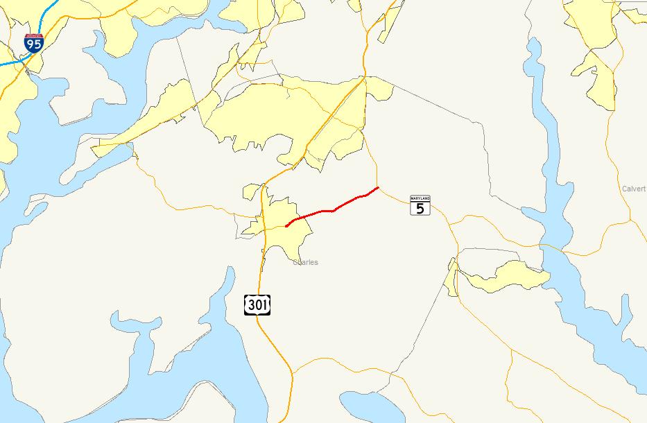
Map of Southern Maryland with MD 488 highlighted in redRoute information Maintained by MDSHA Length: 6.01 mi[1] (9.67 km) Major junctions West end:  MD 6 in La Plata
East end:  MD 5 near Bryantown
Location Counties: Charles Highway system Maryland highway system
Interstate • US • State • Minor • Former • Turnpikes←  MD 485
MD 489  →
→Maryland Route 488 (MD 488) is a state highway in the U.S. state of Maryland. Known as La Plata Road, the state highway runs 6.01 miles (9.67 km) from MD 6 in La Plata east to MD 5 near Bryantown. MD 488 is a connector between La Plata and eastern Charles County, including the town of Hughesville. The state highway was constructed in the mid 1930s.
Contents
Route description
 MD 488 begins a gradual downward slope to cross over the Kerrick Swamp.
MD 488 begins at an intersection with MD 6 (Charles Street) in the town of La Plata. The state highway heads northeast as a two-lane road, passing Radio Station Road, which leads to Laurel Springs Regional Park and La Plata High School. MD 488 leaves La Plata and enters a forested area in which the highway crosses Kerrick Swamp and intersects Piney Church Road, which heads north toward Regency Furniture Stadium, home of the Southern Maryland Blue Crabs of the Atlantic League of Professional Baseball. The state highway passes the historic home The Lindens and crosses Piney Branch—a tributary of the Zekiah Swamp, which parallels the highway to the southeast—before reaching its eastern terminus at a directional crossover intersection with MD 5 (Leonardtown Road) west of Bryantown.[1][2]
History
MD 488 was constructed in four sections starting from the La Plata end. The two sections from MD 6 to the La Plata town limits and from there across Kerrick Swamp to near Piney Church Road were built in 1933.[3][4] The third section, extending from Piney Church Road to near Piney Branch, was constructed in 1934 and 1935.[3][5] The final section, over Piney Branch to MD 5, was completed by 1938.[6] Aside from minor improvements, MD 488 has changed very little from the 1930s.
Junction list
The entire route is in Charles County.
Location Mile
[1]Destinations Notes La Plata 0.00 MD 6 (Charles Street) – Charlotte Hall, Port TobaccoWestern terminus Bryantown 6.01 MD 5 (Leonardtown Road) – Waldorf, HughesvilleEastern terminus 1.000 mi = 1.609 km; 1.000 km = 0.621 mi References
- ^ a b c "Highway Location Reference: Charles County" (PDF). Maryland State Highway Administration. 2009. http://www.marylandroads.com/Location/2009_CHARLES.pdf. Retrieved 2011-01-12.
- ^ Google, Inc. Google Maps – Maryland Route 488 (Map). Cartography by Google, Inc. http://maps.google.com/maps?f=d&source=s_d&saddr=MD-488+E%2FLaplata+Rd&daddr=MD-488+W%2FLaplata+Rd&hl=en&geocode=FWbxSwIdRLFp-w%3BFZJ0TAIdODRr-w&gl=us&mra=ls&sll=38.534235,-76.951933&sspn=0.015409,0.038581&ie=UTF8&t=h&z=13. Retrieved 2011-01-12.
- ^ a b Report of the State Roads Commission of Maryland. 1931-1934. Baltimore: Maryland State Roads Commission. 1934-12-28. pp. 330–331. http://www.archive.org/details/reportofstateroa1931mary. Retrieved 2011-01-12.
- ^ Maryland Geological Survey. Map of Maryland Showing State Road System: State Aid Roads and Improved County Road Connections (Map) (1933 ed.).
- ^ Maryland Geological Survey. Map of Maryland Showing State Road System: State Aid Roads and Improved County Road Connections (Map) (1935 ed.).
- ^ Maryland State Roads Commission. Map of Maryland Showing State Road System (Map) (1938 ed.).
External links
Roads in Charles County, Maryland State highways 
U.S. Highways Categories:- State highways in Maryland
- Roads in Charles County, Maryland


Wikimedia Foundation. 2010.