- Nowy Dwór Królewski
-
Nowy Dwór Królewski — Village — 
 Nowy Dwór Królewski
Coordinates: 53°16′07″N 18°35′20″E / 53.26861°N 18.58889°E Country  Poland
Voivodeship Kuyavian-Pomeranian County Chełmno Gmina Papowo Biskupie Population 190 Nowy Dwór Królewski [ˈnɔvɨ ˈdvur kruˈlɛfski] is a village in the administrative district of Gmina Papowo Biskupie, within Chełmno County, Kuyavian-Pomeranian Voivodeship, in north-central Poland.[1] The built areas of the village take up 3.37 square km.[2]
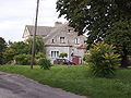
Village has area 337 ha. On her land at 32 hauseholds indyviduals, which the biggest has to Roman Szulz's. In village in found palace build round about 1875 years. In 1900 years village is property Zuzanna Witte. From 1910 to 1945 village is property Gerhard Witte.
Contents
History
Middle Ages to 1800
The town was first mentioned in 1398. In that year, it is written that Nowy Dwór Królewski bred 32 horses, 20 cattle, 215 sheep, and 90 pigs. It appeared in German in documents and chronicles as Nuwenhof, Nuwenhuf, Nuwemhoff, and Koenigliche Neuhof.[2] From 1398-1421 it was a village of the Teutonic Order. In 1505 the village was owned by the Bishop of Chełmno.
In 1772, during the Polish Partition, the village became the property of West Prussia, in the department Kwidzyn. The first known census of residents was taken in 1773.[2]
Recent times
Shortly before the outbreak of World War II, most inhabitants left their homes in fear of the Germans.[2] Soon after the start of the war, the village was taken over. At that time parts of the village were destroyed.[2]
From 1975 to 1998 the village belonged to the administrative region of Toruń. In 1996, it was connected to the telephone network (in area code 56).[2]
Nearby villages
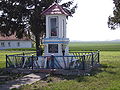
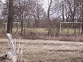
Nearby villages Village km Niemczyk 1 Folgowo 2 Staw 2 Wrocławki 2 Bartlewo 3 Firlus 3 Papowo Biskupie 3 Błachta 4 Tytlewo 4 Lipienek 4 Łyniec 9 Piątkowo 9 Napole 9 Zakrzewo 9 Zelgno-Bezdół 9 Wabcz 9 Malankowo 9 Rybieniec 9 Witkowo 9 Wabcz Kolonia 9 Gallery
-

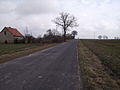
The end of the village
-

Nowy Dwór Królewski and Niemczyk
-

Park
-
-
Palace in Nowy Dwór Królewski
-

Map the Nowy Dwór Królewski (language: polish)
-

Palace
-
-
-
References
- ^ "Central Statistical Office (GUS) – TERYT (National Register of Territorial Land Apportionment Journal)" (in Polish). 2008-06-01. http://www.stat.gov.pl/broker/access/prefile/listPreFiles.jspa.
- ^ a b c d e f Rodzynkowski, Waldemar (1996). "Zarys Dziejów Gminy Papowo Biskupie".
External links
 Media related to Nowy Dwór Królewski at Wikimedia Commons
Seat 
Other villages No longer existing villages Coordinates: 53°16′07″N 18°35′20″E / 53.2686478°N 18.5889533°E
Categories:- Villages in Chełmno County
-


Wikimedia Foundation. 2010.