- Sabetha, Kansas
Infobox Settlement
official_name = Sabetha, Kansas
settlement_type =City
nickname =
motto =
imagesize =
image_caption =
image_
imagesize =
image_caption =
image_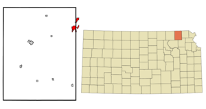
mapsize = 250px
map_caption = Location of Sabetha, Kansas
mapsize1 =
map_caption1 =subdivision_type = Country
subdivision_name =United States
subdivision_type1 = State
subdivision_name1 =Kansas
subdivision_type2 = Counties
subdivision_name2 = Nemaha, Brown
government_footnotes =
government_type =
leader_title =
leader_name =
leader_title1 =
leader_name1 =
established_title =
established_date =unit_pref = Imperial
area_footnotes =area_magnitude =
area_total_km2 = 8.4
area_land_km2 = 8.4
area_water_km2 = 0.0
area_total_sq_mi = 3.2
area_land_sq_mi = 3.2
area_water_sq_mi = 0.0population_as_of = 2000
population_footnotes =
population_total = 2589
population_density_km2 = 308.4
population_density_sq_mi = 798.8timezone = Central (CST)
utc_offset = -6
timezone_DST = CDT
utc_offset_DST = -5
elevation_footnotes =
elevation_m = 402
elevation_ft = 1319
latd = 39 |latm = 54 |lats = 11 |latNS = N
longd = 95 |longm = 47 |longs = 58 |longEW = Wpostal_code_type =
ZIP code
postal_code = 66534
area_code = 785
blank_name = FIPS code
blank_info = 20-62025GR|2
blank1_name = GNIS feature ID
blank1_info = 0472756GR|3
website =
footnotes =Sabetha is a city in Nemaha and Brown counties in the
U.S. state ofKansas . The population was 2,589 at the 2000 census. The current city mayor is Doug Clark.History
On the evening of
June 13 ,1998 , a tornado damaged much of the downtown, which led to the demolition of the City Hall building. No casualties were reported. The downtown area received little warning as the tornado struck less than 1 minute after the tornado siren began to sound. The siren, located atop the city hall was cut off when it was tossed off the roof of the city hall by the tornado.fact|date=September 2007Geography
Sabetha is located at coor dms|39|54|11|N|95|47|58|W|city (39.903109, -95.799408)GR|1.
According to the
United States Census Bureau , the city has a total area of 3.2square mile s (8.4km² ), all land.Demographics
As of the
census GR|2 of 2000, there were 2,589 people, 958 households, and 611 families residing in the city. Thepopulation density was 798.8 people per square mile (308.5/km²). There were 1,049 housing units at an average density of 323.6/sq mi (125.0/km²). The racial makeup of the city was 97.76% White, 0.93% African American, 0.15% Native American, 0.19% Asian, 0.04% Pacific Islander, 0.19% from other races, and 0.73% from two or more races. Hispanic or Latino of any race were 0.31% of the population.There were 958 households out of which 30.1% had children under the age of 18 living with them, 55.7% were married couples living together, 5.7% had a female householder with no husband present, and 36.2% were non-families. 34.0% of all households were made up of individuals and 19.1% had someone living alone who was 65 years of age or older. The average household size was 2.33 and the average family size was 3.01.
In the city the population was spread out with 23.4% under the age of 18, 6.4% from 18 to 24, 22.8% from 25 to 44, 17.3% from 45 to 64, and 30.2% who were 65 years of age or older. The median age was 43 years. For every 100 females there were 85.3 males. For every 100 females age 18 and over, there were 82.4 males.
The median income for a household in the city was $36,450, and the median income for a family was $45,000. Males had a median income of $31,958 versus $21,458 for females. The
per capita income for the city was $22,126. About 3.7% of families and 7.0% of the population were below thepoverty line , including 8.8% of those under age 18 and 7.3% of those age 65 or over.Economy
Sabetha has more jobs than residents, due in part to the large Wenger Manufacturing plant that produces extruders and related equipment. MAC Equipment is also a large employer in the area, manufacturing bulk material handling and air filtration equipment. The city managers estimate that the city has a poll factor of 2 to 1, meaning that the city has nearly 5000 jobs, while only having 2500 residents. Many of the small neighboring communities such as Morrill,Oneida, Berwick, Bern, Fairview, and Wetmore are bedroom communities for the many people who commute to work in Sabetha. Because of a strong job base and large industries, Sabetha is one of the few towns in northeast Kansas that is not shrinking in population. fact|date=September 2007
Notable natives
*
Arthur Schabinger (1889-1972), basketball coach and administrator, member of theBasketball Hall of Fame
*Wilbur Bestwick (1911-1972), the First Sergeant Major of theUnited States Marine Corps References
External links
* [http://www.usd441.org Sabetha Unified School District]
* [http://www.skyways.org/towns/Sabetha/city.htm Sabetha, Kansas - Blue Skyways]
Wikimedia Foundation. 2010.