- Olutanga, Zamboanga Sibugay
-
Olutanga — Municipality — Map of Zamboanga Sibugay showing the location of Olutanga. Location in the Philippines
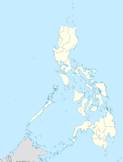
 Olutanga
Coordinates: 7°20′N 122°50′E / 7.333°N 122.833°ECoordinates: 7°20′N 122°50′E / 7.333°N 122.833°E Country  Philippines
Region Zamboanga Peninsula (Region IX) Province Zamboanga Sibugay District 1st District of Zamboanga Sibugay Founded Barangays 19 Government – Mayor Mayor Joel Caputolan Area – Total 113.30 km2 (43.7 sq mi) Population (2008) – Total 29,803 Time zone PST (UTC+8) ZIP code Income class 4th class municipality Olutanga is a 4th class municipality in the province of Zamboanga Sibugay, Philippines. According to the 2008 census, it has a population of 29,803 people in 4,037 households.
Contents
Barangays
Olutanga Municipality 19 barangays.
- Bateria
- Calais
- Esperanza
- Fama
- Galas
- Gandaan
- Kahayagan
- Looc Sapi
- Matim
- Noque
- Pulo Laum
- Pulo Mabao
- San Isidro
- San Jose
- Santa Maria
- Solar (Pob.)
- Tambanan
- Villacorte
- Villagonzalo
Educational institutions
Tertiary
- Western Mindanao State University - External Studies Unit (WMSU)
- South Western Computer College (SWCC)
High schools
- Loyola High School
- Olutanga National High School
- Bateria National High School
Elementary
- Olutanga Central Elementary School
- Buhangin Mahaba Elementary School
- Gandaan Elementary School
- Kahayagan Elementary School
- Pulo Laum Elementary school
- Villagonzalo Elementary School
- Tambanan Elementary School
- Looc Sapi Elementary School
- Villiacorte Elementary School
- Fama Elementary School
- Calais Elementary School
- San Jose Elementary School
- Bateria Elementary School
External links
Municipalities Categories:- Municipalities of Zamboanga Sibugay


Wikimedia Foundation. 2010.