- Cunderdin, Western Australia
-
Cunderdin
Western Australia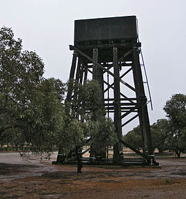
Old Railway Water Tower, Cunderdin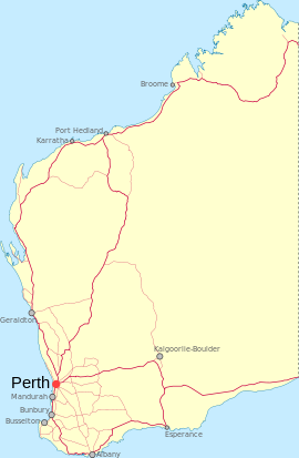
 Cunderdin
Population: 686 (2006 Census) [1] Established: 1906 Postcode: 6407 Elevation: 237 m (778 ft) Location: - 156 km (97 mi) East of Perth
- 46 km (29 mi) West of Kellerberrin
- 54 km (34 mi) South of Dowerin
LGA: Shire of Cunderdin State District: Central Wheatbelt Federal Division: Durack Coordinates: 31°39′22″S 117°14′38″E / 31.656°S 117.244°E
Cunderdin is a town located in the Wheatbelt region of Western Australia 156 km east of Perth,[2] on Great Eastern Highway.
Contents
History
The first European visitor to the area was Charles Cooke Hunt, who explored the area in 1864 and recorded the name Cunderdin, from the Aboriginal name of a nearby hill. The meaning of the name is thought to mean "place of flowers".
Like many small towns in the area, Cunderdin developed as a stop-off town during the gold rush in the WA Goldfields. Significantly in 1894 the railway arrived signalling the earliest settlement in the town. Later, in 1901, the Goldfields Water Scheme designed by C. Y. O'Connor led to a renewed increase in population of the town. The townsite was gazetted in 1906.[3]
Economy
As part of the wheatbelt, the economy of Cunderdin is primarily agricultural. There is an agricultural college 3 km north of the town; it is one of the six campuses of the Western Australia College of Agriculture. There are approximately 110 students supported by 50 staff and their families.[4]
Cunderdin Airstrip is situated next to the agriculture college.[4] It was built early in the Second World War as a base for the RAAF flying school and bomber base.[5]
Farming
Cunderdin is mostly a farming community. Former Chairman of the WA Colleges of Agriculture, Alan Carter, is one of the many farmers to occupy land in the region. His produce consists of wheat, lupins, canola and also livestock. There is also great livestock production. The Jolma Poll Dorset Stud, run by Perry Jasper and Co., has been very successful when competing in exhibition shows in Perth and Adelaide.
Places of interest
 Ettamogah Pub, Cunderdin
- Cunderdin Museum [6]
- Youndegin, 19 km south of Cunderdin, has the ruins of the earliest settlement in the area
- Cunderdin Hill Lookout - panoramic views of the area
- Railway Water Tower
- Ettamogah Pub
- Cunderdin Golf Course, which is situated next to the Cunderdin Reservoir, itself part of the Goldfields water supply scheme
- Cunderdin Pool
- Historic sites of Youndigin and Doodenanning
- Cunderdin Town Oval
- Balga
- Golden Pipeline
- C Y O'Connor Park
Cunderdin daviesia (Daviesiacunderdin) is a small to medium sized shrub, which grows to 1.6 m high. It appears that it is isolated to the Cunderdin area.[7]
Visitors cannot help but notice the large Ettamogah theme hotel and pub when driving through the town, due to its redness and a car on its roof. It is based on the comics of Ken Maynard and is one of a few of these pubs scattered throughout Australia. There are similar venues in Sydney, Albury-Wodonga,[8] The Sunshine Coast, Queensland and Morley.
Cunderdin also serves as a stop on the Prospector and Avonlink rural train services.
References
- ^ Australian Bureau of Statistics (25 October 2007). "Cunderdin (L) (Urban Centre/Locality)". 2006 Census QuickStats. http://www.censusdata.abs.gov.au/ABSNavigation/prenav/LocationSearch?collection=Census&period=2006&areacode=UCL505800&producttype=QuickStats&breadcrumb=PL&action=401. Retrieved 2008-09-20.
- ^ Cunderdin Merredin & Districts Visitor Centre, 2005. Retrieved 11 February 2007.
- ^ Western Australian Land Information Authority. "History of country town names". http://www.landgate.wa.gov.au/corporate.nsf/web/History+of+country+town+names. Retrieved 2008-09-20.
- ^ a b Cunderdin Western Australia Police 2007. Retrieved 11 February 2007.
- ^ Cunderdin www.raaf.gov.au. Retrieved 11 February 2007.
- ^ An alphabetical list of Museums in the wheatbelt. Merredin & Districts Visitor Centre, 2005. Retrieved 11 February 2007.
- ^ Cunderdin Daviesia (Daviesia cunderdin) Recovery Plan 1999-2002 Environment Australia, June 1999. Retrieved 11 February 2007.
- ^ Postcard from the Ettamogah Pub travelsnapz.tripod.com. Retrieved 2007-02-11.
External links
Preceding station Transwa Trains network Following station towards East PerthAvonlink East Perth - Merredintowards MerredinProspector towards KalgoorlieCategories:- Towns in Western Australia
- Wheatbelt (Western Australia)
- Australian Aboriginal placenames


Wikimedia Foundation. 2010.