- Sherman, West Virginia
-
Sherman — Unincorporated community — Location within the state of West Virginia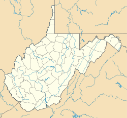
 Sherman
Coordinates: 38°59′30″N 81°45′42″W / 38.99167°N 81.76167°WCoordinates: 38°59′30″N 81°45′42″W / 38.99167°N 81.76167°W Country United States State West Virginia County Jackson Time zone Eastern (EST) (UTC-5) – Summer (DST) EDT (UTC-4) ZIP codes FIPS code GNIS feature ID Sherman (also Mouth of Little Sandy) is an unincorporated community in northern Jackson County, West Virginia, United States, along the Ohio River. It lies along West Virginia Route 68 north of the city of Ravenswood.[1] Its elevation is 600 feet (183 m).[2]
See also
References
- ^ DeLorme. West Virginia Atlas & Gazetteer. 4th ed. Yarmouth: DeLorme, 2007, p. 33. ISBN 0-89933-327-3.
- ^ U.S. Geological Survey Geographic Names Information System: Sherman, West Virginia, Geographic Names Information System, 1980-06-27. Accessed 2008-05-31.
Municipalities and communities of Jackson County, West Virginia Cities 
Unincorporated
communitiesAdvent | Cottageville | Duncan | Evans | Fairplain | Flatwoods | Gay | Given | Goldtown | Independence | Kenna | Kentuck | LeRoy | Liverpool‡ | Millwood | Mt. Alto | Murraysville | Rock Castle | Romance | Sandyville | Sherman | Silverton | Statts Mills
Footnotes ‡This populated place also has portions in an adjacent county or counties
Categories:- Mid-Ohio Valley geography stubs
- Populated places in Jackson County, West Virginia
- Unincorporated communities in West Virginia


Wikimedia Foundation. 2010.