- Norvelt, Pennsylvania
-
Norvelt Unincorporated community  Post Office and Norvelt Union Church
Mount Pleasant RoadNamed for: Eleanor Roosevelt Country United States State Pennsylvania County Westmoreland Township Mount Pleasant Elevation 1,010 ft (308 m) [1] Coordinates 40°12′34″N 79°30′13″W / 40.20944°N 79.50361°W Founded 1934 Timezone EST (UTC-5) - summer (DST) EDT (UTC-4) ZIP code 15674 (Norvelt) Area code Area code 724 School District Mount Pleasant Area School District 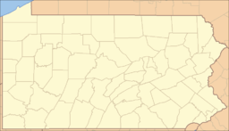
 Location of Norvelt in Pennsylvania
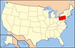 Location of Pennsylvania in the United States
Norvelt is an unincorporated community in Mount Pleasant Township, Westmoreland County, Pennsylvania, United States. Although the United States Census Bureau includes it in a census-designated place with the nearby community of Calumet, they are in reality two very different communities, each reflecting a different chapter in how the Great Depression affected rural Pennsylvanians. Calumet was a typical "patch town", built by a single company to house coal miners as cheaply as possible. The closing of the Calumet mine during the Great Depression caused enormous hardship in an era when unemployment compensation and welfare payments were non-existent. On the other hand, Norvelt was created during the depression by the US federal government as a model community, intended to increase the standard of living of laid-off coal miners.[2]
Contents
- 1 Geography
- 2 State of Pennsylvania Historical Marker
- 3 History
- 4 Points of interest
- 5 Football culture
- 6 Haunted history
- 7 See also
- 8 References
Geography
Sections
The two main areas of Norvelt are “A” section and “B” section, connected into one 2-mile (3.2 km) loose circle made up of East Laurel Circle and West Laurel Circle running on either side of Mt. Pleasant Road. Both circles are built into the rolling hills, and the tree-lined roads.
Waterways
Norvelt has many small waterways. The largest is Sewickley Creek. The Sewickley stretches through Mammoth, Trauger, Calumet, and Norvelt. The Sewickley Creek Watershed Association, a non-profit organization monitors recommends and implements actions essential to the conservation of the Sewickley Creek watershed area for recreational purposes.
Norvelt also has many smaller creeks, most running through it. The small creeks are lined with stone blocks, and run parallel to the village's circuluar streets and through the yards.
State of Pennsylvania Historical Marker
Dedicated on September 8, 2002 by the Pennsylvania Historical and Museum Commission.[2]
A Pennsylvania Historical Marker located at LR 6406 Mount Pleasant Road (State Route 982) on the Volunteer Fire Department V.F.D. property, Norvelt reads:
Originally called "Westmoreland Homesteads", Norvelt was established April 13, 1934, by the federal government as part of a New Deal homestead project. With 250 homes, Norvelt provided housing, work, and a community environment to unemployed workers and their families during the Great Depression. It was renamed “Norvelt" in 1937 in honor of First Lady Eleanor Roosevelt and her interest in the project.
History
Origin
In 1933, as part of the sweeping National Industrial Recovery Act (NIRA), Congress allocated $25 million for the creation of "subsistence homesteads" for dislocated industrial workers. Over the course of the program’s eleven-year history, the federal government seeded nearly 100 planned, cooperative communities. Norvelt, in southwestern Pennsylvania, was the fourth.
The idea for the program was a throwback to the Jeffersonian ideal of a "back to the land" movement, popularized by Americans who promoted small-scale subsistence farming as an antidote to the Great Depression and the alienation of modern life.[2] The idea gained strength in the 1920s among a wide variety of progressive organizations, including church-related groups such as the American Friends Service Committee (AFSC) which was the social services arm of the Religious Society of Friends (Quakers).
Labor strife and the Great Depression
During the 1920s, the AFSC had become deeply concerned with the violence that resulted from labor strife, particularly in the bituminous coal fields of Appalachia. So AFSC volunteers traveled to the bituminous-coal regions in West Virginia and Pennsylvania to help the families of striking and unemployed coal miners. The AFSC also believed in the necessity of economic and social justice as a means of insuring lasting peace in this section of the United States. To that end, it clothed and fed the families of unemployed miners during strikes, and later launched subsistence gardening and vocational retraining programs. After the onset of the Great Depression, these experiences placed the AFSC in the forefront of the movement for cooperative communities, so much so that the Department of the Interior, headed by Altoona native Harold Ickes, in 1933 recruited AFSC staff to guide its subsistence homesteads program.
The Great Depression was an opportunity for these ideals into action. Supporters lobbied for the creation of a government-sponsored resettlement program that would place unemployed industrial workers in farmstead communities. Promoted as a relief measure, it quickly became weighted with the much more ambitious goal of cooperative living.[3]
The planning of Westmoreland homesteads
In 1934, Interior Secretary Harold L. Ickes named Milburn Wilson to head the newly created Division of Subsistence Homesteads. Wilson, in turn, selected the AFSC’s Clarence Pickett to help administer the program. As the AFSC’s executive secretary, Pickett already had overseen vocational reeducation and cooperative farm programs for unemployed coal miners in West Virginia. The AFSC’s work supplied the prototype for the federal program. In the years that followed, AFSC lent its support to the federal program and later sponsored its own cooperative community, Penn Craft in Fayette County.
Although the government opened its program to broad segments of the unemployed, the division was especially keen on it reaching bituminous coal miners. Geographically isolated and dominated by a single employer, the residents of most patch towns were especially vulnerable once employment evaporated. So the division designed the homestead program to give miners and their families an opportunity to become economically independent by working the land, which, in theory, would also free them from the boom/bust cycle of industrial capitalism.
Once the division had identified its target populations, the federal government began buying large parcels of land for subdivision into individual homesteads for up to 300 families. Encouraging home ownership through a rent-to-own program, the program’s administrators expected residents to grow or raise everything they needed to survive, but they also hoped that the new communities would lure local industries that would in turn provide jobs and needed income.
In April 1934, federal officials acquired 1,326 acres (5.37 km2) of farmland in Mount Pleasant Township, Westmoreland County, and announced construction of the Westmoreland Homesteads. Following Division guidelines, local architect Paul Bartholomew designed the planned community’s buildings and its overall layout. On 772 acres (3.12 km2) he arranged 254 individual lots, ranging in size from 1.7 to 7 acres (28,000 m2), in six, mostly curvilinear sections. Each lot was to feature a simply designed, 1 1⁄2-story Cape Cod.[2] Originally, the houses were available in 4- to 6-room models, with a living room, eat-in kitchen, utility room, bathroom and bedroom space. Utilities included water and electricity. The remaining 728 acres (2.95 km2) Bartholomew reserved for a cooperative farm, a schoolhouse, playground, post office, and other common buildings. These original depression-era Cape Cod–style homes are called “Norvelt Houses” by the locals.
A six-room house on more than 2 acres (8,100 m2) usually ended up costing a family $12,000.
Pickett helped establish the first AFSC work camp in, what would become Norvelt, to help the Homesteads project with the construction of a reservoir and ditch to hold a water main for the community. In the summer of 1934, 55 young volunteers contributed 10,000 hours at Norvelt by digging a ditch one-and-a-half miles long and constructing a 260,000-gallon reservoir. The directors of this work camp were Mildred and Wilmer Young, who later led several experiments with cooperative enterprises in Mississippi and South Carolina.[4]
Three years later, Westrmoreland Homesteads was the largest of President Roosevelt's 92 model subsistence homesteads that provided relief for displaced miners and industrial workers.
Political opposition
Although the project faced few political hurdles, the design of the houses for Norvelt and other subsistence farmstead communities set off a debate that revealed top government officials’ contrasting ambitions for the program. Both US President Franklin Roosevelt and Harold Ickes believed that the houses should be constructed to minimal standards, without electricity and running water, as befit a relief program. But program director Milburn Wilson and First Lady Eleanor Roosevelt insisted that the homes be furnished with plumbing, electric lights, and other modern conveniences. Virginia senator Harry F. Byrd criticized such features as an “extravagance" for “simple mountain folk," but Wilson and the First Lady prevailed. Both argued that the project, as a demonstration project, should afford its residents with homes that would elevate their standard of living.[2]
A "build it yourself" government project
Westmoreland received over 1,850 applications for just 250 slots. The first 1,200 residents were broadly representative of the region’s ethnic and racial diversity. As they arrived, heads of households were put to work building the houses they would later occupy. By having the people building their own homes and community, this is in stark contrast to the government handout programs seen in the late 20th century and early 21st century. This ensured that the community would be a "hand up" program instead of a "hand out."
Paying for your home
Basically the government purchased the land and people built their own homes on a lease-to-purchase agreement. Families rented their homes from the government for $12 to $14 a month, which was applied to the future purchase price of the house.[5] By 1946, all the renters had purchased their homes. These early homes had everything a family would need to survive. These amenities included a grape arbor, 3-4 acres of land to plant a garden, and chicken coops.[6]
Building your home
To make construction as efficient and cost-effective as possible, the division assigned crews to a single, specific construction task, such as digging the foundation or installing flooring—thus anticipating the mass building methods that would characterize large-scale residential developments such as Levittown after World War II—and applied most of workers’ wages directly to the cost of their homesteads.
After your home was built
The government then provided each family with a wheelbarrow, rake, hoe and shovel. Mounds of earth were then dumped in front of the houses, and the tenants prepared their own lawns. Families were also expected to paint their own homes. Their choices of paint were white, gray or yellow.[6]
Creating a community
In May 1935, the first families began moving into Westmoreland Homesteads, and the task of creating a community began. Under the direction of a community manager, homesteaders established garden plots and raised livestock, including hogs and chickens. Some families produced enough to sell their surplus at a market, but for most, subsistence farming failed to meet their needs. To remedy the situation, administrators at the Division, now under the Rural Resettlement Administration, approved a loan for the construction of a small garment factory on site. Administered by the Cooperative Association, a nonprofit entity which also operated a cooperative store and a community health center, the factory by 1940 employed around 150 men and women.[2]
The First Lady's visit
On May 21, 1937, First Lady Eleanor Roosevelt visited Westmoreland Homesteads to mark the arrival of the community’s final homesteader. Accompanying her on the trip was the wife of Henry Morgenthau, Jr., the president's Secretary of the Treasury.[5] Residents were so taken by the First Lady’s personal expression of interest in the program that they promptly agreed to rename the community in her honor. (The new town name, Norvelt, was a combination of the last syllables in her names: EleNOR RooseVELT.)
This support helped Norvelt survive until 1944, when the federal government disbanded the program and dispersed its assets. Most residents had by this time already managed to purchase their homes and property. By 1950, the cooperative store and farm had shut down, but the garment factory, now under private ownership, continued for many years.
Legacy
Norvelt was born out of the socialist idea of community farming. However, many in the community soon abandoned working on the government farm in exchange for higher paying jobs in the private sector. The community that was born out of a need to eliminate the strains of capitalism, soon embraced the economic system. Residents took up jobs in neighboring Latrobe, Greensburg and Mount Pleasant.
Norvelt never achieved the lofty goals that Eleanor Roosevelt and others had invested in it. As a relief measure, however, it was a success. In 2002, Norvelt’s handful of surviving original pioneers, expressed their appreciation for their town during the festivities for the Historic Marker Designation.[2] Evidence of the town's original name is still visible. The village's laundromat still carries the name Homestead. And the entrance to the Roosevelt Hall reads Westmoreland Homestead's "Norvelt" Volunteer Fire Department.[6]
Points of interest
Garment factory
The garment factory is still open and running. It is located on Mount Pleasant Road in Norvelt. The factory is owned and operated by Union Apparel Incorporated, which manufactures and exports men's and boy's tailored dress and sport coats; as well as women's, misses' and juniors' suits and coats.[7] It is no longer a garment factory.
Golf course
Norvelt Golf Course is located at the Norvelt Golf Club located on Pennsylvania SR 981. The course has water hazards on various holes. The fairways are narrow, and the greens are average sized. It opened in 1968 and was designed by Larry S. Liprando of the Liprando Development Company [8][9] Steve Bosdosh, rated by Golf Magazine as one of the top 100 teachers in the United States, is a native of Norvelt. He is a PGA golf professional and director of instruction at Four Streams Golf Club in Beallsville MD. and some of his students have included LPGA Tour players Jackie Gallagher-Smith and Katie Peterson-Parker.[10]
Hurst High School
It was built in 1905, and has been used as a high school and a junior high school.
For many years, “Hurst School” was an important stop on the Latrobe line of the West Penn Railways’ electric interurban railway system. The distinctive orange cars carried many Hurst students to and from school.
The Hurst name in Mount Pleasant Township dates from Colonial times. It is understood that the land on which Hurst High School was built was owned by the Hurst family and given to the School District.
In 1961, the Mount Pleasant Township and Borough districts were joined and Hurst and Ramsay High Schools became the present Mt. Pleasant Area Jr. and Sr. High School- the school's football stadium lights are visible from the Pennsylvania Turnpike.[11] Today the old Hurst High School houses many small businesses, offices, and shops.
Norvelt Elementary School
Built in 1938, the school is a K-6 institution that is a part of the Mount Pleasant School District. It is the largest structure in the village. It was originally built as a replica of Independence Hall in Philadelphia. The structure is a two-story brick building which was renovated and expanded in the early 1990s. It sits on top of a hill in the middle of “B” section, overlooking the fire department and post office. Norvelt School has a wide lawn in front with a baseball field and playground equipment. The flat grassy lawn at the base of the hill is about 150 yards (140 m) wide and 100 yards (91 m) deep. The Norvelt Colts use the open space for football practices. Other use the space for golf practice, dog walking, or jogging.
Norvelt Fire Department
The Norvelt Fire Department is an all-Volunteer Fire Department. The Department is located on Mount Pleasant Road.
The original schoolhouse
The original Norvelt schoolhouse later became the Norvelt Firemans Social Club once Norvelt Elementary was built in 1960. The first school that was built was not big enough to accommodate all of the children, so some students went to class in the morning and some in the afternoon. School lunches provided to students by the government usually consisted of bean soup and peanut butter and honey sandwiches.[6] The club was demolished and the organization moved to a new facility that was added on to Roosevelt Hall during the late 1990s. The Norvelt Fireman's Club-Roosevelt Hall is located only a few yards away from the old school site.
Post office
Norvelt's US Post Office Branch was originally across the street from the garment factory. Today it is located on Norvelt's main strip in a renovated section of building that burned down in the early 1980s. The building used to be a dentist office. The new post office is located only a few yards from the fire department.
Roosevelt Hall
The Norvelt Fireman's Hall is named Roosevelt Hall in honor of Eleanor Roosevelt. This is primarily used for wedding receptions.
"The Tracks" and Rails-to-Trails
Along the banks of the Sewickley Creek is a path left by the removal of the Pennsylvania Railroad tracks. Simply referred to as “the tracks" by locals, it has often been used a place to ride bicycles and all-terrain vehicles. As early as 2001, there have been plans involving the Sewickley Creek Watershed Association and the Rails-to-Trails Conservancy to develop the path into a maintained bicycle trail that would connect other developed railroad paths in the region. While plans are under development, the path is private property, and the organizations have made efforts to reduce damage caused by ATVs by posting large fines for trespassing.
Football culture
Only 10 miles (16 km) away from the site first Professional Football Game in Latrobe, PA in 1895, Norvelt has made significant contributions to the local history of the sport.
Hurst Hurricane football
1927 was the first year of WPIAL’s Gardner point system that was used to establish champions and playoff participants. Hurst High fielded a magnificent unscored-against perfect record team that year. At this time the coach of the Hurst Hurricane Football team was Robert Mitinger, Sr., a star guard in 1918 for Greensburg and a member of Lafayette [disambiguation needed
 ]’s great 1921 team. He served as an assistant at Greensburg in 1923 and 1924, as well as 1944. He and his brother, assistant Ed Mitinger took charge at Hurst in 1925.
Mitinger’s son, Robert Mitinger was an All-American tight end and defensive end for Penn State in 1961. He was drafted by the San Diego Chargers and named the 1962 Chargers' team Rookie of the Year. He played 42 games at linebacker for the Chargers for seven seasons (1962–1964, 1966, 1968), including their 51-10 rout of the Boston Patriots at Balboa Stadium in the 1963 AFL Championship, the high point of the team's 44-year history. The Robert B. Mitinger Award, named in his honor, is presented to Penn State Nittany Lions football players who personify courage, character and social responsibility.
Hurst’s 1931 team won the WPIAL Class B championship. At that time the league had gone to a two class format, based on enrollment, in 1928. The AA classification was added in 1932.
The 1938 Hurst team defeated Greensburg for the first time as well as Wilmerding 7-0 to win the WPIAL A title. In 1942, Hurst again reached the championship heights, playing a 14-14 tie with Dormont in the A title playoff.
Three members of the 1938 Hurst Hurricanes reached the NFL, with the Pittsburgh Steelers. Joe Glamp and Walt Gorinski would go on to play college football at Louisiana State University (LSU), while Joe Cibulas would play offensive tackle for the Duquesne Dukes. In 1959, Peter Billey of the Hurst Hurricanes finished second in total scoring for Westmoreland County with 121 points. Billey would go on to play college football at the University of Pittsburgh where he played on the 1963 Pitt team that finished #3 in the nation.
In 1961, the Mount Pleasant Township and Borough districts were joined and Hurst and Ramsay High Schools closed. The new combined school became Mount Pleasant Area High School.[11]
Since 1965, the football field of Hurst Stadium has been the Home of the Mount Pleasant Junior Football Association.
The Norvelt Colts
Norvelt is also the Home of the Norvelt Colts Football Team of the Mount Pleasant Area Junior Football League. The team's motto is "The Area's Team" that was inspired by the Dallas Cowboys' use of the term "America's Team". The motto was established after the Colts dominated opponents and won league championships in 1990 and 1991. The Norvelt Colts hold 12 championships since 1965, second to only the rival United Steelers, who have 17.
Haunted history
This section is used to describe the supposed ghost hauntings that take place on the area. They are based on stories, legends and eyewitness accounts through the years. In no way does this section intend to either prove or disprove the existence of any form of paranormal activity.
Norvelt coke ovens
Abandoned coke ovens. People have heard the noises of rocks being thrown into a pond, while there were no signs of animals present. There have also been reports of ghostly figures walking in the shadows wearing old miner equipment and traveling deep into the woods. This was the home to men that worked for the HC Frick Coal & Coke Company, putting it squarely in the middle of the United Steel Workers (USW) - management clashes of the 1930s. Are the rocks being thrown at the visitors of the ovens or the rowdy spirits still fighting the company police even in the afterlife? [12][unreliable source?] [13][unreliable source?]
Mining was, and still is, one of the most dangerous occupations in Pennsylvania, and in the early 1900s - death and injury were a constant threat. Companies voluntarily, or by law, developed mine-safety programs beginning in the early twentieth century. The H.C. Frick Coke Company started a safety program in its mines that included training rescue and first-aid teams, and posting warning signs in multiple languages. However while these changes (safety programs, mine inspections, and miners’ actions) made mining safer they did not fully stop many deaths from occurring. Therefore there is only a little surprising that there are hauntings at the abandoned mines and coke ovens in the area.
See also
References
- ^ "Norvelt". Geographic Names Information System, U.S. Geological Survey. August 8, 1979. http://geonames.usgs.gov/pls/gnispublic/f?p=gnispq:3:::NO::P3_FID:1182687. Retrieved 2009-05-03.
- ^ a b c d e f g http://www.explorepahistory.com/hmarker.php?markerId=945
- ^ http://www.explorepahistory.com/hmarker.php?markerId=946
- ^ Work Is Love Made Visible : Stories from AFSC's Past : About AFSC
- ^ a b Towns, neighborhoods save their historic sites - Pittsburgh Tribune-Review
- ^ a b c d Descendants recall 'old' Norvelt - Pittsburgh Tribune-Review
- ^ Union Apparel Inc Company Profile Report
- ^ ESPN - Norvelt Golf Club - Golf
- ^ Liprando Development Company: Who We Are
- ^ Heleba, Thomas (May 4, 2007). "Time to Call In a Professional". The Washington Post. http://www.washingtonpost.com/wp-dyn/content/article/2007/05/02/AR2007050201155.html. Retrieved May 20, 2010.
- ^ a b Great PA Teams
- ^ Shadowlands Haunted Places Index - Pennsylvania
- ^ hauntsandhistory - Three Rivers Haunts & History page 8 The legends, lore, and ghost tales of Allegheny, Armstrong, Be
Categories:- Unincorporated communities in Pennsylvania
- Populated places in Westmoreland County, Pennsylvania
- Pittsburgh metropolitan area
- Populated places established in 1934


Wikimedia Foundation. 2010.