- Skagen
Geobox Town
name =
category = Town
image_size =
image_caption =
flag_size =
symbol = Skagens våben.png
country =Denmark
region =Region Nordjylland
district_type = Municipality
district =Frederikshavn municipality
lat_d = 57 | lat_m = 43 | lat_s = 23.24 | lat_NS = N
long_d = 10 | long_m = 35 | long_s = 52.30 | long_EW = E
population_as_of =2006-01-01
population = 9,380
timezone = CET | utc_offset = +1
timezone_DST =CEST | utc_offset_DST = +2
postal_code = 9990
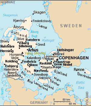
map_caption = Skagen (top center) in Denmark
The Hirschsprung Collection,Copenhagen .] Skagen (The Skaw) is a projection of land and a town inRegion Nordjylland on the northernmost tip ofVendsyssel-Thy , a part of theJutland peninsula in northernDenmark . Skagen is located inFrederikshavn municipality .Geography
Skagen takes its name from the region, which projects into the waters between the North Sea and the straits of Denmark. Skagen is considered the boundary between the
Skagerrak (named after Skagen) and theKattegat . At its very tip is a sandy, shifting headland known asGrenen . Here it's possible to experience the sight of waves clashing together from each side of the tip.Skagen stretches out to the northeast surrounded by the following waters:
* to the east is Ålbæk Bay ("Ålbæk Bugt") and beyond that the waters of theKattegat , thestrait that separates Denmark fromSweden
* to the west is Tannis Bay ("Tannis Bugt") and beyond that the waters of theSkagerrak , thestrait that separates Denmark fromNorway Find Skagen at 57°44'00.00"N 10°35'60.00"E (per
Google Earth ).Description
The area is extremely picturesque, and distinguished by its low, yellow houses with red tile roofs nestled into the
beach areas. The impressive and wild landscape was largely formed by a severe process ofdesertification that hit the area in the 18th and 19th centuries.Problems with moving
dune s and desertification were brought under control in the latter 19th and early 20th centuries by large-scale plantations of grasses, bushes and fir trees. Two significant migratory dunes remain in the area, including the enormousRåbjerg Mile .The area is closely associated with the
Skagen Painters , a community of artists (artist colony ), who flocked to this picturesque, and then unspoiled, area in the late 1800s to escape the city and to record artistically a way of life they realized was soon to disappear.The area continues to be a popular tourist destination visited by many people each year. A highlight of the year is the celebration of Midsummer Eve or St. John's Evening ("Sankt Hans Aften") on the beach with blazing bonfire and song.
Skagen is the setting for small but important parts of Jonathan Coe's novels
The Rotters Club andThe Closed Circle History
Always sparsely populated, until recently Skagen has been of interest mainly to mariners. Of the region now known as Skagen,
Pliny the Elder says (Book IV.97)::"Promenturium Cimbrorum excurrens in maria longe paeninsulam efficit quae Tastris appellatur.":"The promontory of the Cimbri running far out into the seas makes a peninsula, which is called Tastris."The name "Tastris" is a "
hapax legomenon ", recorded only once in all of history. Its meaning is not known: it may be the name assigned by thepre-Indo-European Mesolithic culture that once dwelled in the region, or by the subsequent agriculturalists.Skagen, on the other hand, seems to follow Pliny's description of a projection running out into the "seas" (maria). There is a set of obscure words in modern
Germanic languages that seem relevant: English skeg, a projection of a ship's keel, shag, a surface with projections, Swedish skägg (pronounced sheg), "beard". The root remains as yet unidentified.Once a remote fishing area, it become considerably easier to travel to Skagen after it became connected to the rest of the country via a railroad line in 1890. A paved road followed in the 1940s.
Attractions
The headland at
Grenen , the northernmost point of Denmark, is a spectacular setting where the two parts of the North Sea, the Kattegat and the Skagerrak meet. This makes for turbulent seas and strandings— beachings and shipwreckings are not uncommon. The frequent shipping losses and the strategic location as the gateway to the Baltic led to Skagen being the site of one of Denmark's earliest lighthouses, theVippefyr , constructed in the 15th century. A reconstruction of the lighthouse is located to the north of the town of Skagen.The lighthouse was originally built and funded by the late Medieval Danish state with the proceeds of the "sound dues", and was superseded by the "white lighthouse" or
hvidefyr in the 17th century, and then the far taller "grey lighthouse" orgråfyr of the 1850s.The desertification that hit the area in the 18th and 19th centuries led to the abandonment of the old parish church to the migrating sands— the famous Buried Church ("
Den tilsandende Kirke "). The tower of the church remains protruding from thedune s, as it was left as a sea marker when the church was abandoned at the close of the 18th century.Famous residents of the town
The Skagen Painters, which enjoyed the reputation of a bohemian lifestyle, encompassed not only painters, but also writers, and other influential people as well. While only a few were fulltime residents of the area, they were often joined by friends, especially during the summer months. Among these notable visitors and residents of the time were writers
Holger Drachmann ,Georg Brandes , andHenrik Pontoppidan , artistsPeder Severin Krøyer ,Marie Triepcke Krøyer Alfvén ,Christian Krohg ,Michael Ancher andAnna Ancher , composerHugo Alfvén , and NHL defensemanDavid Campbell . They were often gathered at the area's Brøndums Hotel, which is still in operation today.ee also
*
Frederikshavn municipality
*Tourism in Denmark
*Skagensbanen
*Grenen External links
Wikimedia Foundation. 2010.