- Connah's Quay Power Station
-
Connah's Quay Power Station 
Connah's Quay Power StationLocation of Connah's Quay Power Station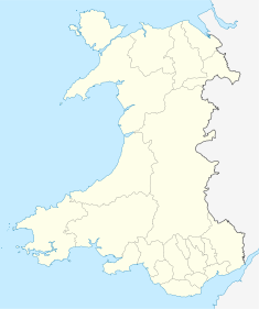

Country Wales, United Kingdom Location Flintshire Coordinates 53°13′56″N 3°04′53″W / 53.232162°N 3.0813°WCoordinates: 53°13′56″N 3°04′53″W / 53.232162°N 3.0813°W Status Operational Commission date 1954 Operator(s) British Electricity Authority
(1954)
Central Electricity Authority
(1954-1957)
Central Electricity Generating Board
(1957-1982)
Powergen
(1993-2002)
E.ON UK
(2002-present)Power station information Primary fuel Natural gas Secondary fuel Coal Generation units 4 x 330 MW Combined cycle? yes Power generation information Installed capacity 1,420 MW As of 7 November 2010 - Not to be confused with the nearby Deeside Power Station
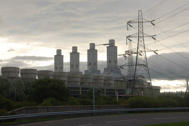
Connah's Quay Power Station is a 1,420 MW gas-fired power station to the west of Connah's Quay in Flintshire in north Wales. It is next to the A548, being tightly situated between the road and the south bank of the River Dee.
Contents
History
The current station is built on the site of a coal-fired power station. The station was opened on the 16 September 1954 by Lord Citrine, the chairman of the British Electricity Authority. The station was originally planned to only be of 60 megawatts (MW), but it was realised that a larger station would be needed. The coal-fired station was built in three stages, each stage having two 30 MW generating sets, giving a total generating capacity of 180 MW. The stages were completed in 1953, 1955 and 1957.[1] The station was closed in 1984 and demolished in 1992.[2]
Construction of the new gas-fired station began in July 1993. The station was built by GEC Alsthom and Henry Boot Construction, with design by Atlantic Projects. In 1999, Henry Boot Construction sued Alstom for breach of contract.[3] The station was completed in March 1996 and cost £580m. It was officially opened by Margaret Beckett on 4 July 1997. In June 1998, the station's visitor centre opened. The station was initially owned by Powergen, who became E.ON UK in 2004. The station is currently E.ON UK's largest CCGT power station.
The power station is not to be confused with the Deeside Power Station, a similar CCGT power station with two chimneys situated on the north bank of the River Dee, one mile to the east of the Connah's Quay station. The two plants are separated by the Flintshire Bridge, with many electricity pylons running alongside.
Specification
It is a CCGT type power station that runs on natural gas. It is made up of four 330 MW modules - hence the four chimneys. Each module has a General Electric Frame 9FA gas turbine, a Stein Industrie heat recovery steam generator and a steam turbine; in a single-shaft layout.[4][5] The gas comes from an eighteen mile pipeline from the Point of Ayr refinery, where gas comes from BHP Billiton's (originally owned by Denver-based Hamilton Oil) Celtic gas fields (Hamilton and Hamilton North) in Liverpool Bay via the Douglas Complex. The station opened soon after the gas from the field was first produced. The station employs around 81 people.
References
- ^ "Connah's Quay Power Station" (HTM). http://incebps.org.uk/. British Electricity Authority. 1954. http://incebps.org.uk/Links/ConnahsA_station_handbook.htm. Retrieved 2008-11-25.
- ^ Altoft, RG (1996). "Demolition of Connah's Quay coal-fired power station". http://cat.inist.fr/. http://cat.inist.fr/?aModele=afficheN&cpsidt=2136987. Retrieved 2008-11-25.
- ^ http://www.hmcourts-service.gov.uk/judgmentsfiles/j41/henryboot.htm
- ^ http://www.gepower.com/prod_serv/products/gas_turbines_cc/en/f_class/ms9001fa.htm
- ^ http://www.power.alstom.com/power-generation-equipment/stein-industrie.htm
External links
- E-ON UK
- Panoramic view
- Demolition of former coal power station
- Steam discharge as seen from the A55
- Worker killed in August 2007
- UK CCGTs
- Henry Boot Construction
 Energy in Wales
Companies and organisations Power stations FutureCoal-firedActiveAberthaw · UskmouthClosedLlynfi (demolished)Gas-firedActiveFutureActiveActiveClosedTrawsfynydd (decommissioned)ClosedPembroke (demolished)ActiveFutureBrechfa Forest · Gwynt y Môr CategoryCategories:
- Natural gas-fired power stations in Wales
- Buildings and structures in Flintshire

Wikimedia Foundation. 2010.