- Medzilaborce
-
Medzilaborce Town  Orthodox church in the center of Medzilaborce
Name origin: "people amidst the Laborec streams" Country Slovakia Region Prešov District Medzilaborce River Laborec Elevation 326 m (1,070 ft) Coordinates 49°16′15″N 21°54′14″E / 49.27083°N 21.90389°E Area 47.479 km2 (18 sq mi) Population 6,616 (31 December 2006) Density 139 / km2 (360 / sq mi) First mentioned 1557 Mayor Ladislav Demko Timezone CET (UTC+1) - summer (DST) CEST (UTC+2) Postal code 068 01 Phone prefix 421-57 Car plate ML 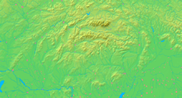

 Location in Slovakia
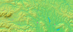
 Location in the Prešov Region
Wikimedia Commons: Medzilaborce Statistics: MOŠ/MIS Website: http://www.medzilaborce.net Medzilaborce (Hungarian: Mezőlaborc, Rusyn: Меджильабірці, Medžilabirci) is a town in northeastern Slovakia close to the border with Poland, located near the towns of Sanok and Bukowsko (in southeastern Małopolska). Its population is approximately 6,600.
Contents
Characteristics
It is an administrative and cultural centre of the Laborec Region. A train line connects it with the town of Humenné to the south and with Poland to the north. The private sector and service industries are developing quickly in the town at the moment.
It is home to the Andy Warhol Museum of Modern Art, opened in 1991, which contains many artworks and effects of Andy Warhol and of his brother Paul and nephew James Warhola. Warhol's mother, Julia Warhola, was born and lived with her husband in the village of Miková, 17 km to the west.
Medzilaborce is situated in one of the least developed regions of Slovakia. There are three churches in the town.
Geography
 Main street in Medzilaborce. The Warhol Museum of Modern Art can be seen on the left
City parts:
- Medzilaborce
- Borov
- Vydraň
The town of Medzilaborce lies in the valley of the Laborec river in north-eastern Slovakia. The hills of the surrounding Laborec Highlands are typical of this countryside.
History
The oldest written record connected with Medzilaborce dates back to 1543. The village first belonged to the Drugeth family, but passed to the Csáky family in the 17th century and later in the 19th century to the Andrassy family manor. As early as the 17th century, an important trade route passed through Medzilaborce connecting the interior of Slovakia with Poland through the Lupkov Pass. Medzilaborce became a town in 1860.[1] In 1873, construction of the train track between Humenné and Medzilaborce and further on to Galicia via the Lupkov Pass, which contributed to the growth of the town from 724 inhabitants in 1851 to 1561 citizens in 1910. During World War I, Russian troops entered the town in February 1915 and stayed there until May 1915, leaving the town significantly damaged. During the first Czechoslovak republic, there was massive unemployment, and many people emigrated from the town. The town was significantly damaged again during World War II. It was the seat of the district until 1960, when it was merged with the Humenné district. It has again been the seat of the Medzilaborce district since 1996.
Demographics
In 1910 the town had 1,561 inhabitants, 677 Ruthenian, 501 German and 255 Hungarian. More than one third of the population (34.3%) were Jewish. The town had a high percentage of Rusyns before World War II.
According to the 2001 census, the town had 6,741 inhabitants. 56.42% of inhabitants were Slovaks, 34.16% Rusyns, 6.13% Ukrainian, 1.11% Roma and 0.68% Czechs.[2] The religious makeup was 41.15% Greek Catholics, 40.07% Orthodox, 4.94% people with no religious affiliation, 10.15% Roman Catholics and 0.33% Lutherans.[2]
Gallery
-

The Andy Warhol Museum of Modern Art
-

The Andy Warhol Museum of Modern Art
-

Statue of Andy Warhol
References
- ^ http://www.medzilaborce.net/medzilaborce_1.htm (Slovak)
- ^ a b "Municipal Statistics". Statistical Office of the Slovak republic. Archived from the original on 2008-02-08. http://web.archive.org/web/20080208225314/http://www.statistics.sk/mosmis/eng/run.html. Retrieved 2008-02-17.
External links
- Unofficial website of Medzilaborce (Slovak)
- Medzilaborce: Modern art in a desolate town by Chris Togneri for the Spectacular Slovakia travel guide
- Catholic church of Byzantine rite in Medzilaborce
- The Andy Warhol Museum of Modern Art - city of origin
- Andy Warhol in Slovakia by Robert Rigney
Medzilaborce
Brestov nad Laborcom · Čabalovce · Čabiny · Čertižné · Habura · Kalinov · Krásny Brod · Ňagov · Oľka · Oľšinkov · Palota · Radvaň nad Laborcom · Repejov · Rokytovce · Roškovce · Sukov · Svetlice · Valentovce · Volica · Výrava · Zbojné · Zbudská Belá Categories:
- Cities and towns in Slovakia


Wikimedia Foundation. 2010.