- Drochtersen
-
Drochtersen 

 DrochtersenLocation of Drochtersen within Stade district
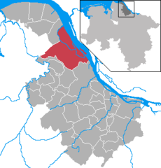
Coordinates 53°42′N 9°23′E / 53.7°N 9.38333°ECoordinates: 53°42′N 9°23′E / 53.7°N 9.38333°E Administration Country Germany State Lower Saxony District Stade subdivisions 2 districts Mayor Hans-Wilhelm Bösch (CDU) Basic statistics Area 126.74 km2 (48.93 sq mi) Elevation 2 m (7 ft) Population 11,857 (31 December 2010)[1] - Density 94 /km2 (242 /sq mi) Other information Time zone CET/CEST (UTC+1/+2) Licence plate STD Postal code 21706 Area codes 04143, 04148, 04775 Website www.drochtersen.de Drochtersen is a municipality in the district Stade, in Lower Saxony (Germany). It is located 45 km north west of Hamburg.
It belonged to the Prince-Archbishopric of Bremen. In 1648 the Prince-Archbishopric was transformed into the Duchy of Bremen, which was first ruled in personal union by the Swedish and from 1715 on by the Hanoverian Crown. In 1823 the Duchy was abolished and its territory became part of the Stade Region.
Notable places
The Drochtersen Shot Tower is a 42 meter high shot tower owned by the Haentler & Natermann Jagd-Schrot & Hagel-Fabrik (Hunt pellet and hail fabrication) factory for the production of shot balls at the Elbe. This tower is not in use any more.
Agathenburg | Ahlerstedt | Apensen | Balje | Bargstedt | Beckdorf | Bliedersdorf | Brest | Burweg | Buxtehude | Deinste | Dollern | Drochtersen | Düdenbüttel | Engelschoff | Estorf | Fredenbeck | Freiburg | Großenwörden | Grünendeich | Guderhandviertel | Hammah | Harsefeld | Heinbockel | Himmelpforten | Hollern-Twielenfleth | Horneburg | Jork | Kranenburg | Krummendeich | Kutenholz | Mittelnkirchen | Neuenkirchen | Nottensdorf | Oederquart | Oldendorf | Sauensiek | Stade | Steinkirchen | Wischhafen
References
- ^ "Bevölkerungsfortschreibung" (in German). Landesbetrieb für Statistik und Kommunikationstechnologie Niedersachsen. 31 December 2009. http://www1.nls.niedersachsen.de/statistik/html/parametereingabe.asp?DT=K1000014&CM=Bev%F6lkerungsfortschreibung.
Categories:- Municipalities in Lower Saxony
- Lüneburg region geography stubs


Wikimedia Foundation. 2010.