- Mississippi
-
This article is about the U.S. state of Mississippi. For the river, see Mississippi River. For other uses, see Mississippi (disambiguation).
State of Mississippi 

Flag Seal Nickname(s): The Magnolia State; The Hospitality State Motto(s): Virtute et armis 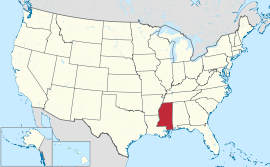
Official language(s) English Demonym Mississippian Capital
(and largest city)Jackson Area Ranked 32nd in the U.S. - Total 48,430 sq mi
(125,443 km2)- Width 170 miles (275 km) - Length 340 miles (545 km) - % water 3% - Latitude 30° 12′ N to 35° N - Longitude 88° 06′ W to 91° 39′ W Population Ranked 31st in the U.S. - Total 2,967,297 (2010 US Census)[1] - Density 60.7/sq mi (23.42/km2)
Ranked 32nd in the U.S.- Median income $36,338[2] (50th) Elevation - Highest point Woodall Mountain[3][4][5]
807 ft (246.0 m)- Mean 300 ft (90 m) - Lowest point Gulf of Mexico[4]
sea levelBefore statehood Mississippi Territory Admission to Union December 10, 1817 (20th) Governor Haley Barbour (R) Lieutenant Governor Phil Bryant (R) Legislature Mississippi Legislature - Upper house State Senate - Lower house House of Representatives U.S. Senators Thad Cochran (R)
Roger Wicker (R)U.S. House delegation 3 Republicans, 1 Democrat (list) Time zone Central: UTC-6/-5 Abbreviations MS Miss. US-MS Website mississippi.gov Mississippi
 i/ˌmɪsɨˈsɪpi/ is a U.S. state located in the Southern United States. Jackson is the state capital and largest city. The name of the state derives from the Mississippi River, which flows along its western boundary, whose name comes from the Ojibwe word misi-ziibi ("Great River"). The state is heavily forested outside of the Mississippi Delta area, which had been cleared for cotton cultivation in the 19th century. Today its catfish aquaculture farms produce the majority of farm-raised catfish consumed in the United States.[6] The state symbol is the magnolia grandiflora tree.
Contents
Geography
Mississippi is bordered on the north by Tennessee, on the east by Alabama, on the south by Louisiana and a narrow coast on the Gulf of Mexico and on the west, across the Mississippi River, by Louisiana and Arkansas.
In addition to its namesake, major rivers in Mississippi include the Big Black River, the Pearl River, the Yazoo River, the Pascagoula River, and the Tombigbee River. Major lakes include Ross Barnett Reservoir, Arkabutla Lake, Sardis Lake and Grenada Lake. The largest lake in Mississippi is Grenada Lake.
 Mississippi State Map
The state of Mississippi is entirely composed of lowlands, the highest point being Woodall Mountain, in the foothills of the Cumberland Mountains, 806 feet (246 m) above sea level. The lowest point is sea level at the Gulf coast. The mean elevation in the state is 300 feet (91 m) above sea level.
Most of Mississippi is part of the East Gulf Coastal Plain. The Coastal Plain is generally composed of low hills, such as the Pine Hills in the south and the North Central Hills. The Pontotoc Ridge and the Fall Line Hills in the northeast have somewhat higher elevations. Yellow-brown loess soil is found in the western parts of the state. The northeast is a region of fertile black earth that extends into the Alabama Black Belt.
The coastline includes large bays at Bay St. Louis, Biloxi and Pascagoula. It is separated from the Gulf of Mexico proper by the shallow Mississippi Sound, which is partially sheltered by Petit Bois Island, Horn Island, East and West Ship Islands, Deer Island, Round Island and Cat Island.
The northwest remainder of the state consists of the Mississippi Delta, a section of the Mississippi Alluvial Plain. The plain is narrow in the south and widens north of Vicksburg. The region has rich soil, partly made up of silt which had been regularly deposited by the floodwaters of the Mississippi River.
Areas under the management of the National Park Service include:[7]
- Brices Cross Roads National Battlefield Site near Baldwyn
- Gulf Islands National Seashore
- Natchez National Historical Park in Natchez
- Natchez Trace National Scenic Trail in Tupelo
- Natchez Trace Parkway
- Tupelo National Battlefield in Tupelo
- Vicksburg National Military Park and Cemetery in Vicksburg
Major cities and towns
 Map with all counties and many cities and towns labeled.
Mississippi City Population Rankings of at least 50,000 (United States Census Bureau as of 2010):[8]
- Jackson (173,514)
- Gulfport (67,793)
- Hattiesburg (51,993)
Mississippi City Population Rankings of at least 20,000 but fewer than 50,000 (United States Census Bureau as of 2010):[8]- Greenville (34,400)
- Olive Branch (33,484)
- Horn Lake (26,066)
- Clinton (25,216)
- Pearl (25,092)
- Madison (24,149)
- Ridgeland (24,047)
- Starkville (23,888)
- Vicksburg (23,856)
- Columbus (23,604)
- Pascagoula (22,392)
- Brandon (21,705)
Mississippi City Population Rankings of at least 10,000 but fewer than 20,000 (United States Census Bureau as of 2010):[8]
- Oxford (18,916)
- Gautier (18,572)
- Laurel (18,540)
- Clarksdale (17,962)
- Ocean Springs (17,442)
- Natchez (15,792)
- Greenwood (15,205)
- Long Beach (14,792)
- Corinth (14,573)
- Hernando (14,090)
- Moss Point (13,704)
- Canton (13,189)
- Grenada (13,092)
- McComb (12,790)
- Brookhaven (12,513)
- Cleveland (12,334)
- Byram (11,489)
- Yazoo City (11,403)
- West Point (11,307)
- Picayune (10,878)
- Indianola (10,683)
- Petal (10,454)
(See: Lists of cities, towns and villages, census-designated places, metropolitan areas, micropolitan areas, and counties in Mississippi)
Climate
Mississippi has a humid subtropical climate with long summers and short, mild winters. Temperatures average about 95°F (about 35°C) in July and about 48 °F (about 9 °C) in January. The temperature varies little statewide in the summer; however, in winter, the region near Mississippi Sound is significantly warmer than the inland portion of the state. The recorded temperature in Mississippi has ranged from −19 °F (−28.3 °C), in 1966, at Corinth in the northeast, to 115 °F (46.1 °C), in 1930, at Holly Springs in the north. Heavy snowfall is possible across the state, such as during the New Year's Eve 1963 snowstorm. Yearly precipitation generally increases from north to south, with the regions closer to the Gulf being the most humid. Thus, Clarksdale, in the northwest, gets about 50 inches (about 1,270 mm) of precipitation annually and Biloxi, in the south, about 61 inches (about 1,550 mm). Small amounts of snow fall in northern and central Mississippi, although snow is occasional in the southern part of the state.
The late summer and fall is the seasonal period of risk for hurricanes moving inland from the Gulf of Mexico, especially in the southern part of the state. Hurricane Camille in 1969 and Hurricane Katrina in 2005, which killed 238 people in the state, are the most devastating hurricanes to hit the state, both causing nearly total storm surge damage around Gulfport, Biloxi and Pascagoula. As in the rest of the Deep South, thunderstorms are common in Mississippi, especially in the southern part of the state. On average, Mississippi has around 27 tornadoes annually; the northern part of the state has more tornadoes earlier in the year and the southern part a higher frequency later in the year. Two of the five deadliest tornadoes in US history have occurred in the state. These storms struck Natchez, in southwest Mississippi (see The Great Natchez Tornado) and Tupelo, in the northeast corner of the state. About seven F5 tornadoes have been recorded in the state.
Monthly Normal High and Low Temperatures (°F) For Various Mississippi Cities City Jan Feb Mar Apr May Jun Jul Aug Sep Oct Nov Dec Gulfport 61/43 64/46 70/52 77/59 84/66 89/72 91/74 91/74 87/70 79/60 70/51 63/45 Jackson 55/35 60/38 68/45 75/52 82/61 89/68 91/71 91/70 86/65 77/52 66/43 58/37 Meridian 58/35 63/38 70/44 77/50 84/60 90/67 93/70 93/70 88/64 78/51 68/43 60/37 Tupelo 50/30 56/34 65/41 74/48 81/58 88/66 91/70 91/68 85/62 75/49 63/40 54/33 [2] Ecology
 Mississippi state welcome sign
Mississippi is heavily forested, with over half of the state's area covered by wild trees, including mostly pine, as well as cottonwood, elm, hickory, oak, pecan, sweetgum and tupelo.
Ecological problems
Flooding
Due to seasonal flooding possible from December to June, the Mississippi River created a fertile floodplain in the Mississippi Delta, including tributaries. Early planters used slaves to build levees along the Mississippi River to control flooding. They built on top of the natural levees that formed from dirt deposited after the river flooded. As cultivation of cotton increased in the Delta, planters hired Irish laborers, who immigrated in high numbers in the 1840s, to ditch and drain their land.
The state took over levee building from 1858 to 1861, accomplishing it through contractors and hired labor. In those years, planters considered their slaves too valuable to hire out for such dangerous work. Contractors hired gangs of Irish immigrant laborers to build levees and sometimes clear land. Many of the Irish were relatively recent immigrants from the famine years, and struggling to get established.[9] Before the American Civil War, the earthwork levees averaged six feet in height, although in some areas they reached twenty feet.
Flooding has been an integral part of Mississippi history, but clearing of the land for cultivation and to supply fuel for steamboats took away the absorption of trees and undergrowth. After the Civil War, major floods swept down the valley in 1865, 1867, 1874 and 1882. Such floods regularly overwhelmed levees damaged by Confederate and Union fighting during the war, as well as those constructed after the war.[10] In 1877, the Mississippi Levee District was created for southern counties. In 1879, the United States Congress created the Mississippi River Commission, whose responsibilities included aiding state levee boards in the construction of levees. Both white and black transient workers built the levees in the late 19th century. By 1882, levees averaged seven feet in height, but many in the southern Delta were severely tested by the flood that year.[10] After the 1882 flood, the levee system was expanded. In 1884, the Yazoo-Mississippi Delta Levee District was established to oversee levee construction and maintenance in the northern Delta counties; also included were some counties in Arkansas.[11]
Flooding overwhelmed northwestern Mississippi in 1912–1913, causing heavy damage to the levee districts. Regional losses and the Mississippi River Levee Association's lobbying for a flood control bill helped gain passage of national bills in 1917 and 1923 to provide federal matching funds for local levee districts, on a scale of 2:1. Although US participation in World War I interrupted funding of levees, the second round of funding helped raise the average height of levees in the Mississippi-Yazoo Delta to 22 feet (6.7 m) in the 1920s.[12] Scientists now understand the levees have increased flooding, and the region was severely damaged due to the Great Mississippi Flood of 1927. There were losses of millions of dollars in property, stock and crops. The most damage occurred in the lower Delta, including Washington and Bolivar counties.[13]
Even as scientific knowledge about the Mississippi River has grown, upstream development and the consequences of the levees have caused more severe flooding in some years. Scientists now understand that the widespread clearing of land and building of the levees have changed the nature of the river, by removing the natural protection of wetlands and forest cover, and strengthening the current. The state and federal governments have been struggling for the best approaches to restore some natural habitats in order to best interact with the original riverine ecology.
History
Mississippi State symbols 
The Flag of Mississippi. 
The Seal of Mississippi. Animate insignia Bird(s) Mockingbird (1944)
Wood Duck (1974)Butterfly Spicebush Swallowtail (1991) Fish Largemouth bass (1974) Flower(s) Magnolia (1952)
Coreopsis (Tickseed) (1991)Insect Honey bee (1980) Mammal(s) White-tailed deer (1974)
Red Fox (1997)
Bottlenose dolphin (1974)Reptile American Alligator (2005) Tree Magnolia (1938) Inanimate insignia Beverage Milk (1984) Dance American folk dance (1995) Fossil Prehistoric whale (1981) Rock Petrified wood (1976) Shell Oyster (1974) Slogan(s) Virtute et armis Soil Natchez silt loam (2003) Song(s) "Go, Mississippi" (1962) Toy Teddy bear (2003) Other Grand Opera House of Meridian (1993)
Tupelo Auto Museum (1972)
Mississippi Industrial Heritage Museum (1972)Route marker(s) 
State Quarter 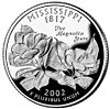
Released in 2002 Lists of United States state insignia Main article: History of MississippiNearly 10,000 B.C. Native Americans or Paleo-Indians arrived in what today is referred to as the South.[14] Paleoindians in the South were hunter-gatherers who pursued the megafauna that became extinct following the end of the Pleistocene age. After thousands of years, the Paleoindians developed a rich and complex agricultural society. Archaeologists called these people the Mississippians of the Mississippian culture; they were Mound Builders, whose large earthworks related to political and religious rituals still stand throughout the Mississippi and Ohio valleys. Descendant Native American tribes include the Chickasaw and Choctaw. Other tribes who inhabited the territory of Mississippi (and whose names were honored in local towns) include the Natchez, the Yazoo and the Biloxi.
The first major European expedition into the territory that became Mississippi was that of Hernando de Soto, who passed through in 1540. The French, in April 1699, established the first European settlement at Fort Maurepas (also known as Old Biloxi), built at Ocean Springs and settled by Pierre Le Moyne d'Iberville. In 1716, the French founded Natchez on the Mississippi River (as Fort Rosalie); it became the dominant town and trading post of the area. The French called the greater territory "New Louisiana"; the Spanish continued to claim the Gulf coast.
Through the next decades, the area was ruled by Spanish, British and French colonial governments. Under French and Spanish rule, there developed a class of free people of color (gens de couleur libres), mostly descendants of European men and enslaved women, and their multiracial children. In the early days the French and Spanish colonists were chiefly men. Even as more European women joined the settlements, there continued to be interracial unions. Often the European men would help their children get educated, and sometimes settled property on them, as well as freeing slave children and their mothers. The free people of color became educated and formed a third class between the Europeans and enslaved Africans in the French and Spanish settlements, although not so large a community as in New Orleans. After Great Britain's victory in the French and Indian War (Seven Years' War), the French surrendered the Mississippi area to them under the terms of the Treaty of Paris (1763).
After the American Revolution, this area became part of the new United States of America. The Mississippi Territory was organized on April 7, 1798, from territory ceded by Georgia and South Carolina. It was later twice expanded to include disputed territory claimed by both the United States and Spain. From 1800 to about 1830, the United States purchased some lands (Treaty of Doak's Stand) from Native American tribes for new settlements of European Americans, mostly from other Southern states.[15] Many slaveholders brought slaves with them or purchased them through the internal slave market, especially New Orleans. They transported hundreds of thousands of slaves to the Deep South, including Mississippi. This was a forced internal migration that broke up many slave families of the Upper South, where planters were selling excess slaves.
On December 10, 1817, Mississippi was the 20th state admitted to the Union. Planters developed plantations along the rivers, where waterfront gave them access to the major transportation routes. This is also where early towns developed, linked by the steamboats that carried commercial products and crops to markets.
When cotton was king during the 1850s, Mississippi plantation owners—especially those of the Delta and Black Belt regions—became wealthy due to the high fertility of the soil, the high price of cotton on the international market, and their assets in slaves. They used the profits to buy more cotton land and more slaves. The planters' dependence on hundreds of thousands of slaves for labor and the severe wealth imbalances among whites, played strong roles both in state politics and in planters' support for secession. By 1860, the enslaved population numbered 436,631 or 55% of the state's total of 791,305. There were fewer than 1000 free people of color.[16] The relatively low population of the state before the Civil War reflected the fact that land and villages were developed only along the riverfronts, which formed the main transportation corridors. Ninety percent of the Delta bottomlands were frontier and undeveloped.[17] The state needed many more settlers for development.
On January 9, 1861, Mississippi became the second state to declare its secession from the Union, and it was one of the founding members of the Confederate States of America.
During Reconstruction, the first constitutional convention in 1868 framed a constitution whose major elements would last for 22 years. The convention was the first political organization to include freedmen representatives, 17 among the 100 members. Although 32 counties had black majorities, they elected whites as well as blacks to represent them. The convention adopted universal suffrage; did away with property qualifications for suffrage or for office, which also benefited poor whites; provided for the state's first public school system; forbade race distinctions in the possession and inheritance of property; and prohibited limiting civil rights in travel.[18] Under the terms of Reconstruction, Mississippi was restored to the Union on February 23, 1870.
While Mississippi typified the Deep South in passing Jim Crow laws in the early 20th century, its history was more complex. Because the Mississippi Delta contained so much fertile bottomland which had not been developed before the Civil War, 90 percent of the land was still frontier. After the Civil War, tens of thousands of migrants were attracted to the area. They could earn money by clearing the land and selling timber, and eventually advance to ownership. The new farmers included freedmen, who achieved unusually high rates of land ownership in the Mississippi bottomlands. In the 1870s and 1880s, many black farmers succeeded in gaining land ownership.[17]
By the turn of the century, two-thirds of the farmers in Mississippi who owned land in the Delta were African-American. Many were able to keep going through difficult years of falling cotton prices only by extending their debts. Cotton prices fell throughout the decades following the Civil War. As another agricultural depression lowered cotton prices into the 1890s, however, numerous African-American farmers finally had to sell their land to pay off debts, thus losing the land into which they had developed.[17]
White legislators created a new constitution in 1890, with electoral and voter registration provisions that effectively disfranchised most blacks and many poor whites. Estimates are that 100,000 black and 50,000 white men were removed from voter registration rolls over the next few years.[19] The loss of political influence contributed to the difficulties of African Americans in their attempts to obtain extended credit in the late nineteenth century. Together with Jim Crow laws, increased frequency of lynchings beginning in the 1890s, failure of the cotton crops due to boll weevil infestation, successive severe flooding in 1912 and 1913 created crisis conditions for many African Americans. With control of the ballot box and more access to credit, white planters expanded their ownership of Delta bottomlands and could take advantage of new railroads.
By 1910, a majority of black farmers in the Delta had lost their land and were sharecroppers. By 1920, the third generation after freedom, most African Americans in Mississippi were landless laborers again facing poverty.[17] Starting about 1913, tens of thousands of black Americans left Mississippi for the North in the Great Migration to industrial cities such as St. Louis, Chicago, Detroit, Philadelphia and New York. They sought jobs, better education for their children, the right to vote, relative freedom from discrimination, and better living. In the migration of 1910–1940, they left a society that had been steadily closing off opportunity. Most migrants from Mississippi took trains directly north to Chicago and often settled near former neighbors.
The Second Great Migration from the South started in the 1940s, lasting until 1970. Almost half a million people left Mississippi in the second migration, three-quarters of them black. Nationwide during the first half of the 20th century, African Americans became rapidly urbanized and many worked in industrial jobs. The Second Great Migration included destinations in the West, especially California, where the buildup of the defense industry offered higher paying jobs to African Americans.
Mississippi generated rich, quintessentially American music traditions: gospel music, country music, jazz, blues and rock and roll. All were invented, promulgated or heavily developed by Mississippi musicians, many of them African American, and most came from the Mississippi Delta. Many musicians carried their music north to Chicago, where they made it the heart of that city's jazz and blues.
Mississippi was a center of activity to educate and register black voters during the Civil Rights Movement. Although 42% of the state's population was African American in 1960, discriminatory voter registration processes still prevented most of them from voting, consequent to provisions of the state constitution, which had been in place since 1890.[20] Students and community organizers from across the country came to help register voters and establish Freedom Schools. Resistance and harsh attitudes of most white politicians (including the creation of the Mississippi State Sovereignty Commission), the participation of many Mississippians in the White Citizens' Councils, and the violent tactics of the Ku Klux Klan and its sympathizers, gained Mississippi a reputation in the 1960s as a reactionary state.[21][22]
In 1966, the state was the last to officially repeal statewide prohibition of alcohol. Prior to that, Mississippi had taxed the illegal alcohol brought in by bootleggers. Governor Paul Johnson urged repeal and the sheriff "raided the annual Junior League Mardi Gras ball at the Jackson Country Club, breaking open the liquor cabinet and carting off the Champagne before a startled crowd of nobility and high-ranking state officials."[23]
The state repealed its ban on interracial marriage (miscegenation) in 1987 (which the United States Supreme Court had ruled unconstitutional in 1967), and repealed the segregationist-era poll tax in 1989. In 1995, it symbolically ratified the Thirteenth Amendment, which had abolished slavery in 1865. In 2009, the legislature passed a bill to repeal other discriminatory civil rights laws which had been enacted in 1964 but ruled unconstitutional in 1967 by federal courts. Republican Governor Haley Barbour signed the bill into law.[24]
On August 17, 1969, Category 5 Hurricane Camille hit the Mississippi coast, killing 248 people and causing US$1.5 billion in damage (1969 dollars). On August 29, 2005, Hurricane Katrina, though a Category 3 storm upon final landfall, caused even greater destruction across the entire 90 miles (145 km) of Mississippi Gulf Coast from Louisiana to Alabama.
Demographics
According to the 2010 US Census, Mississippi has a population of 2,967,297.[1] Mississippi's population has a sizable proportion of African Americans, approximately 37 percent.[25]
The 2000 Census reported Mississippi's population as 2,844,658.[26] The center of population of Mississippi is located in Leake County, in the town of Lena.[27]
Ethnic makeup and ancestry
Historical populations Census Pop. %± 1800 7,600 — 1810 31,306 311.9% 1820 75,448 141.0% 1830 136,621 81.1% 1840 375,651 175.0% 1850 606,526 61.5% 1860 791,305 30.5% 1870 827,922 4.6% 1880 1,131,597 36.7% 1890 1,289,600 14.0% 1900 1,551,270 20.3% 1910 1,797,114 15.8% 1920 1,790,618 −0.4% 1930 2,009,821 12.2% 1940 2,183,796 8.7% 1950 2,178,914 −0.2% 1960 2,178,141 0% 1970 2,216,912 1.8% 1980 2,520,638 13.7% 1990 2,573,216 2.1% 2000 2,844,658 10.5% 2010 2,967,297 4.3% Source: 1910–2010[28]  Mississippi population density map
The Census Bureau considers race and Hispanic ethnicity to be two separate categories. These data, however, are only for non-Hispanic members of each group: non-Hispanic Whites, non-Hispanic Blacks, etc. Americans of Scots-Irish, English and Scottish ancestry are present throughout the state, and are thought to be much larger groups than are reported. English, Scottish and Scots-Irish are generally the most under-reported ancestry groups in both the South Atlantic States and the East South Central States. The historian David Hackett Fischer estimated that a minimum 20% of Mississippi's population is of English ancestry though the figure is probably much higher, and another large percentage is of Scottish ancestry, but many Mississippians of English and Scottish stock self-identify simply as American because their families have been in North America for so long, in many cases since the early 18th century.[29][30] In the 1980 census 656,371 Mississippians out of a total of 1,946,775 claimed to be of English ancestry, making them 38% of the state at the time.[31] For more information on race and the Census, see here.
Demographics of Mississippi (csv) By race White Black AIAN* Asian NHPI* 2000 (total population) 62.37% 36.66% 0.69% 0.82% 0.07% 2000 (Hispanic only) 1.12% 0.24% 0.04% 0.03% 0.01% 2005 (total population) 61.72% 37.24% 0.72% 0.91% 0.07% 2005 (Hispanic only) 1.50% 0.21% 0.04% 0.03% 0.01% Growth 2000–05 (total population) 1.62% 4.33% 7.13% 13.67% 2.89% Growth 2000–05 (non-Hispanic only) 0.96% 4.43% 7.21% 14.21% 6.30% Growth 2000–05 (Hispanic only) 37.78% -11.11% 5.70% -1.51% -13.43% * AIAN is American Indian or Alaskan Native; NHPI is Native Hawaiian or Pacific Islander On September 27, 1830, the Treaty of Dancing Rabbit Creek was signed between the U.S. Government and the Choctaw. The Choctaw agreed to sell their traditional homelands in Mississippi and Alabama, for compensation and removal to reservations in Indian Territory (now Oklahoma). This opened up land for sale to European-American immigrant settlement. Article 14 in the treaty allowed those Choctaw who chose to remain in the state to become U.S. citizens, the first major non-European ethnic group to do so.[32][33] Today approximately 9,500 Choctaw live in Neshoba, Newton, Leake, and Jones counties. Federally recognized tribes include the Mississippi Band of Choctaw Indians.
From before the Civil War until the 1930s, African Americans made up a majority of Mississippians. Due to the Great Migration, when more than 360,000 African Americans left the state during the 1940s and after, the African-American population declined.
The state in 2010 had the highest proportion of African Americans in the nation. Recently, the African-American percentage of population has begun to increase due mainly to a higher birth rate than the state average. Due to patterns of settlement, in almost all of Mississippi's public school districts, a majority of students are of African descent. African Americans are the majority ethnic group in the northwestern Yazoo Delta, and the southwestern and the central parts of the state, chiefly areas where the group owned land as farmers or worked on cotton plantations and farms.[34]
According to the 2000 census, the largest identified ancestries in the state are:
 American (14.2%)
 Irish (6.9%)
 English (6.1%)
 German (4.5%)
 French (2.3%)
 Scots-Irish (1.9%)
 Italian (1.4%)
 Scottish (1.2%)
People of French Creole ancestry form the largest demographic group in Hancock County on the Gulf Coast. The African-American; Choctaw, mostly in Neshoba County; and Chinese-American segments of the population are almost entirely native born.
Although some ethnic Chinese were recruited as indentured laborers from Cuba during the 1870s and later 19th c., the majority immigrated directly from China to Mississippi between 1910–1930. They were recruited as laborers. While planters first made arrangements with the Chinese for sharecropping, most Chinese soon left that work. Many became small merchants and especially grocers in towns throughout the Delta.[35] As the small towns declined, many ethnic Chinese moved to cities or left the state.
Religion
Under French and Spanish rule beginning in the 17th century, the few Europeans in what is now Mississippi were Roman Catholics. The growth of the cotton culture after 1815 brought in tens of thousands of European-American settlers each year, most of whom were Protestants from Southeastern states. Due to such migration, there was rapid growth in Protestant churches, especially Methodist, Presbyterian and Baptist.[36]
The revivals of the Great Awakening in the late eighteenth and early nineteenth centuries initially attracted the "plain folk" by reaching out to all members of society, including women and blacks. Both slaves and free blacks were welcomed into Methodist and Baptist churches. Independent black Baptist churches were established before 1800 in Virginia, Kentucky, South Carolina and Georgia, and later developed in Mississippi as well.
In the post-Civil War years, religion became even more influential as the South became known as the "Bible Belt". Freedmen withdrew from white-run churches in favor of setting up their own. Many left the Southern Baptist Church, and by 1895 had established numerous black Baptist state associations and the National Baptist Convention of black churches. They wanted to be independent of white supervision. In addition, independent black denominations, such as the African Methodist Episcopal Church (established in Philadelphia) and the African Methodist Episcopal Zion Church (established in New York), sent missionaries to the South in the postwar years. They quickly attracted hundreds of thousands of converts and founded new churches across the South. Southern congregations brought their own influences to those denominations as well.[37][38]
By 1900 many ministers, especially in the towns, subscribed to the Social Gospel movement, which attempted to apply Christian ethics to social and economic needs of the day. Many strongly supported Prohibition, believing it would help alleviate many sins.[39]
African-American Baptist churches grew to include more than twice the number of members as their white Baptist counterparts. The African-American call for social equality resonated throughout the Great Depression in the 1930s and World War II in the 1940s. The American Civil Rights Movement had many roots in religion, and the strong community of churches helped supply volunteers and moral purpose for their activism. The end of legal segregation and Jim Crow led to the reintegration of some churches, but most today remain all black or all white.[40] Since the 1970s, fundamentalist conservative churches have grown rapidly, fueling Mississippi's conservative political trends.[36]
In 2000 the Southern Baptist Convention had 916,440 adherents and was the largest religious denomination in the state, followed by the United Methodist Church with 240,576; and the Roman Catholic Church with 115,760.[41] Other religions have a small presence in Mississippi, as by 2000, there were 3900 Muslims, 1400 Jews and 811 Bahá'í.[41]
Health and public safety
The state is ranked 50th or last place among all the states for health care, according to the Commonwealth Fund, a nonprofit foundation working to advance performance of the health care system.[42] For three years in a row, more than 30 percent of Mississippi's residents have been classified as obese. In a 2006 study, 22.8 percent of the state's children were classified as obese. Mississippi had the highest rate of obesity of any U.S. state from 2005–2008 and also ranks first in the nation for high blood pressure, diabetes, and adult inactivity.[43][44] In a 2008 study of African American women, contributing risk factors were shown to be: lack of knowledge about body mass index (BMI), dietary behavior, physical activity and lack of social support, defined as motivation and encouragement by friends.[45] A 2002 report on African American adolescents noted a 1999 survey which suggests that a third of children were obese, with higher ratios for those in the Delta.[46]
The study stressed that "obesity starts in early childhood extending into the adolescent years and then possibly into adulthood". It noted impediments to needed behavioral modification included the Delta likely being "the most underserved region in the state" with African Americans the major ethnic group; lack of accessibility and availability of medical care; and an estimated 60% of residents living below the poverty level.[46] Additional risk factors were that most schools had no physical education curriculum and nutrition education is not emphasized. Previous intervention strategies may have been largely ineffective due to not being culturally sensitive or practical.[46] A 2006 survey found nearly 95 percent of Mississippi adults considered childhood obesity to be a serious problem.[47]
Economy
 A Mississippi U.S. quarter
The Bureau of Economic Analysis estimates that Mississippi's total state product in 2010 was $98 billion.[48] Per capita personal income in 2006 was $26,908, the lowest per capita personal income of any state, but the state also has the nation's lowest living costs. Although the state has one of the lowest per capita income rates in the United States, Mississippians consistently rank as one of the highest per capita in charitable contributions.[49] A 2009 report by the American Legislative Exchange Council ranked Mississippi as having the 19th best economic outlook of all U.S. states.[50]
Before the Civil War, Mississippi was the fifth-wealthiest state in the nation, its wealth generated by cotton plantations along the rivers.[51] Slaves were then counted as property and the rise in the cotton markets since the 1840s had increased their value. A majority – 55 percent – of the population of Mississippi was enslaved in 1860.[52] Ninety percent of the Delta bottomlands were undeveloped and the state had low population overall.
Largely due to the domination of the plantation economy, focused on the production of agricultural cotton, the state was slow to use its wealth to invest in infrastructure such as public schools, roads and railroads. Industrialization did not come in many areas until the late 20th century. The planter aristocracy, the elite of antebellum Mississippi, kept the tax structure low for themselves and made private improvements. Before the war the most successful planters, such as Confederate President Jefferson Davis, owned riverside properties along the Mississippi River. Most of the state was undeveloped frontier away from the riverfronts.
During the Civil War, 30,000 mostly white Mississippi men died from wounds and disease, and many more were left crippled and wounded. Changes to the labor structure and an agricultural depression throughout the South caused severe losses in wealth. In 1860 assessed valuation of property in Mississippi had been more than $500 million, of which $218 million (43 percent) was estimated as the value of slaves. By 1870, total assets had decreased in value to roughly $177 million.[53]
Poor whites and landless former slaves suffered the most from the postwar economic depression. The constitutional convention of early 1868 appointed a committee to recommend what was needed for relief of the state and its citizens. The committee found severe destitution among the laboring classes.[54] It took years for the state to rebuild levees damaged in battles. The upset of the commodity system impoverished the state after the war. By 1868 an increased cotton crop began to show possibilities for free labor in the state, but the crop of 565,000 bales produced in 1870 was still less than half of prewar figures.[55]
Blacks sold timber and developed bottomland to achieve ownership. In 1900, two-thirds of farm owners in Mississippi were blacks, a major achievement for them and their families. Due to the poor economy, low cotton prices and difficulty of getting credit, many of these farmers could not make it through the extended financial difficulties. Two decades later, the majority of African Americans were sharecroppers. The low prices of cotton into the 1890s meant that more than a generation of African Americans lost the result of their labor when they had to sell their farms to pay off accumulated debts.[17]
Mississippi's rank as one of the poorest states is related to its dependence on cotton agriculture before and after the Civil War, late development of its frontier bottomlands in the Mississippi Delta, repeated natural disasters of flooding in the late 19th and early 20th century requiring massive capital investment in levees, heavy capital investment to ditch and drain the bottomlands, and slow development of railroads to link bottomland towns and river cities.[56] In addition, when conservative white Democrats regained control, they passed the 1890 constitution that discouraged industry, a legacy that would slow the state's progress for years.[57]
Democratic Party paramilitary militias and groups such as the Red Shirts and the Knights of the White Camelia terrorized African American Republicans and suppressed voting. The Democrats regained political control of the state in 1877. The legislature passed statutes to establish segregation and a new constitution that effectively disfranchised most blacks, Native Americans and many poor whites by changes to electoral and voter registration rules.[58] The state refused for years to build human capital by fully educating all its citizens. In addition, the reliance on agriculture grew increasingly costly as the state suffered loss of crops due to the devastation of the boll weevil in the early 20th century, devastating floods in 1912–1913 and 1927, collapse of cotton prices after 1920, and drought in 1930.[56]
It was not until 1884, after the flood of 1882, that the state created the Mississippi-Yazoo Delta District Levee Board and started successfully achieving longer term plans for levees in the upper Delta.[11] Despite the state's building and reinforcing levees for years, the Great Mississippi Flood of 1927 broke through and caused massive flooding of 27,000 square miles (70,000 km2) throughout the Delta, homelessness for hundreds of thousands, and millions of dollars in property damages. With the Depression coming so soon after the flood, the state suffered badly during those years. In the Great Migration, tens of thousands of African Americans migrated North and West for jobs and chances to live as full citizens.
The legislature's 1990 decision to legalize casino gambling along the Mississippi River and the Gulf Coast has led to economic gains for the state. Gambling towns in Mississippi include the Gulf Coast resort towns of Bay St. Louis, Gulfport and Biloxi, and the Mississippi River towns of Tunica (the third largest gaming area in the United States), Greenville, Vicksburg and Natchez. Before Hurricane Katrina struck the Gulf Coast, Mississippi was the second largest gambling state in the Union, after Nevada and ahead of New Jersey.[citation needed] An estimated $500,000 per day in tax revenue was lost following Hurricane Katrina's severe damage to several coastal casinos in August 2005.[citation needed] In 2007, Mississippi had the third largest gambling revenue of any state, behind New Jersey and Nevada.[59] Federally recognized Native American tribes have established gaming casinos on their reservations, which are yielding revenue to support education and economic development.[citation needed]
On October 17, 2005, Governor Haley Barbour signed a bill into law that allows casinos in Hancock and Harrison counties to rebuild on land (but within 800 feet (240 m) of the water). The only exception is in Harrison County, where the new law states that casinos can be built to the southern boundary of U.S. Route 90.[citation needed]
Mississippi collects personal income tax in three tax brackets, ranging from 3% to 5%. The retail sales tax rate in Mississippi is 7%. Additional local sales taxes also are collected. For purposes of assessment for ad valorem taxes, taxable property is divided into five classes.[citation needed]
On August 30, 2007, a report by the United States Census Bureau indicated that Mississippi was the poorest state in the country. Many cotton farmers in the Delta have large, mechanized plantations, some of which receive extensive federal subsidies, yet many other residents still live as poor, rural, landless laborers. Of $1.2 billion from 2002–2005 in federal subsidies to farmers in the Bolivar County area of the Delta, 5% went to small farmers. There has been little money apportioned for rural development. Small towns are struggling. More than 100,000 people have left the region in search of work elsewhere.[60] The state had a median household income of $34,473.[61]
As of January 2010, the state's unemployment rate was 10.9%.[62]
Federal subsidies and spending
Despite Mississippi's fiscal conservatism, in which Medicaid, welfare, food stamps, and other social programs are often cut, eligibility requirements are tightened, and stricter employment criteria are imposed, Mississippi still ranks as having the 2nd highest ratio of spending to tax receipts of any state. In 2005, Mississippi citizens received approximately $2.02 per dollar of taxes in the way of federal spending. This ranks the state 2nd highest nationally, and represents an increase from 1995, when Mississippi received $1.54 per dollar of taxes in federal spending and was 3rd highest nationally.[63]
A proportion of federal spending in Mississippi is directed toward large federal installations such as Camp Shelby, John C. Stennis Space Center, and Keesler Air Force Base, in a state with a relatively low population density and one of the lowest proportions of urban dwellers.[64]
Law and government
Main article: Law and government of MississippiAs with all other U.S. states and the federal government, Mississippi's government is based on the separation of legislative, executive and judicial power. Executive authority in the state rests with the Governor, currently Haley Barbour (R). The Lieutenant Governor, currently Phil Bryant (R), is elected on a separate ballot. Both the governor and lieutenant governor are elected to four-year terms of office. Unlike the federal government, but like many other U.S. States, most of the heads of major executive departments are elected by the citizens of Mississippi rather than appointed by the governor.
Mississippi is one of five states that elects its state officials in odd-numbered years (the others are Kentucky, Louisiana, New Jersey and Virginia). Mississippi holds elections for these offices every four years, always in the year preceding Presidential elections. Thus, the last year when Mississippi elected a Governor was 2007, and the next gubernatorial election will occur in 2011.
Laws
In 2004, Mississippi voters approved a state constitutional amendment banning same-sex marriage and prohibiting Mississippi from recognizing same-sex marriages performed elsewhere. The amendment passed 86% to 14%, the largest margin in any state.[65][66] The ban could potentially be upset by the federal court case Perry v. Schwarzenegger, which questions the validity of bans on gay marriage under the Fourteenth Amendment to the United States Constitution.
Section 265 of the Constitution of the State of Mississippi declares that "No person who denies the existence of a Supreme Being shall hold any office in this state."[67] This provision is unenforceable due to the separation of church and state established by the United States Constitution, which overrides any contrary law in the US, including parts of a state constitution.
Transportation
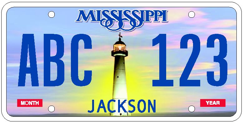
 The current state license plate design, introduced in October 2007.
Road
In March 2011, Mississippi ranked as the third bottom "Worst" state (next to Louisiana and Kentucky) in the American State Litter Scorecard. The Hospitality State suffers from an overall poor effectiveness and quality of its statewide public space cleanliness (primarily from roadway and adjacent litter/debris)--in state and related eradication standards.[68]
Mississippi is served by nine interstate highways:
and fourteen main U.S. Routes:
as well as a system of State Highways.
For more information, visit the Mississippi Department of Transportation website.
Rail
Passenger
Amtrak provides scheduled passenger service along two routes, the Crescent and City of New Orleans.
Freight
All but two of the United States Class I railroads serve Mississippi (the exceptions are the Union Pacific and Canadian Pacific):
- Canadian National Railway's Illinois Central Railroad subsidiary provides north-south service.
- BNSF Railway has an east-west line across northern Mississippi.
- Kansas City Southern Railway provides east-west service in the middle of the state and north-south service along the Alabama state line.
- Norfolk Southern Railway provides service in the extreme north and southeast.
- CSX has a line along the Gulf Coast.
Water
Major rivers
- Mississippi River
- Big Black River
- Pascagoula River
- Pearl River
- Tennessee-Tombigbee Waterway
- Yazoo River
Major bodies of water
- Arkabutla Lake – 19,550 acres (79.1 km2) of water; constructed and managed by the U.S. Army Corps of Engineers Vicksburg District[69]
- Bay Springs Lake – 6,700 acres (27 km2) of water and 133 miles (214 km) of shoreline; constructed and managed by the U.S. Army Corps of Engineers</ref>
- Grenada Lake – 35,000 acres (140 km2) of water; became operational in 1954; constructed and managed by the U.S. Army Corps of Engineers Vicksburg District[70]
- Ross Barnett Reservoir – Named for Ross Barnett, the 52nd Governor of Mississippi; 33,000 acres (130 km2) of water; became operational in 1966; constructed and managed by The Pearl River Valley Water Supply District, a state agency; Provides water supply for the City of Jackson.
- Sardis Lake – 98,520 acres (398.7 km2) of water; became operational in October 1940; constructed and managed by the U.S. Army Corps of Engineers Vicksburg District[71]
Education
Until the Civil War era, Mississippi had a small number of schools and no educational institutions for African Americans. The first school for black people was established in 1862.
During Reconstruction in 1871, black and white Republicans were the first to establish a system of public education in the state. The state's dependence on agriculture and resistance to taxation limited the funds it had available to spend on any schools. As late as the early 20th century, there were few schools in rural areas. With seed money from the Julius Rosenwald Fund, many rural black communities across Mississippi raised matching funds and contributed public funds to build new schools for their children. Essentially, many black adults taxed themselves twice and made significant sacrifices to raise money for the education of children in their communities.[72]
Blacks and whites attended separate public schools in Mississippi until the 1960s, when they began to be integrated following the 1954 U.S. Supreme Court ruling in Brown v. Board of Education that racially segregated public schools were unconstitutional.
In the late 1980s, the state had 954 public elementary and secondary schools, with a total yearly enrollment of about 369,500 elementary pupils and about 132,500 secondary students. Some 45,700 students attended private schools. In 2008, Mississippi was ranked last among the fifty states in academic achievement by the American Legislative Exchange Council's Report Card on Education, with the lowest average ACT scores and sixth lowest spending per pupil in the nation. In contrast, Mississippi had the 17th highest average SAT scores in the nation. According to the report, 92% of Mississippi high school graduates took the ACT and 3% took the SAT, in comparison to the national averages of 43% and 45%, respectively.
In 2007, Mississippi students scored the lowest of any state on the National Assessments of Educational Progress in both math and science.[73]
Mississippi is currently ranked at the bottom of the American Human Development Index.
Jackson, the state's capital city, houses the state residential school for deaf and hard of hearing students. The Mississippi School for the Deaf was established by the state legislature in 1854.
The Mississippi School for Mathematics and Science (MSMS) is a public residential high school for academically gifted students located in Columbus, Mississippi on the campus of the Mississippi University for Women. MSMS was founded in 1987 by appropriations from the Mississippi Legislature and is the fourth public, residential high school for academically gifted students in the United States.[3] The school only enrolls students in the last two years of high school. Tenth grade students from across the state interested in the school apply and are selected to attend.
Culture
While Mississippi has been especially known for its music and literature, it has embraced other forms of art. Its strong religious traditions have inspired striking works by outsider artists who have been shown nationally.
Jackson established the USA International Ballet Competition, which is held every four years. This ballet competition attracts the most talented young dancers from around the world.[74]
The Magnolia Independent Film Festival, still held annually in Starkville, is the first and oldest in the state.
George Ohr, known as the "Mad Potter of Biloxi" and the father of abstract expressionism in pottery, lived and worked in Biloxi, MS.
The New Southern View Ezine, first published in the summer of 2001, is the state's first online magazine.
Music
Musicians of the state's Delta region were historically significant to the development of the blues. Their laments arose out of the region's hard times after Reconstruction.[citation needed] Although by the end of the 19th century, two-thirds of the farm owners were black, continued low prices for cotton and national financial pressures resulted in most of them losing their land. More problems built up with the boll weevil infestation, when thousands of agricultural jobs were lost. Many Mississippi musicians migrated to Chicago and created new forms of jazz and other genres there.[citation needed]
Jimmie Rodgers, a native of Meridian and white guitarist/singer/songwriter known as the "Father of Country Music", played a significant role in the development of the blues. He and Chester Arthur Burnett were friends and admirers of each other's music. Rodgers was supposed to have given Burnett his nickname of Howlin' Wolf. Their friendship and respect is an important example of Mississippi's musical legacy. While the state has had a reputation for being the most racist in the United States, individual musicians created an integrated music community. Mississippi musicians created new forms by combining and creating variations on musical traditions from Africa with the musical traditions of white Southerners, a tradition largely rooted in Scots–Irish music.
The state is creating a Mississippi Blues Trail, with dedicated markers explaining historic sites significant to the history of blues music, such as Clarksdale's Riverside Hotel, where Bessie Smith died after her auto accident on Highway 61. The Riverside Hotel is just one of many historical blues sites in Clarksdale. The Delta Blues Museum there is visited by tourists from all over the world. Close by are "Ground Zero" and "Madidi", a contemporary blues club and restaurant co-owned by actor Morgan Freeman.
Mississippians have contributed to American music. Elvis Presley, who created a sensation in the 1950s as a crossover artist and contributed to rock 'n' roll, was a native of Tupelo. From opera star Leontyne Price to the alternative rock band 3 Doors Down, to gulf and western singer Jimmy Buffett, to rappers David Banner and Afroman, Mississippi musicians have been significant in all genres.
(see: List of people from Mississippi)
Sports
- Biloxi, Mississippi is home to the Mississippi Surge ice hockey team. The team is a member of the Southern Professional Hockey League and began its first season of play in 2009.
- Clinton, Mississippi is home to the Mississippi Brilla soccer team. The Brilla are a member of the USL Premier Development League.
- Pearl, Mississippi is home to the Mississippi Braves baseball team. The Braves are an AA minor league affiliate of the Atlanta Braves. They play in the Southern League.
- Southaven, Mississippi is home to the Mississippi RiverKings hockey team, formerly known as the Memphis RiverKings. The RiverKings are a member of Southern Professional Hockey League.
Notable natives
Main article: List of people from MississippiMississippi has produced a number of notable and famous individuals, especially in the realm of music and literature. Among the most notable are:
- Actors:Lacey Chabert, Morgan Freeman, Jim Henson, James Earl Jones, Gerald McRaney, Parker Posey, Sela Ward, and Oprah Winfrey
- Artists: Walter Inglis Anderson and George E. Ohr
- Athletes: Cool Papa Bell, Brett Favre, Al Jefferson, Archie Manning, Deuce McAllister, Steve McNair, Travis Outlaw, Walter Payton, and Jerry Rice
- Authors: William Faulkner, John Grisham, Thomas Harris, Eudora Welty, Tennessee Williams, and Richard Wright, Charlaine Harris, Kathryn Stockett
- Civil rights leaders: Medgar Evers, Fannie Lou Hamer, Aaron Henry, and Anne Moody
- Musicians: 3 Doors Down, David Banner, Lance Bass, Brandy, Jimmy Buffett, Bo Diddley, Faith Hill, Howlin' Wolf, Robert Johnson, B.B. King, Denise LaSalle, Elvis Presley, Leontyne Price, Charlie Patton, Charlie Pride, LeAnn Rimes, Jimmie Rodgers, Britney Spears, Conway Twitty, Muddy Waters, Hayley Williams, Randy Houser, and Tammy Wynette
Cultural references
Children in the United States and Canada often count "One-Mississippi, two-Mississippi" during informal games such as hide and seek to approximate counting by seconds.
On March 12, 1894, the Biedenharn Candy Company bottled the first Coca-Cola in Vicksburg, Mississippi. Root beer was invented in Biloxi in 1898 by Edward Adolf Barq, the namesake of Barq's Root Beer.
The Teddy bear gets its name from President Theodore "Teddy" Roosevelt. On a 1902 hunting trip to Sharkey County, Mississippi, he ordered the mercy killing of a wounded bear.[75]
In 1935, the world's first night rodeo held outdoors under electric lights was produced by Earl Bascom and Weldon Bascom in Columbia, Marion County, Mississippi
In 1936, Dr. Leslie Rush, of Rush Hospital in Meridian, Mississippi, performed the first bone pinning in the United States. The "Rush Pin" is still in use.
Burnita Shelton Matthews from near Hazlehurst, Mississippi was the first woman appointed as a judge of a U.S. district court. She was appointed by Harry S. Truman on October 21, 1949.
Marilyn Monroe won the Mrs. Mississippi finals in the 1952 movie We're Not Married!.
Texas Rose Bascom, of Columbia, Mississippi, became the most famous female trick roper in the world, performing on stage and in Hollywood movies. She toured the world with Bob Hope, billed as the "Queen of the Trick Ropers," and was the first Mississippian to be inducted into the National Cowgirl Hall of Fame.
In 1963, Dr. James D. Hardy of the University of Mississippi Medical Center performed the first human lung transplant in Jackson, Mississippi. In 1964, Dr. Hardy performed the first heart transplant, transplanting the heart of a chimpanzee into a human, where it beat for 90 minutes.
"At 10:00 a.m. on October 22, 1964, the United States government detonated an underground nuclear device in Lamar County, in south Mississippi. (...) The Project Salmon blast was about one-third as powerful as the bomb that destroyed Hiroshima in 1945. (...) The Project Sterling blast, on December 3, 1966, was considerably weaker than the blast two years earlier, as it was intended to be."[76]
On January 8, 1935, Elvis Aaron Presley was born in Tupelo.[77]
Several warships have been named USS Mississippi.
The comic book character Rogue, from the well-known series X-Men, is a Mississippian and self-declared southern belle. Her home town is located in the fictional county of Caldecott.
For the past seven years, the Sundancer Solar Race Team from Houston, MS, has won first place in the Open Division of the Dell-Winston School Solar Car Challenge.[78]
See also
- Outline of Mississippi
- Index of Mississippi-related articles
- Gulf of Mexico
- List of National Register of Historic Places in Mississippi
- List of people from Mississippi
- U.S. state
References
- ^ a b http://2010.census.gov/news/pdf/st28_MS_TotalPop_2010Map.pdf Mississippi 2010 Census Results by County
- ^ "Median household income in the past 12 months (in 2007 inflation-adjusted dollars)". American Community Survey. United States Census Bureau. 2007. http://factfinder.census.gov/servlet/GRTTable?_bm=y&-_box_head_nbr=R1901&-ds_name=ACS_2007_1YR_G00_&-_lang=en&-format=US-30&-CONTEXT=grt. Retrieved 2009-02-24.
- ^ "Knob Reset". NGS data sheet. U.S. National Geodetic Survey. http://www.ngs.noaa.gov/cgi-bin/ds_mark.prl?PidBox=EG1487.
- ^ a b "Elevations and Distances in the United States". United States Geological Survey. 2001. http://egsc.usgs.gov/isb/pubs/booklets/elvadist/elvadist.html. Retrieved October 24, 2011.
- ^ Elevation adjusted to North American Vertical Datum of 1988.
- ^ "Aquaculture: Catfish", Mississippi State University
- ^ "Mississippi". National Park Service. http://www.nps.gov/state/ms. Retrieved 2008-07-16.
- ^ a b c [1]. Retrieved 2 July 2009.
- ^ David R. Roediger, The Wages of Whiteness: Race and the Making of the American Working Class, New York: Verso, 1999, p. 146
- ^ a b John Otto Solomon,The Final Frontiers, 1880–1930: Settling the Southern Bottomlands. Westport: Greenwood Press, 1999, pp.10–11
- ^ a b "''The New York Times'', The Yazoo-Mississippi Delta Levee Board: Physical development of a levee system, accessed 13 November 2007". Leveeboard.org. http://www.leveeboard.org/about_the_levee/history/physical_development.html. Retrieved 2010-07-30.
- ^ John Otto Solomon,The Final Frontiers, 1880–1930: Settling the Southern Bottomlands. Westport: Greenwood Press, 1999, p.50
- ^ Solomon (1999),The Final Frontiers, p.70
- ^ Prentice, Guy (2003). "Pushmataha, Choctaw Indian Chief". Southeast Chronicles. http://www.nps.gov/history/seac/SoutheastChronicles/NISI/NISI%20Cultural%20Overview.htm. Retrieved 2008-02-11.
- ^ Ben Wynne, Mississippi (2007) p 12
- ^ "Historical Census Browser". Fisher.lib.virginia.edu. http://fisher.lib.virginia.edu/collections/stats/histcensus/php/state.php. Retrieved 2010-07-30.
- ^ a b c d e John C. Willis, Forgotten Time: The Yazoo-Mississippi Delta after the Civil War. Charlottesville: University of Virginia Press, 2000
- ^ W.E.B. DuBois,Black Reconstruction in America, 1860–1880. New York: Harcourt Brace, 1935; reprint New York: The Free Press, 1998, p.437
- ^ Stephen Edward Cresswell, Rednecks, Redeemers and Race: Mississippi after Reconstruction, Jackson: University Press of Mississippi, 2006, p.124
- ^ Historical Census Browser, 1960 US Census, University of Virginia, accessed 13 Mar 2008
- ^ Joseph Crespino, "Mississippi as Metaphor: State, Region and Nation in Historical Imagination", Southern Spaces, 23 Oct 1996, accessed 15 Mar 2008[dead link]
- ^ Michael Schenkler, "Memories of Queens College and an American Tragedy", Queens Press, 18 Oct 2002, accessed 15 Mar 2008
- ^ "Mississippi: Bourbon Borealis", Time Magazine, Feb. 11, 1966.
- ^ "Segregationist Mississippi laws repealed", The Clarion-Ledger[dead link]
- ^ Census.gov
- ^ "Population Growth". CensusScope. http://www.censusscope.org/us/s28/chart_popl.html. Retrieved 2010-07-30.
- ^ "Population and Population Centers by State – 2000". United States Census Bureau. http://www.census.gov/geo/www/cenpop/statecenters.txt. Retrieved 2008-12-05.
- ^ http://2010.census.gov/2010census/data/apportionment-pop-text.php
- ^ David Hackett Fischer, Albion's Seed: Four British Folkways in America, New York: Oxford University Press, 1989, pp.602–645
- ^ Dominic J. Pulera, Sharing the Dream: White Males in a Multicultural America
- ^ http://www.census.gov/population/www/censusdata/files/pc80-s1-10/tab03.pdf
- ^ Kappler, Charles (1904). "Indian Affairs: Laws and Treaties Vol. II, Treaties". Government Printing Office. http://digital.library.okstate.edu/kappler/Vol2/treaties/cho0310.htm#mn15. Retrieved 2008-04-16.
- ^ 87, David (1973). "The Choctaws Meet the Americans, 1783 to 1843". The Choctaw People. United States: Indian Tribal Series. p. 36. Library of Congress 73-80708.
- ^ James C. Cobb, The Most Southern Place on Earth: The Mississippi Delta and the Roots of Regional Identity (1994) p. 244
- ^ Vivian Wu Wong, "Somewhere between White and Black: The Chinese in Mississippi", Magazine of History, v10, n4, pp33–36, Summer 1996, accessed 15 November 2007
- ^ a b "Mississippi History Now – Religion in Mississippi". Mshistory.k12.ms.us. http://mshistory.k12.ms.us/articles/96/religion-in-mississippi. Retrieved 2010-07-30.
- ^ James T. Campbell, Songs of Zion, New York: Oxford University Press, 1995, pp. 53–54, accessed 13 Jan 2009
- ^ "The Church in the Southern Black Community", Documenting the South, University of North Carolina, 2004, accessed 15 Jan 2009
- ^ online edition Randy J. Sparks, Religion in Mississippi, Rice University (2001)
- ^ By John Blake CNN (2008-07-30). "Segregated Sundays". CNN. http://www.cnn.com/2008/LIVING/wayoflife/08/04/segregated.sundays/index.html. Retrieved 2010-07-30.
- ^ a b "Mississippi Denominational Groups, 2000". Thearda.com. http://www.thearda.com/mapsReports/reports/state/28_2000.asp. Retrieved 2010-07-30.
- ^ Commonwealth Fund, Aiming Higher: Results from a State Scorecard on Health System Performance, 2009
- ^ Ronni Mott (2008-12-03). "We-the-Fat". Jackson Free Press. http://www.jacksonfreepress.com/index.php/site/comments/we_the_fat_120308/. Retrieved 2008-12-20.
- ^ Thomas M. Maugh (2007-08-28). "Mississippi heads list of fattest states". Los Angeles Times. http://www.star-telegram.com/national_news/story/215983.html. Retrieved 2007-08-28.[dead link]
- ^ Victor Sutton, PhD, and Sandra Hayes, MPH, Bureau of Health Data and Research, Mississippi Department of Health (2008-10-29). "Impact of Social, Behavioral and Environmental Factors on Overweight and Obesity among African American Women in Mississippi". American Public Health Association: APHA Scientific Session and Event Listing at 2008 136th Annual Meeting. http://apha.confex.com/apha/136am/techprogram/paper_172848.htm. Retrieved 2008-12-20.[dead link]
- ^ a b c Gail D. Hughes, DrPH, MPH and Gloria Areghan, MSN both with Department of Preventive Medicine-Epidemiology, University of Mississippi Medical Centre; Bern'Nadette Knight, MSPH with Department of General Internal Medicine, University of Mississippi Medical Center and Abiodun A. Oyebola, MD with Department of Public Health, Jackson State University (2008-11-11). "Obesity and the African American Adolescent, The Mississippi Delta Report". American Public Health Association: 2002 130th Annual APHA Meeting. http://apha.confex.com/apha/130am/techprogram/paper_46137.htm. Retrieved 2008-12-20.
- ^ Lei Zhang, PhD MBA, Office of Health Data and Research, Mississippi State Department of Health; Jerome Kolbo, PhD ACSW, College of Health, Bonnie Harbaugh, PhD RN, School of Nursing and Charkarra Anderson-Lewis, PhD MPH, Department of Community Health Sciences, University of Southern Mississippi (2008-10-29). "Public Perception of Childhood Obesity among Mississippi Adults". American Public Health Association: : APHA Scientific Session and Event Listing at 2008 136th Annual Meeting. http://apha.confex.com/apha/136am/techprogram/paper_178329.htm. Retrieved 2008-12-20.[dead link]
- ^ "GDP by State". Greyhill Advisors. http://greyhill.com/gdp-by-state. Retrieved 13 September 2011.
- ^ "Generosity Index". Catalogueforphilanthropy.org. http://www.catalogueforphilanthropy.org/cfp/generosity_index/. Retrieved 2010-07-30.
- ^ "Rich States, Poor States: Mississippi" (PDF). http://www.alec.org/am/pdf/tax/09RSPS/states/09mississippi.pdf. Retrieved 2010-07-30.
- ^ "Mississippi Almanac Entry". The New York Times. 2004-07-15. http://travel2.nytimes.com/2004/07/15/travel/NYT_ALMANAC_US_MISSISSIPPI.html?ex=1162094400&en=27939e8b35b285fa&ei=5070. Retrieved 2010-05-12., The New York Times Travel Almanac (2004)
- ^ "Historical Census Browser". Fisher.lib.virginia.edu. http://fisher.lib.virginia.edu/collections/stats/histcensus/php/sate.php. Retrieved 2010-07-30.
- ^ W.E.B. DuBois,Black Reconstruction in America, 1860–1880. New York: Harcourt Brace, 1935; reprint New York: The Free Press, 1998, p.432
- ^ Du Bois, Ibid., p.437
- ^ Du Bois, Ibid., p.432 and 434
- ^ a b John Otto Solomon,The Final Frontiers, 1880–1930: Settling the Southern Bottomlands. Westport: Greenwood Press, 1999, pp.10–11, 42–43, 50–51, and 70
- ^ V.S. Naipaul, A Turn in the South. New York: Alfred A. Knopf, 1989
- ^ Stephen Edward Cresswell, Rednecks, Redeemers, and Race: Mississippi after Reconstruction, Jackson: University Press of Mississippi, 2006, p.124
- ^ Industry Information: State Statistics. American Gaming Association. Retrieved December 23, 2008.
- ^ Gilbert M. Gaul and Dan Morgan, "A Slow Demise in the Delta: US Farm Subsidies Favor Big Over Small and White Over Blacks", The Washington Post, accessed 29 Mar 2008
- ^ Les Christie (August 30, 2007). "The Richest (and Poorest) Places in the U.S.". CNNMoney.com. http://finance.yahoo.com/real-estate/article/103432/The-Richest-(and-Poorest)-Places-in-the-U.S.?mod=oneclick. Retrieved 2007-09-22.
- ^ Bls.gov; Local Area Unemployment Statistics
- ^ "Tax Foundation". Tax Foundation. http://www.taxfoundation.org/research/topic/38.html. Retrieved 2010-07-30.
- ^ US Census. "Urban and Rural Population by State". http://www.census.gov/compendia/statab/2011/tables/11s0029.pdf. Retrieved 27 April 2011.
- ^ "Amendment banning gay marriage passes". USA Today. 2004-11-02. http://www.usatoday.com/news/politicselections/vote2004/2004-11-02-ms-intiative-gay-marriage_x.htm. Retrieved 2007-10-12.
- ^ "Voters pass all 11 bans on gay marriage". AP via MSNBC. 2004-11-03. http://www.msnbc.msn.com/id/6383353/. Retrieved 2007-12-07.
- ^ "Mississippi State Constitution". http://www.sos.state.ms.us/ed_pubs/constitution/constitution.asp. Retrieved 2011-02-15.
- ^ S. Spacek, 2011 American State Litter Scorecard.
- ^ U.S. Army Corps of Engineers Vicksburg District: Arkabutla Lake[dead link]
- ^ U.S. Army Corps of Engineers Vicksburg District: Grenada Lake[dead link]
- ^ U.S. Army Corps of Engineers Vicksburg District: Sardis Lake
- ^ James D. Anderson,The Education of Blacks in the South, 1860–1935. Chapel Hill: University of North Carolina, 1988, pp.160–161
- ^ Dillon, Sam (2007-11-14). "Study Compares States' Math and Science Scores With Other Countries'". The New York Times. http://www.nytimes.com/2007/11/14/education/14students.html. Retrieved 2010-05-12., The New York Times (2007)
- ^ "USA International Ballet Competition". Usaibc.com. http://www.usaibc.com/. Retrieved 2010-07-30.
- ^ "History of the Teddy Bear". Retrieved March 7, 2006.
- ^ "Nuclear Blasts in Mississippi". Mshistory.k12.ms.us. http://mshistory.k12.ms.us/articles/293/nuclear-blasts-in-mississippi. Retrieved 2010-07-30.
- ^ http://www.elvis.com/about-the-king/biography_.aspx
- ^ The Cirlot Agency at http://www.cirlot.com. "Mississippi, Believe It!". Mississippi, Believe It!. http://www.mississippibelieveit.com. Retrieved 2010-07-30.
External links
- Official website
- Mississippi State Databases – Annotated list of searchable databases produced by Mississippi state agencies and compiled by the Government Documents Roundtable of the American Library Association.
- Mississippi Travel and Tourism
- Mississippi Development Authority
- The "Mississippi Believe It" Campaign
- Mississippi State Facts
- University Press of Mississippi
- Mississippi at the Open Directory Project
- Mississippi as Metaphor State, Region, and Nation in Historical Imagination," Southern Spaces, 23 October 2006.
 OpenStreetMap has geographic data related to Mississippi
Related information
Preceded by
IndianaList of U.S. states by date of statehood
Admitted on December 10, 1817 (20th)Succeeded by
Illinois
 Arkansas
 Missouri •
  Kentucky
 Tennessee
 Alabama
 Mississippi: Outline • Index

 Louisiana
Gulf of Mexico Atlantic Ocean United States (Outline) History Pre-Columbian era · Colonial era (Thirteen Colonies · Colonial American military history) · American Revolution (War) · Federalist Era · War of 1812 · Territorial acquisitions · Territorial evolution · Mexican–American War · Civil War · Reconstruction era · Indian Wars · Gilded Age · African-American Civil Rights Movement (1896–1954) · Spanish–American War · Imperialism · World War I · Roaring Twenties · Great Depression · World War II (Home front) · Cold War · Korean War · Space Race · African-American Civil Rights Movement (1955–1968) · Feminist Movement · Vietnam War · Post-Cold War (1991–present) · War on Terror (War in Afghanistan · Iraq War) · Timeline of modern American conservatismTopicsDemographic · Discoveries · Economic (Debt Ceiling) · Inventions (before 1890 · 1890–1945 · 1946–1991 · after 1991) · Military · Postal · Technological and industrialFederal
governmentLegislature - Congress
Senate
· Vice President
· President pro tem
House of Representatives
· Speaker
Judiciary - Supreme Court
Federal courts
Courts of appeal
District courtsExecutive - President
Executive Office
Cabinet / Executive departments
Civil service
Independent agencies
Law enforcement
Public policy
Intelligence
Central Intelligence Agency
Defense Intelligence Agency
National Security Agency
Federal Bureau of InvestigationPolitics Divisions · Elections (Electoral College) · Foreign policy · Foreign relations · Ideologies · Local governments · Parties (Democratic Party · Republican Party · Third parties) · Political status of Puerto Rico · Red states and blue states · Scandals · State governments · Uncle SamGeography Cities, towns, and villages · Counties · Extreme points · Islands · Mountains (Peaks · Appalachian · Rocky) · National Park System · Regions (Great Plains · Mid-Atlantic · Midwestern · New England · Northwestern · Southern · Southwestern · Pacific · Western) · Rivers (Colorado · Columbia · Mississippi · Missouri · Ohio · Rio Grande) · States · Territory · Water supply and sanitationEconomy Agriculture · Banking · Communications · Companies · Dollar · Energy · Federal Budget · Federal Reserve System · Financial position · Insurance · Mining · Public debt · Taxation · Tourism · Trade · Transportation · Wall StreetSociety TopicsCrime · Demographics · Education · Family structure · Health care · Health insurance · Incarceration · Languages (American English · Spanish · French) · Media · People · Public holidays · Religion · SportsArchitecture · Art · Cinema · Cuisine · Dance · Fashion · Flag · Folklore · Literature · Music · Philosophy · Radio · Television · TheaterIssues Book ·
  Category ·
  Portal ·
  WikiProject
Political divisions of the United States States - Alabama
- Alaska
- Arizona
- Arkansas
- California
- Colorado
- Connecticut
- Delaware
- Florida
- Georgia
- Hawaii
- Idaho
- Illinois
- Indiana
- Iowa
- Kansas
- Kentucky
- Louisiana
- Maine
- Maryland
- Massachusetts
- Michigan
- Minnesota
- Mississippi
- Missouri
- Montana
- Nebraska
- Nevada
- New Hampshire
- New Jersey
- New Mexico
- New York
- North Carolina
- North Dakota
- Ohio
- Oklahoma
- Oregon
- Pennsylvania
- Rhode Island
- South Carolina
- South Dakota
- Tennessee
- Texas
- Utah
- Vermont
- Virginia
- Washington
- West Virginia
- Wisconsin
- Wyoming
Federal district Insular areas Outlying islands Categories:- Mississippi
- States of the United States
- States of the Confederate States of America
- States of the Southern United States
- States and territories established in 1817
- Former British colonies


Wikimedia Foundation. 2010.