- Waramanga, Australian Capital Territory
Infobox Australian Place | type = suburb
name = Waramanga
state = Australian Capital Territory
city = Canberra
caption =
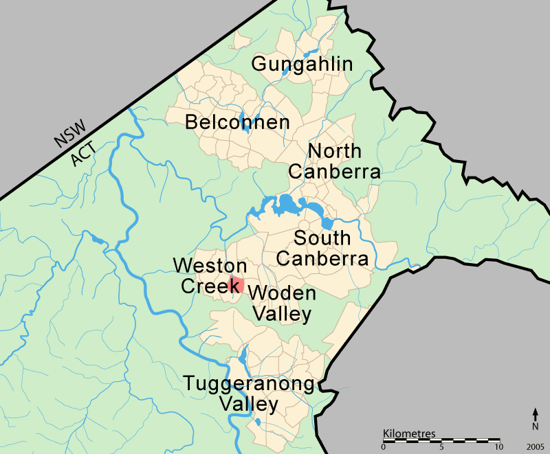
lga = Weston Creek
postcode = 2611
est = 1968
propval = $335,000 (2005) [http://allhomes.com.au/c/ah?a=uisu&i=820]
pop = 2590 (2001 census)
ACTgov = Molonglo
fedgov = Canberra
near-nw = Weston
near-n = Weston
near-ne = Lyons
near-e = Chifley
near-w = Stirling
near-sw = Chapman
near-s = Fisher
near-se =Waramanga (postcode: 2611) is a suburb of
Canberra ,Australian Capital Territory ,Australia located in the district of Weston Creek. In the 2001 census there were 2590 people counted in Waramanga (ABS, 2002).Waramanga was established in the late 1960s and was named after the Aboriginal tribe of Central Australia, also known as Warramunga. The theme for the street names in Waramanga is Aboriginal tribal units (ACTPLA, 2003).
History
The Weston Creek district was part of Yarralumla Station, a 40,000 acre (162 km²) property dating back to 1828. It was resumed by the Commonwealth in 1913 from Frederick Campbell who bought the property in 1881. In 1920 9,000 acres (36 km²) of the Woden Valley, including the Weston Creek district, were subdivided for soldier settlement leases. A 1950's map of the district shows four paddocks, Weston paddock, Track paddock, Brown Hill paddock and Oakey Hill paddock intersecting the area which is now the suburb of Waramanga. Long Gully Road ran through the suburb and the nearest homestead was Cooleman on the Kambah Road just west of the present suburb of Fisher. Cooleman was farmed by the Champion family from about 1932. It was previously known as Allawah and was leased to the Anderson family in 1920. Other properties in the district were Avondale and Weston whose homesteads were in the present suburb of Holder, Yamba in the suburb of Phillip and Iloura, Melrose and Yarra Glen in the suburb of Curtin (Douglas, 1996).
In June 1968 the suburb of Waramanga was officially gazetted (ACTPLA, 2003).
The
bushfire which engulfed parts ofCanberra onJanuary 18 ,2003 flowed out of Mount Taylor Nature Reserve and reached the eastern boundary of the suburb at Badimara Street where it was slowed by residents and stopped by a contrary wind. For more information about the bushfire seeCanberra bushfires of 2003 .Demographics
On census night 2001 Waramanga had a population of 2590 people.Waramanga residents had a median age of 36 compared to a Canberra median of 34. 27.7% of the population earned over AU$1000 a week, compared to a Canberra wide figure of 29% and an Australia wide figure of 18.6%.
The population of Waramanga is predominantly Australian-born, 73.3% of people being born in Australia. With 6.7% of the population, the second most common birth place is the
United Kingdom . Accommodation is mostly separate houses (80.0%), with semi detached, row or terrace houses and townhouses comprising 16.2% (ABS, 2002).The population of Waramanga is expected to decline by 7.7% to 2,400 over the 10 years to 2014 compared to a decline of 5.3% for the Weston Creek-Stromlo district (Chief Minister’s Department, 2004).
Politics
Waramanga is located in the federal House of Representatives
electorate of Canberra. Covering the southside of Canberra and southern ACT, the electorate of Canberra is currently represented byAnnette Ellis of the [http://www.alp.org.au Australian Labor Party] . The two federal electorates in the ACT are safe or fairly safe ALP seats (AEC, 2005).Waramanga is located in the ACT Legislative Assembly electorate of Molonglo. Covering central Canberra, the electorate of Molonglo is currently represented by 3 [http://www.act.alp.org.au Australian Labor Party] members, 3 [http://www.canberraliberals.org.au Liberal Party] members and 1 [http://www.act.greens.org.au ACT Greens] member (ACTEC, 2005).
Links to Waramanga polling place results for the 2004 Federal Election and 2004 ACT Legislative Assembly election are listed in the External Links section below.
Geology
Deakin Volcanics green grey, red, and purple
rhyodacite with spherulitic texture fill up Warramanga from beneath.uburb amenities
Waramanga has a busy local shopping centre located on the corner of Damala Street and Waramanga Place. The centre contains a
supermarket ,bakery , Malaysian restaurant,hairdresser , beauty salon,chemist , newsagency, medical centre and a nearby service station.Educational institutions located in Waramanga are:
(a) Government schools -
* Waramanga Preschool located in Nemarang Circuit.
* [http://www.arawangps.act.edu.au/ Arawang Primary] located in Nemarang Circuit.
* [http://www.stromlohs.act.edu.au/ Stromlo High] on the corner of Badimara Street and Namatjira Drive.(b) Non-government schools and colleges -
* [http://www.sjv.cg.catholic.edu.au/ St John Vianney Primary] located in Namatjira Drive.
* [http://www.aca.act.edu.au/ Alliance College of Australia] located in Namatjira Drive.Churches located in Waramanga are:
* St John Vianney Parish Centre of the [http://www.catholic.org.au/ Catholic Church in Australia] located in Namatjira Drive.
* [http://www.wvac.org.au/ Woden Valley Alliance Church] of the [http://www.cma.org.au/ Christian and Missionary Alliance] located in Namatjira Drive.
* Canberra Korean Manse of the [http://www.unitingchurch.org.au/ Uniting Church of Australia ] located in Badimara Street.Health facilities located in Waramanga are:
* [http://www.wcvh.com.au/ Weston Creek Veterinary Hospital] located in Badimara Street.
* Waramanga Medical Centre located in the shopping centre on the corner of Damala Street and Waramanga Place.Public Transport located in Waramanga are:
* [http://www.action.act.gov.au/ ACTION Buses] run regular services to Waramanga, usually every hour, or every half hour in peak periods. [http://www.action.act.gov.au/timetable.cfm?route=27&when=weekday Route 27] services most of Waramanga, on its way between the nearest major bus interchange atWoden Town Centre and theWeston Creek Centre . [http://www.action.act.gov.au/timetable.cfm?route=927&when=weekday Route 927] provides an evening service but a seat must be booked. [http://www.action.act.gov.au/timetable.cfm?route=227&when=weekday Route 227] provides a more direct service to Civic during rush hours.
*No other public transportation is available, apart from taxis.Waramanga has extensive open spaces with playing fields on the western side of the suburb, several neighbourhood parks and pedestrian parkland along the ridge in the centre of the suburb. Waramanga is adjacent to Mount Taylor Nature Reserve, part of
Canberra Nature Park with grassland and hillside walking tracks and sweeping views across Woden andTuggeranong Valleys.External links
* [http://www.abs.gov.au/ausstats/abs@census.nsf/4079a1bbd2a04b80ca256b9d00208f92/b08284a23379b838ca256bbf0001cf32!OpenDocument Australian Bureau of Statistics - 2001 census information]
* [http://www.wccc.com.au/ Weston Creek Community Council] (includes map of area)
* [http://www.tomw.net.au/cnbst4.html Canberra history]
* [http://www.environment.act.gov.au/text/bushparksandreserves/canbnaturepk.html Canberra Nature Park]
* [http://results.aec.gov.au/PollingPlaceResults-12246-8792.htm 2004 Federal Election - Waramanga polling place results]
* [http://www.elections.act.gov.au/FirstPref04.xls 2004 ACT Legislative Assembly election - ACT polling place results] (Excel file, 431kb)References
* ACT Electoral Commission (2005). [http://www.elections.act.gov.au/Result04.html 2004 ACT Legislative Assembly election] . Retrieved 3 Sept. 2005.
* ACT Planning & Land Authority (2003) [http://203.15.126.40/cgi-bin/search.pl Search: origins and meanings of Canberra’s suburb and street names] . Retrieved 3 Sept. 2005.
* Australian Bureau of Statistics (2002). [http://www.abs.gov.au/ausstats/abs@census.nsf/4079a1bbd2a04b80ca256b9d00208f92/b08284a23379b838ca256bbf0001cf32!OpenDocument 2001 Census Basic Community Profile and Snapshot: 805208469 Waramanga (Statistical Local Area)] . Retrieved 3 Sept. 2005.
* Australian Electoral Commission (2005). [http://www.aec.gov.au/_content/Who/profiles/state.htm Electorates by State/Territory] Retrieved 3 Sept. 2005.
* Chief Minister’s Department (2004). [http://www.cmd.act.gov.au/demography/2004to2014/04subpub1.pdf Population Projections for Canberra Suburbs and Districts 2004 to 2014] . Retrieved 3 Sept. 2005.
* Douglas, F (1996). Not without my corsets!: oral histories of the families who farmed soldier settler blocks in the Woden Valley from 1920 to 1963. O'Connor, ACT. ISBN 0-646-42672-9
Wikimedia Foundation. 2010.