- Sequoia National Forest
-
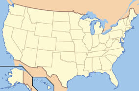
Sequoia National Forest IUCN Category VI (Managed Resource Protected Area)
Location Tulare / Kern / Fresno counties, California, US Nearest city Bakersfield, CA / Porterville, CA / Visalia, CA / Fresno, CA Coordinates 36°2′24″N 118°30′16″W / 36.04°N 118.50444°WCoordinates: 36°2′24″N 118°30′16″W / 36.04°N 118.50444°W Area 1,144,235 acres (4,630.55 km²) Established 1908 Governing body U.S. Forest Service Sequoia National Forest is located in the southern Sierra Nevada mountains of California. The U.S. National Forest is named for the majestic Giant Sequoia (Sequoiadendron giganteum) trees which populate 38 distinct groves within the boundaries of the forest.
The Giant Sequoia National Monument is located in the national forest. Other notable features include glacier-carved landscapes and impressive granite monoliths.
Contents
Geography
The Sequoia National Forest covers 1,787.87 square miles (4,630.55 km²), and ranges in elevation from 1,000 feet (300 m) in the foothills of the Sierra Nevada to over 12,000 feet (3,700 m). Its Giant Sequoia (Sequoiadendron giganteum) groves are part of its 196,000 acres (790 km2) of old growth forests. Other tree species include:[1]
- Jeffrey Pine (Pinus jeffreyi)
- Red Fir (Abies magnifica)
- Coast Douglas-fir (Pseudotsuga menziesii var. menziesii)
- Ponderosa Pine (Pinus ponderosa)
- White Fir (Abies concolor)
- Lodgepole Pine (Pinus contorta)
Recreation
The National Forest contains over 2,500 miles (4,000 km) of road and 850 miles (1,370 km) of trails, and hosts a number of camping and recreational facilities. The forest is adjacent to Sequoia National Park. Forest headquarters are located in Porterville, California. There are local ranger district offices in Dunlap, Kernville, Lake Isabella, and Springville.[2]
History
Sequoia NF was established on July 1, 1908 from a portion of Sierra Forest Reserve. On March 2, 1909 Theodore Roosevelt added land by Presidential Proclamation.[3] On July 1, 1910 1,951,191 acres (7,896.19 km2) was removed from the forest to create the Kern National Forest.[4] This land was returned to Sequoia National Forest on July 1, 1915.
Giant sequoia groves
Further information: List of giant sequoia grovesThe Sequoia National Forest has 34 giant sequoia groves.
- The 14 groves in the Kings River watershed are in the northern section of Giant Sequoia National Monument (GSNM), or in the Sequoia National Forest (SeNF), in southernmost Fresno County and Tulare County:
- Indian Basin Grove (GSNM) A mid-size grove, mostly logged. It can be accessed by paved roads. The grove contains many young sequoias approaching diameters of up to 10 feet (3.0 m). 36°48′N 118°56′W / 36.8°N 118.933°W 1800–2000 m.
- Converse Basin Grove (GSNM). Once the second-largest grove, but much logged around 1890-1900; However, nearly 100 widely scattered old-growth Giant Sequoias remain (apparently bypassed by the loggers), also good regrowth of younger trees. Home of the Boole Tree, which the loggers spared as it was by far the largest tree in the grove and is now identified as the sixth-largest tree by volume. Also home of the Chicago Stump, which is the remnant of the General Noble Tree that was cut for the 1893 World Columbian Exposition the General Noble Tree was the second largest tree in the grove (after the Boole Tree) and it was the largest tree ever cut down. Although not among the very largest Giant Sequoias, the General Noble Tree was perhaps among the top 30 largest Giant Sequoias before it was cut. 36°48′N 118°58′W / 36.8°N 118.967°W 1800–2000 m.
- Lockwood Grove (GSNM). 36°48′N 118°52′W / 36.8°N 118.867°W 1700–1800 m.
- Monarch Grove (GSNM). Immediately north of the Agnew Grove, near Monarch Wilderness boundary. On Forest Service GSNM map.
- Evans Grove (GSNM). Partially logged, before 1920. 36°48'N 118°49'30"W 2050–2250 m.
- Agnew & Deer Meadow Grove (GSNM). 36°47′20″N 118°46′45″W / 36.78889°N 118.77917°W 1950–2000 m.
- Cherry Gap Grove (GSNM). Logged. Located between Converse Basin Grove and General Grant Grove, near McGee Overlook (36°46′40″N 118°57′30″W / 36.77778°N 118.95833°W). 2070 m. Cherry Gap Grove is a small sequoia grove of about thirty-five acres in Sequoia national forest; it was logged of all of its old growth sequoias.
- Abbott Creek Grove (GSNM). 36°46′N 118°58′W / 36.767°N 118.967°W 1900 m. Listed by Rundel and Flint; very small (largely logged); too few trees to qualify as a grove according to Willard.
- Kennedy Grove (GSNM). 36°46′0″N 118°49′20″W / 36.766667°N 118.82222°W 2050–2250 m. Contains the 13th largest giant sequoia in the world, The Ishi Giant.
- Little Boulder Creek Grove (GSNM). 36°45′10″N 118°49′0″W / 36.75278°N 118.816667°W 2000 m.
- Boulder Creek Grove (GSNM). 36°45′N 118°49′W / 36.75°N 118.817°W 2050 m.
- Landslide Grove (GSNM). 36°45′0″N 118°51′50″W / 36.75°N 118.86389°W 2050–2250 m.
- Bearskin Grove (GSNM). 36°45′0″N 118°54′40″W / 36.75°N 118.91111°W 1850–1900 m.
- Big Stump Grove (KCNP/GSNM). 36°43′N 118°58′W / 36.717°N 118.967°W 1850 m.
- One grove in the Kaweah River watershed:
- Redwood Mountain Grove (KCNP/GSNM). The largest grove, 1240 ha (3100 acres), with 15,800 sequoias 30 cm (one foot) or more in diameter at the base.
- The 19 groves in the Tule River and Kern River watersheds are mostly in Giant Sequoia National Monument (GSNM); all in southern Tulare County.
- Upper Tule Grove (GSNM). Included on Forest Service GSNM map.
- Maggie Mountain Grove (GSNM).
- Silver Creek Grove (GSNM).
- Mountain Home Grove (CSF / GSNM). Home of the 'Genesis' tree, seventh largest by volume, this grove also contains the smaller Middle Tule Grove
- Burro Creek Grove (GSNM).
- Wishon Grove (GSNM). South of Silver Creek Grove. Included on Forest Service GSNM map.
- Alder Creek Grove (GSNM / private); also known as Hossack, Pixley, or Ross Creek Grove. Home of 'Alonzo Stagg', the fifth largest tree by volume. Also home to the Waterfall tree, which has the largest circumference and diameter at ground level of any sequoia.
- McIntyre Grove (GSNM).
- Carr Wilson Grove(GSNM); also known as Bear Creek Grove.
- Freeman Creek Grove (GSNM).
- Black Mountain Grove (GSNM / TIR / private). Heavily logged in 1984, though mature sequoias were not cut.
- Red Hill Grove (GSNM / private).
- Peyrone Grove (GSNM / TIR).
- South Peyrone Grove (GSNM) New discovery by Willard in 1992.
- Long Meadow Grove (GSNM), Site of the Trail of 100 Giants and one tree of great size.
- Cunningham Grove (GSNM).
- Starvation Creek Grove (GSNM).
- Packsaddle Grove (GSNM).
- Deer Creek Grove (GSNM). The southernmost grove.
Giant Sequoia National Monument
On April 15, 2000 President Bill Clinton proclaimed 328,000-acre (1,330 km2) of the Sequoia National Forest as the Giant Sequoia National Monument by Presidential Proclamation 7295, published in the Federal Register, Tuesday, April 25, 2000, Vol. 65, No. 80.
The monument is in two sections. The northern section surrounds General Grant Grove and other parts of Kings Canyon National Park and is administered by the Hume Lake Ranger District. The southern section is directly south of Sequoia National Park and is administered by the Western Divide Ranger District, surrounding the eastern half of the Tule River Indian Reservation.
Marijuana
The forest has been the scene of extensive illegal marijuana cultivation, with recent involvement of Mexican drug cartels.[5][6]
Photos
-

Havilah Work Center.
-

Giant Sequoias.
-

Long Meadow Grove on a misty day.
-

Snow on the mountains
See also
- List of plants of the Sierra Nevada (U.S.)
- Index: Fauna of the Sierra Nevada (U.S.)
- Ecology of the Sierra Nevada
Notes
- ^ Warbington, Ralph; Beardsley, Debby (2002). 2002 Estimates of Old Growth Forests on the 18 National Forests of the Pacific Southwest Region. United States Forest Service, Pacific Southwest Region. http://www.fs.fed.us/r5/rsl/publications/oldgrowth/oldgrowth2002.html
- ^ USFS Ranger Districts by State
- ^ "Proclamation – Adding Lands to the Sequoia National Forest". http://www.presidency.ucsb.edu/ws/index.php?pid=76613. Retrieved 2009-12-04.
- ^ Davis, , Richard C. (September 29, 2005). National Forests of the United States. The Forest History Society. http://www.foresthistory.org/ASPNET/places/National%20Forests%20of%20the%20U.S.pdf.
- ^ "Sequoia and Kings Canyon National Parks Continues the Fight Against Illegal Marijuana Production". National Park Service. 2008-03-17. http://www.nps.gov/seki/parknews/upload/spring%20clean%20up.pdf.
- ^ "Mexican cartels running pot farms in U.S. national forest". CNN. 2008-08-08. http://www.cnn.com/2008/CRIME/08/08/pot.eradication/index.html.
References
- "Sequoia National Forest". United States Department of Agriculture Forest Service. Retrieved August 8, 2005.
- Willard, D. (1994). The natural Giant Sequoia groves of the Sierra Nevada, California - an updated annotated list. USDA Forest Service Gen. Tech. Rep. PSW-GTR-151: 159-164.
External links
Protected areas of California National Park System National Parks National Preserves National Monuments Cabrillo · Devils Postpile · Lava Beds · Muir Woods · Pinnacles · World War II Valor in the Pacific National MonumentNational Seashores National Historical Parks National Historic Sites National Memorials Port Chicago Naval MagazineNational Recreation Areas National Forests National Forests Angeles · Cleveland · Eldorado · Inyo · Klamath · Lassen · Los Padres · Mendocino · Modoc · Plumas · San Bernardino · Sequoia · Shasta-Trinity · Sierra · Six Rivers · Stanislaus · TahoeNational Wilderness
Preservation SystemAgua Tibia · Ansel Adams · Bucks Lake · Caribou · Carson-Iceberg · Castle Crags · Cucamonga · Desolation · Dick Smith · Dinkey Lakes · Emigrant · Golden Trout · Hoover · Inyo Mountains · Ishi · Jennie Lakes · John Muir · Kaiser · Marble Mountain · Mokelumne · Mount Shasta Wilderness · North Fork · San Gabriel · Sanhedrin · San Jacinto · San Rafael · Sespe · Siskiyou · Snow Mountain · South Fork Eel River · South Sierra · South Warner · Thousand Lakes · Trinity Alps · Ventana · Yolla Bolly-Middle Eel · YukiOther State Forests Boggs Mountain Demonstration · Ellen Pickett · Jackson Demonstration · Las Posadas · LaTour Demonstration · Mount Zion · Mountain Home Demonstration · Soquel Demonstration
National Wildlife Refuges Antioch Dunes · Bitter Creek · Blue Ridge · Butte Sink · Castle Rock · Clear Lake · Coachella Valley · Colusa · Delevan · Don Edwards San Francisco Bay · Ellicott Slough · Farallon · Guadalupe-Nipomo Dunes · Hopper Mountain · Humboldt Bay · Kern · Lower Klamath · Marin Islands · Merced · Modoc · Pixley · Sacramento · Sacramento River · Salinas River · San Diego Bay · San Diego · San Joaquin River · San Luis · San Pablo Bay · Seal Beach · Sonny Bono Salton Sea · Stone Lakes · Sutter · Tijuana Slough · Tule LakeState Wildlife Areas Wildlife Areas Antelope Valley · Ash Creek · Bass Hill · Battle Creek · Big Lagoon · Big Sandy · Biscar · Butte Valley · Buttermilk Country · Cache Creek · Camp Cady · Cantara/Ney Springs · Cedar Roughs · Cinder Flats · Collins Eddy · Colusa Bypass · Coon Hollow · Cottonwood Creek · Crescent City Marsh · Crocker Meadows · Daugherty Hill · Decker Island · Doyle · Dutch Flat · Eastlker River · Eel River · Elk Creek Wetlands · Elk River · Fay Slough · Feather River · Fitzhugh Creek · Fremont Weir · Grass Lake · Gray Lodge · Green Creek · Grizzly Island · Hallelujah Junction · Heenan Lake · Hill Slough · Hollenbeck Canyon · Honey Lake · Hope Valley · Horseshoe Ranch · Imperial · Indian Valley · Kelso Peak and Old Dad Mountains · Kinsman Flat · Knoxville · Laguna · Lake Berryessa · Lake Earl · Lake Sonoma · Little Panoche Reservoir · Los Banos · Lower Sherman Island · Mad River Slough · Marble Mountains · Mendota · Merrill's Landing · Miner Slough · Monache Meadows · Morro Bay · Moss Landing · Mouth of Cottonwood Creek · Napa-Sonoma Marshes · North Grasslands · O'Neill Forebay · Oroville · Petaluma Marsh · Pickel Meadow · Pine Creek · Point Edith · Putah Creek · Rector Reservoir · Red Lake · Rhode Island · Sacramento River · San Felipe Valley · San Jacinto · San Luis Obispo · San Luis Reservoir · San Pablo Bay · Santa Rosa · Shasta Valley · Silver Creek · Slinkard/Little Antelope · Smithneck Creek · South Fork · Spenceville · Surprise Valley · Sutter Bypass · Tehama · Truckee River · Upper Butte Basin · Volta · Warner Valley · Waukell Creek · West Hilmar · Westlker River · White Slough · Willow Creek · Yolo BypassEcological Reserves Albany Mudflats · Alkali Sink · Allensworth · Atascadero Creek Marsh · Bair Island · Baldwin Lake · Batiquitos Lagoon · Blue Sky · Boden Canyon · Boggs Lake · Bolsa Chica · Bonny Doon · Buena Vista Lagoon · Butler Slough · Butte Creek Canyon · Butte Creek House · Buttonwillow · By Day Creek · Calhoun Cut · Canebrake · Carlsbad Highlands · Carmel Bay · Carrizo Canyon · Carrizo Plains · China Point · Clover Creek · Coachella Valley · Coal Canyon · Corte Madera Marsh · Crestridge · Dairy Mart Ponds · Dales Lake · Del Mar Landing · Eden Landing · Elkhorn Slough · Estelle Mountain · Fall River Mills · Fish Slough · Fremont Valley · Goleta Slough · Indian Joe Spring · Kaweah · Kerman · King Clone · Laguna Laurel · Loch Lomond Vernal Pool · Lokern · Magnesia Spring · Marin Islands · Mattole River · McGinty Mountain · Morro Dunes · Morro Rock · Napa River · North Table Mountain · Oasis Spring · Panoche Hills · Peytonia Slough · Pine Hill · Piute Creek · Pleasant Valley · Point Lobos · Rancho Jamul · Redwood Shores · River Springs Lakes · Saline Valley · San Dieguito Lagoon · San Elijo Lagoon · San Felipe Creek · San Joaquin River · Santa Rosa Plateau · Springville · Stone Corral · Sycamore Canyon · Sycuan Peak · Thomes Creek · Tomales Bay · Upper Newport Bay · Watsonville Slough · West Mojave Desert · Woodbridge · YaudanchiMarine Protected Areas Abalone Cove · Agua Hedionda Lagoon · Albany Mudflats · Anacapa · Anacapa · Año Nuevo · Asilomar · Atascadero Beach · Bair Island · Batiquitos Lagoon · Big Creek · Big Creek · Big Sycamore Canyon · Bodega · Bolsa Chica · Buena Vista Lagoon · Cambria · Cardiff and San Elijo · Carmel Bay · Carmel Pinnacles · Carrington Point · Catalina Marine Science Center · Corte Madera Marsh · Crystal Cove · Dana Point · Del Mar Landing · Doheny · Doheny · Duxbury Reef · Edward F. Ricketts · Elkhorn Slough · Elkhorn Slough · Encinitas · Estero de Limantour · Fagan Marsh · Farallon Islands · Farnsworth Bank · Fort Ross · Gerstle Cove · Goleta Slough · Greyhound Rock · Gull Island · Harris Point · Heisler Park · Hopkins · Irvine Coast · James V. Fitzgerald · Judith Rock · Julia Pfeiffer Burns · La Jolla · Laguna Beach · Lovers Cove (Catalina Island) · Lovers Point · MacKerricher · Manchester and Arena Rock · Marin Islands · Mia J. Tegner · Moro Cojo Slough · Morro Bay · Morro Bay · Morro Beach · Natural Bridges · Niguel · Pacific Grove Marine Gardens · Painted Cave · Peytonia Slough · Piedras Blancas · Piedras Blancas · Pismo · Pismo-Oceano Beach · Point Buchon · Point Buchon · Point Cabrillo · Point Fermin · Point Lobos · Point Reyes Headlands · Point Sur · Point Sur · Portuguese Ledge · Punta Gorda · Redwood Shores · Refugio · Richardson Rock · Robert E. Badham · Robert W. Crown · Russian Gulch · Russian River · Salt Point · San Diego-Scripps · San Dieguito Lagoon · San Elijo Lagoon · Santa Barbara Island · Scorpion · Skunk Point · Sonoma Coast · Soquel Canyon · South Laguna Beach · South Point · Tomales Bay · Upper Newport Bay · Van Damme · Vandenberg · White Rock (Cambria)National Landscape Conservation System National Monuments National Conservation Areas California Desert · King RangeWilderness Areas Argus Range · Big Maria Mountains · Bigelow Cholla Garden · Bighorn Mountain · Black Mountain · Bright Star · Bristol Mountains · Cadiz Dunes · Carrizo Gorge · Chemehuevi Mountains · Chimney Peak · Chuckwalla Mountains · Chumash · Cleghorn Lakes · Clipper Mountain · Coso Range · Coyote Mountains · Darwin Falls · Dead Mountains · Dick Smith · El Paso Mountains · Fish Creek Mountains · Funeral Mountains · Golden Valley · Grass Valley · Headwaters Forest Reserve · Hollow Hills · Ibex · Indian Pass · Inyo Mountains · Jacumba · Kelso Dunes · Kiavah · Kingston Range · Little Chuckwalla Mountains · Little Picacho · Machesna Mountain · Matilija · Malpais Mesa · Manly Peak · Mecca Hills · Mesquite · Newberry Mountains · Nopah Range · North Algodones Dunes · North Mesquite Mountains · Old Woman Mountains · Orocopia Mountains · Otay Mountain · Owens Peak · Pahrump Valley · Palen/McCoy · Palo Verde Mountains · Picacho Peak · Piper Mountain · Piute Mountains · Red Buttes · Resting Spring Range · Rice Valley · Riverside Mountains · Rodman Mountains · Sacatar Trail · Saddle Peak Hills · San Gorgonio · Santa Lucia · Santa Rosa · Sawtooth Mountains · Sespe · Sheephole Valley · South Nopah Range · Stateline · Stepladder Mountains · Surprise Canyon · Sylvania Mountains · Trilobite · Turtle Mountains · Whipple Mountains ·National Marine Sanctuaries National Estuarine Research Reserves Elkhorn Slough · San Francisco Bay · Tijuana River Estuary
University of California Natural Reserve System Año Nuevo Island · Bodega Marine · Box Springs · Boyd Deep Canyon Desert Research Center · Burns Piñon Ridge · Carpinteria Salt Marsh · Chickering American River · Coal Oil Point · Dawson Los Monos Canyon · Eagle Lake Field Station · Elliott Chaparral · Emerson Oaks · Fort Ord · Hastings · James San Jacinto Mountains · Jenny Pygmy Forest · Jepson Prairie · Kendall-Frost Mission Bay Marsh · Kenneth S. Norris Rancho Marino · Landels-Hill Big Creek · McLaughlin · Motte Rimrock · Quail Ridge · Sagehen Creek Field Station · San Joaquin Freshwater Marsh · Santa Cruz Island · Scripps Coastal · Sedgwick · Stebbins Cold Canyon · Steele Burnand Anza-Borrego · Stunt Ranch Santa Monica Mountains · Sweeney Granite Mountains Desert Research Center · Valentine Eastern Sierra · Younger LagoonHeritage registers: World Heritage Sites · World Network of Biosphere Reserves · National Register of Historic Places · National Historic Landmarks · National Natural Landmarks · California Historical Landmarks · California Points of Historical Interest · California Register of Historical Resources
Categories:- IUCN Category VI
- Protected areas of the Sierra Nevada (U.S.)
- National Forests of California
- Forests of California
- Protected areas of Fresno County, California
- Protected areas of Kern County, California
- Protected areas of Tulare County, California
- Giant sequoia groves


Wikimedia Foundation. 2010.