- Island Pond, Vermont
:"Island Pond" is also the name of several bodies of water. See
Island Pond (disambiguation) ." Infobox Settlement
official_name = Pagename
other_name =
native_name =
nickname =
settlement_type = Census-designated place
motto =
imagesize =
image_caption =
flag_size =
image_
seal_size =
image_shield =
shield_size =
image_blank_emblem =
blank_emblem_size =
mapsize = 250px
map_caption = Located in Essex County, Vermont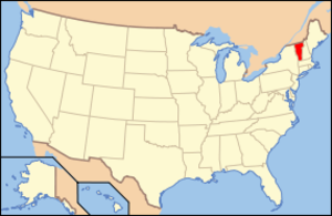
mapsize1 = 195px
map_caption1 = Location of Vermont with the U.S.A.
subdivision_type = Country
subdivision_name =United States
subdivision_type1 = State
subdivision_name1 =Vermont
subdivision_type2 = County
subdivision_name2 = Essex
subdivision_type3 = Town
subdivision_name3 = Brighton
subdivision_type4 =
subdivision_name4 =
government_footnotes =
government_type =
leader_title =
leader_name =
leader_title1 =
leader_name1 =
leader_title2 =
leader_name2 =
leader_title3 =
leader_name3 =
leader_title4 =
leader_name4 =
established_title =
established_date =
area_magnitude =
unit_pref =
area_footnotes =
area_total_km2 = 11.7
area_land_km2 = 10.8
area_water_km2 = 0.9
area_total_sq_mi = 4.5
area_land_sq_mi = 4.2
area_water_sq_mi = 0.3
area_water_percent =
population_as_of = 2000
population_footnotes =
population_note =
population_total = 849
population_density_km2 = 78.4
population_density_sq_mi = 202.9
population_blank1_title = Households
population_blank1 = 374
population_blank2_title = Families
population_blank2 = 228
timezone = EST
utc_offset = -5
timezone_DST = EDT
utc_offset_DST = -4
latd = 44 |latm = 48 |lats = 52 |latNS = N
longd = 71 |longm = 52 |longs = 56 |longEW = W
elevation_footnotes =
elevation_m = 365
elevation_ft = 1198
postal_code_type =ZIP code
postal_code = 05846
area_code = 802
blank_name = FIPS code
blank_info = 50-35725GR|2
blank1_name = GNIS feature ID
blank1_info = 1457977GR|3
website = http://www.islandpond.com/
footnotes =Island Pond is a
census-designated place (CDP) in the town of Brighton in Essex County,Vermont ,United States . The population was 849 at the 2000 census. It is part of the Berlin, NH–VT Micropolitan Statistical Area.Geography
According to the
United States Census Bureau , the CDP has a total area of 4.5 mi² (11.7km² ). 4.2 mi² (10.8 km²) of it is land and 0.3 mi² (0.9 km²) of it (7.32%) is water.Bluff Mountain overlooks the lake and the island.
The Clyde River flows from into Island Pond after which the town is named [The pond was originally called "Knowles Pond" in the 19th century] The river exits from the north end of the pond to the west.
Demographics
As of the
census GR|2 of 2000, there were 849 people, 374 households, and 228 families residing in the CDP. Thepopulation density was 202.9/mi² (78.4/km²). There were 556 housing units at an average density of 132.9/mi² (51.4/km²). The racial makeup of the CDP was 94.23% White, 0.12% African American, 1.06% Native American, 0.59% Asian, and 4.00% from two or more races. Hispanic or Latino of any race were 0.12% of the population.There were 374 households out of which 28.3% had children under the age of 18 living with them, 44.4% were married couples living together, 13.4% had a female householder with no husband present, and 38.8% were non-families. 32.6% of all households were made up of individuals and 19.0% had someone living alone who was 65 years of age or older. The average household size was 2.27 and the average family size was 2.88.
In the CDP the population was spread out with 24.0% under the age of 18, 8.7% from 18 to 24, 22.6% from 25 to 44, 25.3% from 45 to 64, and 19.3% who were 65 years of age or older. The median age was 42 years. For every 100 females there were 94.3 males. For every 100 females age 18 and over, there were 89.1 males.
The median income for a household in the CDP was $25,547, and the median income for a family was $31,250. Males had a median income of $25,577 versus $23,542 for females. The
per capita income for the CDP was $13,207. About 14.9% of families and 19.4% of the population were below thepoverty line , including 28.8% of those under age 18 and 18.0% of those age 65 or over.History
The Twelve Tribes
Island Pond became the home of the Twelve Tribes when the religious movement relocated to Island Pond from Tennessee in 1977. Though the group sought shelter from the opposition it met elsewhere, it continually faced opposition, which culminated in the Island Pond raid in 1984, where State Police and state
social worker s seized 112 children due to allegations ofchild abuse . The subsequent trial found no evidence of child abuse, and the children were returned. Nevertheless, the Island Pond Raid retains its notoriety. [http://religiousmovements.lib.virginia.edu/nrms/tribes.html article on the website of theUniversity of Virginia , note: the articles on individual religious groups were mostly written by students with as a result highly varying degrees of quality]The railroad
Island Pond became an important
railroad center in 1853 when theGrand Trunk Railway established international connections betweenMontreal ,Canada , and Portland,Maine . The half-way point in the Portland-Montreal railroad line, this town became a booming railroad center with aroundhouse , shops, and all the facilities associated with train operations. In 1923 the Grand Trunk Railway of Canada wasbankrupt and taken over by the Canadian government and operated as theCanadian National Railways . With the Canadian government directing the railroad, political considerations soon outweighed the economics of the railroad; commerce was displaced from the Port of Portland, Maine to the Canadian ports of Halifax and St. John. The importance of the Portland line then began a decline which was never to be reversed. Island Pond's days as a major railroad town were over by the late 1950s due to the elimination ofsteam locomotive s. By 1960passenger train service to Portland had ended, and three years later thediesel locomotive shop was closed. In 1966 the roundhouse closed, and barely a skeleton staff of people worked in Island Pond. Throughfreight train service between Montreal and Portland lasted until 1988; the line was sold to a short line operator the following year.Today, only the passenger station remains and is used by a bank. An historical society is housed on the upper floors.
Traffic Enforcement Controversy
From 2004 to 2008 Island Pond gained publicity nationwide because of the town's practice of strict traffic enforcement. In 2006, the constable issued 1,224 traffic tickets and 1,662 warnings. [ [http://www.boston.com/news/local/vermont/articles/2007/10/29/youll_stop_there_or_be_stopped Boston Glober news item] ] The town was listed as one of the top "
speed traps " in New England. [ [http://www.speedtrap.org/speedtraps/comments.asp?state=VT&city=Brighton%20(Island%20Pond)&st=23824 SpeedTrap Exchange ] ] In March of 2008, the constable was defeated in his bid for reelection.Media
The town was the setting of the memoir "A Dresser of Sycamore Trees," by
Garret Keizer . [ [http://query.nytimes.com/gst/fullpage.html?res=9A0CE1DE1239F932A1575AC0A961958260&sec=&spon=&pagewanted=all New York Times] retrieved June 29, 2008]Notable natives
*
Porter H. Dale , U.S. Representative and Senator from Vermont.
*Rudy Vallée , popular American singer, actor, bandleader, and entertainer.Notes

Wikimedia Foundation. 2010.