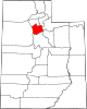
- Sandy, Utah
-
Sandy City, Utah — City — Sandy city hall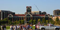

Coordinates: 40°34′21″N 111°51′35″W / 40.5725°N 111.85972°WCoordinates: 40°34′21″N 111°51′35″W / 40.5725°N 111.85972°W Country United States State Utah County Salt Lake Established 1871 Government - Mayor Tom Dolan Area - Total 22.3 sq mi (57.9 km2) - Land 22.3 sq mi (57.8 km2) - Water 0.0 sq mi (0.1 km2) Elevation 4,450 ft (1,356 m) Population (United States Census, 2010) - Total 87,461 Time zone MST (UTC-7) - Summer (DST) MDT (UTC-6) ZIP codes 84070, 84090-84094 Area code(s) 385, 801 FIPS code 49-67440[1] Website http://www.sandy.utah.gov/ 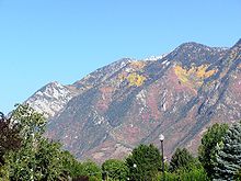 A view of the Wasatch Mountains from a Sandy neighborhood.
Sandy (officially known as Sandy City) is a city in Salt Lake County, Utah, United States. It is a suburb of Salt Lake City. The population was 87,461 at the 2010 census,[2] making it the sixth-largest city in Utah.
Sandy is home to the South Towne Center shopping mall, the Jordan Commons entertainment and dining complex, and the Southtowne Exposition Center. It is also the location of the soccer-specific Rio Tinto Stadium, which hosts Real Salt Lake home games, and opened on October 8, 2008.
Contents
History
Located at the base of the Wasatch Mountains thirteen miles (19 km) south of Salt Lake City, Sandy was a likely area for early settlement. The area was first used by nomadic bands of Paiute, Shoshone, and Bannock Indians who roamed along the base of the mountains as they travelled from their winter home at Utah Lake to their summer fishing grounds at Bear Lake.
Permanent settlers first moved into Sandy during the 1860s and 1870s because of the availability of land in the less crowded southern end of the Salt Lake Valley. The original plat was essentially one square mile, situated on an alluvial terrace running north and south along the eastern edge of the Jordan River drainage system and paralleling the mountain range. Brigham Young named Sandy City in 1873 for its thirsty soil.[3]
In 1863, there were only four homes between Union (7200 South) and Dunyon (Point of the Mountain): the Thayne homestead at 6600 South and 800 East, one in Crescent, one at Dunyon, and a fourth outside present-day Sandy boundaries altogether. Within a few years, Thomas Allsop, a Yorkshire farmer who had immigrated to Utah in 1853, owned almost half of present-day Sandy from County Road to Fourth East along Alta Road to Lindell Parkway. LeGrand Young owned the land between Fourth East and State Street.
Farmers willing to try their hand at the thirsty soil that inspired Sandy's name took up land along State Street, which stretched from downtown Salt Lake City to Point of the Mountain. But it was mining that shaped Sandy's first four decades. When silver mining began in Little Cottonwood Canyon, entrepreneurs recognized Sandy's value as a supply station; soon its main street was lined with hotels, saloons, and brothels serving miners ready to spend their newly earned wages. Three major smelters were located in Sandy. They were the Flagstaff, the Mingo, and the Saturn. These made Sandy the territory's most significant smelting center for a number of years.
The railroad was also significant in determining the course of Sandy's history. Built in 1873, the railroad connected Sandy to Salt Lake City and facilitated the transportation of ore and other products both in and out of the area. A streetcar line in 1907 facilitated the transportation of locals to jobs in Salt Lake City; and the automobile later continued to serve that function.
When the mines failed in the 1890s, Sandy faltered, then underwent a significant economic transformation into an agricultural community. The fact that Sandy did not disappear, like so many other mining towns that dwindled with their mother lodes, was due to its location, resources, and the spirit of its inhabitants.
Sandy was incorporated in 1893, largely as part of an effort to combat what Mormon inhabitants considered "unsavory" elements in the town. Due to its mine-based beginnings, Sandy was somewhat of a boomtown, unlike the majority of other rural Utah towns. After incorporation, it was almost as if Sandy had redefined itself. Gone were the large numbers of single, transient men. By 1900 there was only a handful of saloons and hotels, and Sandy began to more closely resemble other rural Utah towns — a place where everyone knew everyone else. Church, farming, business, and family formed the focus of the inhabitants' world.
This pace and way of life continued for more than six decades, interrupted only by wars, the Depression, and the changing seasons. No significant jumps in population, economic trends, or social patterns altered the predictable and stable rhythm of life.
In the late 1960s, however, this rural town dramatically changed course with its second boom. It had always been assumed by local leaders and citizens that Sandy would grow outward from its logical and historic center—the nexus of Main and Center streets. However, population growth overwhelmed the physical center as neighborhoods spread out in every direction over the land.
During the 1970s, pocket communities took shape, providing the services, schools, and shopping traditionally offered by a city. Annexation issues became prominent as Salt Lake County and Sandy vied for control over land and resources. Sandy became a collection of small local communities identified by a youthful, family-oriented population. Although it was initially perceived as a bedroom community, and often still is, it has since developed a thriving commercial center along State Street and other various arterial roads.
Geography and climate
Sandy is located at 40°34′21″N 111°51′35″W / 40.5725°N 111.85972°W (40.572415, -111.859610).[4]
According to the United States Census Bureau, the city has a total area of 22.4 square miles (57.9 km²), of which, 22.3 square miles (57.8 km²) of it is land and 0.04 square miles (0.1 km²) of it (0.09%) is water.
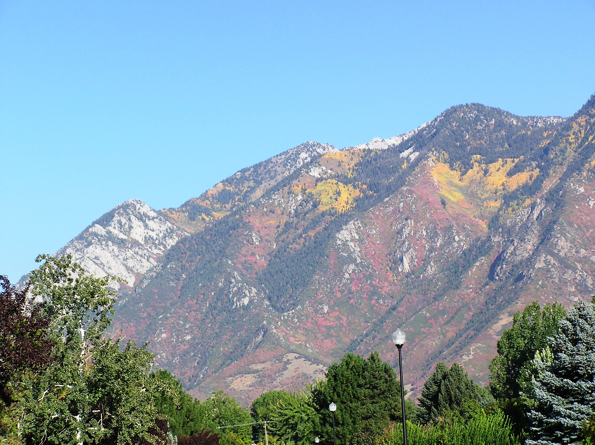
The major residential region of eastern Sandy climbs high on the slopes of the Wasatch Range while the western section lies at the bottom of the valley. Interstate 15 and State Street (US-89) run through the western portions of the city, while the Jordan River forms part of the western border with West Jordan and South Jordan.
Climate data for Sandy, UT Month Jan Feb Mar Apr May Jun Jul Aug Sep Oct Nov Dec Year Record high °F (°C) 63
(17)70
(21)84
(29)89
(32)103
(39)106
(41)111
(44)106
(41)100
(38)94
(34)76
(24)69
(21)111
(44)Average high °F (°C) 41
(5)47
(8)56
(13)65
(18)75
(24)87
(31)95
(35)94
(34)83
(28)69
(21)53
(12)42
(6)67 Average low °F (°C) 22
(−6)25
(−4)32
(0)38
(3)46
(8)54
(12)61
(16)60
(16)51
(11)40
(4)30
(−1)22
(−6)40 Record low °F (°C) 1
(−17)−12
(−24)10
(−12)21
(−6)21
(−6)32
(0)44
(7)37
(3)31
(−1)18
(−8)1
(−17)−17
(−27)−17
(−27)Precipitation inches (mm) 1.51
(38.4)1.22
(31)1.56
(39.6)1.82
(46.2)1.79
(45.5)0.85
(21.6)0.95
(24.1)0.95
(24.1)1.08
(27.4)1.73
(43.9)1.32
(33.5)0.96
(24.4)15.74
(399.8)Source: [5] Demographics
Historical populations Census Pop. %± 1880 488 — 1900 1,637 — 1910 1,716 4.8% 1920 1,208 −29.6% 1930 1,436 18.9% 1940 1,487 3.6% 1950 2,095 40.9% 1960 3,327 58.8% 1970 6,438 93.5% 1980 52,210 711.0% 1990 75,058 43.8% 2000 88,418 17.8% 2010 87,461 −1.1% As of the census[1] of 2000, there were 88,418 people, 25,737 households, and 21,773 families residing in the city. The population density was 3,960.5 people per square mile (1,528.8/km²). There were 26,579 housing units at an average density of 1,190.5 per square mile (459.6/km²). The racial makeup of the city was 93.52% White, 0.50% African American, 0.35% Native American, 2.17% Asian, 0.31% Pacific Islander, 1.50% from other races, and 1.65% from two or more races. Hispanic or Latino of any race were 4.38% of the population.
There were 25,737 households out of which 51.3% had children under the age of 18 living with them, 72.9% were married couples living together, 8.6% had a female householder with no husband present, and 15.4% were non-families. 11.6% of all households were made up of individuals and 3.4% had someone living alone who was 65 years of age or older. The average household size was 3.42 and the average family size was 3.73.
In the city the population was spread out with 34.5% under the age of 18, 11.1% from 18 to 24, 27.5% from 25 to 44, 21.8% from 45 to 64, and 5.2% who were 65 years of age or older. The median age was 29 years. For every 100 females there were 100.9 males. For every 100 females age 18 and over, there were 97.7 males.
The median income for a household in the city was $66,458, and the median income for a family was $70,801 (these figures had risen to $73,322 and $81,257 respectively as of a 2007 estimate[6]). Males had a median income of $47,031 versus $29,661 for females. The per capita income for the city was $22,928. About 2.8% of families and 3.8% of the population were below the poverty line, including 4.0% of those under age 18 and 5.7% of those age 65 or over.
Education
Sandy is located in the Canyons School District, which citizens voted to create in 2007 out of the eastern Jordan School District and which began operation at the beginning of the 2009-10 school year. Sandy has eighteen elementary schools (Alta View, Altara, Bell View, Brookwood, Crescent, East Sandy, Edgemont, Granite, Lone Peak, Oakdale, Park Lane, Peruvian Park, Quail Hollow, Sandy, Silver Mesa, Sprucewood, Sunrise, Willow Canyon), six middle schools (Albion, Crescent View, Eastmont, Indian Hills, Mount Jordan, Union), four high schools (Jordan, Hillcrest, Brighton, and Alta), one technical school (Canyons Technical Education Center—CTEC), and one alternative high school (Southpointe).
Transportation
I-15 runs down the western side of Sandy, with three exits (at 9000 South, 10600 South and 11400 South) located in the city. U.S. Route 89 runs parallel to I-15 through the city as State Street, and Utah State Route 209 runs east/west, terminating within the Wasatach mountains at Alta Ski Resort. The Utah Transit Authority operates a bus system that reaches into the city, as well as the TRAX light rail system, which originates in Downtown Salt Lake City and ends at 10000 South near Jordan High School and the Sandy Civic Center. A light rail extension from 10000 South to Draper is planned for construction in 2011. There are a total of 3 TRAX stations located in the city. The city's roads are located on the same "grid system" as the rest of Salt Lake County.
Notable natives and residents
- Heather Anderson - Miss Utah USA 2007
- John Brzenk - professional arm-wrestler
- Jim Fullington - professional wrestler
- Bonnie Gritton - pianist and professor
- Julianne Hough - professional dancer
- Derek Hough- professional dancer
- DaMarques Johnson - Mixed martial artist currently in the UFC Welterweight division
- Doug Jolley - professional American football player
- Megan Joy - finalist on American Idol season 8
- Karl Meltzer - ultra-marathon runner, 2006 North-American ultra-runner of the year by UltraRunning Magazine
- Paul Millsap - professional basketball player for the Utah Jazz
- Grant H. Palmer - historian and author
- Jamie Pierre - professional free skier
- Dick Simon - race car driver
- Brent Steffensen - stuntman and American Ninja Warrior competitor
- Mike Weir - professional golfer
- Mary Elizabeth Winstead - actress
In the media
- The 1992 TV movie Deliver Them From Evil: The Taking of Alta View is based on the Alta View Hospital hostage incident that took place in Sandy in 1991.
- Elizabeth Smart was discovered walking down the street with her captors in Sandy nine months after being abducted from her home. This scene was not dramatized in the CBS movie The Elizabeth Smart Story.
- The fictional HBO drama Big Love is set in Sandy.
Sister cities
Sandy has two sister cities, as designated by Sister Cities International:
References
- ^ a b "American FactFinder". United States Census Bureau. http://factfinder.census.gov. Retrieved 2008-01-31.
- ^ http://www.census.gov/popest/cities/files/SUB-EST2008-49.csv
- ^ Arave, Lynn (January 5, 2007). "Tidbits of history — Unusual highlights of Salt Lake County". Deseret Morning News. pp. S1-S2. http://deseretnews.com/dn/view/0,1249,650218849,00.html. Retrieved 2007-01-05.
- ^ "US Gazetteer files: 2010, 2000, and 1990". United States Census Bureau. 2011-02-12. http://www.census.gov/geo/www/gazetteer/gazette.html. Retrieved 2011-04-23.
- ^ "Average Weather for Sandy, UT - Temperature and Precipitation". Weather.com. http://www.weather.com/weather/wxclimatology/monthly/graph/USUT0226?from=36hr_bottomnav_undeclared. Retrieved July 28, 2009.
- ^ http://factfinder.census.gov/servlet/ACSSAFFFacts?_event=Search&geo_id=16000US4916270&_geoContext=01000US%7C04000US49%7C16000US4916270&_street=&_county=sandy&_cityTown=sandy&_state=04000US49&_zip=&_lang=en&_sse=on&ActiveGeoDiv=geoSelect&_useEV=&pctxt=fph&pgsl=160&_submenuId=factsheet_1&ds_name=ACS_2007_3YR_SAFF&_ci_nbr=null&qr_name=null®=null%3Anull&_keyword=&_industry=
External links
Municipalities and communities of Salt Lake County, Utah Cities Bluffdale | Cottonwood Heights | Draper | Herriman | Holladay | Midvale | Murray | Riverton | Salt Lake City | Sandy | South Jordan | South Salt Lake | Taylorsville | West Jordan | West Valley City
Town CDPs Copperton | Emigration Canyon | Granite | Kearns | Magna | Millcreek | White City
Townships Copperton | Emigration Canyon | Kearns | Magna | Millcreek
Unincorporated
communityGhost towns  State of UtahSalt Lake City (capital)
Topics - Cities
- Congressional districts
- Counties
- Flag
- Geography
- Government
- Governors
- History
- People
- Portal
- Symbols
- Visitor Attractions
Society - Demographics
- Economy
- Politics
Regions Largest cities - American Fork
- Bountiful
- Cedar City
- Clearfield
- Cottonwood Heights
- Draper
- Holladay
- Kaysville
- Layton
- Lehi
- Logan
- Midvale
- Murray
- Ogden
- Orem
- Pleasant Grove
- Provo
- Riverton
- Roy
- St. George
- Salt Lake City
- Sandy
- South Jordan
- South Salt Lake
- Spanish Fork
- Springville
- Taylorsville
- Tooele
- West Jordan
- West Valley City
Counties Attractions Categories:- Wasatch Front
- Cities in Utah
- Populated places in Salt Lake County, Utah
- Populated places established in 1873
- Salt Lake City metropolitan area


Wikimedia Foundation. 2010.