- Chubu International Airport Connecting Road
-


中部国際空港連絡道路 Route information Length: 2.1 km[2] (1.3 mi) Existed: 2005[1] – present Major junctions From: Rinkū Interchange in Tokoname, Aichi
 Chitaōdan Road
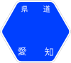
Aichi Prefectural Route 522To: Centrair-higashi Interchange in Tokoname, Aichi
Aichi Prefectural Route 522Highway system The Chubu International Airport Connecting Road (中部国際空港連絡道路 Chūbu Kokusai Kūkō Renraku Dōro) is a 4-laned toll road in Tokoname, Aichi, Japan. It is managed by Aichi Prefectural Road Public Corporation.
Contents
Overview
Officially the road is designated as Aichi Prefectural Route 522. The road is designated for motor vehicles only (自動車専用道路 Jidōsha Senyō Dōro) (motor vehicles must have a displacement of at least 125 cc), and the design standard of the road is similar to national expressways.
Together with the Chitaōdan Road it is also referred to as the Centrair Line[2] to indicate its status as the access road for Chubu Centrair International Airport.
Interchange list
- IC - interchange, JCT - junction
Name Connections Dist. from
Handa-Chūō JCTNotes Location Through to Chitaōdan RoadRinkū IC Pref. Route 522 (Chubu International Airport Route) 8.5 Tokoname, Aichi Rinkū Toll Gate ↓ Centrair Bridge ↓ Length - 1,414 m Centrair-higashi IC 10.6 Expressway ends, road continues as Pref. Route 522 References
- ^ Aichi Prefectural Government. "Toll Road Information". http://www.pref.aichi.jp/dourokensetsu/yuryodouro/. Retrieved 2008-05-19.
- ^ a b Aichi Prefectural Road Public Corporation. "Centrair Line Overview". http://www.aichi-dourokousha.or.jp/t_centrair_s1.php. Retrieved 2008-05-19.
External links
- (Japanese) Aichi Prefectural Road Public Corporation
Coordinates: 34°52′26″N 136°49′11″E / 34.87382°N 136.819696°E
Categories:- Toll roads in Japan
- Japan road stubs

Wikimedia Foundation. 2010.