- New Milford, New Jersey
-
Borough of New Milford, New Jersey — Borough — Nickname(s): The Birthplace of Bergen County[1] Map highlighting New Milford's location within Bergen County. Inset: Bergen County's location within New Jersey Census Bureau map of New Milford, New Jersey
Coordinates: 40°56′10″N 74°1′8″W / 40.93611°N 74.01889°WCoordinates: 40°56′10″N 74°1′8″W / 40.93611°N 74.01889°W Country United States State New Jersey County Bergen Incorporated March 11, 1922 Government – Type Borough – Mayor Ann Subrizi (R, 2014)[2] – Administrator Christine Demiris[3] Area[4] – Total 2.31 sq mi (6.0 km2) – Land 2.31 sq mi (6.0 km2) – Water 0.00 sq mi (0.0 km2) Elevation[5] 30 ft (9 m) Population (2010 Census)[6][7] – Total 16,341 – Density 7,053.8/sq mi (2,723.5/km2) Time zone Eastern (EST) (UTC-5) – Summer (DST) EDT (UTC-4) ZIP code 07646[8] Area code(s) 201 FIPS code 34-51660[9][10] GNIS feature ID 0885320[11] Website http://www.newmilfordboro.com New Milford is a borough in Bergen County, New Jersey, United States. As of the 2010 United States Census, the borough population was 16,341.[6]
New Milford was incorporated as a borough on March 11, 1922, from what remained of Palisades Township,[12] based on the results of a referendum held on April 18, 1922.[13] With the creation of New Milford, Palisades Township (which had been created in 1871) was dissolved.[14]
Contents
Geography
New Milford is located at 40°56′10″N 74°01′08″W / 40.936211°N 74.018809°W (40.936211, -74.018809).[15]
According to the United States Census Bureau, the borough has a total area of 2.31 square miles (6.0 km2), all of it land.[4]
During Hurricane Irene on August 28, 2011, the Hackensack River crested at 11.84 feet, the second-highest recorded height and almost six feet above flood stage. The record height at the New Milford flood gauge is 12.36 feet set during a storm on April 16, 2007, and the previous second-highest level of 11.45 feet had been set during Hurricane Floyd on September 16, 1999.[16]
Demographic
Historical populations Census Pop. %± 1900 860 — 1910 1,141 32.7% 1920 3,833 235.9% 1930 2,556 −33.3% 1940 3,215 25.8% 1950 6,006 86.8% 1960 18,810 213.2% 1970 19,149 1.8% 1980 16,876 −11.9% 1990 15,990 −5.3% 2000 16,400 2.6% 2010 16,341 −0.4% Population sources:
1930-1990[17][18] 2000[19] 2010[6][7]As of the census[9] of 2000, there were 16,400 people, 6,346 households, and 4,277 families residing in the borough. The population density was 7,099.0 people per square mile (2,741.2/km2). There were 6,437 housing units at an average density of 2,786.4 per square mile (1,075.9/km2). The racial makeup of the borough was 78.59% White, 2.62% African American, 0.12% Native American, 14.76% Asian, 0.02% Pacific Islander, 1.86% from other races, and 2.04% from two or more races. Hispanic or Latino of any race were 8.09% of the population.[19]
There were 6,346 households out of which 29.2% had children under the age of 18 living with them, 55.9% were married couples living together, 8.8% had a female householder with no husband present, and 32.6% were non-families. 28.6% of all households were made up of individuals and 10.4% had someone living alone who was 65 years of age or older. The average household size was 2.54 and the average family size was 3.18.[19]
In the borough the population was spread out with 21.4% under the age of 18, 6.0% from 18 to 24, 31.8% from 25 to 44, 23.2% from 45 to 64, and 17.6% who were 65 years of age or older. The median age was 40 years. For every 100 females there were 92.9 males. For every 100 females age 18 and over, there were 88.4 males.[19]
The median income for a household in the borough was $59,118, and the median income for a family was $77,216. Males had a median income of $46,463 versus $36,987 for females. The per capita income for the borough was $29,064. About 1.7% of families and 3.4% of the population were below the poverty line, including 2.8% of those under age 18 and 6.5% of those age 65 or over.[19]
Government
Local government
New Milford is governed under the Borough form of New Jersey municipal government. The government consists of a Mayor and a Borough Council comprising six council members, with all positions elected at large. A Mayor is elected directly by the voters to a four-year term of office and only votes to break a tie. The Borough Council consists of six members elected to serve three-year terms on a staggered basis, with two seats coming up for election each year.[20]
As of 2011[update], the Mayor of New Milford is Ann Subrizi (R, term ends December 31, 2014). The members of the Borough Council are Howard Berner (R, 2012), Dominic Colucci (R, 2013), Randi Duffie (D, 2011), Peter Rebsch (R, term ends November 2011), Diego Robalino (R, 2013), Celeste Scavetta (R, 2011) and a single seat vacancy.[21] Celeste Scavetta was appointed by the Borough Council on January 11, 2011, to fill the vacant seat of Ann Subrizi that expires at the end of 2011 that was created when Subrizi was elected as mayor.[22] Peter Rebsch was appointed in June 2011 to fill the vacant seat of Council President Keith Bachmann, who had resigned from office; Rebsch will serve until November 2011, when voters will select a candidate to fill the balance of Bachmann's term that expires in 2012.[23]
The results of the election held November 2, 2010, were a Republican sweep. Republican challenger Ann Subrizi (2,433 votes) ousted 14-year Democratic incumbent, Frank DeBari (2,120). The Republican challengers for Council defeated both incumbents, with Dominic Colucci (2,328 votes) and Diego Robalino (2,285) unseating Democrats Michael J. Putrino (2,210) and Arthur E. Zeilner (2,115). These result gave the Republicans a 4-1 margin, with Ann Subrizi's seat on the Council left vacant.[24]
Federal, state and county representation
New Milford is split between the 5th and 9th Congressional districts and is part of New Jersey's 39th state legislative district.[25] The borough was relocated to the 38th state legislative district by the New Jersey Apportionment Commission based on the results of the 2010 Census.[6] The new district is in effect for the June 2011 primary and the November 2011 general election, with the state senator and assembly members elected taking office in the new district as of January 2012.[25]
New Jersey's Fifth Congressional District is represented by Scott Garrett (R, Wantage Township). New Jersey's Ninth Congressional District is represented by Steve Rothman (D, Fair Lawn). New Jersey is represented in the United States Senate by Frank Lautenberg (D, Cliffside Park) and Bob Menendez (D, Hoboken).
39th Legislative District of the New Jersey Legislature, which is represented in the New Jersey Senate by Gerald Cardinale (R, Demarest) and in the New Jersey General Assembly by Bob Schroeder (R, Washington Township) and Charlotte Vandervalk (R, Hillsdale).[26] The Governor of New Jersey is Chris Christie (R, Mendham).[27] The Lieutenant Governor of New Jersey is Kim Guadagno (R, Monmouth Beach).[28]
Bergen County's County Executive is Kathleen Donovan (R, Rutherford; term ends December 31, 2014).[29] The Board of Chosen Freeholders is the county's legislative body and its seven members are elected at-large on a staggered basis, with two or three seats coming up for election each year.[30] As of 2011, Bergen County's Freeholders are Chairman John Driscoll, Jr. (R, 2012; Paramus),[31] Vice-Chairwoman Maura DeNicola (R, 2013; Franklin Lakes),[32] Chair Pro Tempore John D. Mitchell (R, 2013; Cliffside Park)[33] John A. Felice (R, 2013; River Edge),[34] David L. Ganz (D, 2011; Fair Lawn),[35] Robert G. Hermansen (R, 2012; Mahwah)[36] and Bernadette P. McPherson (D, 2011; Rutherford).[37][38] Other countywide constitutional officials are Sheriff Michael Saudino (R), Surrogate Michael R. Dressler (D, Cresskill) and County Clerk Elizabeth Randall (R, Westwood).[39]
Politics
As of Election Day, November 4, 2008, there were 8,824 registered voters. Of registered voters, of which 2,758 (31.3% of all registered voters) were registered as Democrats, 1,601 (18.1%) were registered as Republicans and 4,464 (50.6%) were registered as Unaffiliated. There was one voter registered to another party.[40]
In the 2008 presidential election, Democrat Barack Obama received 53.5% of the vote here (3,887 ballots cast), ahead of Republican John McCain, who received 45.3% of the vote (3,285 ballots), with 82.6% of registered voters participating.[40] In the 2004 presidential election, Democrat John Kerry received 51.1% of the vote in New Milford (3,838 cast), ahead of Republican George W. Bush, who received around 47.6% (3,574 votes), with 7,506 ballots cast among the borough's 9,596 registered voters, for a turnout of 78.2%.[41]
Education
The New Milford School District serves students in Kindergarten through twelfth grade. Schools in the district (with 2009-10 enrollment data from the National Center for Education Statistics[42]) are Bertram F. Gibbs Elementary School (PreK-5; 511 students), Berkley Street School (K-5; 410), David E. Owens Middle School (6-8; 499) and New Milford High School (9-12; 687).
The Hovnanian School, founded in 1976 and dedicated to help foster knowledge of Armenian culture and the Armenian language, serves students in preschool through eighth grade.[43]
New Milford is also the home of The Art Center of Northern New Jersey, a fine arts school and gallery offering classes for adults and children that was originally established in 1957 in Englewood, New Jersey.[44]
Transportation
New Jersey Transit bus route 167 offers service to the Port Authority Bus Terminal in Midtown Manhattan, with local service offered on the 753, 756, 762, and 772 bus routes through New Milford.[45] Coach USA's Rockland Coaches offers service on the 11C and 25 routes to the George Washington Bridge Bus Terminal and on the 21T to the Port Authority Bus Terminal.[46]
Commuter rail service is provided by New Jersey Transit's Pascack Valley Line, with station stops at River Edge and North Hackensack, which are just outside New Milford.[47] The Pascack Valley Line offers two-way weekday and weekend service to and from Hoboken Terminal, and connecting service to Penn Station via Secaucus Junction.
Main roads in New Milford include River Road, Madison Avenue, Milford Avenue, and Boulevard.
Notable residents
Notable current and former residents of New Milford include:
- J. Walter Christie (1865–1944), father of the modern tank.[48]
- The Fontane Sisters, musical group.[49]
- Beth Fowler (born 1940), actress.[50]
- Dave Jeser, co-creator of Drawn Together.[51]
- Ed Marinaro (born 1950), football player and actor.[52]
- Simon "J.J." Racaza, finished 3rd place on History Channels Top Shot and is a double grandmaster in the USPSA/IPSC.[53]
- Bobby Steele (born 1956), guitar player for the The Misfits and The Undead.[54]
References
- ^ Home Page, Borough of New Milford. Accessed January 23, 2011.
- ^ 2011 New Jersey Mayors Directory, New Jersey Department of Community Affairs. Accessed August 28, 2011.
- ^ Borough Hall, Borough of New Milford. Accessed August 29, 2011.
- ^ a b GCT-PH1. Population, Housing Units, Area, and Density: 2000 for Bergen County, New Jersey -- County Subdivision and Place, United States Census Bureau. Accessed August 29, 2011.
- ^ U.S. Geological Survey Geographic Names Information System: Borough of New Milford, Geographic Names Information System, accessed July 6, 2007.
- ^ a b c d 2011 Apportionment Redistricting: Municipalities sorted alphabetically, New Jersey Department of State, p. 7. Accessed August 29, 2011.
- ^ a b Table DP-1. Profile of General Demographic Characteristics: 2010 for New Milford borough, New Jersey Department of Labor and Workforce Development. Accessed August 29, 2011.
- ^ Look Up a ZIP Code, United States Postal Service. Accessed August 29, 2011.
- ^ a b "American FactFinder". United States Census Bureau. http://factfinder.census.gov. Retrieved 2008-01-31.
- ^ A Cure for the Common Codes: New Jersey, Missouri Census Data Center. Accessed July 14, 2008.
- ^ "US Board on Geographic Names". United States Geological Survey. 2007-10-25. http://geonames.usgs.gov. Retrieved 2008-01-31.
- ^ Bergen County New Jersey Municipalities, Dutch Door Genealogy. Accessed September 13, 2006.
- ^ "The Story of New Jersey's Civil Boundaries: 1606-1968", John P. Snyder, Bureau of Geology and Topography; Trenton, New Jersey; 1969. p. 194.
- ^ "Municipal Incorporations of the State of New Jersey", p. 80
- ^ "US Gazetteer files: 2010, 2000, and 1990". United States Census Bureau. 2011-02-12. http://www.census.gov/geo/www/gazetteer/gazette.html. Retrieved 2011-04-23.
- ^ Hackensack River flood gauge at New Milford, National Weather Service Advanced Hydrologic Prediction Service. Accessed August 29, 2011.
- ^ New Jersey Resident Population by Municipality: 1930 - 1990, Workforce New Jersey Public Information Network, backed up by the Internet Archive as of May 2, 2009. Accessed August 29, 2011.
- ^ Bergen County Census Data, Bergen County, New Jersey. Accessed December 23, 2007.
- ^ a b c d e Census 2000 Demographic Profile Highlights: New Milforsd borough, New Jersey, United States Census Bureau. Accessed August 29, 2011.
- ^ 2005 New Jersey Legislative District Data Book, Rutgers University Edward J. Bloustein School of Planning and Public Policy, April 2005, p. 165.
- ^ Mayor and Council, Borough of New Milford. Accessed January 7, 2011.
- ^ Hayes, Melissa. "New Milford council pegs Celeste Scavetta for open seat", The Record (Bergen County) Bergen Beat, January 11, 2011. Accessed August 29, 2011. "The New Milford Borough Council has appointed Celeste Scavetta to serve the remainder of Mayor Ann Subrizi’s council term."
- ^ Griffiths, Erin Patricia. "Peter Rebsch appointed to the New Milford Council", Twin-Boro News, June 14, 2011. Accessed August 29, 2011. "Peter Rebsch, New Milford resident and Republican council candidate for the November election, was appointed last night to fill the vacancy on the borough's governing body. He was appointed in a 4-1 vote, with Councilwoman Randi Duffie dissenting.Rebsch was one of three candidates put forth by the New Milford Republican Club for the open borough seat, which was left vacant with the resignation of Council President Keith Bachmann."
- ^ Kindergan, Ashley. "Political change in New Milford", The Record (Bergen County), November 4, 2010. Accessed August 29, 2011.
- ^ a b 2011 New Jersey Citizen's Guide to Government, New Jersey League of Women Voters, p. 61. Accessed August 29, 2011.
- ^ "Legislative Roster: 2010-2011 Session". New Jersey Legislature. http://www.njleg.state.nj.us/members/roster.asp. Retrieved 2010-10-22.
- ^ "About the Governor". New Jersey. http://www.nj.gov/governor/about/. Retrieved 2010-01-21.
- ^ "About the Lieutenant Governor". New Jersey. http://www.nj.gov/governor/lt/. Retrieved 2010-01-21.
- ^ Bergen County Executive, Bergen County, New Jersey. Accessed January 3, 2011.
- ^ What Is a Freeholder?, Bergen County, New Jersey. Accessed January 6, 2011.
- ^ Freeholder John Driscoll, Jr., Bergen County, New Jersey. Accessed January 11, 2011.
- ^ Maura R. DeNicola, Bergen County, New Jersey. Accessed January 11, 2011.
- ^ John D. Mitchell, Bergen County, New Jersey. Accessed January 11, 2011.
- ^ John A. Felice, Bergen County, New Jersey. Accessed January 11, 2011.
- ^ Freeholder David L. Ganz, Bergen County, New Jersey. Accessed January 11, 2011.
- ^ Freeholder Robert G. Hermansen, Bergen County, New Jersey. Accessed January 11, 2011.
- ^ Freeholder Bernadette P. McPherson, Bergen County, New Jersey. Accessed January 11, 2011.
- ^ Freeholder Home Page, Bergen County, New Jersey. Accessed January 3, 2011.
- ^ Constitutional Officers, Bergen County, New Jersey. Accessed January 3, 2011.
- ^ a b 2008 General Election Results for New Milford, The Record (Bergen County). Accessed August 29, 2011.
- ^ 2004 Presidential Election results: Bergen County, New Jersey Department of Law and Public Safety, Division of Elections, dated December 13, 2004. Accessed August 29, 2011.
- ^ Data for the New Milford School District, National Center for Education Statistics. Accessed August 29, 2011.
- ^ the School&pic=12.jpg About the School, Hovnanian School. Accessed August 29, 2011.
- ^ About: History & Ongoing Growth, The Art Center of Northern New Jersey. Accessed August 29, 2011.
- ^ Routes by County: Bergen County, New Jersey Transit, backed up by the Internet Archive as of May 22, 2009. Accessed August 29, 2011.
- ^ Available Schedules from New Milford, NJ to New York, NY., Rockland Coaches. Accessed August 29, 2011.
- ^ Pascack Valley Line schedule, New Jersey Transit. Accessed September 13, 2007
- ^ Campbell-Christie House, accessed April 26, 2007. "John Walter Christie, born in the house on May 6, 1865, achieved fame as an inventor."
- ^ Hammerston, Claude. "Two Gypsy Folk Tales", Ottawa Citizen, August 8, 1949. Accessed January 23, 2011.
- ^ Beckerman, Jim. "Fowler draws on salon ties for role", The Record (Bergen County), March 12, 2008. Accessed March 12, 2008. "Born in Jersey City, raised in Rutherford (she cut her acting teeth with the Bergen County Players in Oradell), she lived in Teaneck, Hawthorne and Glen Rock before settling, eight years ago, in New Milford."
- ^ Rohan, Virginia. "Two Jersey guys get it 'Together'", The Record (Bergen County), October 4, 2007. Accessed October 6, 2007. "New Milford's Jeser, 34, moved to Bergen County at age 10."
- ^ Rondinaro, Gene. "IF YOU'RE THINKING OF LIVING IN; New Milford", The New York Times, October 19, 1986. Accessed July 6, 2007. "Ed Marinaro, a local high-school football star, set N.C.A.A. rushing records at Cornell University, then played professionally with the Minnesota Vikings and the New York Jets. Then he turned actor, with his most recent role as Officer Joe Coffey in the hit television series Hill Street Blues."
- ^ Meet the Marksmen > Top Shot Season 1 > Simon "J.J." Racaza, Top Shot. Accessed January 23, 2011.
- ^ Garcia, Alfa. "Veteran punk rocker continues the struggle", The Record (Bergen County), October 6, 2010. Accessed January 23, 2011. "Steele, 54, is the only constant in the band — a New Milford native with a thick New Jersey accent who emits the energy of a 25-year-old and the hustle of a time-worn New York musician."
Sources
- "History of Bergen County, New Jersey, 1630-1923;" by Westervelt, Frances A. (Frances Augusta), 1858–1942
- "Municipal Incorporations of the State of New Jersey (according to Counties)" prepared by the Division of Local Government, Department of the Treasury (New Jersey); December 1, 1958
External links
- Borough of New Milford website
- New Milford School District
- New Milford School District's 2009–10 School Report Card from the New Jersey Department of Education
- Data for the New Milford School District, National Center for Education Statistics
- Midbergen Communities website (unofficial)
Municipalities and communities of Bergen County, New Jersey Cities 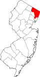
Boroughs Allendale | Alpine | Bergenfield | Bogota | Carlstadt | Cliffside Park | Closter | Cresskill | Demarest | Dumont | East Rutherford | Edgewater | Elmwood Park | Emerson | Englewood Cliffs | Fair Lawn | Fairview | Fort Lee | Franklin Lakes | Glen Rock | Harrington Park | Hasbrouck Heights | Haworth | Hillsdale | Ho-Ho-Kus | Leonia | Little Ferry | Lodi | Maywood | Midland Park | Montvale | Moonachie | New Milford | North Arlington | Northvale | Norwood | Oakland | Old Tappan | Oradell | Palisades Park | Paramus | Park Ridge | Ramsey | Ridgefield | River Edge | Rockleigh | Rutherford | Saddle River | Tenafly | Teterboro | Upper Saddle River | Waldwick | Wallington | Westwood | Wood-Ridge | Woodcliff Lake
Townships Villages Unincorporated
communitiesCategories:- Populated places established in 1922
- Boroughs in Bergen County, New Jersey


Wikimedia Foundation. 2010.