- Coastal regions of Western Australia
-
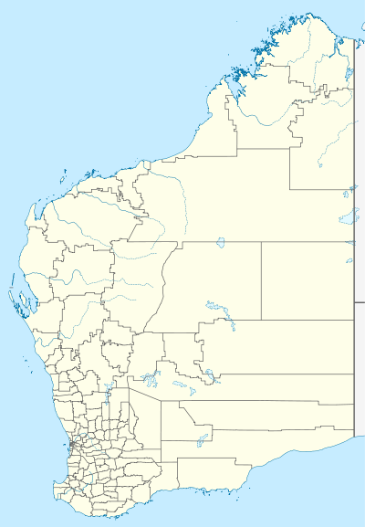
 WallalCape PrestonJurienBremer BayIsraelite BayEuclaCommonly used Bureau of Meteorology coastal landmarks
Western Australia has the longest coastline of any state in Australia, at 10,194 km [1] or 12,889 km.[2]
Integrated Marine and Coastal Regionalisation of Australia
The IMCRA has offshore regions delineated in a systematic appraisal of ecology and geography [3]
Coastal regions used in weather reports
Standard Bureau of Meteorology reports include the following reference points for coastal weather reports:[4] -
- WA/NT border (or Wyndham) to Kuri Bay:
- Kuri Bay to Wallal: (Kimberley land region)
- Wallal to Cape Preston: (Pilbara land region)
- Cape Preston to North West Cape: (Pilbara land region)
- Northwest Cape to Carnarvon: (Gascoyne land region)
- Carnarvon to Kalbarri: (Gascoyne land region)
- Kalbarri to Jurien Bay: (Central west land region)
- Jurien Bay to Mandurah: (Lower west land region)
- Mandurah to Cape Leeuwin: (South west land region)
- Cape Leeuwin to Bremer Bay: (South west and South coastal land regions)
- Bremer Bay to Israelite Bay: (Southeast coastal land region)
- Israelite Bay to SA Border: (Eucla land region)
General coastal regions
There are groupings for wider regions that are based very close to the land regions, one made in the 1980s [5] - has 8 coastal regions, while the 2003 Coastal Planning and Management Manual has five regions with component sections [6]
- Kimberley Coast - Northern Territory / Western Australia border to Broome (2003 manual 'Figure 2-2 Pilbara Kimberley Region')
- Canning - Broome to Port Hedland (Cape Keraudren - east of the De Grey River delta in the 2003 manual)
- Pilbara - Port Hedland to Onslow
- Coral Coast or Gascoyne region - Onslow to Kalbarri (Shark Bay in the 2003 manual)
- Kalbarri to Cape Naturaliste - which includes - the 'Central West' also known as the 'Turquoise Coast' and another further south known at the Sunset Coast
- South West Capes - Cape Naturaliste to Cape Leeuwin (to Albany in the 2003 manual)
- Cape Leeuwin to Israelite Bay South Coast - incorporates the coastal region between Cape Leeuwin and Windy Harbour, usually considered part of the south west;
- South Coast Region or the South East - Israelite Bay (Albany in the 2003 manual) to the Western Australia / South Australian Border (Eucla)
Ports, settlements and towns
- See Category:Coastal towns in Western Australia and Category:Port cities in Australia
Fisheries bioregions
Under the Fish Resources Management Act 1994 there are four main regions on the Western Australian coast.[7]
- North Coast (Pilbara/Kimberley) from the Western Australian and Northern Territory border to 114° 50' E 21° 46' S, just west of the mouth of the Ashburton River Mouth.
- Gascoyne Coast[8] from 114° 50' E 21° 46' S, just west of the mouth of the Ashburton River Mouth to 27° S - about half way between Kalbarri and Denham.
- West Coast from 27° S - about half way between Kalbarri and Denham south to 115 ° 30' E - Black Point[disambiguation needed
 ] east of Cape Leeuwin.
- South Coast from 115 ° 30' E - Black Point[disambiguation needed ] east of Cape Leeuwin, to the South Australian Border
Features
The coastal regions include a range of beaches, cliffs, and coastline features that are dependent upon the underlying geology - and the geological provinces have direct relationship to the coastal forms: -
- Eucla Basin - Eucla - Israelite Bay - Limestone
- Yilgarn Craton - Point Malcolm - Cape Arid and Point Hood to Point D'Entrecasteaux
- Bremer Basin - Israelite Bay - Point D'Entrecasteaux
- Perth Basin - Augusta - Murchison River
- Carnarvon Basin - Murchison River - Cape Preston
- Pilbara craton - Cape Preston - Port Hedland
- Canning Basin - Port Hedland - King Sound
- Kimberley Basin - Kimberley Coast
- Bonaparte Basin - Cambridge Gulf
Gulfs
- Admiralty Gulf
- Cambridge Gulf
- Exmouth Gulf
- Joseph Bonaparte Gulf
Sounds
Specifically referring to Sound (geography)
- Camden Sound
- Cockburn Sound
- King Sound
- Yampi Sound
- York Sound
- King George Sound
Archipelagoes and island groups
- Archipelago of the Recherche
- Bonaparte Archipelago
- Buccaneer Archipelago
- Houtman Abrolhos
- Monte Bello Islands
Aquatic flora
The Western Australian coastline has the greatest diversity of seagrasses in the world, and the meadows they form are among the largest on earth [9]
- Amphibolis antarctica Wireweed, Sea Nymph
- Amphibolis griffithii
- Halophila australis
- Halophila decipiens
- Halophila ovalis Paddle Weed, Sea Wrack
- Heterozostera tasmanica
- Posidonia angustifolia
- Posidonia australis Fireball Weed
- Posidonia coriacea
- Posidonia denhartogii
- Posidonia robertsoniae
- Posidonia sinuosa
- Syringodium isoetifolium
- Thalassodendron pachyrhizum
References
- ^ Short, Andrew D (2005)Beaches of the Western Australian Coast: Eucla to Roeback Bay ISBN 0-9586504-3-8. page 1
- ^ "Coastline Lengths". Geoscience Australia. Commonwealth of Australia. 16 October 2008. http://www.ga.gov.au/education/geoscience-basics/dimensions/coastline-lengths.html. Retrieved 2008-10-27.
- ^ http://www.environment.gov.au/coasts/mbp/imcra/index.html
- ^ See the map at http://www.bom.gov.au/weather/wa/wa-forecast-map.shtml for locations of the coastal forecast boundary locations
- ^ Woods, P.J and Eliot, Ian (1980) The Western Australian Coast being Number 6 of Coastal Management in Western Australia Bulletin Number 49 of the Department of Conservation and Environment
- ^ print form:- Western Australian Planning Commission.(2003) Coastal planning and management manual : a community guide for protecting and conserving the West Australian Coast Perth, W.A. : Western Australian Planning Commission. ISBN 0730993833 - http://henrietta.liswa.wa.gov.au/record=b2151782~S2: web-based pdfs = http://www.planning.wa.gov.au/Plans+and+policies/Publications/312.aspx
- ^ Recreational fishing guides published by the Department of Fisheries (W.A.) in September 2008 map titled 'Western Australia's Fisheries Bioregions'
- ^ Not to be confused with the tourist coast region which might have slightly different start and finish points from the fisheries designated coast
- ^ Rippey, Elizabeth and Rowland, Barbara (2004) Coast plants:Perth and the south-west region Second Edition. University of Western Australia Press. Crawley, Western Australia. ISBN 1-920694-05-6. page 245 - also Part Three: Descriptions and Illustrations of the Seagrasses pp.243-260
Further reading
Flora
- Rippey, Elizabeth and Rowland, Barbara (2004) Coastal Plants: Perth and the south-west region Second Edition, Crawley, W.A. University of Western Australia Press. ISBN 1-920694-05-6
Conferences
- WA State Coastal Conference (3rd : 2005 : Mandurah, Bunbury and Busselton, W.A.)
Title 3rd WA State Coastal Conference, Mandurah - Bunbury - Busselton, November 2005 : coastal solutions : balancing the waves of change : program and papers. Canning Bridge, W.A. : Promaco Conventions Pty Ltd, 2005. ISBN 1863081267
Locations
- Murray, Ian and Marion Hercock (2008) Where on the Coast is That? Victoria Park, Western Australia. Hesperian Press. ISBN 978-0-85905-452-2
Government reports
- Department of Conservation and Land Management, 1994: A Representative Marine Reserves
- System for Western Australia: Report of the Marine Parks and Reserves Selection Working Group (the Wilson Report).
- Government of Western Australia, 1998: New Horizons: the Way Ahead in Marine Conservation and Management.
- Government of Western Australia, 2002b: Focus on the Future: the Western Australian State Sustainability Strategy, Consultation Draft.
- Government of Western Australia, 2002c: A Biodiversity Conservation Act for Western Australia, Consultation Paper.
- Western Australian Planning Commission, 2001: Coastal Zone Management Policy for Western Australia, for public comment.
- Western Australian Planning Commission, 2002: Coastal Planning Program - Status of Coastal Planning in Western Australia 2001/02.
- Western Australian Planning Commission, 2003a: Statement of Planning Policy No. 2.6: StateCoastal Planning Policy.
- Western Australian Planning Commission, 2003b: Coastal Planning and Management Manual
See also
Australian context:-
Local features:-
- List of islands of Western Australia, A-C and numerals and subsequent sections
- List of watercourses in Western Australia
Regional divisions:-
- Interim Biogeographic Regionalisation for Australia
- Ecoregions in Australia
- Regions of Western Australia
Plants and natural history:-
Categories:- Geography of Western Australia
- Coastline of Western Australia

Wikimedia Foundation. 2010.