- Ashland City, Tennessee
Infobox Settlement
official_name = Ashland City, Tennessee
settlement_type =Town
nickname =
motto =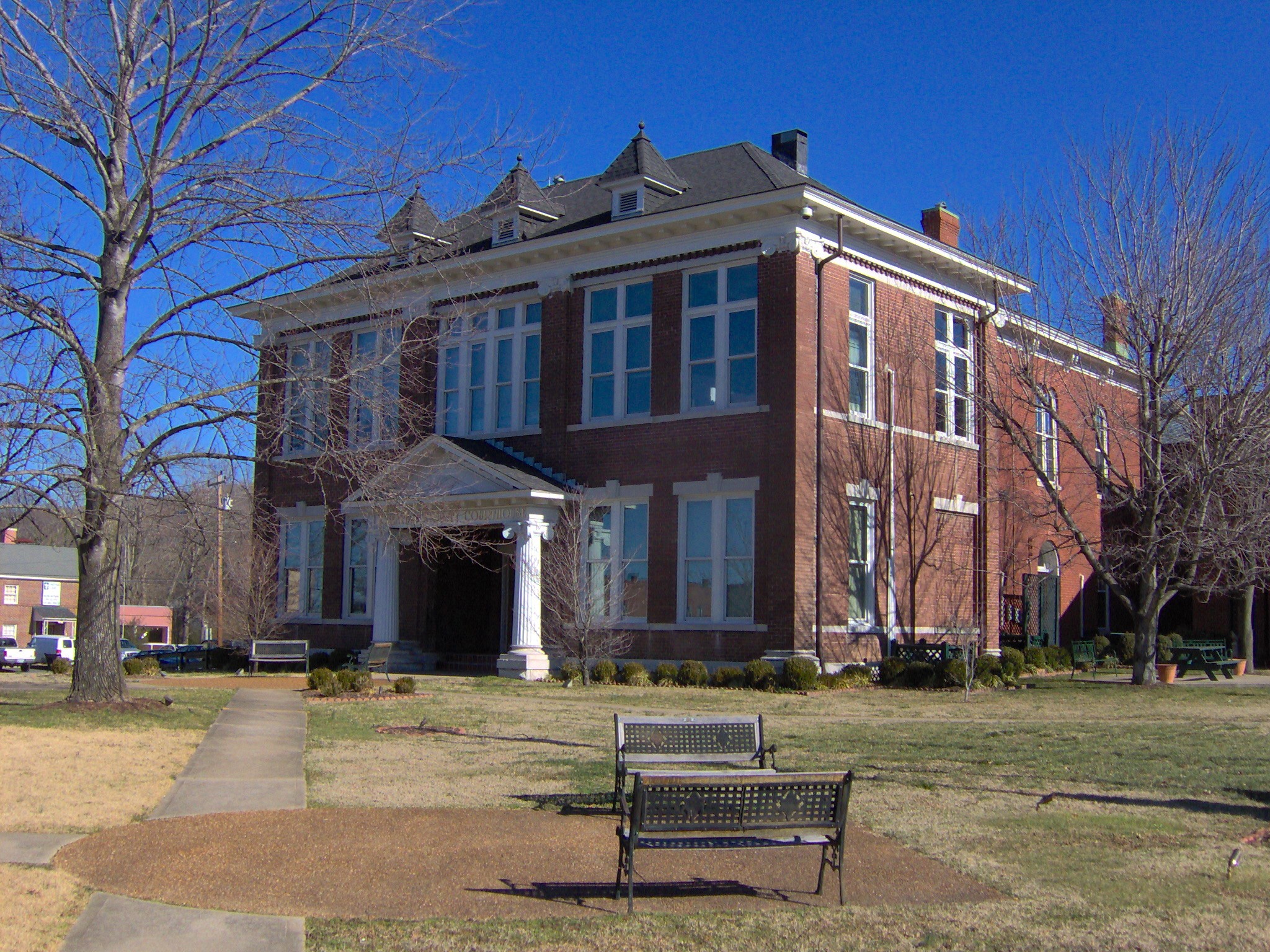
imagesize = 250px
image_caption = Cheatham County Courthouse in Ashland City
image_
mapsize = 250x200px
map_caption = Location of Ashland City, Tennessee
mapsize1 =
map_caption1 =subdivision_type = Country
subdivision_name =United States
subdivision_type1 = State
subdivision_name1 =Tennessee
subdivision_type2 = County
subdivision_name2 = Cheathamgovernment_footnotes =
government_type =
leader_title =
leader_name =
leader_title1 =
leader_name1 =
established_title =
established_date =unit_pref = Imperial
area_footnotes =
area_magnitude =
area_total_km2 = 24.8
area_land_km2 = 23.0
area_water_km2 = 1.9
area_total_sq_mi = 9.6
area_land_sq_mi = 8.9
area_water_sq_mi = 0.7population_as_of = 2000
population_footnotes =
population_total = 3641
population_density_km2 = 158.6
population_density_sq_mi = 410.8timezone = Central (CST)
utc_offset = -6
timezone_DST = CDT
utc_offset_DST = -5
elevation_footnotes =
elevation_m = 130
elevation_ft = 427
latd = 36 |latm = 16 |lats = 5 |latNS = N
longd = 87 |longm = 3 |longs = 18 |longEW = Wpostal_code_type =
ZIP code
postal_code = 37015
area_code = 615
blank_name = FIPS code
blank_info = 47-02180GR|2
blank1_name = GNIS feature ID
blank1_info = 1304885GR|3
website =
footnotes =Ashland City is a town in Cheatham County,
Tennessee ,United States . The population was 3,641 at the 2000 census. It is thecounty seat of Cheatham CountyGR|6.Geography
Ashland City is located at coor dms|36|16|5|N|87|3|18|W|city (36.267954, -87.054877)GR|1. The city is situated in a bottomland along the northeast bank of the
Cumberland River , a few miles upstream from the river's confluence with theHarpeth River . The Cheatham State Wildlife Management Area covers most of the hilly area on the opposite side of the Cumberland.Ashland City is centered around the junction of
Tennessee State Route 12 , which connects the city with Nashville to the south and Clarksville to the northwest, and Tennessee State Route 49, which connects the city to Springfield andKentucky to the northeast and Charlotte to the west.According to the
United States Census Bureau , the town has a total area of 9.6 square miles (24.8 km²), of which, 8.9 square miles (22.9 km²) of it is land and 0.7 square miles (1.9 km²) of it (7.61%) is water.Landmarks
Sydney's Bluff, located on the opposite bank of the Cumberland River, is visible from most parts of the city, especially from the residential districts which are built on hills rising to the north of the river flood plain. This jagged cliff system, which was carved by the Cumberland River, is popular with local rock climbers and hikers.
The bluff was supposedly named after a girl who fell from the bluff while trying to escape hostile Native Americans in the early 1800s. [" [http://www.savethecumberland.org/historic.htm Save the Cumberland] ," 1999. Retrieved: 11 February 2008.]
Cheatham Lock and Dam, is a large recreational area operated by the
US Army Corps of Engineers that offers many outdoor experiences such as Camping, Fishing, Wildlife Viewing, Water sports, swimming, and multiple children's play areas stretching along theCumberland River . Cheatham Dam is a popular rustic weekend getaway for many surrounding areas.Strattons Restaurant located at the corner of highway 12 and Stratton Blvd is a popular dining experience for locals and travellers taking the scenic route across historic Tennessee. This 50's style Diner is a nostalgic experience complete with classic jukebox, hand dipped ice cream floats and shakes, and classic American Decor.
Demographics
As of the
census GR|2 of 2000, there were 3,641 people, 1,416 households, and 944 families residing in the town. Thepopulation density was 410.8 people per square mile (158.7/km²). There were 1,508 housing units at an average density of 170.2/sq mi (65.7/km²). The racial makeup of the town was 94.04% White, 3.74% African American, 0.27% Native American, 0.25% Asian, 1.04% from other races, and 0.66% from two or more races. Hispanic or Latino of any race were 2.03% of the population.There were 1,416 households out of which 33.3% had children under the age of 18 living with them, 47.3% were married couples living together, 14.4% had a female householder with no husband present, and 33.3% were non-families. 27.6% of all households were made up of individuals and 11.3% had someone living alone who was 65 years of age or older. The average household size was 2.44 and the average family size was 2.96.
In the town the population was spread out with 25.1% under the age of 18, 9.6% from 18 to 24, 32.7% from 25 to 44, 19.4% from 45 to 64, and 13.1% who were 65 years of age or older. The median age was 34 years. For every 100 females there were 95.9 males. For every 100 females age 18 and over, there were 93.6 males.
The median income for a household in the town was $35,282, and the median income for a family was $39,550. Males had a median income of $29,694 versus $22,454 for females. The
per capita income for the town was $17,228. About 5.5% of families and 9.4% of the population were below thepoverty line , including 10.3% of those under age 18 and 12.6% of those age 65 or over.Industry
The largest manufacturing operation in Ashland City is [http://www.statewaterheaters.com/ State Industries] , (State Water Heaters) a division of [http://www.hotwater.com/ AO Smith WPC] , which fabricates A.O. Smith, State Industries, Reliance, American, Whirlpool and Apollo water heaters. AO Smtih WPC is the largest manufacturer of water heaters in the United States. This facility provides work for many residents of Cheatham County and nearby Montgomery and Dickson counties.
Additionally, the city limits were recently extended along State Highway 12 to the Davidson County line. This expansion incorporated the Cheatham County Industrial Park, which includes
Triton Boat as well as barge building operations, paper products, and concrete manufacturers along the Cumberland River. Ashland City industry is served by the Nashville & Western Railroad (which is a division of theNashville and Eastern Railroad corporation).History
Ashland City was created in 1856 as a county seat for the newly-established Cheatham County. The county's commissioners purchased the initial convert|50|acre|km2 of land (now the courthouse square) from James Lenox, and a temporary courthouse was erected shortly thereafter. The temporary structure was replaced by the present courthouse in 1869. [James Hallums, " [http://tennesseeencyclopedia.net/imagegallery.php?EntryID=C067# Cheatham County] ." "The Tennessee Encyclopedia of History and Culture", 2002. Retrieved: 11 February 2008.] Ashland City was officially incorporated in 1859. [" [http://www.ashlandcity.net/past.htm Ashland City Past] ," 2006-2012. Originally published as "Goodspeed's History of Cheatham County, Tennessee" by the Goodspeed Publishing Company in 1887. Retrieved: 11 February 2008.]
The first major industry in the Ashland City area was the forge operated by Montgomery Bell at Narrows of the Harpeth, several miles to the southwest, which was established in 1818. In 1835, Samuel Watson established a grist mill and powder mill along Sycamore Creek, just north of Ashland City. Watson's mill developed into one of the largest powder mills in the South, making it a target during the
American Civil War . The mill continued in operation under various owners until 1904. [James Hallums, " [http://tennesseeencyclopedia.net/imagegallery.php?EntryID=C067# Cheatham County] ." "The Tennessee Encyclopedia of History and Culture", 2002. Retrieved: 11 February 2008.]Ashland City today
Ashland City is gaining distinction as a "bedroom community" for
Nashville and the greater Davidson County Area. Many business owners and other upper middle class families have begun to spill into Ashland City and neighboring cities Pleasant View and Kingston Springs. Much of this is due to the accessibility to the larger Metro area and the more secluded and simple atmosphere these cities provide. The Cheatham County area is fairly rural and undeveloped in comparison to other Nashville Metro areas making it a popular place to raise a family. Much of the town's activities revolve around youth and high school sporting events such as soccer, football and other outdoor activities. Strict building and development codes are leading to a higher quality of living within the Ashland City area.Ashland City is also home to the Harpeth Shoals Marina (opened 2007) and the Braxton Condominiums due to open within the upcoming year. These "high class condos," which rest on the shores of the Cumberland River, will comprise the tallest building in Ashland City.
The Ashland Estates neighborhood behind the town's
Food Lion plays host to a locally famous Halloween street fair each October. The informal event attracts kids and parents from most of northern Cheatham County.The Cheatham County area is host to numerous wildlife preserves popular with animal watchers and biologists who document/research the abundance of untamed wildlife common to the area. The most substantial preserves include the Cheatham Wildlife Management Area opposite Ashland City to the west and
Harpeth River State Park , a linear state park north of Kingston Springs.References
External links
* [http://www.ashlandcity.net/ Ashland City] — official site
* [http://www.statewaterheaters.com/ State Industries]
* [http://www.hotwater.com/ AO Smith WPC]
* [http://www.braxtoncondos.com/index.php The Braxton Condominiums]
Wikimedia Foundation. 2010.