- Mingan, Quebec
-
Mingan — Indian reserve — 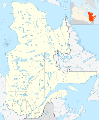
 Mingan
Coordinates: 50°18′N 64°02′W / 50.3°N 64.033°WCoordinates: 50°18′N 64°02′W / 50.3°N 64.033°W Country  Canada
Province  Quebec
Region Côte-Nord Regional county none Settled Formed 1963 Government[1][2] - Chief Jean-Charles Piétacho - Federal riding Manicouagan - Prov. riding Duplessis Area[2][3] - Total 19.15 km2 (7.4 sq mi) - Land 16.89 km2 (6.5 sq mi) Population (2006)[3] - Total 407 - Density 24.1/km2 (62.4/sq mi) Time zone EST (UTC-5) - Summer (DST) EDT (UTC-4) Postal Code G0G 1V0 Area code(s) 418 and 581 Mingan, also known as Ekuantshit in Innu-aimun, is an Innu First Nations reserve in the Canadian province of Quebec, at the mouth of the Mingan River on Mingan Bay of the Gulf of Saint Lawrence. It belongs to the Innu band of Ekuanitshit.[1] Geographically it is within the Minganie Regional County Municipality but administratively not part of it.
The reserve is accessible via Quebec Route 138, 10 kilometers (6.2 mi) east of the village of Longue-Pointe-de-Mingan and 36 kilometers (22 mi) west of downtown Havre-Saint-Pierre. It is serviced by a health centre, community radio station, library, cultural centre, community store, municipal water and sewer system, fire station, and an aboriginal police force.[1]
The name Mingan, already appearing as mican on a map of 1631, is generally considered to originate from the Innu word maikan, meaning "timber wolf". But there is no certainty over this interpretation. It has also been proposed that it may have came from the Basque word mingain meaning "language", or the Breton term menguen that translates as "white stone".[4]
Contents
History
 Indian group at Mingan, 1920
Historically, the region was the homeland of the Innu indigenous people, who would leave their inland hunting grounds for the coast during the summer. Mingan was a summer gathering site where they would fish for salmon, hunt for whale, have family meetings, and trade with each other. In 1661 when the Mingan Seignory was granted and Europeans began to inhabit the area, the fur trade began that continued until the start of the 20th century. The North West Company and then the Hudson's Bay Company (from 1807 to 1873) maintained trading posts there under the name Mingan, that was frequently visited by the Innu to trade fur and who continued to use the place only as a summer camp site.[4][5]
The Innu nomadic life became disrupted at the time of World War II, when mining and forestry companies began to develop the area. After the war, mandatory education, fluctuating fur prices, and government housing programs led to the permanent settlement of the Innu.[5]
On April 30, 1963, the Government of Québec transferred 7 square miles (18 km2) of land within the seignory of Mingan to the Government of Canada as a reserve for Indians of the Mingan region. But the reserve provided no access to the Mingan River upon which the Innu relied for subsistence. After many years of land claims, the river banks were added to the reserve in 1983 and in 1996, the reserve was expanded again.[5][6]
Demographics
As of December 2009, the band counted 556 members, of which 532 persons are living in the community.[1]Private dwellings occupied by usual residents amount to 120 out of a total of 209. Mother tongues spoken on the reserve are:[3]
- English as first language: 0 %
- French as first language: 2.4 %
- English and French as first language: 0 %
- Other as first language: 97.6 %
Population trend:[7]
- Population in 2006: 407 (2001 to 2006 population change: 4.1 %)
- Population in 2001: 391
- Population in 1996: 431
- Population in 1991: 365
Education
There is only one school on the reserve, École Teueikan, that provides pre-Kindergarten to Secondary grade 4, and had an enrollment of 106 students in 2008-2009.[1]
References
- ^ a b c d e "Ekuanitshit First Nation". Aboriginal Community profiles. Indian and Northern Affairs Canada. http://www.ainc-inac.gc.ca/ai/scr/qc/aqc/prof/Ekuanitshit-eng.asp. Retrieved 2010-10-01.
- ^ a b Ministère des Affaires Municipales, Régions et Occupation du territoire - Répertoire des municipalités: Mingan
- ^ a b c Statistics Canada 2006 Census - Mingan community profile
- ^ a b "Mingan (Réserve indienne)" (in French). Commission de toponymie du Québec. http://www.toponymie.gouv.qc.ca/ct/ToposWeb/fiche.aspx?no_seq=178726. Retrieved 2010-10-01.
- ^ a b c Harold Bherer; Sylvie Gagnon; Jacinte Roberge (1990), Wampum and letters patent: exploratory study of native entrepreneurship, IRPP, pp. 109–111, ISBN 9780886451165, http://books.google.ca/books?id=mhlkVMPRItAC&pg=PA109&lpg=PA109&dq=mingan+reserve&source=bl&ots=tCduVS_Dy0&sig=dPmxlroQ3gq-mQoLYmuieGP42Tk&hl=en&ei=MPGpTP_CG4H_8Abjh63gDA&sa=X&oi=book_result&ct=result&resnum=10&ved=0CCoQ6AEwCThu#v=onepage&q=mingan%20reserve&f=false
- ^ Natural Resources Canada - Legal Surveys Division, Historical Review - Mingan land title history
- ^ Statistics Canada: 1996, 2001, 2006 census
External links

Havre-Saint-Pierre Longue-Pointe-de-Mingan 
Havre-Saint-Pierre  Mingan

Gulf of Saint Lawrence (Mingan Bay) Labrador communities Natuashish (Naskapi) • Sheshatshiu
Quebec communities Betsiamites (Pessamit) • Essipit • Kawawachikamach (Naskapi) • Lac-John • Mashteuiatsh • Matimekosh • Mingan (Ekuantshit) • Natashquan (Nutashkuan) • Pakuashipi • La Romaine (Unamenshipit) • Uashat-MaliotenamSee also: Category:Innu, Naskapi Administrative divisions of Côte-Nord (Region 09)Regional county municipalities
and equivalent territoriesLa Haute-Côte-Nord · Le Golfe-du-Saint-Laurent · Manicouagan · Sept-Rivières · Caniapiscau · Minganie
Municipalities Forestville · Baie-Comeau · Sept-Îles · Port-Cartier · Havre-Saint-Pierre · Fermont · Schefferville
Categories:- Innu communities in Quebec
- Communities in Côte-Nord
- Hudson's Bay Company trading posts


Wikimedia Foundation. 2010.