- Lead, South Dakota
Infobox Settlement
official_name = Lead, South Dakota
other_name =
native_name =
nickname =
settlement_type =City
motto =
imagesize =
image_caption =
flag_size =
image_
seal_size =
image_shield =
shield_size =
image_blank_emblem =
blank_emblem_type =
blank_emblem_size =
imagesize =
image_caption =
flag_size =
image_
seal_size =
image_shield =
shield_size =
image_blank_emblem =
blank_emblem_type =
blank_emblem_size =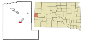
mapsize = 250px
map_caption = Location in Lawrence County and the state ofSouth Dakota
mapsize1 =
map_caption1 =
image_dot_
dot_mapsize =
dot_map_caption =
dot_x =
dot_y =
pushpin_
pushpin_label_position =
pushpin_map_caption =
pushpin_mapsize =
subdivision_type = Country
subdivision_name =United States
subdivision_type1 = State
subdivision_name1 =South Dakota
subdivision_type2 = County
subdivision_name2 = Lawrence
subdivision_type3 =
subdivision_name3 =
subdivision_type4 =
subdivision_name4 =
government_footnotes =
government_type =
leader_title =
leader_name =
leader_title1 =
leader_name1 =
leader_title2 =
leader_name2 =
leader_title3 =
leader_name3 =
leader_title4 =
leader_name4 =
established_title =
established_date =
established_title2 =
established_date2 =
established_title3 =
established_date3 =
area_magnitude =
unit_pref = Imperial
area_footnotes =
area_total_km2 = 5.2
area_land_km2 = 5.2
area_water_km2 = 0
area_total_sq_mi = 2
area_land_sq_mi = 2
area_water_sq_mi = 0
area_water_percent =
area_urban_km2 =
area_urban_sq_mi =
area_metro_km2 =
area_metro_sq_mi =
area_blank1_title =
area_blank1_km2 =
area_blank1_sq_mi =
population_as_of = 2000
population_footnotes =
population_note =
population_total = 3027
population_density_km2 = 582.1
population_density_sq_mi = 1513.5
population_metro =
population_density_metro_km2 =
population_density_metro_sq_mi =
population_urban =
population_density_urban_km2 =
population_density_urban_sq_mi =
population_blank1_title =
population_blank1 =
population_density_blank1_km2 =
population_density_blank1_sq_mi =
timezone = Mountain (MST)
utc_offset = -7
timezone_DST = MDT
utc_offset_DST = -6
latd = 44 |latm = 21 |lats = 3 |latNS = N
longd = 103 |longm = 45 |longs = 57 |longEW = W
elevation_footnotes =
elevation_m = 1589
elevation_ft = 5213
postal_code_type =ZIP code
postal_code = 57754
area_code = 605
blank_name = FIPS code
blank_info = 46-36220GR|2
blank1_name = GNIS feature ID
blank1_info = 1265276GR|3
website =
footnotes =Lead (pronounced as "leed") is a city in Lawrence County,
South Dakota ,United States . The population was 3,027 at the 2000 census. Lead is located in westernSouth Dakota , in theBlack Hills near theWyoming state line. The town was officially founded in 1876 after the discovery ofgold . It is the site of the Homestake Mine, the largest, deepest (8240 feet) and most productive gold mine in theWestern Hemisphere before closing in 2001.Lead was originally founded as a company town by the
Homestake Gold Mining Company , which ran the nearby Homestake mine.Phoebe Hearst , wife of one of the principals, was instrumental in making Lead a good place to live. She established the Hearst Free Public Library in town, and in 1900 the Hearst Free Kindergarten. She donated regularly to Lead's churches, and provided college scholarships to the children of mine and mill workers. [Duane A. Smith (2003) "Here's to low-grade ore and plenty of it," the Hearsts and the Homestake mine", Mining Engineering, 9/2003, p.23-27. ] Lead and theHomestake Mine have been selected [ [http://www.nsf.gov/news/news_summ.jsp?cntn_id=109694&org=NSF&from=news nsf.gov - News - Team Selected for the Proposed Design of the Deep Underground Science and Engineering Laboratory - US National Science Foundation (NSF) ] ] as the site of theDeep Underground Science and Engineering Laboratory , a proposed NSF facility for low-background experiments on neutrinos, dark matter, and other nuclear physics topics, as well as biology and mine engineering studies.Geography
Lead is located at coor dms|44|21|3|N|103|45|57|W|city (44.350967, -103.765784)GR|1.
According to the
United States Census Bureau , the city has a total area of 2.0square mile s (5.2km² ), all of it land.Lead has been assigned the
ZIP code 57754 and theFIPS place code 36220.Lead's proximity to Deadwood, South Dakota, often leads to the two towns being collectively named "Lead-Deadwood".
Two prominent man-made features of Lead's geography are the giant open cut, which was used for surface gold mining by the Homestake Mine, and the resulting ridge nearby built with the non-producing material from the cut.
Recreation
In the summer, there are numerous trails for hiking, mountain biking, and horse back riding. The
George S. Mickelson Trail , which runs from Edgemont to Deadwood, runs through town. Several man made lakes, includingSheridan Lake provide fishing and swimming.Spearfish Canyon to the north has many places to rock climb.During the winter there are two ski areas just a few miles outside of Lead.
Terry Peak andDeer Mountain are both full service ski areas.Demographics
As of the
census GR|2 of 2000, there were 3,027 people, 1,279 households, and 832 families residing in the city. Thepopulation density was 1,521.5 people per square mile (587.3/km²). There were 1,617 housing units at an average density of 812.8/sq mi (313.7/km²). The racial makeup of the city was 95.74% White, 0.23% African American, 2.25% Native American, 0.20% Asian, 0.59% from other races, and 0.99% from two or more races. Hispanic or Latino of any race were 2.71% of the population. 36.5% were of German, 8.1% English, 7.8% Irish, 7.1% Norwegian and 6.7% American ancestry according toCensus 2000 .There were 1,279 households out of which 33.2% had children under the age of 18 living with them, 47.8% were married couples living together, 12.4% had a female householder with no husband present, and 34.9% were non-families. 29.2% of all households were made up of individuals and 11.8% had someone living alone who was 65 years of age or older. The average household size was 2.35 and the average family size was 2.89.
In the city the population was spread out with 26.1% under the age of 18, 8.5% from 18 to 24, 30.2% from 25 to 44, 22.2% from 45 to 64, and 13.0% who were 65 years of age or older. The median age was 37 years. For every 100 females there were 100.9 males. For every 100 females age 18 and over, there were 96.8 males.
The median income for a household in the city was $29,485, and the median income for a family was $35,855. Males had a median income of $25,958 versus $18,841 for females. The
per capita income for the city was $15,726. About 10.7% of families and 12.9% of the population were below thepoverty line , including 15.7% of those under age 18 and 12.9% of those age 65 or over.Notable Natives
*
Mike Steponovich was anAmerican football end in theNational Football League for the Boston Redskins.References
External links
Wikimedia Foundation. 2010.