- North Kingstown, Rhode Island
-
North Kingstown, Rhode Island — Town — The Gilbert Stuart Birthplace in North Kingstown Location of North Kingstown in Washington County, Rhode Island
Coordinates: 41°34′50″N 71°27′14″W / 41.58056°N 71.45389°WCoordinates: 41°34′50″N 71°27′14″W / 41.58056°N 71.45389°W Country United States State Rhode Island County Washington Area – Total 58.3 sq mi (151.1 km2) – Land 43.6 sq mi (112.9 km2) – Water 14.7 sq mi (38.2 km2) Elevation 82 ft (25 m) Population (2010) – Total 26,486 – Density 607.5/sq mi (234.6/km2) Time zone Eastern (EST) (UTC-5) – Summer (DST) EDT (UTC-4) ZIP codes 02852, 02854, 02874 Area code(s) 401 FIPS code 44-51580[1] GNIS feature ID 1220088[2] Website www.northkingstown.org North Kingstown is a town in Washington County, Rhode Island, United States. The population was 26,486 at the 2010 census. The famous American portraitist Gilbert Stuart was born in the village of Saunderstown, located in the southern region of North Kingstown.
The town of Kings Towne was founded in 1674, by the colonial government, and included the present day towns of North Kingstown, South Kingstown, Exeter, and Narragansett. In 1722, Kings Towne was split into two parts, North Kingstown and South Kingstown, with North Kingstown, having the earliest settlements, retaining the 1674 establishment date. In 1742 the town of Exeter was taken from the western part of North Kingstown.
Contents
Geography
According to the United States Census Bureau, the town has a total area of 58.3 square miles (151 km2). 43.6 square miles (113 km2) of it is land and 14.8 square miles (38 km2) of it (25.28%) is water.
Demographics
 Self portrait of Gilbert Stuart, Painted in 1778. Stuart was born in North Kingstown.
As of the census[1] of 2000, there were 26,326 people, 10,154 households, and 7,310 families residing in the town. The population density was 603.9 people per square mile (233.2/km²). There were 10,743 housing units at an average density of 246.4 per square mile (95.2/km²). The racial makeup of the town was 95.71% White, 0.97% African American, 0.55% Native American, 0.95% Asian, 0.03% Pacific Islander, 0.53% from other races, and 1.25% from two or more races. Hispanic or Latino of any race were 1.77% of the population.
There were 10,154 households out of which 35.7% had children under the age of 18 living with them, 40.6% were married couples living together, 46.5% had a female householder with no husband present, and 28.0% were non-families. 22.5% of all households were made up of individuals and 8.2% had someone living alone who was 65 years of age or older. The average household size was 2.57 and the average family size was 3.03.
In the town the population was spread out with 26.0% under the age of 18, 6.0% from 18 to 24, 29.6% from 25 to 44, 26.6% from 45 to 64, and 11.8% who were 65 years of age or older. The median age was 39 years. For every 100 females there were 93.9 males. For every 100 females age 18 and over, there were 89.6 males.
The median income for a household in the town was $60,027, and the median income for a family was $69,559. Males had a median income of $20,668 versus $18,399 for females. The per capita income for the town was $28,139. About 18.8% of families and 16.1% of the population were below the poverty line, including 9.6% of those under age 18 and 4.8% of those age 65 or over.
Notable facts
North Kingstown is the birthplace of Gilbert Stuart (1755–1828), the American painter whose portrait of George Washington appears on the one dollar bill.
North Kingstown is also home to Quonset Point, a former military base which was once the home of the Naval Construction Battalions known as the SeaBees.
Points of interest
- Casey Farm (1725) - An original colonial plantation that is today one of the oldest operational farms in New England.
- Davis Memorial Wildlife Refuge - 96 Acres of forest and wetlands preserved by the Audubon Society of Rhode Island.
- Devil's Foot Rock - A footprint-like natural impression or possibly petrosomatoglyph. Legends going back to the colonial era tell of a squaw being chased by the devil. Some say that she fled from Boston. Her pursuer is said to have left his footprints at Devil's Foot Rock, then at Chimney Hill in South Kingstown, and finally at Block Island.
- Gilbert Stuart Birthplace and Museum (1751) - The house in which American portraitist Gilbert Stuart was born in 1755. The museum features works from throughout Stuart's career and operational grist and snuff mills.
- Historic Wickford Village - A Historic Seaside Village which contains one of the largest collections of preserved 18th century houses in the Northeastern United States. Wickford also has a large and scenic harbor.
- Quonset Air Museum - A large Museum located near the Quonset Naval Air Station which focuses on military aviation history.
- Smith's Castle (1678) - A colonial plantation located on the shore of Narragansett Bay.
Other National Historic Places in North Kingstown
 Old Narragansett Church, built in 1707, is the oldest Episcopal Church building in New England
 Baptist Church in Wickford
- Allen-Madison House (1801)
- Camp Endicott (1942)
- Crowfield Historic District
- Davisville Historic District
- George Douglas House (1738)
- George Fayerweather Blacksmith Shop (1819)
- Ezekial Gardner House
- Hamilton Mill Village Historic District
- Lafayette Village
- Stephen Northrup House (1712)
- Old Narragansett Cemetery
- Old Narragansett Church (1707)
- Palmer-Northrup House (1680)
- Joseph Pierce Farm
- Plum Beach Lighthouse (1899)
- Poplar Point Lighthouse (1831)
- Rathbun House
- Esbon Sanford House (1832)
- Saunderstown Historic District
- Six Principle Baptist Church (1703)
- Joseph Slocum House (1750)
- Spink Farm (1798)
- St. Paul's Church(1847)
- The Young House
- YWCA Site
-

Allie's Donuts, a well known local restaurant on Rhode Island Route 2
References
- ^ a b "American FactFinder". United States Census Bureau. http://factfinder.census.gov. Retrieved 2008-01-31.
- ^ "US Board on Geographic Names". United States Geological Survey. 2007-10-25. http://geonames.usgs.gov. Retrieved 2008-01-31.
External links
- Town of North Kingstown website
- North Kingstown Chamber of Commerce
- North Kingstown School Department
- Wickford Art Festival
- North East Independent Newspaper
- North Kingstown School District
Municipalities and communities of Washington County, Rhode Island Towns Charlestown | Exeter | Hopkinton | Narragansett | New Shoreham | North Kingstown | Richmond | South Kingstown | Westerly

CDPs Other
villagesAlton | Carolina | Kingston | Peace Dale | Point Judith | Quonochontaug | Saunderstown | Usquepaug | Wakefield | Watch Hill | Wickford | Wyoming
 State of Rhode Island and Providence Plantations
Topics Culture | Delegations | Geography | Government | History | Thirteen Colonies | Colonial Colleges | Images | Narragansett Indian Tribe | People | Visitor attractions | State symbols
Regions Counties: Bristol | Kent | Newport | Providence | Washington | Geographic: Blackstone Valley | Block Island
Cities Central Falls | Cranston | East Providence | Newport | Pawtucket | Providence | Warwick | Woonsocket
Towns Barrington | Bristol | Burrillville | Charlestown | Coventry | Cumberland | East Greenwich | Exeter | Foster | Glocester | Hopkinton | Jamestown | Johnston | Lincoln | Little Compton | Middletown | Narragansett | New Shoreham (Block Island) | North Kingstown | North Providence | North Smithfield | Portsmouth | Richmond | Scituate | Smithfield | South Kingstown | Tiverton | Warren | Westerly | West Greenwich | West Warwick
Narragansett Bay Islands Aquidneck Island · Conanicut Island · Prudence Island · Patience Island · Hog Island · Dutch Island · Coaster's Harbor Island · Cornelius Island · Despair Island · Dyer Island · Fox Island · Goat Island · Gould Island · Greene Island · Hope Island · Lime Rock · Rabbit Island · Rock Island · Rose Island · Starvegoat Island · Whale Rock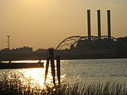
Major rivers Cities & towns Providence · Newport · Cranston · Warwick · East Providence · Barrington · Bristol · East Greenwich · Jamestown · Middletown · Narragansett · North Kingstown . Portsmouth · WarrenBridges Categories:- Populated places in Washington County, Rhode Island
- Towns in Rhode Island
- Populated coastal places in Rhode Island
- North Kingstown, Rhode Island


Wikimedia Foundation. 2010.