- McMurray, Pennsylvania
-
McMurray Census-designated place Country United States Commonwealth Pennsylvania County Washington Coordinates 40°16′56″N 80°5′14″W / 40.28222°N 80.08722°W Area 3.1 sq mi (8 km2) Population 4,726 (2000) Density 1,533.5 / sq mi (592 / km2) Timezone EST (UTC-4) - summer (DST) EDT (UTC-5) 15317 Zip code Area code 724  Location of McMurray in Washington County
 Location of Washington County in Pennsylvania
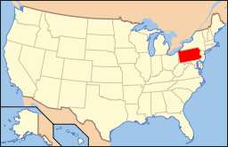 Location of Pennsylvania in the United States
McMurray is a community in Peters Township, Washington County in the U.S. state of Pennsylvania. The U.S. Census Bureau defined the community as a census-designated place (CDP), though it has no legal status as a separately incorporated municipality. The population was 4,726 at the 2000 census. Its zip code is 15317, which it shares with neighboring borough Canonsburg.
Contents
Geography
McMurray is located at 40°16′56″N 80°5′14″W / 40.28222°N 80.08722°W (40.282276, -80.087162)[1].
According to the United States Census Bureau, the CDP has a total area of 3.1 square miles (8.0 km2), all of it land.
Demographics
As of the census[2] of 2000, there were 4,726 people, 1,582 households, and 1,387 families residing in the CDP. The population density was 1,533.5 people per square mile (592.4/km²). There were 1,612 housing units at an average density of 523.1/sq mi (202.1/km²). The racial makeup of the CDP was 97.97% White, 0.55% African American, 0.02% Native American, 0.97% Asian, 0.15% from other races, and 0.34% from two or more races. Hispanic or Latino of any race were 0.72% of the population.
Ancestries of CDP residents include Italian (28.7%), German (28.4%), Irish (24.3%), English (12.0%), Polish (9.4%), and Slovak (4.4%).
There were 1,582 households out of which 43.7% had children under the age of 18 living with them, 82.1% were married couples living together, 4.7% had a female householder with no husband present, and 12.3% were non-families. 11.2% of all households were made up of individuals and 6.0% had someone living alone who was 65 years of age or older. The average household size was 2.96 and the average family size was 3.21.
In the CDP the population was spread out with 31.0% under the age of 18, 3.7% from 18 to 24, 24.9% from 25 to 44, 29.2% from 45 to 64, and 11.3% who were 65 years of age or older. The median age was 40 years. For every 100 females there were 92.4 males. For every 100 females age 18 and over, there were 92.4 males.
The median income for a household in the CDP was $81,736, and the median income for a family was $86,711. Males had a median income of $67,317 versus $41,467 for females. The per capita income for the CDP was $37,364. 0.7% of the population and 0.6% of families were below the poverty line. Out of the total The median house value in the year 2000 was $187,100.
See also
- Household Harmony
References
- ^ "US Gazetteer files: 2010, 2000, and 1990". United States Census Bureau. 2011-02-12. http://www.census.gov/geo/www/gazetteer/gazette.html. Retrieved 2011-04-23.
- ^ "American FactFinder". United States Census Bureau. http://factfinder.census.gov. Retrieved 2008-01-31.
Categories:- Census-designated places in Washington County, Pennsylvania
- Pittsburgh metropolitan area


Wikimedia Foundation. 2010.