- Mount Pocono, Pennsylvania
-
Borough of Mount Pocono Settlement Country United States State Pennsylvania County Monroe Elevation 1,988 ft (605.9 m) Coordinates 41°07′23″N 75°21′34″W / 41.12306°N 75.35944°W Area 3.5 sq mi (9.1 km2) - land 3.5 sq mi (9 km2) - water 0.0 sq mi (0 km2), 0% Population 2,742 (2000) Density 792.2 / sq mi (305.9 / km2) Mayor Francis R. O'Boyle Timezone EST (UTC-5) - summer (DST) EDT (UTC-4) ZIP Code 18344 Area code 570  Location of Mount Pocono in Monroe County
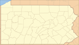
 Location of Mount Pocono in Pennsylvania
 Location of Pennsylvania in the United States
Website: http://www.borough.mountpocono.pa.us Mount Pocono is a borough in Monroe County, Pennsylvania, in the United States. It is located in the Poconos region of the state.
As of the 2000 census, the borough population was 2,742.
Contents
Geography
Mount Pocono is located at 41°7′23″N 75°21′34″W / 41.12306°N 75.35944°W (41.123012, -75.359574)[1].
According to the United States Census Bureau, the borough has a total area of 3.5 square miles (9.0 km²), all of it land.
Demographics
As of the census[2] of 2000, there were 2,742 people, 1,038 households, and 712 families residing in the borough. The population density was 792.2 people per square mile (306.0/km²). There were 1,239 housing units at an average density of 358.0 per square mile (138.3/km²). The racial makeup of the borough was 29.15% White, 33.45% Black or African American, 0.15% Native American, 0.91% Asian, 3.54% from other races, and 2.63% from two or more races. Hispanic or Latino of any race were 63.14% of the population.
There were 1,038 households out of which 35.0% had children under the age of 18 living with them, 51.8% were married couples living together, 11.8% had a female householder with no husband present, and 31.4% were non-families. 25.4% of all households were made up of individuals and 10.7% had someone living alone who was 65 years of age or older. The average household size was 2.63 and the average family size was 3.19.
In the borough the population was spread out with 27.5% under the age of 18, 7.8% from 18 to 24, 29.1% from 25 to 44, 21.6% from 45 to 64, and 14.0% who were 65 years of age or older. The median age was 36 years. For every 100 females there were 91.7 males. For every 100 females age 18 and over, there were 89.8 males.
The median income for a household in the borough was $40,224, and the median income for a family was $48,700. Males had a median income of $35,571 versus $23,047 for females. The per capita income for the borough was $19,068. About 7.6% of families and 10.4% of the population were below the poverty line, including 11.7% of those under age 18 and 8.7% of those age 65 or over.
Public education
The Borough is served by the Pocono Mountain School District.
Transportation
Transit
The Monroe County Transit Authority (MCTA) serves Monroe County with five bus routes. The Authority's Blue Route serves Mount Pocono's Main Street (Pocono Blvd.) with northbound service to Tobyhanna, PA and southbound service to Tannersville, and The Stroud Mall. Connections to other MCTA routes are provided at the Stroud Mall.[3]
References
- ^ "US Gazetteer files: 2010, 2000, and 1990". United States Census Bureau. 2011-02-12. http://www.census.gov/geo/www/gazetteer/gazette.html. Retrieved 2011-04-23.
- ^ "American FactFinder". United States Census Bureau. http://factfinder.census.gov. Retrieved 2008-01-31.
- ^ http://www.gomcta.com/schedules.htm
Municipalities and communities of Monroe County, Pennsylvania Boroughs Delaware Water Gap | East Stroudsburg | Mount Pocono | Stroudsburg

Townships Barrett | Chestnuthill | Coolbaugh | Eldred | Hamilton | Jackson | Middle Smithfield | Paradise | Pocono | Polk | Price | Ross | Smithfield | Stroud | Tobyhanna | Tunkhannock
CDPs Unincorporated
communitiesBartonsville | Canadensis | Cresco | Effort | Gilbert | Jonas | Long Pond | Marshalls Creek | Pocono Manor | Pocono Summit | Skytop | Swiftwater | Tannersville | Tobyhanna
Categories:- The Poconos
- Populated places established in 1927
- Boroughs in Monroe County, Pennsylvania
- Populated places in the United States with Hispanic majority populations


Wikimedia Foundation. 2010.