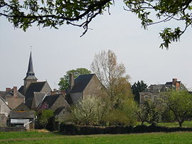
- Champteussé-sur-Baconne
-
Champteussé-sur-Baconne


 Champteussé-sur-BaconneLocation within Pays de la Loire region
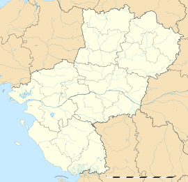 Champteussé-sur-Baconne
Administration Country France Region Pays de la Loire Department Maine-et-Loire Arrondissement Segré Canton Châteauneuf-sur-Sarthe Intercommunality communauté de commune du Lion d'Angers Mayor Jean-Pierre BOUVET Statistics Elevation 24–77 m (79–253 ft)
(avg. 27 m/89 ft)Land area1 11.48 km2 (4.43 sq mi) Population2 222 (2006[1]) - Density 19 /km2 (49 /sq mi) INSEE/Postal code 49067/ 49220 1 French Land Register data, which excludes lakes, ponds, glaciers > 1 km² (0.386 sq mi or 247 acres) and river estuaries. 2 Population without double counting: residents of multiple communes (e.g., students and military personnel) only counted once. Coordinates: 47°40′07″N 0°39′14″W / 47.6686111111°N 0.653888888889°W
Champteussé-sur-Baconne is a commune in the Maine-et-Loire department of western France.
See also
References
Categories:- Communes of Maine-et-Loire
- Maine-et-Loire geography stubs


Wikimedia Foundation. 2010.