- George Massey Tunnel
-
George Massey Tunnel 
Descending into the Massey Tunnel Overview Location Metro Vancouver Coordinates 49°07′18″N 123°04′32″W / 49.121663°N 123.075628°W Route British Columbia Highway 99 Operation Opened April 1958 Owner British Columbia Toll Highways and Bridge Authority(original)
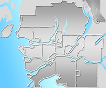
British Columbia Ministry of TransportationTraffic Automotive Character Freeway Technical Number of lanes 4 Water Depth 22 metres[1] Location in Metro VancouverThe George Massey Tunnel (often referred to simply as the Massey Tunnel) is a highway traffic tunnel in the Metro Vancouver region of southwestern British Columbia. It is located approximately 20 km (12 mi) south of the city centre of Vancouver, British Columbia, and approximately 30 km (20 mi) north of the Canada-U.S. Border at Blaine, Washington.
The tunnel was opened to traffic in April 1958 as the Deas Island Tunnel,[2] with a construction cost of approximately $25 million. Her Majesty Queen Elizabeth II attended the official opening ceremony of the tunnel which was on July 15, 1959. It carries a four lane divided highway under the south arm of the Fraser River estuary, joining the City of Richmond to the north with the Corporation of Delta (a municipality) to the south.
The tunnel forms part of Highway 99. It is named for (Nehamiah) George Massey, a former Member of the Legislative Assembly of British Columbia. He represented Delta between 1956 and 1960, and was a long-time advocate of a permanent crossing to replace an existing ferry that crossed the south arm of the Fraser River.
Contents
Configuration
The tunnel is a single tube that is subdivided with a concrete wall, each side containing two traffic lanes. The typical traffic flow has two northbound lanes in the east tube and two southbound lanes in the west tube. In 1989 a counterflow system was introduced to meet increasing traffic demand in the tunnel.
At peak rush traffic periods, a reversible lane system is used, with a series of swing gates deployed reducing traffic in one direction to a single lane, while increasing the other direction to three lanes. Morning rush has three lanes northbound (inbound to Vancouver) and evening rush has three southbound lanes (outbound from Vancouver).
Construction and maintenance
The 629 m (2,063 ft) long tunnel is made up of six precast concrete sections (length: 105 m, 345 ft; height: 7 m, 23 ft; width: 23 m, 75 ft). This was the first tunnel to use this precast construction method in North America. The sections were floated into position by barge and then sunk into a shallow trench that had been dug into the loose sand and silt of the river bed. The trench and tunnel sections were then covered over with a protective layer of rock - 500 pound stones filled 50 feet (15 m) out on each side, plus a bed of 1,500 pound stone on top. A structure located at each end of the tunnel houses the main ventilation and pumping equipment. Concrete retaining walls make up the approaches, which extend out about 400 m (¼ mi) from the ventilation buildings. At its lowest point the roadway is about 22 metres (72 ft) below sea level, making it the lowest section of roadway in Canada.[3] The Fraser River flows into the Strait of Georgia about 5 kilometres (3 mi) downstream from the tunnel.
Due to the tunnel being designed and constructed in the 1950s, very little consideration was given to seismic factors. The river bed is a 600 m (2,000 ft) thick layer of sediment on top of bedrock. This sedimentary layer may liquefy during a major earthquake, [1] [2], leaving the tunnel with nothing to rest on, and thus vulnerable to total collapse. In recent years, as the awareness of the effect of serious seismic activity developed, an engineering assessment and subsequent retrofit project was initiated to increase the survivability of the tunnel in the event of a significant earthquake. This retrofit project started in the fall of 2004 and had been completed by the spring of 2006.
The tunnel was constructed for the British Columbia Toll Highways and Bridge Authority, and is now administered by the British Columbia Ministry of Transportation. It has not had a toll on it since the 1960s, when tolls were removed from all of the bridges and tunnels in the Lower Mainland (although tolls are collected on the Golden Ears Bridge, completed in 2009 and the future replacement Port Mann bridge).
On February 16, 2006, it was reported that the provincial government had plans to expand the tunnel's capacity, from four lanes to six, dubbed the "H99" project[citation needed].
As the tunnel would be prohibitively dangerous for cyclists, fare-free shuttle service is available from April to October.
See also
External links
- Satellite photo of George Massey Tunnel from Google Maps
- "Prefab Tunnel Conquers A Tough River" , March 1959, Popular Mechanics detailed article on what was then the Deas Island Tunnel
- Vancouver Sun Article - Twinned Tunnel Part of Victoria's Plan
- Buckand and Taylor Bridge Engineering, George Massey Tunnel project
- George Massey Tunnel Bicycle Shuttle
- Videos of the construction of the George Massey Tunnel - courtesy of the Delta Optimist
References
- ^ "Predicting Liquefaction Response of Granular Soils from Pressuremeter Tests". http://www.civil.ubc.ca/people/faculty/campanella/publications/117-Liquef%20Response%20by%20SBPMT-Byrne%20et%20al-ASCE%20Gravel-SP27-95.pdf.
- ^ It is still sometimes referred to as the Deas Island Tunnel. "Deas Island Tunnel Traffic Cams". http://www.gvrd.com/traffic_cams/deas_island_tunnel_traffic_cams.html.
- ^ "Chronology: 1959-JUL-15". http://www.vancouverhistory.ca/chronology1959.htm.
Crossings of the Fraser River Upstream
Alex Fraser BridgeGeorge Massey Tunnel Downstream
Westham Island Bridge
(Canoe Pass)Coordinates: 49°07′18″N 123°04′32″W / 49.121663°N 123.075628°W
Categories:- Tunnels in British Columbia
- Delta, British Columbia
- Transportation in Richmond, British Columbia
- Crossings of the Fraser River
- Tunnels completed in 1958
Wikimedia Foundation. 2010.

