- Mackenzie Mountains
Geobox|Range
name=Mackenzie Mountains
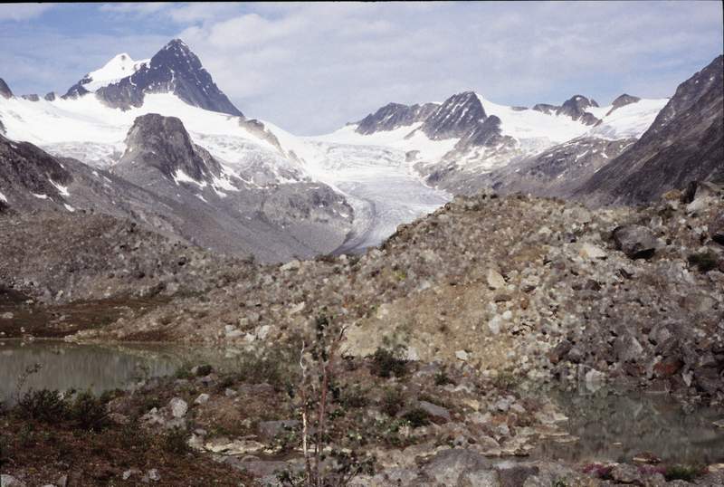
image_caption=Keele Peak, 2005
country=Canada
region=Yukon| region1=Northwest Territories | region_type=Territories
parent=
border=
length_imperial=| length_round=-1| length_orientation=
width_imperial =| width_round=-1 | width_orientation=
highest=Keele Peak
highest_elevation=2972
highest_lat_d=63|highest_lat_m=25|highest_lat_s=53|highest_lat_NS=N
highest_long_d=130|highest_long_m=19|highest_long_s=26|highest_long_EW=W
geology= | period= | orogeny=
map_caption=The Mackenzie Mountains are amountain range forming part of theYukon -Northwest Territories boundary between the Liard and Peel rivers.Nahanni National Park Reserve is in the Mackenzie Mountains.The Mackenzie Mountains hold about 55% of the world's known reserves of
tungsten . Fact|date=February 2007 The mining town of Tungsten, site of theCantung Mine is in the Mackenzie mountains. Only two roads lead into the Mackenzie Mountains, both in the Yukon: theNahanni Range Road leading to the townsite of Tungsten and theCanol Road leading to theMacmillan Pass .The highest mountain in this range is
Keele Peak at convert|2972|m|ft|0. The second highest mountain isMount Nirvana . It is, at convert|2773|m|ft|0, the highest mountain in the Northwest Territories.Further reading
* Aitken, J. D. (1991). "The Ice Brook Formation and post-Rapitan, Late Proterozoic glaciation, Mackenzie Mountains, Northwest Territories". [Ottawa] : Energy, Mines and Resources Canada. ISBN 0660138387
* EXCELeration Corp. (2000). "Benefits of outfitted hunting in the NWT Mackenzie mountains". Calgary: EXCELeration Corp.
* Hanke, G. F., Wilson, M. V., & Lindoe, L. A. (2001). "New species of Silurian acanthodians from the Mackenzie Mountains, Canada". Canadian Journal of Earth Sciences. 38 (11), 1517.
* James, N., Narbonne, G., & Kyser, T. (2001). "Late Neoproterozoic cap carbonates: Mackenzie Mountains, northwestern Canada: precipitation and global glacial meltdown". Canadian Journal of Earth Sciences. 38, 1229-1262.
* Keele, J. (1910). "A reconnaissance across the Mackenzie mountains on the Pelly, Ross, and Gravel rivers, Yukon, and North West territories". Ottawa: Government printing bureau.
* Latour, Paul B. "A Survey of Dall's Sheep in Zone E/1-1, Northern Mackenzie Mountains". Norman Wells, NWT: Dept. of Renewable Resources, Govt. of the Northwest Territories, 1992.
* Miller, S. J., Barichello, N., & Tait, D. E. N. (1982). "The grizzly bears of the Mackenzie Mountains, Northwest Territories". Yellowknife, N.W.T.: N.W.T. Wildlife Service.
* Morrow, D. W., & Cook, D. G. (1987). "The Prairie Creek Embayment and Lower Paleozoic strata of the southern Mackenzie Mountains". Ottawa, Canada: Energy, Mines and Resources Canada. ISBN 0660125161
* Porsild, A. E. (1945). "The Alpine flora of the east slope of Mackenzie mountains, Northwest territories". Ottawa: E. Cloutier, Printer to the King.External links
* [http://72.14.253.104/search?q=cache:uCsOngu77AoJ:www.int-res.com/articles/cr/5/c005p001.pdf+Mackenzie+Mountains+55%25+tungsten+-wiki&hl=en&ct=clnk&cd=1&gl=us Climate change in the Mackenzie Mountains] (1995), Liang, L, Kershaw, G.P. "Climate Research"
* [http://72.14.253.104/search?q=cache:nlt4te7601cJ:www.nwtwildlife.com/Publications/ManuscriptReports/pdf/157.pdf+Mackenzie+Mountains+55%25+tungsten+-wiki&hl=en&ct=clnk&cd=2&gl=us Mountain goat survey, Flat River area, Western Mackenzie Mountains] (2004). Artier, N.C.L. "Dept of Resources, Wildlife, and Economic Development, Gov't of the NWT.
Wikimedia Foundation. 2010.