Des Plaines (Metra)

Des Plaines (Metra)
Metra logo negative.png
Des Plaines
Des Plaines Metra Station.jpg
Station statistics
Address 1501 Miner Street
Des Plaines, Illinois 60016
Coordinates 42°02′28″N 87°53′12″W / 42.0410°N 87.8866°W / 42.0410; -87.8866Coordinates: 42°02′28″N 87°53′12″W / 42.0410°N 87.8866°W / 42.0410; -87.8866
Lines
  Union Pacific/Northwest
Connections Pace Buses
Platforms 1 Side platform
1 Island platform
Tracks 3
Parking Yes
Other information
Opened 1915
Accessible Handicapped/disabled access
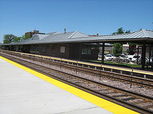
Fare zone D
Services
Preceding station   Metra   Following station
toward Harvard or McHenry
Union Pacific/Northwest
toward Ogilvie

Des Plaines is one of two commuter railroad stations on Metra's Union Pacific/Northwest line in the City of Des Plaines, Illinois. The station is officially located at 1501 Miner Street (US 14), and lies 16.7 miles (26.9 km) from the Ogilvie Transportation Center in Chicago.[1] In Metra's zone-based fare system, Des Plaines is in zone D.

Parking is mostly available along the streets on either side of the tracks. Primarily this includes Miner Street between southeast of Perry Street and west of Des Plaines River Road. Other parking areas exist along Ellinwood Street between Pearson Street and Des Plaines River Road east of the Des Plaines Public Library, a lot on Wesford Avenue off of Graceland Avenue (Southbound US 12-45), and on Prairie Avenue east of Pearson Street.

Pace Bus Connections

  • 208: Golf Road.
  • 209: Busse Highway.
  • 230: South Des Plaines.
  • 234: Wheeling - Des Plaines.
  • 250: Dempster Street.

References

External links


Wikimedia Foundation. 2010.

Игры ⚽ Нужен реферат?

Look at other dictionaries:

  • Des Plaines, Illinois — Des Plaines redirects here. For the river, see Des Plaines River. Des Plaines, Illinois County: Cook Township: Maine Mayor: Martin J. Moylan ZIP code(s): 60016, 60017, 60018, 60019 Area code(s): 847 224 …   Wikipedia

  • Cumberland (Metra) — Cumberland …   Wikipedia

  • Dee Road (Metra) — Dee Road …   Wikipedia

  • Mount Prospect (Metra) — Mount Prospect Station statistics Address 13 East Northwest Highway …   Wikipedia

  • Jefferson Park (Metra-CTA) — The Jefferson Park Transit Center is an intermodal passenger transport center, in the Jefferson Park neighborhood of Chicago, Illinois. It functions as a station for rail as well as rapid transit and also as a bus terminal. Jefferson Park Transit …   Wikipedia

  • U.S. Route 12 in Illinois — infobox road route = 12 type = US alternate name = length mi = 85.14 length round = 2 length ref = cite web |author=Illinois Technology Transfer Center |url=http://www.dot.state.il.us/gist2/select.html |title=T2 GIS Data |accessdate=2007 11 08… …   Wikipedia

  • Chicago — This article is about the U.S. city. For other uses, see Chicago (disambiguation). Windy City redirects here. For other uses, see Windy City (disambiguation). Chicago   City   City of Chicago …   Wikipedia

  • Lincolnshire, Illinois — Geobox|Settlement name = Lincolnshire native name = other name = category = Village etymology = official name = motto = nickname = image caption = The village hall of Lincolnshire symbol = country = United States state = Illinois region = Lake… …   Wikipedia

  • Evanston, Illinois — Fountain Square County: Cook Township: Evanston Incorporated: C …   Wikipedia

  • Chicago 'L' — A Green Line train approaching Randolph/Wabash. Info Locale Chicago, Illinois, United States …   Wikipedia

Share the article and excerpts

Direct link
Do a right-click on the link above
and select “Copy Link”