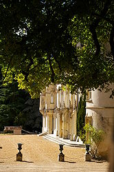
- Charbonnières, Eure-et-Loir
-
Charbonnières

 Charbonnières
Administration Country France Region Centre Department Eure-et-Loir Arrondissement Nogent-le-Rotrou Canton Authon-du-Perche Intercommunality Perche Mayor Pierre Boudet
(2008–2014)Statistics Elevation 192–245 m (630–804 ft)
(avg. 234 m/768 ft)Land area1 20.91 km2 (8.07 sq mi) Population2 257 (2008) - Density 12 /km2 (31 /sq mi) INSEE/Postal code 28080/ 28330 1 French Land Register data, which excludes lakes, ponds, glaciers > 1 km² (0.386 sq mi or 247 acres) and river estuaries. 2 Population without double counting: residents of multiple communes (e.g., students and military personnel) only counted once. Coordinates: 48°11′34″N 0°56′13″E / 48.1927777778°N 0.936944444444°E
Charbonnières is a commune in the Eure-et-Loir department in northern France.
Population
Historical population of Charbonnières, Eure-et-Loir 1962 1968 1975 1982 1990 1999 2008 396 455 404 311 258 260 257 See also
References
Categories:- Communes of Eure-et-Loir
- Eure-et-Loir geography stubs


Wikimedia Foundation. 2010.