- McKeesport, Pennsylvania
-
McKeesport City  McKeesport City Hall, formerly McKeesport National Bank, built circa 1890.
Official name: City of McKeesport Named for: John McKee Country United States State Pennsylvania County Allegheny County Coordinates 40°20′38″N 79°50′56″W / 40.34389°N 79.84889°W Area 13.9 sq mi (36 km2) - land 12.9 sq mi (33 km2) - water 1 sq mi (3 km2) Population 19,731 (2010) Density 1,529.5 / sq mi (591 / km2) Founded 1795 - Incorporated (borough) September 3, 1842 Mayor Regis T. McLaughlin Timezone EST (UTC-4) - summer (DST) EDT (UTC-5) Area code 412 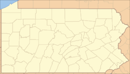
 Location of McKeesport within Pennsylvania
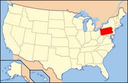 Location of Pennsylvania in the United States
Website: www.mckeesport.org McKeesport is a city in Allegheny County, Pennsylvania, in the United States; it is located at the confluence of the Monongahela and Youghiogheny rivers and is part of the Pittsburgh Metro Area. The population was 19,731 at the 2010 census.[1] It is the second largest city (not including townships, boroughs, and Home Rule Municipalities) in the county after Pittsburgh.
Settled in 1795 and named in honor of John McKee, its founder, McKeesport remained a village until 1830 when coal mining began in the region. Large deposits of bituminous coal existed.
McKeesport was incorporated as a borough in 1842 and as a city in 1891. Its population grew steadily until the mid 20th century, when it peaked in the 1940s. The city's population in 1900 was 34,227; in 1910, 42,694; in 1920, 45,975; and in 1940, 55,355. The decrease in the population since the 1940s is attributable to the general economic malaise that descended upon the region when the steelmaking industry moved elsewhere. The major employer was the National Tube Works, a manufacturer of iron pipes, which once employed 10,000 men. McKeesport was the site of the first G. C. Murphy five-and-ten-cent store.
Contents
History
John McKee, an original settler of Philadelphia and son of David McKee, built a log cabin near the confluence of the Monongahela and Youghiogheny rivers, the site of present-day McKeesport. After taking over his father's local river ferry business, he devised a plan for a city to be called McKee's Port. John set out his proposal in the Pittsburgh Gazette, as part of a program under which new residents could purchase plots of land for $20.00 (a lottery was the means to distribute the plots to avoid complaints from new land owners concerning "inferior" locations).
Around the time of the French and Indian Wars, George Washington often came to McKeesport to visit his friend, Queen Alliquippa, a Seneca Indian ruler. After being settled by the McKee family in 1795, McKeesport began to grow in 1830 when coal mining began. The first schoolhouse was built in 1832, with James E. Huey as its schoolmaster (Huey Street in McKeesport is named for him). The city's first steel mill was established in 1851.
The National Tube Company opened in 1872 and became part of U.S. Steel. In the years directly following the opening of the National Tube Company, according to the U.S. Census Bureau, McKeesport was the fastest growing municipality in the nation.[2] The city's population reached a peak of 55,355 in 1940. Families arrived from other parts of the eastern United States, Italy, Germany, Russia, Poland, Czechoslovakia, and Hungary, with most working at the National Tube Company. National Tube closed in the 1980s, along with other U.S. Steel plants in the Mon Valley.
Kennedy-Nixon debate
Thirteen years before both faced off in some of the most memorable televised Presidential debates, future presidents (and contemporary Senators) Richard M. Nixon and John F. Kennedy met in McKeesport for their first of five debates on April 22, 1947, to debate labor issues. [1]
Geography
McKeesport is located at 40°20′38″N 79°50′56″W / 40.34389°N 79.84889°W (40.343919, -79.848844).[3] McKeesport is about 12 miles (19 km) upstream from (south of) Pittsburgh, at the confluence of the Monongahela and Youghiogheny rivers.
According to the United States Census Bureau, the city has a total area of 5.4 square miles (14 km2), of which 5.0 square miles (13 km2) is land and 0.4 square miles (1.0 km2), or 7.06%, is water.
Surrounding and adjacent communities
- Dravosburg (across the Monongahela River, via W.D. Mansfield Memorial Bridge)
- Duquesne (across the Monongahela River, via McKeesport-Duquesne Bridge)
- Versailles
- Port Vue
- White Oak
- North Versailles (borders McKeesport's Highland Grove section to the north)
Demographics
The population has fallen to less than half of its war-time high. In 2008 the U.S. Census estimated that only 22,130 people remained.[4] As of the 2000 census,[5] there were 24,040 people, 9,655 households, and 5,976 families residing in the city. The population density was 4,806.9 people per square mile (1,856.4/km²). There were 11,124 housing units at an average density of 2,224.3 per square mile (859.0/km²). The racial makeup of the city was 72.40% White, 24.46% African American, 0.27% Native American, 0.12% Asian, 0.01% Pacific Islander, 0.59% from other races, and 2.14% from two or more races. Hispanic or Latino of any race were 1.50% of the population.
Households: There were 9,655 households out of which 28.6% had children under the age of 18 living with them, 34.7% were married couples living together, 21.9% had a female householder with no husband present, and 38.1% were non-families. 33.9% of all households were made up of individuals and 15.7% had someone living alone who was 65 years of age or older. The average household size was 2.35 and the average family size was 3.01.
Age Distribution: The population was well distributed by age, with 25.4% under 18, 7.5% from 18 to 24, 24.8% from 25 to 44, 21.3% from 45 to 64, and 20.9% who were 65 years of age or older. The median age was 40. For every 100 females, there were 84.8 males; for every 100 females age 18 and over, there were 76.8 males.
Income: The median income for a household in the city was $23,715, and the median income for a family was $31,577. Males had a median income of $27,412 versus $21,977 for females. The per capita income for the city was $13,242. About 18.1% of families and 23.0% of the population were below the poverty line, including 35.9% of those under age 18 and 12.1% of those age 65 or over.
Points of interest
- Renziehausen Park Rose Garden and Arboretum
- Penn State University - Greater Allegheny Campus
- McKeesport Area High School
Notable people
Further information: Category:People from McKeesport, PennsylvaniaActors and broadcasters
- Ed Coulter, actor, portrayed "The Crypt Keeper" on 100 episodes of Tales from the Crypt
- Grover Dale, actor, dancer, choreographer, director
- Aline MacMahon, Oscar-nominated actress
- Tamara Tunie, actress
Musicians and artists
- Byron Janis, pianist
- Henrietta Leaver, Miss America 1935
- Duane Michals, photographer
- Sam Sneed, music producer and rapper
- Jerry Tachoir, jazz vibraphone and marimba player
Writers
- Bob Carroll, Jr., television screenwriter noted for his work on I Love Lucy
- Marc Connelly, playwright
- John Hoerr, journalist and author of And the Wolf Finally Came: The Decline of the American Steel Industry
- David Kalstone, writer and literary critic
- Robert M. McBride, writer and publisher
Academia
- George Marcus, anthropologist
- Merrill Singer, anthropologist
- Herbert Spiegel, psychiatrist, "father of hypnosis"[6]
- Robert E. Nahory, physicist
Sports
Baseball
- Tim Conroy, former major league pitcher
- Brian Holton, former MLB relief pitcher
- Rick Krivda, MLB pitcher and 2000 Olympic gold medalist
- Tom Qualters, former MLB pitcher
- Bill Robinson, former MLB outfielder and coach
Basketball
Bullfighting
- Bette Ford, first American bullfighter to fight in the Plaza Mexico
Football
- Jim Beirne, former NFL wide receiver
- Maurice Leggett, former Kansas City Chiefs cornerback
- Mike Logan, former Pittsburgh Steelers safety
- Bob Long, former NFL wide receiver
- Bill Miller, former AFL wide receiver
- George Mrkonic, football player for the University of Kansas
- Brandon Short, former NFL linebacker
- Russell Stuvaints, former Pittsburgh Steelers safety
- Jim Trimble, former NFL and CFL head football coach
Politicians and governmental leaders
- Queen Alliquippa, leader of the Seneca tribe of American Indians during the early part of the 18th century
- Frank Buchanan, former mayor of McKeesport and member of the United States House of Representatives, husband of Vera Buchanan
- Vera Buchanan, former member of the United States House of Representatives, wife of Frank Buchanan
- William Henry Coleman, former member of the United States House of Representatives
- Marc Gergely, Pennsylvania state representative
- John E. McLaughlin, former Deputy Director of Central Intelligence
- Bill Shuster, member of the United States House of Representatives
- Frederick A. Bray, former first African-American Fire Chief
Military heroes
- Donald M. Carpenter, aviator in the U.S. Navy
- Franklin J. Phillips, also known as Harry Fisher, United States Marine and Medal of Honor recipient
Business and industry
- Helen Richey, first woman pilot of a commercial airliner
- Robert J. Stevens, Chairman, President and Chief Executive Officer of Lockheed Martin
Gallery
-

The Carnegie Free Library of McKeesport, built in 1902
-

The Jerome Street Bridge (aka Lysle Blvd or 5th Avenue Bridge)
-

Hitzrot House, built in 1892
See also
Notes and references
- ^ "Race, Hispanic or Latino, Age, and Housing Occupancy: 2010 Census Redistricting Data (Public Law 94-171) Summary File (QT-PL), McKeesport city, Pennsylvania". U.S. Census Bureau, American FactFinder 2. http://factfinder2.census.gov. Retrieved September 8, 2011.
- ^ "History". mckeesport.org. Archived from the original on 2007-03-24. http://web.archive.org/web/20070324224304/http://www.mckeesport.org/history.php. Retrieved 2007-05-12.
- ^ "US Gazetteer files: 2010, 2000, and 1990". United States Census Bureau. 2011-02-12. http://www.census.gov/geo/www/gazetteer/gazette.html. Retrieved 2011-04-23.
- ^ U.S. Census Bureau, American Factfinder, retrieved 2009-10-23
- ^ "American FactFinder". United States Census Bureau. http://factfinder.census.gov. Retrieved 2008-01-31.
- ^ Obituaries, The New York Times, Jan. 10, 2010
External links
- City of McKeesport official website
- Historic Pittsburgh Map Collections
- Supplier for McKeesport related gift products
Municipalities and communities of Allegheny County, Pennsylvania County seat: Pittsburgh Cities Clairton | Duquesne | McKeesport | Pittsburgh

Boroughs Aspinwall | Avalon | Baldwin | Bell Acres | Bellevue | Ben Avon | Ben Avon Heights | Bethel Park | Blawnox | Brackenridge | Braddock | Braddock Hills | Bradford Woods | Brentwood | Bridgeville | Carnegie | Castle Shannon | Chalfant | Cheswick | Churchill | Coraopolis | Crafton | Dormont | Dravosburg | East McKeesport | East Pittsburgh | Edgewood | Edgeworth | Elizabeth | Emsworth | Etna | Forest Hills | Fox Chapel | Franklin Park | Glassport | Glen Osborne | Glenfield | Green Tree | Haysville | Heidelberg | Homestead | Ingram | Jefferson Hills | Leetsdale | Liberty | Lincoln | McDonald‡ | McKees Rocks | Millvale | Monroeville | Mount Oliver | Munhall | North Braddock | Oakdale | Oakmont | Pennsbury Village | Pitcairn | Pleasant Hills | Plum | Port Vue | Rankin | Rosslyn Farms | Sewickley | Sewickley Heights | Sewickley Hills | Sharpsburg | Springdale | Swissvale | Tarentum | Thornburg | Trafford‡ | Turtle Creek | Verona | Versailles | Wall | West Elizabeth | West Homestead | West Mifflin | West View | Whitaker | White Oak | Whitehall | Wilkinsburg | Wilmerding
Townships Aleppo | Baldwin | Collier | Crescent | East Deer | Elizabeth | Fawn | Findlay | Forward | Frazer | Hampton | Harmar | Harrison | Indiana | Kennedy | Kilbuck | Leet | Marshall | McCandless | Moon | Mt. Lebanon | Neville | North Fayette | North Versailles | O'Hara | Ohio | Penn Hills | Pine | Reserve | Richland | Robinson | Ross | Scott | Shaler | South Fayette | South Park | South Versailles | Springdale | Stowe | Upper St. Clair | West Deer | Wilkins
CDPs Allison Park | Bairdford | Bakerstown | Carnot-Moon | Clinton | Curtisville | Enlow | Gibsonia | Glenshaw | Harwick | Imperial | Noblestown | Rennerdale | Russellton | Sturgeon
Unincorporated
communitiesAcmetonia | Blackridge | Blanchard | Broughton | Bruceton | Buena Vista | Creighton | Dorseyville | Elfinwild | Harmarville | Hickory Heights | Karns | Keown Station | Natrona | Natrona Heights | Warrendale | Wexford | Wildwood
Footnotes ‡This populated place also has portions in an adjacent county or counties
 Commonwealth of Pennsylvania
Harrisburg (capital) Topics Cities | Politics | Government | Delegations | History | Geography | Geology | Pennsylvanians | State parks | Symbols | Visitor attractions
Metro areas Altoona | Philadelphia | Erie | Harrisburg–Carlisle | Johnstown | Lancaster | Lebanon | Lehigh Valley | New York | Pittsburgh | Reading | State College | Williamsport | Scranton‑Wilkes-Barre | York-Hanover
Cities Allentown | Altoona | Bethlehem | Chester | DuBois | Easton | Erie | Greensburg | Harrisburg | Hazleton | Johnstown | Lancaster | Lebanon | McKeesport | New Castle | Philadelphia | Pittsburgh | Pottsville | Reading | Scranton | Sunbury | Wilkes-Barre | Williamsport | York
Largest
municipalitiesBaldwin | Berwick | Bethel Park | Brentwood | Carlisle | Chambersburg | Columbia | Darby | Dunmore | Elizabethtown | Emmaus | Ephrata | Franklin Park | Hanover | Hummelstown | Indiana | Kingston | Lansdale | Lansdowne | Monroeville | Munhall | Murrysville | Norristown | Penn Hills | Phoenixville | Plum | Pottstown | State College | West Chester | West Mifflin | Whitehall | Wilkinsburg | Wyomissing | Yeadon
Regions Allegheny Mountains | Allegheny National Forest | Allegheny Plateau | Atlantic Coastal Plain | Blue Ridge | Coal Region | Cumberland Valley | Delaware Valley | Dutch Country | Endless Mountains | Happy Valley | Laurel Highlands | Lehigh Valley | Main Line | Northeast | Northern Tier | Northwestern | Oil Region | Pennsylvania Highlands | Piedmont | The Poconos | Ridge and Valley | South Central | Susquehanna Valley | Western | Wyoming Valley
Counties Adams | Allegheny | Armstrong | Beaver | Bedford | Berks | Blair | Bradford | Bucks | Butler | Cambria | Cameron | Carbon | Centre | Chester | Clarion | Clearfield | Clinton | Columbia | Crawford | Cumberland | Dauphin | Delaware | Elk | Erie | Fayette | Forest | Franklin | Fulton | Greene | Huntingdon | Indiana | Jefferson | Juniata | Lackawanna | Lancaster | Lawrence | Lebanon | Lehigh | Luzerne | Lycoming | McKean | Mercer | Mifflin | Monroe | Montgomery | Montour | Northampton | Northumberland | Perry | Philadelphia | Pike | Potter | Schuylkill | Snyder | Somerset | Sullivan | Susquehanna | Tioga | Union | Venango | Warren | Washington | Wayne | Westmoreland | Wyoming | York
Categories:- Cities in Pennsylvania
- Populated places established in 1795
- Pittsburgh metropolitan area
- Populated places in Allegheny County, Pennsylvania


Wikimedia Foundation. 2010.