- McKees Rocks, Pennsylvania
-
McKees Rocks, Pennsylvania Borough  Chartiers Avenue, McKees Rocks, PA
Official name: Borough of McKees Rocks Named for: Alexander McKee Nickname: The Rocks Country United States State Pennsylvania County Allegheny Coordinates 40°28′12.79″N 80°3′49.22″W / 40.4702194°N 80.0636722°W Population 6,104 (2010) Settled in 1764 Incorporated in 1892 Timezone EST (UTC-5) - summer (DST) EDT (UTC-4) ZIP code 15136 Area code 412 School District Sto-Rox  Location of McKees Rocks in Allegheny County
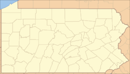
 Location of McKees Rocks in Pennsylvania
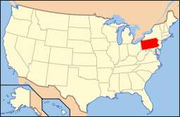 Location of Pennsylvania in the United States
Website: McKees Rocks McKees Rocks, also known as "The Rocks", is a borough in Allegheny County, Pennsylvania, along the south bank of the Ohio River. The borough population was 6,104 at the 2010 census.[1]
In the past, it was known for its extensive iron and steel interests. Also, there were large railroad machine shops, and manufacturers of locomotives, freight and passenger cars, and springs, enamel ware, lumber, wall materials, plaster, nuts and bolts, malleable castings, chains and forgings, tin ware, concrete, and cigars.
The Pittsburgh, Allegheny and McKees Rocks Railroad is located in an area known as the "Bottoms".
The name of the borough is often incorrectly stated as "Mc Kees Rocks," "McKee's Rocks," or "McKees Rock," but the official name is "McKees Rocks." It is within the Sto-Rox School District, which serves McKees Rocks and neighboring Stowe Township. The local high school is Sto-Rox High School.
The McKees Rocks Bridge, which carries traffic between McKees Rocks and Pittsburgh, is the longest bridge in Allegheny County, at 7,293 feet (2,223 m).
The area is well-served by Port Authority bus routes 20, 21, 22, 24, and CO.
Contents
History
For thousands of years, Native Americans inhabited the region. The Adena culture built a large mound at the future site of McKees Rocks. The mound, a burial site, was augmented in later years by members of the Hopewell culture.[2] Much later, it was considered by George Washington as a possible location for Fort Pitt, which was eventually built on the site of the destroyed French Fort Duquesne in what is now Pittsburgh's Point State Park.[3]
The borough derives its name from Alexander McKee, to whom a 1,300-acre (530 ha) tract of land was given in 1764, and from a rocky projection into the river at this site. In 1769, McKees Rocks officially got its name on a deed,[4] and that year is considered to be its founding date.[5] In 1892, it was incorporated as a borough.[5] In 1900, 6,353 people resided in the borough; in 1910, 14,702; in 1920, 16,713; and in 1940, 17,021 people inhabited McKees Rocks. The population was 6,104 at the 2010 census.
Mann's Hotel, which was possibly one of the oldest buildings in the Pittsburgh area,[6] was located at 23 Singer Avenue in McKees Rocks. It was built around 1803, although other sources put the construction in the 18th century.[6] It is rumored that George Washington stayed there[6] when he was surveying the Indian mound. On October 12, 2009, Mann's Hotel was condemned due to neglect and had to be demolished[7] due to its deteriorating condition.[6]
McKees Rocks lent its name to one of the pivotal labor conflicts of the early 20th century, the 1909 McKees Rocks Strike. In the summer and early fall of 1909, some 5,000 workers of the Pressed Steel Car Company's plant at McKees Rocks went on strike, joined by 3,000 others who worked for the Standard Steel Car Company of Butler and others in New Castle.[8] The strike, led by organizers of the Industrial Workers of the World, was repressed by armed security guards and the state militia, resulting in at least a dozen deaths, involving participants on both sides.[9]
Geography
McKees Rocks is located at 40°28′13″N 80°3′49″W / 40.47028°N 80.06361°W (40.470218, -80.063674).[10]
According to the United States Census Bureau, the borough has a total area of 1.1 square miles (2.8 km2), of which 1.0 square mile (2.6 km2) is land and 0.1 square miles (0.26 km2), or 6.31%, is water. McKees Rocks is made up of several neighborhoods, such as West Park, Meyers Ridge, and "The Bottoms".
Demographics
As of the census[11] of 2000, there were 6,622 people, 2,905 households, and 1,652 families residing in the borough. The population density was 6,377.5 people per square mile (2,458.4/km²). There were 3,402 housing units at an average density of 3,276.4 per square mile (1,263.0/km²). The racial makeup of the borough was 82.71% White, 14.06% African American, 0.26% Native American, 0.68% Asian, 0.03% Pacific Islander, 0.41% from other races, and 1.86% from two or more races. Hispanic or Latino of any race were 1.09% of the population.
Households: There were 2,905 households out of which 26.0% had children under the age of 18 living with them, 29.4% were married couples living together, 21.3% had a female householder with no husband present, and 43.1% were non-families. 37.8% of all households were made up of individuals and 17.2% had someone living alone who was 65 or older. The average household size was 2.24 and the average family size was 2.96.
Age Distribution: The population included 24.1% under the age of 18, 7.8% from 18 to 24, 28.3% from 25 to 44, 20.9% from 45 to 64, and 19.0% who were 65 or older. The median age was 38. For every 100 females, there were 89.1 males; for every 100 females age 18 and over, there were 84.2 males.
Income: The median income for a household in the borough was $22,278, and the median income for a family was $29,063. Males had a median income of $25,872 versus $23,402 for females. The per capita income for the borough was $13,858. About 20.5% of families and 25.3% of the population were below the poverty line, including 38.8% of those under age 18 and 17.0% of those age 65 or over.
Points of interest
The multi-million-dollar, 40,000 sq ft (3,700 m2) Father Ryan Cultural Arts Center opened in 2008, at 420 Chartiers Avenue, adjacent to the F.O.R. Sto-Rox Library (at 500 Chartiers Avenue). It offers many creative and performing arts courses to the public.
The "Bottoms" neighborhood is the site of the McKees Rocks Indian Mound, a designated historic landmark, where the oldest human bones in eastern North America have been discovered.
Surrounding and adjacent neighborhoods
Brighton Heights (Pittsburgh via McKees Rocks Bridge), Esplen (Pittsburgh), Kennedy Township, Stowe Township, Windgap (Pittsburgh)
Notable people
Further information: Category:People from McKees Rocks, Pennsylvania Billy Mays is from McKees Rocks
- Myron Brown, Slippery Rock University basketball star and NBA player
- Tom Clements, quarterbacks coach of the Green Bay Packers
- Chuck Fusina, Penn State, USFL, and NFL football player
- John Kasich, Republican governor of Ohio, former congressman, and former presidential candidate
- Catherine Baker Knoll, former Pennsylvania lieutenant governor
- Carl Kosak, author
- Ted Kwalick, Penn State all-America football player and San Francisco 49ers all-Pro tight end; member of the College Football Hall of Fame
- Bob Ligashesky, Sto-Rox graduate of 1985, tight ends coach for the Denver Broncos
- Ettore J. Marsolo, recipient of the Navy Cross
- Billy Mays, the late Oxi-Clean spokesperson, well known for his bearded face and distinct voice.[12]
- Jeff Smith, cartoonist, best known as the creator of the self-published comic book series Bone
- Paul Spadafora, former IBF world lightweight boxing champion, known as the "Pittsburgh Kid"
- Olive Thomas, silent film actress, and the original flapper
- Fredrick "Tex" Williams, world-record duckpin bowler in the 1930s; appeared in Ripley's Believe It or Not! for rolling 25 consecutive strikes
In popular culture
McKees Rocks is the fictionalized setting of the novels Duffy's Rocks, Riot, and more than a dozen by the crime writer K.C. Constantine.
See also
Gallery
-

The McKees Rocks Bridge from Island Avenue
-

Another view of the McKees Rocks Bridge
-

Mancini's Bakery (since 1926)
-

McKees Rocks Mound historical marker
-

"The Rocks" of McKees Rocks
References
- ^ "Race, Hispanic or Latino, Age, and Housing Occupancy: 2010 Census Redistricting Data (Public Law 94-171) Summary File (QT-PL), McKees Rocks borough, Pennsylvania". U.S. Census Bureau, American FactFinder 2. http://factfinder2.census.gov. Retrieved September 20, 2011.
- ^ Pitz, Marylynne (2001-05-12). "Burial Mound to Get Historical Marker". Pittsburgh Post-Gazette. http://www.post-gazette.com/regionstate/20010513mound4.asp. Retrieved 2008-11-05.
- ^ Part I
- ^ http://www.mckeesrocks.com/qa.jsp
- ^ a b http://www.pittsburghlive.com/x/pittsburghtrib/s_78303.html
- ^ a b c d Torsten Ove, "Historic Mann's Hotel will become history", Pittsburgh Post-Gazette, Saturday, August 08, 2009.
- ^ Pittsburgh History & Landmarks Foundation, "Historic Mann's Hotel Demolished", PHLF News, Monday, October 12, 2009.
- ^ Louis Duchez, "The Strikes in Pennsylvania," The International Socialist Review, vol. 10, no. 3 (September 1909), pp. 194-195.
- ^ Marylynne Pitz, "Pressed Steel Car strike in McKees Rocks reaches centennial anniversary". Pittsburgh Post-Gazette, August 16, 2009, pg. E1.
- ^ "US Gazetteer files: 2010, 2000, and 1990". United States Census Bureau. 2011-02-12. http://www.census.gov/geo/www/gazetteer/gazette.html. Retrieved 2011-04-23.
- ^ "American FactFinder". United States Census Bureau. http://factfinder.census.gov. Retrieved 2008-01-31.
- ^ Stacy, Mitch (2009-06-28). "TV pitchman Billy Mays found dead" (in en-US). FOX Toledo.com. TVL Broadcasting, Inc.. http://www.foxtoledo.com/dpp/news/national/TV_pitchman_Billy_Mays_found_dead_20090628_2583975. Retrieved 2009-06-28.
External links
Municipalities and communities of Allegheny County, Pennsylvania County seat: Pittsburgh Cities Clairton | Duquesne | McKeesport | Pittsburgh

Boroughs Aspinwall | Avalon | Baldwin | Bell Acres | Bellevue | Ben Avon | Ben Avon Heights | Bethel Park | Blawnox | Brackenridge | Braddock | Braddock Hills | Bradford Woods | Brentwood | Bridgeville | Carnegie | Castle Shannon | Chalfant | Cheswick | Churchill | Coraopolis | Crafton | Dormont | Dravosburg | East McKeesport | East Pittsburgh | Edgewood | Edgeworth | Elizabeth | Emsworth | Etna | Forest Hills | Fox Chapel | Franklin Park | Glassport | Glen Osborne | Glenfield | Green Tree | Haysville | Heidelberg | Homestead | Ingram | Jefferson Hills | Leetsdale | Liberty | Lincoln | McDonald‡ | McKees Rocks | Millvale | Monroeville | Mount Oliver | Munhall | North Braddock | Oakdale | Oakmont | Pennsbury Village | Pitcairn | Pleasant Hills | Plum | Port Vue | Rankin | Rosslyn Farms | Sewickley | Sewickley Heights | Sewickley Hills | Sharpsburg | Springdale | Swissvale | Tarentum | Thornburg | Trafford‡ | Turtle Creek | Verona | Versailles | Wall | West Elizabeth | West Homestead | West Mifflin | West View | Whitaker | White Oak | Whitehall | Wilkinsburg | Wilmerding
Townships Aleppo | Baldwin | Collier | Crescent | East Deer | Elizabeth | Fawn | Findlay | Forward | Frazer | Hampton | Harmar | Harrison | Indiana | Kennedy | Kilbuck | Leet | Marshall | McCandless | Moon | Mt. Lebanon | Neville | North Fayette | North Versailles | O'Hara | Ohio | Penn Hills | Pine | Reserve | Richland | Robinson | Ross | Scott | Shaler | South Fayette | South Park | South Versailles | Springdale | Stowe | Upper St. Clair | West Deer | Wilkins
CDPs Allison Park | Bairdford | Bakerstown | Carnot-Moon | Clinton | Curtisville | Enlow | Gibsonia | Glenshaw | Harwick | Imperial | Noblestown | Rennerdale | Russellton | Sturgeon
Unincorporated
communitiesAcmetonia | Blackridge | Blanchard | Broughton | Bruceton | Buena Vista | Creighton | Dorseyville | Elfinwild | Harmarville | Hickory Heights | Karns | Keown Station | Natrona | Natrona Heights | Warrendale | Wexford | Wildwood
Footnotes ‡This populated place also has portions in an adjacent county or counties
Categories:- Pennsylvania populated places on the Ohio River
- Populated places established in 1764
- Pittsburgh metropolitan area
- Boroughs in Allegheny County, Pennsylvania


Wikimedia Foundation. 2010.