- Mt. Angel, Oregon
-
Mt. Angel, Oregon 
Nickname(s): City of Bells Location in Oregon
Coordinates: 45°4′8″N 122°47′49″W / 45.06889°N 122.79694°W County Marion County Incorporated 1893 Government – Mayor Rick Schiedler Area – Total 2.5 km2 (1.0 sq mi) – Land 2.5 km2 (1.0 sq mi) – Water 0 km2 (0 sq mi) Elevation 51.2 m (168 ft) Population (2000) – Total 3,121 – Density 1,255.2/km2 (3,264.3/sq mi) Time zone Pacific (UTC-8) – Summer (DST) Pacific (UTC-7) Website www.mtangelor.org Mt. Angel is a city in Marion County, Oregon, United States. It is 18 miles (29 km) northeast of Salem, Oregon on Oregon Route 214. The population was 3,121 at the 2000 census. Mt. Angel is part of the Salem Metropolitan Statistical Area. Portland State University Population Research Center estimate from 2008 has the population at 3,758.
Contents
History
 St. Mary's Catholic Church
Mt. Angel was originally settled in 1850 by Benjamin Cleaver, who later planned a townsite which he named Roy. In 1881, a railroad station was established and named Fillmore after a railroad official. The following year, a post office with the name of Roy was established, but neither name was to last.
Rev. Fr. Adelheim Odermatt, O.S.B., came to Oregon in 1881 with a contingent of Benedictine monks from Engelberg, Switzerland, in order to establish a new American daughter house. After visiting several locations, he found Lone Butte to be the ideal location for a new abbey, and shortly afterwards ministered to several local Roman Catholic parishes, about the same time large numbers of immigrants from Bavaria settled in the area. Due to his efforts, the city, post office and the nearby elevation Lone Butte came to be known as Mount Angel (an English translation of Engelberg) in 1883. He also established Mount Angel Abbey, a Benedictine monastery and school, which was moved permanently to Mt. Angel in 1884.
The city of Mt. Angel was incorporated April 3, 1893. The post office of Saint Benedict, Oregon was established at the Abbey.
Mount Angel Abbey is still located on Mount Angel. The original Kalapuyan name of the butte is Tapalamaho, which translates to "Mount of Communion." At the request of the Archbishop of Oregon City, the abbey opened Mount Angel Seminary in 1889 for the training of priests. The original wooden buildings at the foot of the butte were destroyed in a fire in the 1890s, and another disastrous fire in 1926 consumed the second monastery, an imposing five-story edifice of black basalt at the top of the butte. The current monastery building was completed in 1928, and subsequent structures followed, including a library built by Finnish architect Alvar Aalto in 1970. A bell tower was added to the abbey church in 2007 which contains eight bells, one of which is the largest swinging bell in the Pacific Northwest.
Geography
According to the United States Census Bureau, the city has a total area of 1.0 square mile (2.6 km2), all of it land.
Mt. Angel is in the Pudding River watershed.
Demographics
 Mt. Angel railway depot
As of the census[1] of 2000, there were 3,121 people, 1,059 households, and 661 families residing in the city. The population density was 3,264.3 people per square mile (1,255.2/km²). There were 1,124 housing units at an average density of 1,175.6 per square mile (452.1/km²). The racial makeup of the city was 75.65% White, 0.45% African American, 0.93% Native American, 0.19% Asian, 0.10% Pacific Islander, 17.85% from other races, and 4.84% from two or more races. Hispanic or Latino of any race were 27.84% of the population.
There were 1,059 households out of which 35.5% had children under the age of 18 living with them, 48.0% were married couples living together, 10.8% had a female householder with no husband present, and 37.5% were non-families. 33.1% of all households were made up of individuals and 20.5% had someone living alone who was 65 years of age or older. The average household size was 2.75 and the average family size was 3.54.
In the city the population was spread out with 30.2% under the age of 18, 8.5% from 18 to 24, 25.1% from 25 to 44, 17.9% from 45 to 64, and 18.2% who were 65 years of age or older. The median age was 34 years. For every 100 females there were 92.5 males. For every 100 females age 18 and over, there were 85.3 males.
The median income for a household in the city was $36,293, and the median income for a family was $45,650. Males had a median income of $33,523 versus $21,442 for females. The per capita income for the city was $15,535. About 10.3% of families and 16.3% of the population were below the poverty line, including 16.6% of those under age 18 and 20.2% of those age 65 or over.
Economy
As of 2000, the five largest employers in Mt. Angel were Wilco, Providence Benedictine Assisted Living, Mt. Angel Towers, Highland Laboratories, and the Mt. Angel School District.[2]
Arts and culture
 Dancing children fountain in central crossroad of Mt. Angel. Former Wilco grain elevator in the background.
Annual cultural events
Mt. Angel is well-known locally for its annual Oktoberfest. The Mt. Angel Oktoberfest is one of the largest of its kind in the U.S.[citation needed] The festival can attract upwards of 350,000 people and includes beer and wine gardens, softball tournaments at Ebner Ball Park, a local football game and volleyball invitational tournament, carnival rides, crafts, a wide assortment of German food, and a two-day car show.
Museums and other points of interest
Mt. Angel is also home to the historic Queen of Angels Monastery, run by the Benedictine Sisters of Mt. Angel,[3] and the 1912 Saint Mary Catholic Church, both of which are listed on the National Register of Historic Places (NRHP). Windischar's General Blacksmith Shop is another NRHP-listed structure in the city.
In March 2006, the city announced plans to build a 49 foot (15 m) glockenspiel.[4] Completed in time for Oktoberfest 2006, the glockenspiel is the largest in the United States. Located on the corner of Charles and Garfield streets, the four-story-tall glockenspiel is part of the Edelweiss Village Building.
Education
Mt. Angel is served by the three-school Mt. Angel School District, which includes John F. Kennedy High School.
Colegio César Chávez was a college-without-walls program that existed in Mt. Angel from 1973 until 1983. At the time, Colegio was the only four-year Latino college in the country. In the early 1980s the former Colegio grounds and building were purchased by a private buyer and donated to the Benedictine sisters. The Benedictine sisters now operate St. Joseph Shelter in the former Colegio building and dorms.
Media
Mt. Angel is served by the weekly Silverton Appeal Tribune newspaper, which is published on Wednesdays by the Statesman Journal,[5] and by the Woodburn Independent.[citation needed]
Infrastructure
Transportation
- Highway
Mt. Angel is on Oregon Route 214; Interstate 5, 10 miles to the west, is the closest major highway.
- Rail
The Willamette Valley Railway serves Mt. Angel.
- Air
The closest airport is McNary Field in Salem.
Utilities
Water and wastewater treatment are provided by the City of Mt. Angel.[2] Natural gas is provided by NW Natural and electricity is provided by Portland General Electric.[2]
Healthcare
The closest hospital is Silverton Hospital, four miles away in Silverton.[2]
References
- ^ "American FactFinder". United States Census Bureau. http://factfinder.census.gov. Retrieved 2008-01-31.
- ^ a b c d Mt. Angel Community Profile from Oregon Economic & Community Development Department
- ^ Benedictine Sisters of Mt. Angel
- ^ "Ore. Town to Build Tallest Glockenspiel". Associated Press. 17 March 2006.
- ^ About the Appeal Tribune
External links
- City of Mt. Angel (official website)
- Mt. Angel Chamber of Commerce
- Mt. Angel Oktoberfest
- Listing for Mount Angel in the Oregon Blue Book
Coordinates: 45°04′05″N 122°47′56″W / 45.06806°N 122.79889°W
Municipalities and communities of Marion County, Oregon Cities 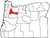
CDPs Brooks | Butteville | Four Corners | Hayesville | Labish Village | Marion | Mehama
Unincorporated
communitiesBreitenbush | Clear Lake | Macleay | McKee | Middle Grove | Monitor | Niagara | North Howell | Pratum | Saint Benedict | Saint Louis | Shaw | Talbot | Waconda | West Stayton
Ghost town Footnotes ‡This populated place also has portions in an adjacent county or counties
Categories:- Cities in Oregon
- Populated places in Marion County, Oregon
- Mt. Angel, Oregon
- Salem, Oregon metropolitan area


Wikimedia Foundation. 2010.