- Laissey
French commune
nomcommune=Laissey
caption=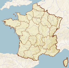
x=209
y=118
lat_long=coord|47|17|55|N|6|13|54|E|region:FR_type:city
insee=25323
cp=25820
région=Franche-Comté
département=Doubs
arrondissement=Besançon
canton=Roulans
maire=Dominique Mesnier
mandat=
intercomm=Vaîte-Aigremont
alt mini=251
alt maxi=592 m
km²=2.86
sans=420
date-sans=1999
dens=145|Laissey is a commune in the
Doubs department in the region ofFranche-Comté in easternFrance .Geography
The village lies in the deep valley of the
Doubs River .The Rognon forms a 17-meter waterfall, where it flows into the Doubs.
Demographics
Economy
The village housed a mill from its inception, which served the villages of the
Roulans plateau andBouclans .At the beginning of the 19th century, an iron mine was opened that employed up to 60 miners. However, with the arrival of the railroad in
1860 , the mine was closed.About
1870 , a textile mill was established on the site of the old mill. It employed about 30 women, but it closed when the Bost brothers opened a tool factory at the end of the 19th century. From that time on, the village grew along with the factory. Of its 500 inhabitants, 200 worked at the factory.ee also
*
Communes of the Doubs department References
* [http://www.insee.fr/en/home/home_page.asp INSEE] en icon
* [http://www.ign.fr/rubrique.asp?rbr_id=1&lng_id=EN IGN] en icon
* [http://www.routedescommunes.com/departement-25-commune-297.html Laissey on the intercommunal Web site of the department] fr icon
Wikimedia Foundation. 2010.